Wyalusing State Park

Wyalusing State Park

Geobox|Protected area
name = Wyalusing State Park
category = Wisconsin State Park
category_iucn = V


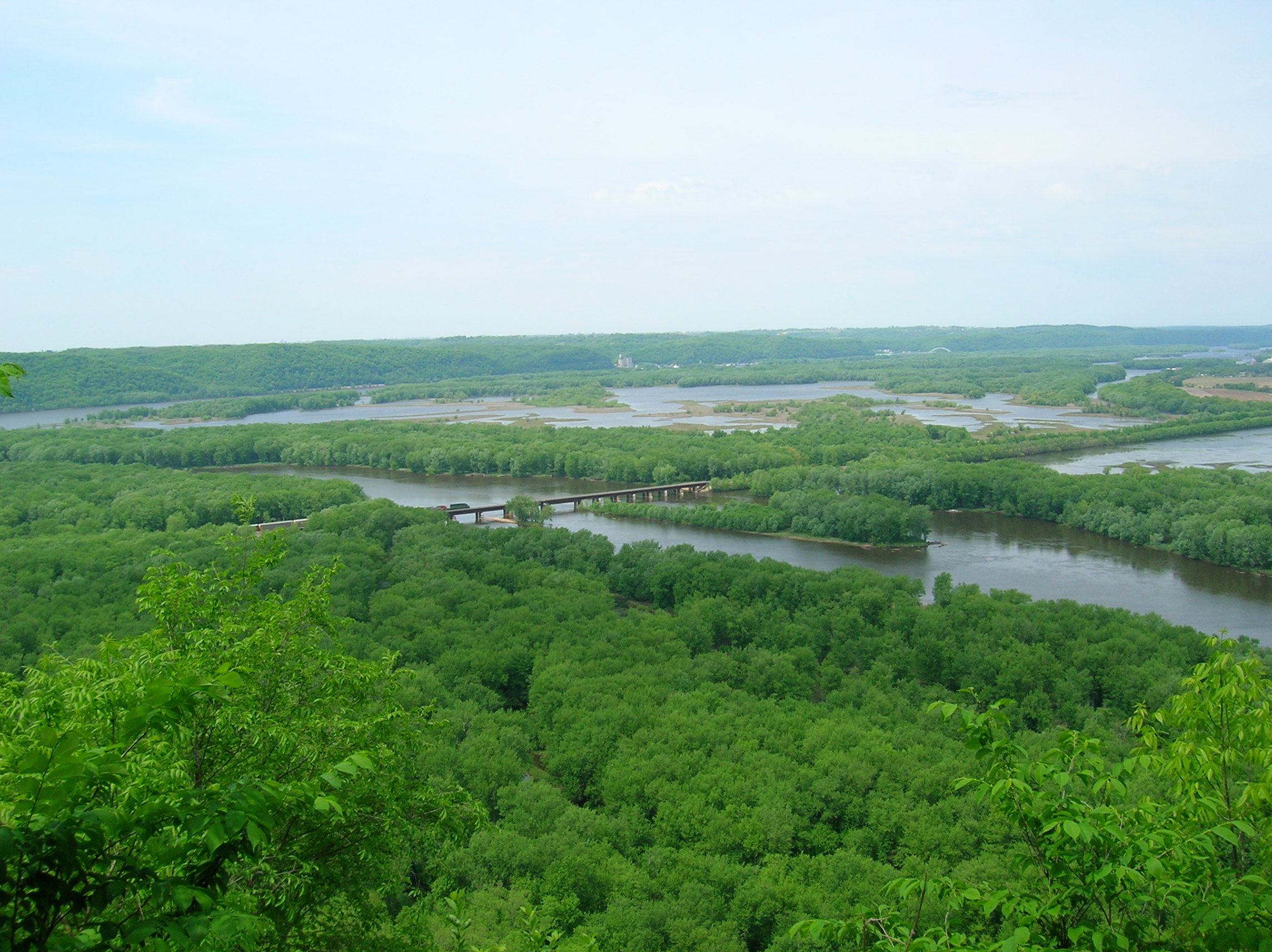
image_caption = Wyalusing State Park.
country = United States
country_

state = Wisconsin
state_

state_type = State
region_type = County
region = Grant
city_type = City
location = Wyalusing
lat_d = 42
lat_m = 58
lat_s = 47
lat_NS = N
long_d = 91
long_m = 6
long_s = 31
long_EW = W
area_unit = acre
area_imperial = 2628
area_round = 1
established = 1917
map_locator = Wisconsin


management_body =Wisconsin Department of Natural Resources

Wyalusing State Park IPA2|waɪəˡlusɪŋ is a convert|2628|acre|km2|sing=on Wisconsin state park at the confluence of the Mississippi and Wisconsin Rivers in the town of Wyalusing, just south of Prairie du Chien. Wyalusing means "home of the warrior" in the Lenape language spoken by Munsee-Delaware Indians who settled in the area in the 1800s after being displaced from farther east. convert|500|ft|m|sing=on high bluffs dotted with prehistoric Indian mounds look out over the river valleys.

The park is in the Driftless Area of Wisconsin, a portion of territory that remained ice free during the last ice age, while land to the east and west was crushed by glaciers. The high bluffs along the Mississippi River and the large deep canyon of the Wisconsin River are evidence of glacial meltwaters reshaping this region.

ee also

* List of Wisconsin state parks

External links

* [http://www.dnr.state.wi.us/org/land/parks/specific/wyalusing/ Wyalusing State Park] official website
* [http://www.wyalusing.org/ Friends of Wyalusing State Park]


Wikimedia Foundation. 2010.

Игры ⚽ Нужен реферат?

Look at other dictionaries:

  • Wyalusing State Park — von den Klippen in Richtung Westen gesehen Der Wyalusing State Park befindet sich im Grant County des US Bundesstaates Wisconsin. Der 1917 gegründete State Park liegt südöstlich des Zusammenflusses von Wisconsin River und Mississippi River. Im …   Deutsch Wikipedia

  • Newport State Park — Coordinates: 45°14′6″N 86°59′39″W / 45.235°N 86.99417°W / 45.235; 86.99417 …   Wikipedia

  • Merrick State Park — Coordinates: 44°9′16″N 91°45′17″W / 44.15444°N 91.75472°W / 44.15444; 91.75472 …   Wikipedia

  • Buckhorn State Park — IUCN Kategorie V Lage …   Deutsch Wikipedia

  • Kinnickinnic State Park — IUCN Kategorie V Lage …   Deutsch Wikipedia

  • Devil's Lake State Park (Wisconsin) — This is about the state park in Wisconsin. For parks with similar names, see Devil s Lake State Park (disambiguation) Coordinates: 43°24′53″N 89°42′47″W / 43.41472°N 89.7 …   Wikipedia

  • Mill Bluff State Park — Coordinates: 43°56′47″N 90°18′55″W / 43.94639°N 90.31528°W / 43.94639; 90.31528 …   Wikipedia

  • Natural Bridge State Park (Wisconsin) — Coordinates: 43°20′39″N 89°55′47″W / 43.34417°N 89.92972°W / 43.34417; 89.92972 …   Wikipedia

  • Mirror Lake State Park — For the lake in Waupaca, Wisconsin, see Mirror Lake (Waupaca). Coordinates: 43°33′54″N 89°49′12″W / 43.565°N 89.82°W / …   Wikipedia

  • Copper Culture State Park — Oconto Site U.S. National Register of Historic Places U.S. National Historic Landmark …   Wikipedia

Share the article and excerpts

Direct link
Do a right-click on the link above
and select “Copy Link”