- Montclair, New Jersey
-
Montclair, New Jersey — Township — 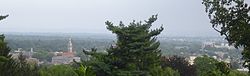

SealMap of Montclair in Essex County. Inset: Location of Essex County in the State of New Jersey.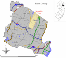 Census Bureau map of Montclair, New Jersey
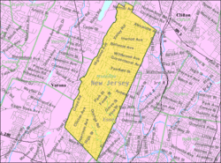
Coordinates: 40°49′20″N 74°12′43″W / 40.82222°N 74.21194°WCoordinates: 40°49′20″N 74°12′43″W / 40.82222°N 74.21194°W Country United States State New Jersey County Essex Incorporated April 15, 1868 Government[1] – Type Faulkner Act (Council-Manager) – Mayor Jerry Fried – Manager Marc D. Dashield[2] Area – Total 6.3 sq mi (16.3 km2) – Land 6.3 sq mi (16.3 km2) – Water 0.0 sq mi (0.0 km2) Elevation[3] 302 ft (92 m) Population (2010) – Total 37,669 – Density 5,979.2/sq mi (2,311.0/km2) Time zone Eastern (EST) (UTC-5) – Summer (DST) EDT (UTC-4) ZIP codes 07042-07043 Area code(s) 973 FIPS code 34-47500[4][5] GNIS feature ID 1729720[6] Website http://www.montclairnjusa.org/ Montclair (
 /mɒntˈklɛər/ or /mɒŋˈklɛər/) is a township in Essex County, New Jersey, United States. It is the 50th largest municipality in New Jersey by population. As of the 2010 United States Census, the township population was 37,669.
Montclair was first formed as a Township on April 15, 1868, from portions of Bloomfield Township,[7] so that a railroad could be built to Montclair. After a referendum held on February 21, 1894, Montclair was reincorporated as a Town, effective February 24, 1894.[8] In the late 1970s, after protesting for years at the inequities built into the formulas, Montclair joined several other communities to qualify for a pool of federal aid allocated only to Townships, that allowed townships to receive as much as double the revenue-sharing aid per capita received by the four other types of New Jersey municipalities — Borough, City, Town or Village.[9][10]
Contents
Climate
Montclair has a temperate climate, with warm/hot humid summers and cool/cold winters, according to the Köppen climate classification humid subtropical climate. January tends to be the coldest month, with average high temperatures in the upper 30s Fahrenheit and lows averaging 21. July, the warmest month, features high temperatures in the mid 80s and lows in the 70s, the average high is at 86 Fahrenheit. From April to June and from September to early November, Montclair experiences temperatures from the lower 60s to the lower 70s.
Montclair, NJ, gets on average 44 inches (1100 mm) of rain per year, above the US average of 37 inches. Snowfall is common from December to early March, at about 30 inches annually. The number of days each year in Montclair with any measurable precipitation is 90; the area has an average of 202 sunny days.
Montclair is one or two degrees warmer than the neighboring towns of Verona and Cedar Grove because of the mountain between them, which sometimes blocks winds and clouds, including warmer air from the ocean to the east.
Geography
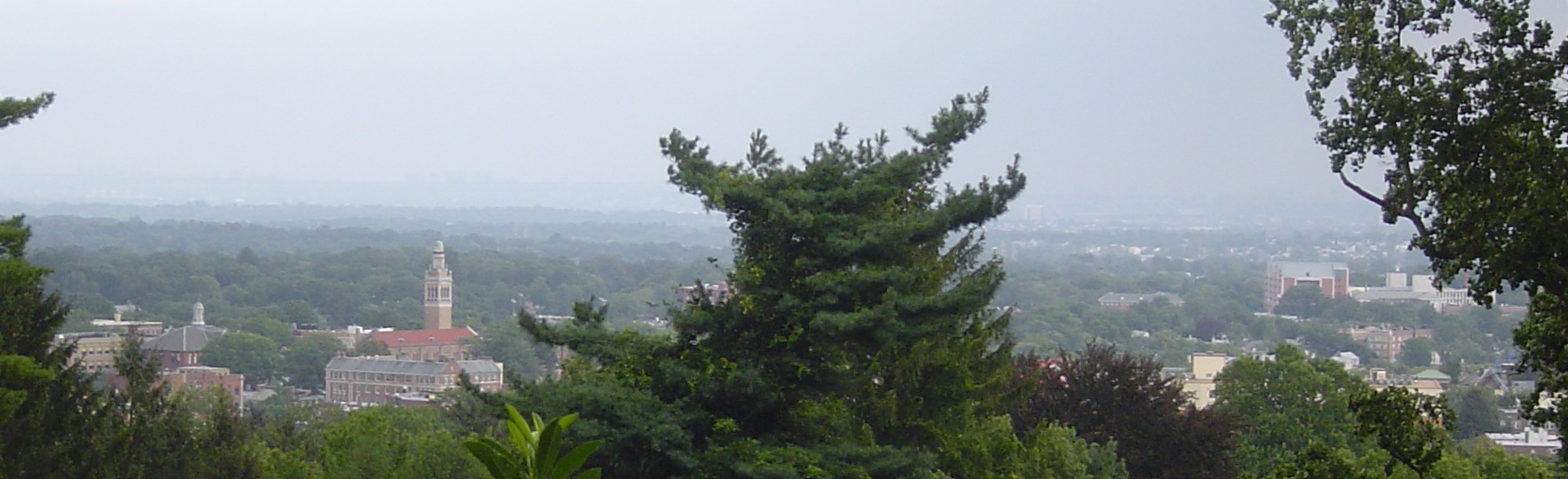
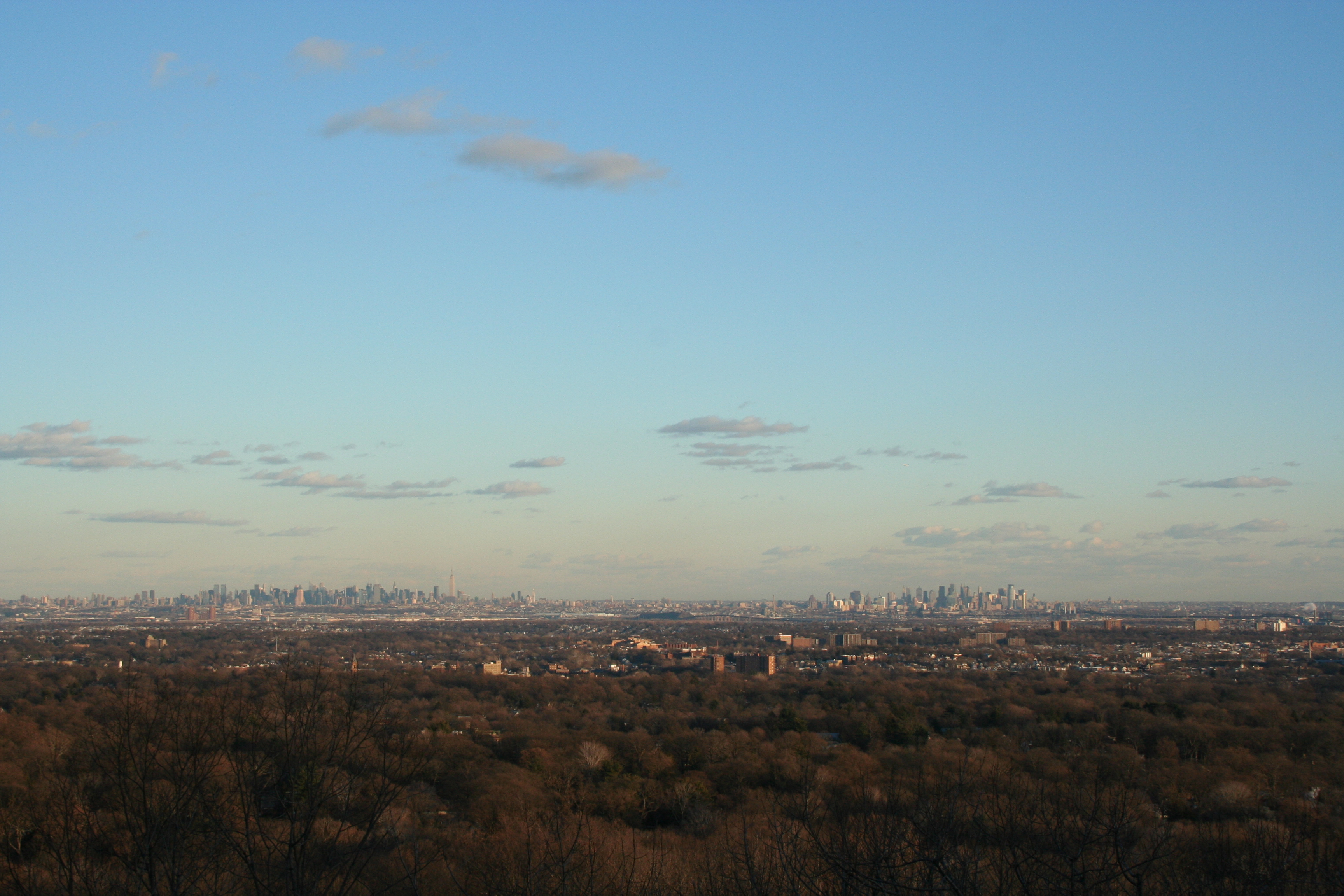
 Skyline of New York City from Montclair at the start of the Watchung Mountains
Montclair is located at 40°49′20″N 74°12′43″W / 40.822249°N 74.211989°W (40.822249, -74.211989).[11]
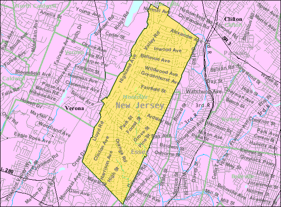
According to the United States Census Bureau, the township has a total area of 6.3 square miles (16 km2).
Montclair is located on the First Mountain of the Watchung Mountains. Most of the town stands on the east side of this ridge. Thus, many locations provide excellent views of the surrounding area and of the New York City skyline about 12 miles (19 km) away. Since the formation of Montclair, the western border on that mountain with Verona, West Orange, and Cedar Grove has moved slightly eastward, making the town slightly smaller.
Montclair citizens use two different main ZIP codes, the central and southern parts of the town are designated 07042. The portion of town from Watchung north has a separate ZIP code, 07043, and is known as Upper Montclair. Because the ZIP codes do not exactly match municipal boundaries, a few homes near the borders with neighboring towns fall into the ZIP codes for those towns (likewise, a few homes in some adjoining towns use one of the two ZIP codes assigned to Montclair, as does Mountainside Hospital (07042), even though it is completely located just over the border in Glen Ridge). Small areas in the southeast of town fall into the Glen Ridge ZIP code, 07028
Several streams flow eastward through Montclair: Toney's Brook in the center, Nishuane Brook in the southeast, the Wigwam Brook in the southwest, the Pearl Brook in the northwest, and the Yantacaw Brook in the northeast - all in the Passaic River watershed. The Yantacaw and Toney's brooks are dammed in parks to create ponds. The Wigwam, Nishuane, and Toney's brook flow into the Second River, and the others flow into the Third River. Formerly, north of Bloomfield Avenue between Grove Street and Pine Street there was another dam and another pond, powering a factory. Montclair is just north of the northern border of the Rahway River watershed.
The Southern border of Montclair is a straight line between the Eagle Rock, on the ridge of the First Watchung Mountain, and the point where Orange Road crosses the Nishuane Brook. The western border runs roughly along the ridge of the First Watchung Mountain between the Eagle Rock and the Essex County/Passaic County Border. The northern border is the same as the border between those two counties.
Neighboring towns. 
Little Falls Clifton Clifton Verona and Cedar Grove 
Glen Ridge and Bloomfield  Montclair

West Orange Orange East Orange Demographics
Historical populations Census Pop. %± 1830 under 1,400 — 1870 2,853 — 1880 5,147 80.4% 1910 21,559 — 1920 28,772 33.5% 1930 42,017 46.0% 1940 39,807 −5.3% 1950 43,927 10.3% 1960 43,129 −1.8% 1970 44,043 2.1% 1980 38,321 −13.0% 1990 37,729 −1.5% 2000 38,977 3.3% 2010 37,669 −3.4% Population 1930 - 1990.[12][13] 1830 data.[14] As of the census[4] of 2000, there were 38,977 people, 15,020 households, and 9,687 families residing in the township. The population density was 6,183.6 people per square mile (2,388.7/km2). There were 15,531 housing units at an average density of 2,464.0 per square mile (951.8/km2). The racial makeup of the CDP was 59.77% White, 32.06% African American, 3.15% Asian,0.19% Native American, 0.04% Pacific Islander, 1.77% from other races, and 3.03% from two or more races. Hispanic or Latino of any race were 5.12% of the population. Montclair has long highlighted its diversity, a feature that has attracted many to the community.[15]
There were 15,020 households out of which 34.3% had children under the age of 18 living with them, 47.2% were married couples living together, 14.1% had a female householder with no husband present, and 35.5% were non-families. 29.3% of all households were made up of individuals and 8.6% had someone living alone who was 65 years of age or older. The average household size was 2.53 and the average family size was 3.16.
In the township the population was spread out with 25.6% under the age of 18, 6.6% from 18 to 24, 31.9% from 25 to 44, 24.1% from 45 to 64, and 12.0% who were 65 years of age or older. The median age was 38 years. For every 100 females there were 86.3 males. For every 100 females age 18 and over, there were 80.7 males.
According to a 2007 estimate,[16] the median income for a household in the township was $92,988, and the median income for a family was $119,850. Males had a median income of $64,151 versus $43,520 for females. The per capita income for the township was $44,870. About 3.9% of families and 5.6% of the population were below the poverty line, including 5.4% of those under age 18 and 7.2% of those age 65 or over.
As of 2007, 35.29% of the population are Catholic; 9.60% in Montclair are Jewish; 2.74% affiliate with Islam; 9.3% are with another Christian sect.; with a small percentages of others.[17] Proportionally, there are more Muslims, Jews, and Catholics than the country's average.
Montclair has attracted many who work for major media organizations in New York City, including The New York Times and Newsweek. A March 11, 2007, posting in the blog Gawker.com listed some of those who work in the media and live in Montclair.[18] In it also live many commuters to New York City and the Metro Area.
Government
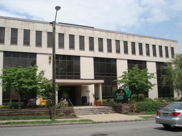
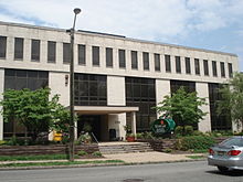 Montclair Municipal Building, the town's government building
Local government
Montclair is governed under the Council-Manager form of municipal government under the Faulkner Act, whose originator was a former mayor of Montclair. The government consists of a mayor and a six-member Township Council. The mayor and council are all elected to four-year terms in nonpartisan elections on a concurrent basis. The mayor and two council seats are elected at-large, with four council seats elected from each of four wards.[1]
 Fire Headquarters
Though the Mayor has no executive powers, the Mayor presides over council meetings and has both a voice and vote in its proceedings. The Mayor appoints members to many local governing groups, most notably the board of education.[19]
As of 2011[update], members of the Montclair Township Council are Mayor of Montclair, New Jersey Jerry Fried, Deputy Mayor Kathryn Weller-Demming (At-Large), Cary Africk (Second Ward), Dr. Renée E. Baskerville (Fourth Ward), Nick Lewis (Third Ward), Rich Murnick (First Ward) and Roger S. Terry (At-Large).[20]
In elections held on May 13, 2008, Jerry Fried won election as mayor, defeating councilmembers Joyce Michaelson and Ted Mattox. Fried's Unity Montclair running mates also won office, with Kathryn Weller taking one of the at-large seats, Cary Africk winning the 2nd Ward and Nick Lewis taking the 3rd Ward. Partnership Montclair's Roger Terry won an at-large seat and Rich Murnick won in the 1st Ward. The new council takes office on July 1, 2008. The 4th ward was won by Dr. Renée Baskerville, who ran as an independent.[21]
 Seal of Montclair has images for its historic components: a crane for Cranetown, a Lenape for Watchung, and a spear for Speertown.
Federal, state and county representation
 Logo of Montclair, depicting the letter 'l' as the memorial obelisk in Edgemont Memorial Park.
Montclair is split between the 8th Congressional district in the north and 10th Congressional district in the south and is part of New Jersey's 34th State legislative district.[22]
New Jersey's Eighth Congressional District is represented by Bill Pascrell (D, Paterson). New Jersey's Tenth Congressional District is represented by Donald M. Payne (D, Newark). New Jersey is represented in the United States Senate by Frank Lautenberg (D, Cliffside Park) and Bob Menendez (D, Hoboken).
34th District of the New Jersey Legislature, which is represented in the New Jersey Senate by Nia Gill (D, Montclair) and in the New Jersey General Assembly by Thomas P. Giblin (D, Montclair) and Sheila Y. Oliver (D, East Orange).[23] The Governor of New Jersey is Chris Christie (R, Mendham).[24] The Lieutenant Governor of New Jersey is Kim Guadagno (R, Monmouth Beach).[25]
Essex County's County Executive is Joseph N. DiVincenzo, Jr.[26] The executive, along with the Board of Chosen Freeholders administer all county business. The county's Board of Chosen Freeholders consists of nine members, four elected on an at-large basis and one from each of five wards, who serve terms of office on a concurrent basis.[27] As of 2011 Essex County's Freeholders are Freeholder President Blonnie R. Watson (at large)[28], Freeholder Vice President Ralph R. Caputo (District 5)[29], Rufus I. Johnson (at large)[30], Donald M. Payne, Jr. (at large)[31], Patricia Sebold (at large)[32], Samuel Gonzalez (District 1)[33], D. Bilal Beasley (District 2)[34], Carol Y. Clark (District 3)[35] and Linda Lordi Cavanaugh (District 4).[36][37]
Politics
On the national level, Montclair leans strongly toward the Democratic Party. In 2008, Democrat Barack Obama received 83% of the vote here, defeating Republican John McCain. About 70% of people in Montclair are Democrats.[citation needed]
Arts
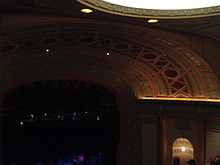 The Wellmont Theater during the BB King Concert on 12/4/08
Montclair hosts many art institutions and theaters, and despite its relatively small size, has many art venues. It has its own art museum, the Montclair Art Museum and several small galleries. Montclair also hosts two theaters that showcase movies and films, both originally live theaters, having been later converted. Clearview Cinemas has two locations in Montclair, the Bellevue Theater located in Upper Montclair and the Clairidge Cinema, located on Bloomfield Avenue. While the Bellevue Cinema mostly shows main-stream Hollywood films, the Clairidge Cinema shows different types of movies from documentaries to small scale indie films. Live theaters include, but are not limited to, The Montclair Opretta Company, the Wellmont Theatre, Montclair State University's Kasser Theater, Montclair State University's theater in Life Hall, and the Studio Playhouse. On Bloomfield Avenue there is a public stage used for concerts and other events. Dotted around Montclair there are also many art galleries, though most are centered in the Bloomfield Avenue Downtown Area.[38][39] Concerts are held at the Wellmont Theatre and at several churches and auditoriums sponsored by Outpost in the Burbs, a community-based organization.
Commerce
Montclair has six distinct commercial zones scattered around the town:
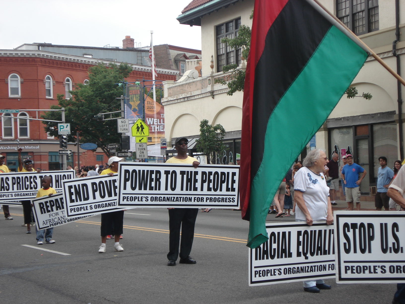
 A political rally on the intersection of Bloomfield Avenue and Church Street
- Montclair Center, centered on the intersection of Bloomfield Avenue, South Fullerton Avenue, Glen Ridge Avenue and Church Street. This intersection is also known as Six Corners. Montclair Center is the main commercial zone of Montclair and has the largest stores such as furniture stores and large restaurants which are more upscale near the center, which has many restaurants and boutiques. Near the eastern end of this business area is Lackawanna Plaza, a shopping center with about ten stores built inside the former Lackawana railway station. There is a post office one block to the north of this place.
- Upper Montclair in the north of the town, the second largest commercial zone. The center is the intersection of Valley Road and Bellevue Avenue, with surrounding areas as well. The Upper Montclair Business District is home to several restaurants and shops. Unlike many of Montclair's other commercial zones, it has chain stores like Starbucks, Talbots, Williams-Sonoma, Gap, Cold Stone Creamery, Supercuts, CVS and smaller chains such as Tinga. Despite the recession, the area in 2009-2010 saw the opening of several new national and local merchants. Among them are Chyten Tutors & Test Preparation, Five Guys, The Beauty Bar, and Montclair Station Restaurant & Bar- which occupies the historic Upper Montclair Station building. Upper Montclair also has both a park, Anderson Park, and a railway station, Upper Montclair, nearby. There is a post office here.
- Watchung Plaza, around the intersection of Watchung Avenue and Park Street. It is home to many "Mom and Pop Stores" and other small businesses and is located on the divide Montclair's two ZIP Codes, 07042 and 07043. Watchung Plaza has its own post office. It is served by the Watchung Avenue train station.
- Walnut Street, built around the Walnut Street train station. In the Spring, Summer, and Fall it is home to the Montclair Farmer's Market.
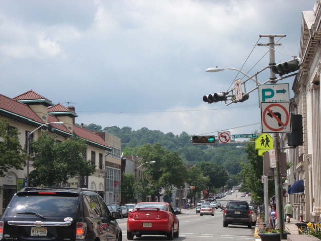
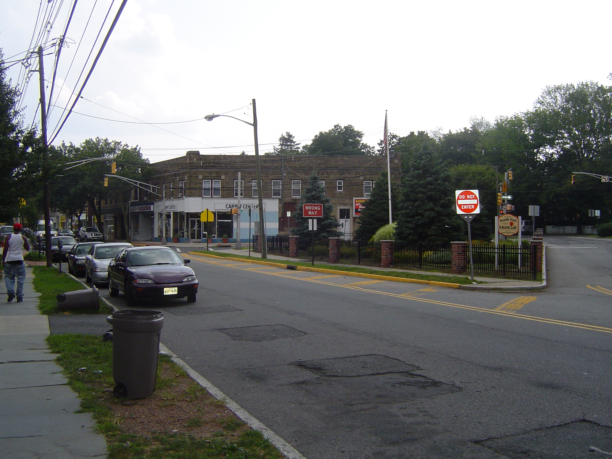
- South End, in the south of town, at the intersection of Cedar Avenue and Orange Road.
- Valley Road between Chestnut Street and Claremont Avenue. Known locally as "Frog Hollow", this area has some strip-mall style shops on one side of Valley Road, and on the other side window shops with residential apartments on top of them.
Transportation
New Jersey Transit and DeCamp Bus Lines are the providers of public transportation in Montclair. Montclair is considered a commuter town of New York City. The average Montclair commute is 38 minutes each way. 24% of commuters travelers take mass transit, while 59% drive alone. Twelve times more Montclair commuters take mass transit than the national average.[40]
Bus
NJ Transit buses 11, 28, 29, 34, 97, 191 and 705 run through Montclair, most going along the main street, Bloomfield Avenue. The New Jersey transit bus routes are:
- #11 goes from Downtown Newark through Verona, Cedar Grove, and Little Falls to Willowbrook Mall in Wayne. The only Montclair street it goes along is Bloomfield Avenue.
- #28 follows the route of #29 on Bloomfield Avenue until halfway through Montclair, where it goes north along Park Street, Watchung Avenue, and Valley Road to Montclair State University, and to Willowbrook Mall on Weekends
- #29 between West Caldwell and Newark, passing through Caldwell, Verona, Montclair, Glen Ridge, and Bloomfield on Bloomfield Avenue. It goes to Parsippany at rush hour. The only Montclair street it goes along is Bloomfield Avenue.
- #34 to Newark through East Orange and Orange on some trips, otherwise it goes to Bloomfield along Orange Road, Elm Street, and Bloomfield Avenue. It goes farther to the Montclair High School during that school's start and end times.
- #97 goes from the Montclair Center south along Orange and Harrison Roads through the Oranges.
- #191 goes from Willowbrook Mall through Little Falls to Montclair State University, then to New York City.
- #705 goes from Passaic along Alexander Avenue, Grove Street (for one block), Mt. Hebron Road and through Montclair State University to Willowbrook Mall
All of these routes except #97, #191, and #705 were trolley lines originally, operated by the Public Service Railway. A trolley Garage existed on Bloomfield Avenue. In the 1930s and 1950s the trolleys were destroyed and replaced with buses.
DeCamp Bus Lines routes 33 and 66 run through Montclair to the Port Authority Bus Terminal in New York City, carrying primarily commuters.
- #33 goes along Bloomfield Avenue, with some buses going onto Grove Street
- #66 goes along Orange Road, Park Street, Valley Road, and Mt. Hebron Road
Montclair State University has shuttle buses going around its campus.
The township of Montclair operates a jitney in the evening from the Bay Street train station to the southern end of Montclair.
Rail
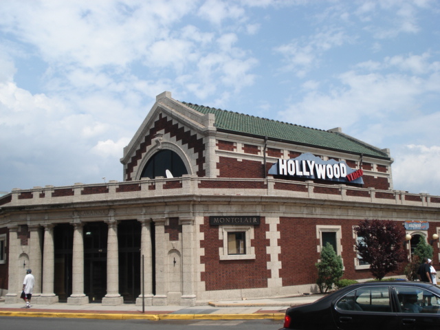
 The former Lackawanna Railroad terminal, photographed when it housed a Hollywood Video
Running through Montclair is the Montclair-Boonton Line, which goes between New York City / Hoboken and Hackettstown. There are seven railway stations serving Montclair: Bay Street, Walnut Street, Watchung Avenue, Upper Montclair, Mountain Avenue, and Montclair Heights in Montclair, and Montclair State University Station in the Great Notch area of Little Falls, New Jersey. Only Bay Street station has weekend train service. Montclair has a long history of railroads. The first railroad was built to Montclair in 1856 by the Newark and Bloomfield Railroad. It terminated at a station in Downtown Montclair. First the Morris and Essex Railroad, then the Delaware, Lackawanna and Western Railroad leased the line.
In 1868, the Montclair Railway built another line through Montclair, which caused disputes leading to Montclair's separation from Bloomfield. Shortly afterward it was taken over by the New York and Greenwood Lake Railway, a subsidiary of the Erie Railroad. A third railroad to Morristown was planned in 1860 and construction began, but the Panic of 1873 ended the project. In 1912 the Lackawanna Railroad built a large terminal at the end of their line. The Erie and Lackawanna Railroads later merged, forming the Erie-Lackawanna Railroad, which operated both lines for many decades. They were next operated by Conrail for approximately one year, after which NJ Transit took over passenger operations and Conrail continued freight operations. Meanwhile, the 1912 terminal was closed in 1981 and converted into shops. In 2002, the two railway lines were connected with the construction of the Montclair Connection.
Air and Road
Montclair is 13 miles (21 km) from Newark Liberty International Airport, 42 miles (68 km) from JFK Airport and 31 miles (50 km) from LaGuardia Airport. The Garden State Parkway to the east, U.S. Route 46 and New Jersey Route 3 to the north, and New Jersey Route 23 to the west are slightly past the town's borders. The main road through Montclair is Bloomfield Avenue.
There is a taxi stand off of Bloomfield Avenue in eastern Montclair, in front of Lackawanna Plaza, formerly the Montclair train station.
Housing
The median price for a house in Montclair is $670,400, more than three times the national average. The cost of living is also 48.37% percent higher than the USA's average. The median age of a house in Montclair is 51 years old.[citation needed]
Montclair is noted for its historic architecture. It is home to six historic districts listed on the Register of Historic Places of both the state and country as a whole, 92 individually listed landmarks, and two locally designated commercial districts. Works by significant architects include designs by Van Vleck and Goldsmith, Charles Follen McKim, McKim, Mead, and White, Henry Hudson Holly, Charles A. Platt, Alexander Jackson Davis, Dudley Van Antwerp, Effingham R. North, and Frances Nelson, among others.[citation needed]
Education
 Board of Education Building
The Montclair Public Schools serve students in kindergarten through twelfth grade. Schools in the district (with 2008-09 enrollment data from the National Center for Education Statistics[41]) are seven elementary schools (K-5, except as noted, with enrollment and magnet program listed in parentheses) — Bradford (498 students, Magnet Theme: The University Magnet), Bullock (325, Environmental Science; was Rand), Edgemont (309, Montessori), Hillside (3-5; 630, Gifted and Talented), Nishuane (K-2; 562, Gifted and Talented), Northeast (401, Global Studies) and Watchung (440, Science and Technology) — Glenfield (694, Visual and Performing Arts), Mount Hebron (579, Science, Technology, Engineering & Math) and Renaissance at Rand (247, Liberal Arts) for grades 6-8, along with Montclair High School (1,951) for grades 9-12.
Montclair is home to Montclair State University.
Montclair is also home to a host of private and parochial schools, including: Montclair Kimberley Academy, Lacordaire Academy, Immaculate Conception High School, St. Cassian's School, Virginia Harkness Sawtelle Learning, Maria Montessori Early Learning, Montclair Cooperative School, Trinity Academy, and Deron School II.
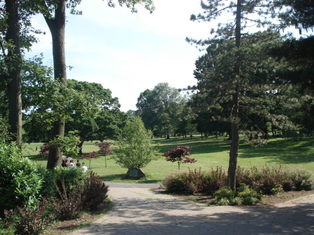
Parks
Montclair is home to many parks and nature reserves.
In Montclair there are many parks, such as Edgemont Memorial Park, Essex Park, Glenfield Park, Nishuane Park, Rand Park, Graz Park, Canterbury Park, Watchung Park, Eagle Rock Reservation, Brookdale Park, Anderson Park, Yantacaw Brook Park, the Bonsal Nature Reserve, Mountainside Park, the Presby Memorial Iris Gardens, and Mills Reservation. There are also many sports fields, some public, like in the parks, or some school owned, like the Essex Park fields or Montclair State University's Sprague Field. In total Montclair has 153.86 acres (0.6226 km2) of township park land spread around 18 parks and 123.76 acres (0.5008 km2) of county park land consisting of five parks.[42]
There are also 18 public tennis courts, four skating rinks (two of which are indoor) and 3 public swimming pools, which are the Mountainside pool, the Nishuane pool, and the Essex pool.[43]
Montclair parks County parks 
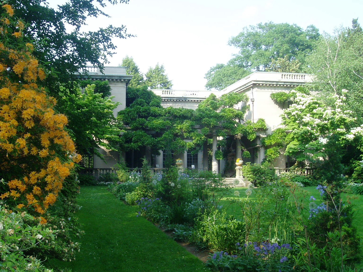
Town parks Canterbury Park · Edgemont Memorial Park · Essex Park · Graz Park · Mountainside Park · Nishuane Park · Rand Park · Tuers Park · Watchung Park · Yantacaw Brook ParkReservations Other facilities Montclair Golf Club · Presby Memorial Iris Gardens · Van Vleck House and Gardens · Howard Van Vleck Arboretum · Sprague Field · Mt. Hebron Cemetery · Immaculate Conception CemeteryMedia
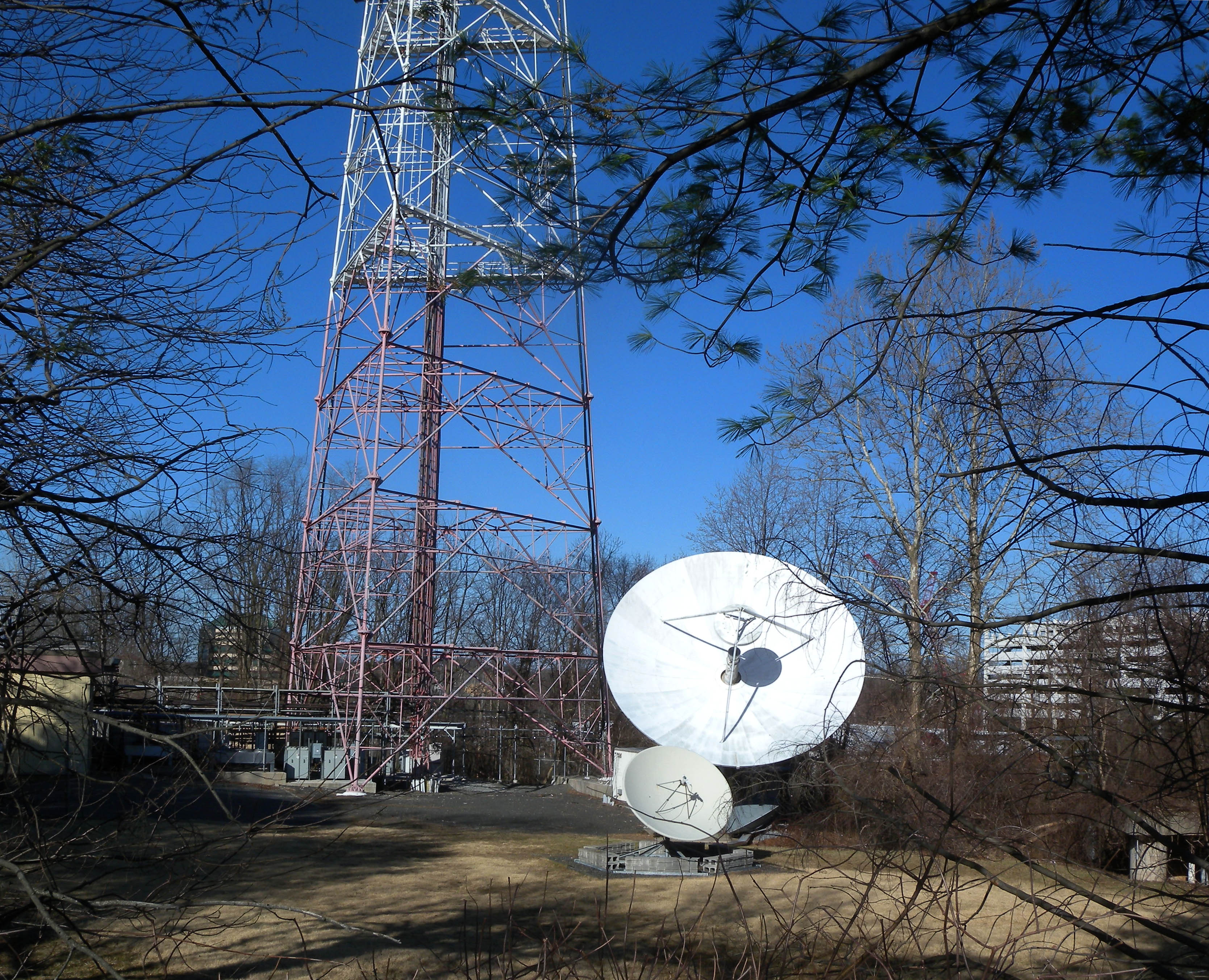
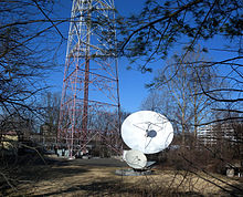 WNJN-TV transmitter site
Montclair has its own local newspaper, the Montclair Times. In addition, there is a radio station on the campus of Montclair State University, WMSC. Montclair State University is also the major broadcasting site for NJTV in Northern New Jersey. Locals also subscribe to The Star-Ledger of Newark, New Jersey, and The New York Times. The township has a municipal public service television channel, Channel 34, where town council meetings and school board meetings are broadcast. Montclair High School has its own paper the Mountaineer, and Montclair State University has its own student-run paper, the Montclarion. WVRM (Village Radio Montclair) has served the community since 1997 at 1620 AM, 91.9FM and on Comcast 34.
Sports
- Home to the Minor league baseball New Jersey Jackals of the Can-Am League. The Jackals play at Yogi Berra Stadium.
- Home to Floyd Hall Arena, an Ice Rink which is actually located in Little Falls but lies in the grounds of Montclair State University and is host to its Ice Hockey club. Various other hockey leagues, teams and on ice sports take part there as well.
- Former home to the New Jersey Pride of Major League Lacrosse.
- Home to the Montclair Rugby Club, also known as the Norsemen, of USA Rugby Division 2. They play at Codey Field.
- Montclair is home to Essex Eagles cricket team, a Division III team in the Cricket League of New Jersey.
- The New York Red Bulls of MLS practice at Montclair State University.
Sister cities
Montclair is twinned with the following cities:[44]
 Barnet, London, United Kingdom[45]
 Cherepovets, Russia
 Graz, Austria[46]
 Laguna de Perlas (Pearl Lagoon), Nicaragua[47]
Points of interest
- Montclair Art Museum
- Howard Van Vleck Arboretum
- Presby Memorial Iris Gardens
- Van Vleck House and Gardens
- Crane House and Museum
- The Montclair Historical Society, which consists of:
- Nathaniel Crane House
- Clark House
- Evergreens (House)
- Yogi Berra Stadium, Museum and Learning Center
- Parks and dining in Upper Montclair
- Shopping on Bloomfield Avenue and on Church Street[citation needed]
Historic sites
Montclair is home to the following locations on the National Register of Historic Places:
- The Anchorage - 155 Wildwood Ave. (added 1988)
- Anderson Park - SE corner of Bellevue and North Mountain Ave. (added 2009)
- Joseph Bardsley House - 345 Park St. (added 1988)
- Bradner`s Pharmacy - 33 Watchung Plaza (added 1988)
- Carnegie Library - Church St. at Valley Rd. (added 1988)
- Casa Deldra - 35 Afterglow Way (added 1988)
- Central Presbyterian Church - 46 Park St. (added 1986)
- J. M. Chapman House - 10 Rockledge (added 1988)
- Cliffside Hose Company No. 4 - 588 Valley Rd. (added 1988)
- Congregational Church - 42 S. Fullerton Ave. (added 1988)
- Israel Crane House - 110 Orange Rd (added 1973)
- Eastward - 50 Lloyd Rd. (added 1988)
- Egbert Farm - 128 N. Mountain Ave. (added 1988)
- Henry Fenn House - 208 N. Mountain Ave. (added 1988)
- First Methodist Episcopal Church - 24 N. Fullerton Ave. (added 1988)
- Free Public Library, Upper Montclair Branch - 185 Bellevue Ave. (added 1988)
- Frank Goodwillie House - 17 Wayside Pl. (added 1988)
- Haskell's Bloomfield Villa - 84 Llewellyn Rd. (added 1988)
- House at 147 Park Street - 147 Park St. (added 1988)
- The House that Lives - 83 Watchung Ave. (added 1988)
- Marlboro Park Historic District - Roughly along Fairfield St., Waterbury Rd., Montclair Ave., and Watchung Ave. between N. Fullerton and Grove Sts. (added 1988)
- Marsellis House - 190 Cooper Ave. (added 1988)
- Miller Street Historic District - Miller and Fulton Sts. between Elmwood Ave., Elm, and New Sts. (added 1988)
- George A. Miller House - 275 Claremont Ave. (added 1988)
- Montclair Art Museum - 3 S. Mountain Ave. (added 1986)
- Montclair Railroad Station - Lackawanna Plaza (added 1973)
- Mountain Avenue Station - 451 Upper Mountain Ave. (added 1984)
- Mountain District - Roughly bounded by Highland, Bradford, Upper Mountain, and Claremont Aves. (added 1988)
- Mulford House - 207 Union St. (added 1988)
- Pine Street Historic District - Roughly bounded by Glenridge Ave., the NJ TRANSIT Boonton Line, Pine and Baldwin Sts. (added 2000)
- Post Office Building, Upper Montclair - 242-244 Bellevue Ave. (added 1988)
- Presby Memorial Iris Gardens Horticultural Center - 474 Upper Mountain Ave. (added 1980)
- M. F. Reading House - 87 Midland Ave. (added 1988)
- Red Gables - 99 S. Fullerton Ave. (added 1988)
- Charles S. Schultz House - 30 N. Mountain Ave. (added 1979)
- S. C. Smith House - 40 Northview Ave. (added 1988)
- St. Luke's Church - 69 S. Fullerton Ave. (added 1988)
- Stone Eagles - 60 Undercliff Rd. (added 1988)
- Upper Montclair Station - 275 Bellvue Ave. (added 1984)
- Van Reyper-Bond House - 848 Valley Rd. (added 1979)
- Von Schmid House - 580 Park St. (added 1988)
- Watchung Avenue Station - Park St. (added 1984)
- Allyn Wight House - 75 Gates Ave. (added 1988)
Gallery
- Montclair Gallery
-

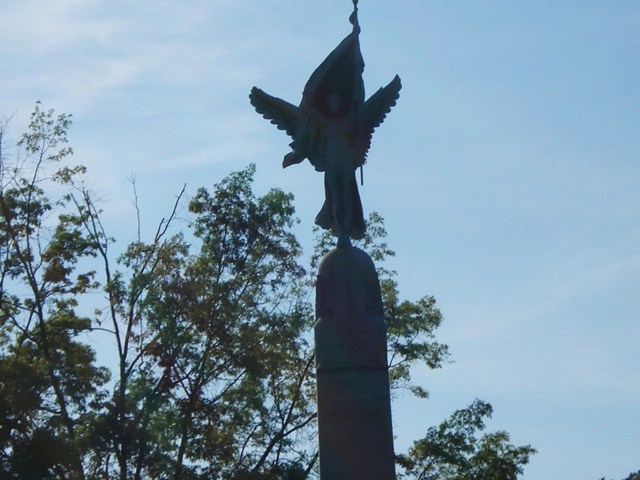
Icon of Montclair, WWI Memorial in Edgemont Memorial Park
-
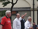
Former Governor of New Jersey, Jon Corzine, walking down Bloomfield Avenue
-

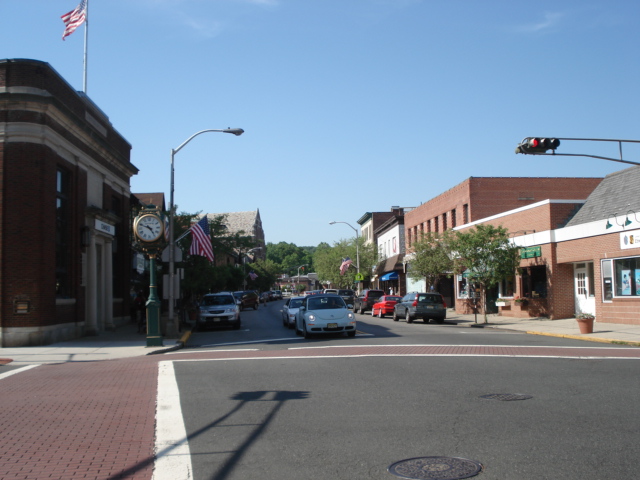
Business district in Upper Montclair, which is around the intersection of Valley Road and Bellevue Avenue
-

Montclair Public Library
-
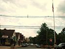
Bloomfield Avenue business district
-
Watchung Plaza
-
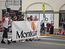
Montclair's banner held by exchange students from Montclair's sister city, Graz, Austria
-
Mountainside Hospital, (Which is located just across the border in Glen Ridge)
-
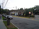
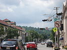
the South End area of Montclair
-
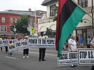
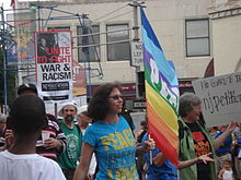
A political march in Montclair
Notable residents
Main article: List of people from Montclair, New JerseyReferences
- Notes
- ^ a b 2005 New Jersey Legislative District Data Book, Rutgers University Edward J. Bloustein School of Planning and Public Policy, April 2005, p. 148.
- ^ Township Manager, Township of Montclair. Accessed May 31, 2011.
- ^ U.S. Geological Survey Geographic Names Information System: Township of Montclair, Geographic Names Information System, accessed October 23, 2007.
- ^ a b "American FactFinder". United States Census Bureau. http://factfinder.census.gov. Retrieved 2008-01-31.
- ^ A Cure for the Common Codes: New Jersey, Missouri Census Data Center. Accessed July 14, 2008.
- ^ "US Board on Geographic Names". United States Geological Survey. 2007-10-25. http://geonames.usgs.gov. Retrieved 2008-01-31.
- ^ History of Montclair, Montclair Township. Accessed August 5, 2007. "When Bloomfield authorities declined to authorize a bond issue to underwrite another railroad, Montclair residents were successful in securing from the State legislature a charter for a separate township. Thus in 1868, the Township of Montclair was created."
- ^ "The Story of New Jersey's Civil Boundaries: 1606-1968", John P. Snyder, Bureau of Geology and Topography; Trenton, New Jersey; 1969. p. 129.
- ^ "Opponent of Distribution Formula For Federal Aid Steps Up Attack; As South Orange Moves to Become Township, Montclair Aide Calls for Equitable Sharing", The New York Times August 29, 1977. p. 59.
- ^ History of Montclair, accessed January 1, 2007.
- ^ "US Gazetteer files: 2010, 2000, and 1990". United States Census Bureau. 2011-02-12. http://www.census.gov/geo/www/gazetteer/gazette.html. Retrieved 2011-04-23.
- ^ New Jersey Resident Population by Municipality: 1930 - 1990, Workforce New Jersey Public Information Network. Accessed March 1, 2007.
- ^ http://www.firstbaptistbloomfield.org/knox-hist.htm
- ^ Montclair Historical Society
- ^ Goodnough, Abby. " SCHOOLS: REFERENDUM;How to Pick the School Board?", The New York Times, October 22, 1995. Accessed July 14, 2008. "In a town that has always been proud of its diversity -- many residents say it was their primary reason for moving to Montclair -- the difference of opinion has caused considerable strife."
- ^ 2007 estimate at census.gov
- ^ http://www.bestplaces.net/city/Montclair-New_Jersey.aspx Best Places city data. accessed September 2008
- ^ Where They Weekend: Montclair, NJ, Gawker.com, March 11, 2007. Accessed July 3, 2007.
- ^ Montclair's Form of Government, Montclair Township. Accessed June 27, 2006.
- ^ Mayor & Council, Montclair Township. Accessed April 10, 2011.
- ^ Zarra, Erica. "Fried finishes first", Montclair Times, May 16, 2008. Accessed June 4, 2008.
- ^ 2011 New Jersey Citizen's Guide to Government, New Jersey League of Women Voters, p. 61. Accessed May 31, 2011.
- ^ "Legislative Roster: 2010-2011 Session". New Jersey Legislature. http://www.njleg.state.nj.us/members/roster.asp. Retrieved 2010-02-08.
- ^ "About the Governor". New Jersey. http://www.nj.gov/governor/about/. Retrieved 2010-01-21.
- ^ "About the Lieutenant Governor". New Jersey. http://www.nj.gov/governor/lt/. Retrieved 2010-01-21.
- ^ Essex County Executive, Essex County, New Jersey. Accessed January 3, 2011.
- ^ Definition of a Freeholder, Essex County, New Jersey. Accessed January 3, 2011.
- ^ Blonnie R. Watson, Essex County, New Jersey. Accessed January 3, 2011.
- ^ Ralph R. Caputo, Essex County, New Jersey. Accessed January 3, 2011.
- ^ Rufus I. Johnson, Essex County, New Jersey. Accessed January 3, 2011.
- ^ Donald M. Payne, Jr., Essex County, New Jersey. Accessed January 3, 2011.
- ^ Patricia Sebold, Essex County, New Jersey. Accessed January 3, 2011.
- ^ Samuel Gonzalez, Essex County, New Jersey. Accessed January 3, 2011.
- ^ D. Bilal Beasley, Essex County, New Jersey. Accessed January 3, 2011.
- ^ Carol Y. Clark, Essex County, New Jersey. Accessed January 3, 2011.
- ^ Linda Lordi Cavanaugh, Essex County, New Jersey. Accessed January 3, 2011.
- ^ The Board of Chosen Freeholders, Essex County, New Jersey. Accessed January 3, 2011.
- ^ [1] September 3, 2009.
- ^ [2] September 3, 2009.
- ^ http://factfinder.census.gov/servlet/NPTable?_bm=y&-qr_name=ACS_2007_3YR_G00_NP01&-geo_id=06000US3401347500&-gc_url=&-ds_name=&-_lang=en
- ^ Data for the Montclair Public Schools, National Center for Education Statistics. Accessed April 10, 2011.
- ^ List of parks http://www.gotomontclairnj.com/parks.htm
- ^ Montclair Information, Township of Montclair. Accessed July 4, 2008.
- ^ Online Directory: New Jersey, USA, Sister Cities International. Accessed November 8, 2007.
- ^ Sister City Exchange With Barnet, England, accessed September 12, 2006.
- ^ "Twin Towns - Graz Online - English Version". www.graz.at. http://www.graz.at/cms/beitrag/10045157/606819/. Retrieved 2010-01-05.
- ^ Nicaragua Sister City projects
External links
- Township of Montclair Official Website
- Montclair Business Improvement District
- Montclair Historical Society
- Montclair, New Jersey at the Open Directory Project
Municipalities and communities of Essex County, New Jersey Cities 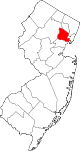
Boroughs Townships Belleville | Bloomfield | Cedar Grove | City of Orange | Fairfield | Irvington | Livingston | Maplewood | Millburn | Montclair | Nutley | South Orange | Verona | West Caldwell | West Orange
Communities Broadway | Downtown Newark | Fairmount | Forest Hill | Halcyon Park | Ironbound | Llewellyn Park | Roseville | Seventh Avenue | Short Hills | Springfield/Belmont | University Heights | Upper Montclair | Vailsburg | Weequahic
Categories:- Populated places established in 1868
- Former towns in New Jersey
- Montclair, New Jersey
- Faulkner Act Council-Manager
- Townships in Essex County, New Jersey


Wikimedia Foundation. 2010.