- Roseland, New Jersey
Infobox Settlement
official_name = Roseland, New Jersey
settlement_type = Borough
nickname =
motto =
imagesize =
image_caption =
image_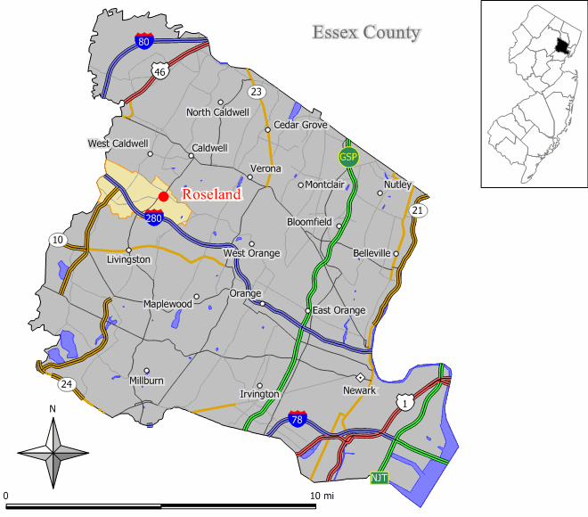
mapsize = 250x200px
map_caption = Map of Roseland in Essex County. Inset: Location of Essex County highlighted in the State of New Jersey.
mapsize1 = 250x200px
map_caption1 = Census Bureau map of Roseland, New Jerseysubdivision_type = Country
subdivision_name =United States
subdivision_type1 = State
subdivision_name1 =New Jersey
subdivision_type2 = County
subdivision_name2 = Essex
government_footnotes =
government_type =Borough (New Jersey)
leader_title =Mayor
leader_name = John Arvanites
leader_title1 = Administrator
leader_name1 = Thomas P. Kaczynski
established_title = Incorporated
established_date =March 10 ,1908 unit_pref = Imperial
area_footnotes =
area_magnitude =
area_total_km2 = 9.4
area_land_km2 = 9.4
area_water_km2 = 0.0
area_total_sq_mi = 3.6
area_land_sq_mi = 3.6
area_water_sq_mi = 0.0population_as_of = 2006
population_footnotes =
population_total = 5400
population_density_km2 = 565.1
population_density_sq_mi = 1463.6timezone = Eastern (EST)
utc_offset = -5
timezone_DST = EDT
utc_offset_DST = -4
elevation_footnotes = [Gnis|885378|Borough of Roseland,Geographic Names Information System . AccessedJanuary 4 ,2008 .]
elevation_m = 74
elevation_ft = 243
latd = 40 |latm = 49 |lats = 19 |latNS = N
longd = 74 |longm = 18 |longs = 29 |longEW = Wpostal_code_type =
ZIP code
postal_code = 07068
area_code = 973
blank_name = FIPS code
blank_info = 34-64590GR|2 [ [http://mcdc2.missouri.edu/webrepts/commoncodes/ccc_nj.html A Cure for the Common Codes: New Jersey] , Missouri Census Data Center. AccessedJuly 14 ,2008 .]
blank1_name = GNIS feature ID
blank1_info = 0885378GR|3
website = http://www.roselandnj.org
footnotes =Roseland is a borough in western Essex County,
New Jersey ,United States . As of theUnited States 2000 Census , the borough population was 5,298.Roseland was incorporated as a borough by an Act of the
New Jersey Legislature onMarch 10 ,1908 , from portions of Livingston Township."The Story of New Jersey's Civil Boundaries: 1606-1968", John P. Snyder, Bureau of Geology and Topography; Trenton, New Jersey; 1969. p. 84.]"
New Jersey Monthly " magazine ranked Roseland as its 14th best place to live in its 2008 rankings of the "Best Places To Live" in New Jersey. [ [http://njmonthly.com/articles/best_of/placestolive/best-places-to-live---the-complete-top-towns-list-.html "Best Places To Live - The Complete Top Towns List 1-100"] , "New Jersey Monthly ",February 21 ,2008 . AccessedFebruary 24 ,2008 .]Geography
Roseland is located at coor dms|40|49|12|N|74|18|24|W|city (40.819899, -74.306701)GR|1. Roseland is located about convert|20|mi|km|-1 west of New York City. Roseland is part of the
New York -Northern New Jersey-Long Island , NY-NJ-CT Metropolitan Statistical Area.According to the
United States Census Bureau , the borough has a total area of 3.6square mile s (9.4km² ), all of it land.Demographics
USCensusPop
1930= 1058
1940= 1556
1950= 2019
1960= 2804
1970= 4453
1980= 5330
1990= 4847
2000= 5298
estimate= 5400
estyear=2006
estref= [http://factfinder.census.gov/servlet/SAFFPopulation?_event=Search&geo_id=06000US3401313045&_geoContext=01000US%7C04000US34%7C05000US34013%7C06000US3401313045&_street=&_county=roseland&_cityTown=roseland&_state=04000US34&_zip=&_lang=en&_sse=on&ActiveGeoDiv=geoSelect&_useEV=&pctxt=fph&pgsl=060&_submenuId=population_0&ds_name=null&_ci_nbr=null&qr_name=null®=null%3Anull&_keyword=&_industry= Census data for Roseland borough] ,United States Census Bureau . AccessedAugust 20 ,2007 .]
footnote=Population 1930 - 1990. [ [http://www.wnjpin.net/OneStopCareerCenter/LaborMarketInformation/lmi01/poptrd6.htm New Jersey Resident Population by Municipality: 1930 - 1990] , Workforce New Jersey Public Information Network. AccessedMarch 1 ,2007 .] As of thecensus GR|2 of 2000, there were 5,298 people, 2,142 households, and 1,525 families residing in the borough. Thepopulation density was 1,463.6 people per square mile (565.1/km²). There were 2,187 housing units at an average density of 604.2/sq mi (233.3/km²). The racial makeup of the borough was 93.43% White, 0.72% African American, 0.04% Native American, 4.72% Asian, 0.43% from other races, and 0.66% from two or more races. Hispanic or Latino of any race were 2.28% of the population.As of the 2000 census, 32.0% of Roseland residents were of Italian ancestry, the 27th-highest percentage of any municipality in the United States, and 10th-highest in New Jersey, among all places with more than 1,000 residents identifying their ancestry. [ [http://www.epodunk.com/ancestry/Italian.html Italian Communities] ,
Epodunk . AccessedJune 9 ,2007 .]There were 2,142 households out of which 26.2% had children under the age of 18 living with them, 60.8% were married couples living together, 7.9% had a female householder with no husband present, and 28.8% were non-families. 25.7% of all households were made up of individuals and 13.4% had someone living alone who was 65 years of age or older. The average household size was 2.47 and the average family size was 2.99.
In the borough the population was spread out with 20.6% under the age of 18, 4.2% from 18 to 24, 26.3% from 25 to 44, 29.2% from 45 to 64, and 19.7% who were 65 years of age or older. The median age was 44 years. For every 100 females there were 85.9 males. For every 100 females age 18 and over, there were 82.6 males.
The median income for a household in the borough was $82,499, and the median income for a family was $93,957. Males had a median income of $61,049 versus $41,688 for females. The
per capita income for the borough was $41,415. None of the families and 1.7% of the population were living below thepoverty line , including no under eighteens and 2.7% of those over 64.Government
Local government
Roseland is governed under the Borough form of New Jersey municipal government. The government consists of a Mayor and a Borough Council comprising six council members, with all positions elected at large. A Mayor is elected directly by the voters to a four-year term of office. The Borough Council consists of six members elected to serve three-year terms on a staggered basis, with two seats coming up for election each year."2005 New Jersey Legislative District Data Book",
Rutgers University Edward J. Bloustein School of Planning and Public Policy , April 2005, p. 125.]The
Mayor of Roseland is [http://www.roselandnj.org/Borofficials/Mayor/mayor.htm John Arvanites] .As of 2008 , members of the Roseland Borough Council are Council President [http://www.roselandnj.org/Borofficials/Council/dianechristiana.htm Diane V. Christiana] , [http://www.roselandnj.org/Borofficials/Council/johnduthie.htm John Duthie] , [http://www.roselandnj.org/Borofficials/Council/jacobs.htm David B. Jacobs] , [http://www.roselandnj.org/Borofficials/Council/seanmcgovern.htm Sean McGovern] , [http://www.roselandnj.org/Borofficials/Council/thomasmoore.htm Thomas M. Moore] and [http://www.roselandnj.org/Borofficials/Council/micheletolli.htm Michele Tolli] . [http://www.roselandnj.org/Borofficials/mayorcouncil.htm Borough Officials] , Borough of Roseland. AccessedApril 14 ,2008 .]Federal, state and county representation
Roseland is part of New Jersey's 27th Legislative District and is in the Eleventh Congressional District. [ [http://www.lwvnj.org/pubs/CG06.pdf 2006 New Jersey Citizen's Guide to Government] , New Jersey
League of Women Voters , p. 63. AccessedAugust 30 ,2006 .]Politics
On the national level, Roseland leans toward the Republican Party. In 2004, Republican
George W. Bush received 59% of the vote here, defeating DemocratJohn Kerry , who received around 40%.Education
The
Roseland School District serves public school students in Kindergarten through Sixth grade at [http://www.lestercnoecker.org/ Lester C. Noecker Elementary School] , which had an enrollment of 467 students (as of 2005-2006). [ [http://nces.ed.gov/ccd/schoolsearch/school_list.asp?Search=1&DistrictID=3414250 Data for Lester C. Noecker Elementary School] ,National Center for Education Statistics . AccessedMarch 2 ,2008 .]Students in public school for grades 7 - 12 attend the
West Essex Regional School District , a regional school district serving students from four municipalities in western Essex County,New Jersey . Communities served by the district's schools are Essex Fells, Fairfield, North Caldwell and Roseland. [ [http://education.state.nj.us/rc/rc07/narrative/13/5630/13-5630-050.html West Essex Regional High School 2007 School Report Card] ,New Jersey Department of Education . AccessedMarch 1 ,2008 . "West Essex High School is located in North Caldwell and serves the four area sending districts of Essex Fells, Fairfield, North Caldwell, and Roseland."] Schools in the district (with 2005-06 enrollment data from theNational Center for Education Statistics [ [http://nces.ed.gov/ccd/schoolsearch/school_list.asp?Search=1&DistrictID=3417460 Data for the West Essex Regional School District] ,National Center for Education Statistics . AccessedAugust 4 ,2008 .] ) are [http://www.westex.org/juniorhigh/index.html West Essex Junior High School] (grades 7-9; 833 students) andWest Essex High School (grades 10-12; 729 students).History
Roseland was part of the
Horseneck Tract , which was an area that consisted of what are now the municipalities of Caldwell, West Caldwell, North Caldwell, Fairfield, Verona, Cedar Grove, Essex Fells, Roseland, and portions of Livingston and West Orange.In 1702, settlers purchased the 14,000 acre (57 km²) Horseneck Tract — so-called because of its irregular shape that suggested a horse's neck and head — from the
Lenni Lenape Native Americans for goods equal to $325. This purchase encompassed much of western Essex County, from the First Mountain to thePassaic River .Originally named Centerville, the name of the town was changed to Roseland to avoid confusion with the several other Centervilles spread across the state.
One of the most notable places of interest in the town was the
Becker Farm Railroad , otherwise known as the Centerville & Southwestern Railroad. Located on the Becker Farm (on what is now a large business complex, which comprises more than half of the total area within the town), a miniature railroad operated from 1938 until 1972. Some vestiges of the railroad still exist.Corporate residents
Companies based in Roseland include
Automatic Data Processing [ [http://finance.yahoo.com/q/pr?s=adp Automatic Data Processing, Inc. (ADP)] ,Yahoo! Finance . AccessedJuly 14 ,2008 .] , law firmsLowenstein Sandler andConnell Foley [ [http://www.cfg-lawfirm.com/news/070108CFnewsignage.htm Connell Foley’s Roseland Office Undergoing Renovations] ,Connell Foley ,July 2 ,2008 . AccessedJuly 14 ,2008 .] ,Curtiss-Wright , and pharmaceutical companyOrganon International , which opened its worldwide headquarters here in 2003. [ [http://findarticles.com/p/articles/mi_m4PRN/is_2003_May_15/ai_n27619454 "Organon Pharmaceuticals USA Inc. and Organon International Inc. Open Worldwide Headquarters in Roseland; Ceremony Marks New State of Development for New Jersey"] , "PR Newswire ",May 15 ,2003 . AccessedJuly 14 ,2008 .]References
External links
* [http://www.roselandnj.org/ Roseland Borough website]
* [http://www.lestercnoecker.org/ Lester C. Noecker Elementary School]
*NJReportCard|13|4530|020|Lester C. Noecker Elementary School
* [http://nces.ed.gov/ccd/schoolsearch/school_list.asp?Search=1&DistrictID=3414250 Data for Lester C. Noecker Elementary School] ,National Center for Education Statistics
* [http://www.Westex.org West Essex Regional School District]
Wikimedia Foundation. 2010.