- Mass transit in New York City
-
New York City's public transportation network is the most extensive in North America. About one in every three users of mass transit in the United States and two-thirds of the nation's rail riders are residents of New York City, or its suburbs. Data from the 2000 U.S. Census reveals that New York is the only locality in the United States where more than half of all households do not own a car (the figure is even higher in Manhattan, over 75 percent). While nearly 90 percent of Americans drive to their jobs, mass transit is the primary form of travel for New Yorkers.[1] New York's uniquely high rate of public transit makes it one of the most energy efficient cities in the country.
Contents
Ridership
The Metropolitan Transportation Authority (MTA) operates most of New York City's transit systems. Using census data, the MTA reported in August 2006 that ridership on its buses, subways and commuter trains in recent years has grown faster than population growth, indicating that more New Yorkers are choosing to use mass transit. The MTA attributed the ridership gains to the introduction of the MetroCard in 1993, and the replacement of more than 2,800 subway and train cars since 2000.
From 1995 to 2005, the authority said, ridership on city buses and subways grew by 36%, compared with a population gain in the city of 7%. In the suburbs, it said, a 14% increase in ridership on Metro-North and the Long Island Rail Road outpaced a suburban population gain of 6%.[2] With dramatic increases in fuel prices in 2008, as well as increased tourism and residential growth, ridership on New York buses and subways grew 3.1% up to a 2.37 billion trips a year compared to 2007. This is the highest since 1965.[3]
Transit culture
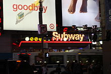
With nearly 4.5 million people riding the transit network each weekday, the system is a major venue for commerce, entertainment and political activism. Life in the city is so dependent on the subway that New York City is home to two of only three 24 hour subway systems in the world. Campaigning at subway stations is a staple of New York elections akin to candidate appearances at small town diners during presidential campaigns in the rest of the country. Each week, more than 100 musicians and ensembles - ranging in genre from classical to Cajun, bluegrass, African, South American and jazz - give over 150 performances sanctioned by New York City Transit at 25 locations throughout the subway system.[4] There are of course many more who are unauthorized performers, ranging from professionals putting on an impromptu show to panhandlers seeking donations by way of a song.
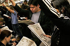
One outcome of the city's extensive mass transit use is a robust local newspaper industry. The readership of many New York dailies is comprised in large part by transit riders who read during their commutes. The three-day transit strike in December 2005 briefly depressed circulation figures, underscoring the relationship between the city's commuting culture and newspaper readership.[5]
The subways of New York have been venues for beauty pageants and guerrilla theater. The MTA's annual Miss Subways contest ran from 1941 to 1976 and again in 2004 (under the revised name "Ms. Subways").
Fare collection
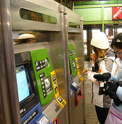
The MetroCard is the current payment method for New York City subways and buses. It is a thin, plastic card on which the customer electronically loads fares. Payment may be made at automated machines that accept money, credit cards, and debit cards. Variable pay schemes are available; cards with more pre-paid rides offer greater discounts. The MetroCard was introduced to enhance the technology of the transit system and eliminate the burden of carrying and collecting tokens. The use of tokens in New York's transit system was discontinued in 2003.
- The future of the MetroCard
In 2006 New York City's two main transportation systems announced plans to introduce smart cards for paying fares. In February the Port Authority of New York and New Jersey unveiled a $73 million smart card system in the PATH station at the World Trade Center.
The PATH "SmartLink" card contains an antenna attached to a computer chip, which can be read by turnstiles without requiring passengers to swipe cards, similar to the TfL Oyster Card. The "SmartLink" card will eventually replace the magnetic-strip QuickCard accepted at PATH turnstiles.
The New York City subway and bus network will eventually use this same technology. A consortium of New York metropolitan transit agencies, including the Port Authority and New Jersey Transit, will test different versions and introduce a single standard. In the future all New York City area transit systems will use the same "contactless" payment system.
Metropolitan Transportation Authority
The Metropolitan Transportation Authority (MTA) is a New York State public benefit corporation tasked with providing mass transit in the New York City metropolitan area through its various subsidiary agencies.
- MTA New York City Transit provides extensive fixed-fare subway and bus service (the latter controlled by Regional Bus above) throughout the five boroughs of New York City. The subway system is one of the largest in the world, with over 720 miles (1,160 km) of track and 468 stations. The free (except at St. George and Tompkinsville) Staten Island Railway, part of this system, provides north-south service along the entire length of Staten Island.
- MTA Regional Bus Operations provides bus service within New York City and Nassau County, utilizing three public brands:
- MTA New York City Bus for most transit service within New York City
- MTA Long Island Bus for bus service between Queens and Nassau County, with some extensions into Suffolk County
- MTA Bus Company for routes previously operated by private companies under contract to the New York City Department of Transportation
- MTA Metro-North Railroad provides commuter service from The Bronx, Westchester County, Putnam County, Dutchess County and southern Connecticut into Grand Central Terminal. Three main lines terminate in Poughkeepsie, Wassaic, and New Haven. The lattermost line has connecting branches to New Canaan, Danbury and Waterbury in Connecticut. In partnership with New Jersey Transit, Metro-North Railroad also provides commuter services into Hoboken, New Jersey from Port Jervis and Spring Valley.
- MTA Long Island Rail Road provides extensive commuter service to most of Long Island, with destinations in Queens, Nassau, and Suffolk Counties via two trunk lines and six subsidiary branches.
Port Authority of New York and New Jersey
The Port Authority of New York and New Jersey operates three rail systems:
- PATH, an electric railroad connecting Manhattan to New Jersey
- AirTrain JFK, a rapid transit system connecting the terminals and parking areas at John F. Kennedy International Airport (JFK), Jamaica, and Howard Beach, Queens
- AirTrain Newark, a monorail connecting the terminals and parking areas at Newark Liberty International Airport and the Newark Liberty International Airport train station on the Northeast Corridor.
The Port Authority also owns and operates the three major airports in the New York City area and the Stewart International Airport about 55 miles north of New York City. Regional bus service to New Jersey, upstate New York, the Midwest, and Canada travels from the Port Authority Bus Terminal near Times Square and the smaller George Washington Bridge Bus Terminal.
New Jersey Transit
New Jersey Transit (NJ Transit) provides extensive commuter rail service from northern and central New Jersey to Hoboken Terminal in New Jersey and Pennsylvania Station in Manhattan. NJ Transit also has an extensive network of bus routes radiating in and out of the Port Authority Bus Terminal and the George Washington Bridge Bus Station. In addition to buses and commuter trains, NJ Transit also operates three light rail systems in the state.
- The Northeast Corridor Line provides electric rail service between Pennsylvania Station in Manhattan and Trenton. At Trenton, riders can connect to SEPTA and Amtrak.
- The North Jersey Coast Line provides electric rail service between Pennsylvania Station in Manhattan and Long Branch. Diesel service is provided between Long Branch and Bay Head or Hoboken and Bay Head.
- The Raritan Valley Line provides diesel rail service between High Bridge, Raritan, and Newark Penn Station. Certain weekend trips continue to Hoboken Terminal
- The Pascack Valley Line provides diesel rail service between Spring Valley, NY and Hoboken Terminal.
- The Bergen County Line, Main Line and Port Jervis Line provide diesel rail service between Port Jervis, NY and Hoboken. NJ Transit has a partnership with Metro North Railroad in which they provide the facilities necessary for stations within the state of New York north of Suffern, New York.
- The Montclair-Boonton Line provides electric rail service between Montclair, and either Hoboken Terminal or Pennsylvania Station (Manhattan). It provides diesel service from Hackettstown, Dover, Montclair, and Hoboken. Trains designated Midtown Direct are the ones that will terminate at Pennsylvania Station.
- The Morris and Essex Lines provide electric rail service between Dover or Gladstone and Hoboken or New York Penn Station, and diesel service from Hackettstown to Hoboken . Trains designated Midtown Direct are the ones that will terminate at Pennsylvania Station.
- The Hudson-Bergen Light Rail system operates along the west bank of the Hudson River, connecting the communities of Bayonne, Jersey City, Hoboken, Weehawken, Union City and North Bergen.
- The Newark Light Rail system, formerly the Newark City Subway, is a light rail system connecting Downtown Newark, Newark Broad Street Station (serving the Morris and Essex Lines and the Montclair-Boonton Line), and Newark Penn Station (serving Amtrak, PATH, and NJ Transit's Northeast Corridor, North Jersey Coast, and Raritan Valley Lines) with neighboring Belleville and Bloomfield.
Inter-City Rail
Amtrak provides long-distance passenger rail connections from New York's Pennsylvania Station to Boston, Philadelphia, Baltimore, Washington, D.C., New England, Upstate New York, Montreal, Toronto, Florida, Atlanta, New Orleans, Chicago and the Midwest. For trips of less than 500 miles, Amtrak is often cheaper and easier than air travel, and sometimes faster if travel to and from the airport and security check-in times are included. Amtrak's high-speed Acela service from New York to Boston, Philadelphia, Baltimore, and Washington uses tilting technology and fast electric locomotives. This route, known as the Northeast Corridor, accounts for about half of Amtrak's ridership and covers its own operating, but not capital, costs.
Other transit
Other transit in the city includes:
- The Roosevelt Island Tramway, an aerial commuter tram connecting Manhattan to Roosevelt Island. Connecting "Red Bus" service is available on the Island.
- The Staten Island Ferry, a free ferry operated by the New York City Department of Transportation connecting St. George and the Staten Island Railway in Staten Island to South Ferry in Manhattan.
- NY Waterway, Liberty Water Taxi, New York Water Taxi, NY Waterway, and SeaStreak, are privately operated ferry systems with service to Hudson County, Brooklyn, and the Raritan Bayshore.
- The Bee-Line Bus System, connecting New York City and Westchester County.
- The Downtown Connection, a free shuttle bus service in lower Manhattan operated by the Downtown Alliance.
- Coach USA and Atlantic Express privately-operated commuter bus lines with service to New Jersey. Several private bus companies also operate shuttles to area airports.
- US Helicopter, a private scheduled helicopter service operating from the Downtown Manhattan Heliport and the 34th Street Heliport to area airports and Connecticut.
- Private Transportation operates a bus route between Borough Park and Williamsburg in Brooklyn.
- Dollar vans operate in the boroughs outside Manhattan and in New Jersey.
Major transit terminals
There are several major transit terminals in the New York metropolitan area. They include train stations, bus terminals, and ferry landings.
Train stations
- Pennsylvania Station, which is served by Amtrak, Long Island Rail Road, New Jersey Transit, and the New York City Subway
- Grand Central Terminal, which is served by Metro-North Railroad and the New York City Subway
- Jamaica Station, which is served by Long Island Rail Road, New York City Subway, and AirTrain JFK
- Atlantic Terminal, which is served by the New York City Subway and Long Island Rail Road
- Harlem – 125th Street, which is served by Metro-North Railroad and New York City Subway.
- Secaucus Junction allows passengers on the New Jersey Transit Port Jervis, Pascack Valley, Main and Bergen County Lines to make a swift connection to certain Pennsylvania Station-bound trains for an easier commute into New York City. It also enables transfers between those lines and trains serving Newark Airport and southern New Jersey.
- Hoboken Terminal, which is served by New Jersey Transit, Hudson-Bergen Light Rail, PATH and NY Waterway ferries to New York City
- Newark Penn Station, which is served by Amtrak, New Jersey Transit commuter rail, Newark City Subway and PATH
Bus terminals
- Port Authority Bus Terminal, served by commuter and intercity buses
- George Washington Bridge Bus Station, also served by commuter and some intercity buses
- Chinatown, including the corner of East Broadway and Forsyth Street, where several intercity Chinatown buses have a common terminus.
Ferry landings
- East 34th Street Ferry Landing, served by NY Waterway and SeaStreak
- South Street Seaport, served by New York Water Taxi
- St. George Ferry Terminal, served by the Staten Island Ferry
- Wall Street Ferry Pier, served by New York Water Taxi, NY Waterway, and SeaStreak
- West Midtown Ferry Terminal, served NY Waterway
- Whitehall Terminal (South Ferry), served by the Staten Island Ferry
- Battery Park City Ferry Terminal, near the World Financial Center, served by NY Waterway, Liberty Water Taxi, New York Water Taxi, and
- Fulton Slip
- Red Hook
Expansion plans
There are several proposals for expanding the New York City transit system that are in various stages of planning or initial funding:
- PATH World Trade Center station, whose construction began in late 2005, will replace the PATH terminal destroyed in the September 11, 2001 attacks with a new central terminal designed by Santiago Calatrava that will allow easy transfer between the PATH system, several subway lines and proposed new projects. It is expected to serve 250,000 travelers daily.
- Moynihan Station would expand Penn Station into the James Farley Post Office building across the street.
- Second Avenue Subway, a new north-south line, first proposed in 1929, would run from 125th Street to Hanover Square in lower Manhattan.
- 7 Subway Extension, a project to extend the IRT Flushing Line from Times Square to the West Side. It will be finished in 2013.
- East Side Access project, would route some Long Island Rail Road trains to Grand Central Terminal instead of Penn Station. Since many LIRR commuters work on the east side of Manhattan, many in walking distance of Grand Central, this proposal would save considerable travel time and would reduce congestion at Penn Station and on subway lines connecting it with the east side.
- Fulton Street Transit Center, a $1.4 billion project in Lower Manhattan that will improve access to and connections between 11 subway routes, PATH service and the World Trade Center site. Construction began in 2005 and will be finished in 2014.
- Gateway Project would add a second pair of railroad tracks to the Northeast Corridor under the Hudson River from New Jersey, connecting to an expanded Penn Station.
- AirTrain JFK to lower Manhattan would extend the existing Long Island Rail Road line from Jamaica Station to downtown Manhattan via a new 3-mile tunnel under the East River. AirTrain-compatible cars would run along the new route, connecting John F. Kennedy International Airport and Jamaica with lower Manhattan.
- Although New York City has not had light rail since the middle 20th century, there was a proposal in 2009 to convert 42nd Street into a light rail transit mall which would be closed to all vehicles except emergency vehicles. [6] The idea was previously planned in the early 1990s, and was approved by the City Council in 1994 but cancelled due to lack of funds.
See also
- Dollar van
- Transportation in New York City
- New York City Subway
- Port Authority Trans-Hudson
- Long Island Rail Road
- Transportation to New York City area airports, which details bus and rail connections to the three major area airports
References
- ^ http://www.brookings.edu/views/articles/200510waller.htm
- ^ Lueck, Thomas J. (2006-08-24). "M.T.A. Ridership Grows Faster Than Population". New York Times. http://www.nytimes.com/2006/08/24/nyregion/24mbrfs-005.html. Retrieved 2010-02-24.
- ^ Chan, Sewell (2009-02-20). "Subway and Bus Ridership Sets Record". New York Times. http://cityroom.blogs.nytimes.com/2009/02/20/subways-and-buses-reach-new-ridership-record/. Retrieved 2010-02-24.
- ^ http://www.mta.nyc.ny.us/mta/aft/munyfacts1.htm
- ^ Ivry, Sara (2005-12-26). "Since Riders Had No Subways, Commuter Papers Struggled, Too". New York Times. http://www.nytimes.com/2005/12/26/business/media/26commute.html. Retrieved 2010-02-24.
- ^ http://www.vision42.org
External links
Categories:- Transportation in New York City
- Public transportation in New York City
Wikimedia Foundation. 2010.


