- Dawson Township, McLean County, Illinois
-
Dawson Township — Township — Location in McLean County McLean County's location in Illinois
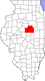
Country United States State Illinois County McLean Established After 1920 Government – Supervisor Area – Total 37.5 sq mi (97.12 km2) – Land 37.2 sq mi (96.34 km2) – Water 0.3 sq mi (0.77 km2) 1% Population (2000) – Total 668 Time zone CST (UTC-6) – Summer (DST) CDT (UTC-5) Dawson Township is located in McLean County, Illinois. The population was 668 at the 2000 census. Dawson Township was originally named Lee Township, but changed to Padua Township on May 17, 1858, and then to Dawson on an unknown date.
Dawson Township was named for John Wells Dawson.[1]
References
- ^ Gannett, Henry (January 22, 2008). " "The Origin of Certain Place Names in the United States". US Geological Survey (Govt. Print. Off.): 258. http://books.google.com/?id=BqwPAAAAIAAJ&pg=PA194&dq=Mclean+county#PPA101,M1".
External links
Municipalities and communities of McLean County, Illinois Cities Bloomington | Chenoa | El Paso‡ | Le Roy | Lexington

Town Villages Townships Allin | Anchor | Arrowsmith | Bellflower | Bloomington | Blue Mound | Cheney's Grove | Chenoa | Cropsey | Dale | Danvers | Dawson | Downs | Dry Grove | Empire | Funk's Grove | Gridley | Hudson | Lawndale | Lexington | Martin | Money Creek | Mount Hope | Normal | Old Town | Randolph | Towanda | West | White Oak | Yates
Unincorporated
communitiesBarnes | Bentown | Bloomington Heights | Cropsey | Covell | Fletcher | Funks Grove | Gillum | Glen Avon | Holder | Kerrick | Lyttleville | Meadows | Merna | Padua | Sabina | Shirley | Twin Grove | Watkins‡ | Weedman‡ | Weston | Yuton
Ghost town Footnotes ‡This populated place also has portions in an adjacent county or counties
Coordinates: 40°26′13″N 88°45′09″W / 40.43694°N 88.7525°W
Categories:- Townships in McLean County, Illinois
- Central Illinois geography stubs


Wikimedia Foundation. 2010.