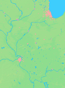
- Cooksville, Illinois
-
Cooksville Village Country United States State Illinois County McLean Township Blue Mound Elevation 767 ft (234 m) Coordinates 40°32′32″N 88°42′59″W / 40.54222°N 88.71639°W Area 0.2 sq mi (1 km2) - land 0.2 sq mi (1 km2) Population 182 (2010) Density 917.9 / sq mi (354 / km2) Timezone CST (UTC-6) - summer (DST) CDT (UTC-5) Postal code 61730 Area code 309 Wikimedia Commons: Cooksville, Illinois Cooksville is a village in McLean County, Illinois, United States. The population was 182 at the 2010 census. It is part of the Bloomington–Normal Metropolitan Statistical Area.
Contents
Geography
Cooksville is located at 40°32′32″N 88°42′59″W / 40.54222°N 88.71639°W (40.542278, -88.716274)[1].
According to the United States Census Bureau, the village has a total area of 0.2 square miles (0.52 km2), all of it land.
History
Founding of Cooksville
Cooksville was laid out under the name Kochsville on 4 December 1882 by Frederick Wilhelm Koch (4 September 1829 – 4 May 1900).[2] Within a year of its founding the name was changed to Cooksville. Koch was a Bloomington Real estate dealer.[3] He was born in Westphalia, in what is now Germany, and arrived in the United States on 6 November 1854. Koch was in Bloomington by 1860. He sold thirty or forty lots near his home in west Bloomington, and this neighborhood soon became known as Kochsville, giving Koch the honor of having two McLean County places named in his honor.[4] The town of Kochsville was founded when the Clinton, Bloomington and Northeastern Railroad was finished from Colfax to Bloomington; in 1880 the part of the railroad from Kankakee to Colfax had been finished, resulting in the 1880 founding of Cropsey, Anchor, and Colfax; but the remainder of the railroad was delayed for two years. The railroad was soon taken over by the Illinois Central and was sometimes known as the Bloomer Line.
Design and Growth of Cooksville
Cooksville was incorporated in December 1901. The population of the town peaked in 1910 with 332 people. The design of the original Town of Cooksville was a rectangle north of the tracks with the southern blocks slightly truncated because the railroad did not run exactly east and west. The Original Town contained about fifty-five lots. The depot was on the north side of the tracks and the two early elevators on the south side. Soon small additions were laid out south of the tracks and on the east side of the Original Town.[5] In 1883 William G. Darnell established the first grain elevator in Cooksville.[6] Harvey W. Crumbacker also moved to the town in 1883. He established a hardware store and in 1902 built a two story brick building in the town.[7]
Demographics
As of the census[8] of 2000, there were 213 people, 91 households, and 64 families residing in the village. The population density was 917.9 people per square mile (357.6/km²). There were 94 housing units at an average density of 405.1 per square mile (157.8/km²). The racial makeup of the village was 99.53% White, 0.47% from other races. Hispanic or Latino of any race were 0.47% of the population.
There were 91 households out of which 28.6% had children under the age of 18 living with them, 59.3% were married couples living together, 12.1% had a female householder with no husband present, and 28.6% were non-families. 25.3% of all households were made up of individuals and 12.1% had someone living alone who was 65 years of age or older. The average household size was 2.34 and the average family size was 2.82.
In the village the population was spread out with 23.5% under the age of 18, 9.9% from 18 to 24, 29.6% from 25 to 44, 25.8% from 45 to 64, and 11.3% who were 65 years of age or older. The median age was 37 years. For every 100 females there were 85.2 males. For every 100 females age 18 and over, there were 83.1 males.
The median income for a household in the village was $41,094, and the median income for a family was $48,125. Males had a median income of $31,563 versus $23,594 for females. The per capita income for the village was $16,984. None of the families and 0.8% of the population were living below the poverty line.
References
- ^ "US Gazetteer files: 2010, 2000, and 1990". United States Census Bureau. 2011-02-12. http://www.census.gov/geo/www/gazetteer/gazette.html. Retrieved 2011-04-23.
- ^ Historical Encyclopedia of Illinois and History of McLean County (Chicago: Munsell, 1908. p. 902.
- ^ Jacob L. Hasbrouck, History of McLean County (Indianapolis and Topeka: Historical Publishing Company, 1924) p. 89.
- ^ Historical Encyclopedia, 1908, p.686.
- ^ Combined Indexed Atlas, 1856–1914, McLean County, Illinois (Bloomington: McLean County Historical Society and McLean County Genealogical Society, 2006) P.59.
- ^ Historical Encyclopedia, 1908, p. 996.
- ^ Historical Encyclopedia, 1908, p.990.
- ^ "American FactFinder". United States Census Bureau. http://factfinder.census.gov. Retrieved 2008-01-31.
External links
Municipalities and communities of McLean County, Illinois Cities Bloomington | Chenoa | El Paso‡ | Le Roy | Lexington
Town Villages Townships Allin | Anchor | Arrowsmith | Bellflower | Bloomington | Blue Mound | Cheney's Grove | Chenoa | Cropsey | Dale | Danvers | Dawson | Downs | Dry Grove | Empire | Funk's Grove | Gridley | Hudson | Lawndale | Lexington | Martin | Money Creek | Mount Hope | Normal | Old Town | Randolph | Towanda | West | White Oak | Yates
Unincorporated
communitiesBarnes | Bentown | Bloomington Heights | Cropsey | Covell | Fletcher | Funks Grove | Gillum | Glen Avon | Holder | Kerrick | Lyttleville | Meadows | Merna | Padua | Sabina | Shirley | Twin Grove | Watkins‡ | Weedman‡ | Weston | Yuton
Ghost town Footnotes ‡This populated place also has portions in an adjacent county or counties
Categories:- Populated places in McLean County, Illinois
- Villages in Illinois
- Populated places established in 1882
Wikimedia Foundation. 2010.


