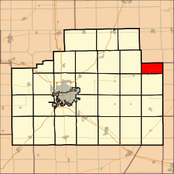
- Cropsey Township, McLean County, Illinois
-
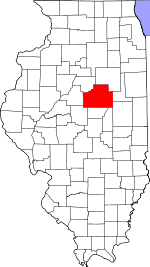
Cropsey Township — Township — Location in McLean County McLean County's location in Illinois Country United States State Illinois County McLean Established November 3, 1857 Government – Supervisor Area – Total 18.3 sq mi (47.39 km2) – Land 18.3 sq mi (47.39 km2) – Water 0.0 sq mi (0.0 km2) 0.0% Population (2000) – Total 256 Time zone CST (UTC-6) – Summer (DST) CDT (UTC-5) Cropsey Township is located in McLean County, Illinois. The population was 256 at the 2000 census. It was named after Col. A.J. Cropsey, the owner of a large farm in the area. In 1860 there were 25 families living in the township, by the 2000 census the total population was reported at 256.
External links
Municipalities and communities of McLean County, Illinois Cities Bloomington | Chenoa | El Paso‡ | Le Roy | Lexington
Town Villages Townships Allin | Anchor | Arrowsmith | Bellflower | Bloomington | Blue Mound | Cheney's Grove | Chenoa | Cropsey | Dale | Danvers | Dawson | Downs | Dry Grove | Empire | Funk's Grove | Gridley | Hudson | Lawndale | Lexington | Martin | Money Creek | Mount Hope | Normal | Old Town | Randolph | Towanda | West | White Oak | Yates
Unincorporated
communitiesBarnes | Bentown | Bloomington Heights | Cropsey | Covell | Fletcher | Funks Grove | Gillum | Glen Avon | Holder | Kerrick | Lyttleville | Meadows | Merna | Padua | Sabina | Shirley | Twin Grove | Watkins‡ | Weedman‡ | Weston | Yuton
Ghost town Footnotes ‡This populated place also has portions in an adjacent county or counties
Coordinates: 40°35′33″N 88°30′52″W / 40.5925°N 88.51444°W
Categories:- Townships in McLean County, Illinois
- Populated places established in 1857
- Central Illinois geography stubs
Wikimedia Foundation. 2010.


