- Zeeland
-
For other uses, see Zeeland (disambiguation).
Zeeland — Province — 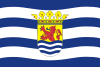
Flag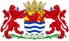
Coat of armsAnthem: Zeeuws volkslied Location of Zeeland in the Netherlands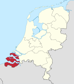
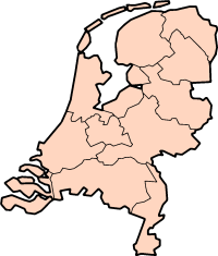
Country Netherlands Capital Middelburg Government - Queen's Commissioner Karla Peijs Area - Land 1,788 km2 (690.4 sq mi) - Water 1,146 km2 (442.5 sq mi) Area rank 10th Population (2006) - Land 380,186 - Rank 11th - Density 212.6/km2 (550.7/sq mi) - Density rank 10th ISO 3166 code NL-ZE Religion (2005) Protestant 30%
Catholic 20%
Muslim 1.5%Website [http://www.Zeeland.nl www.Zeeland.nl Zeeland [ˈzeːlɐnt] (
 listen), also called Zealand in English, is the westernmost province of the Netherlands. The province, located in the south-west of the country, consists of a number of islands (hence its name, meaning "sea-land") and a strip bordering Belgium. Its capital is Middelburg. With a population of about 380,000, its area is about 2930 km², of which almost 1140 km² is water. Large parts of Zeeland are below sea level. The last great flooding of the area was in 1953. Tourism is an important economic activity. Its beaches make it a popular holiday destination in the summer. Most tourists are Germans. In some areas, the population can be two to four times higher during high summer season. The coat of arms of Zeeland shows a lion half-emerged from water, and the text "luctor et emergo" (Latin for "I struggle and I emerge").[1] The Pacific nation of New Zealand is named after Zeeland.
Contents
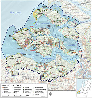
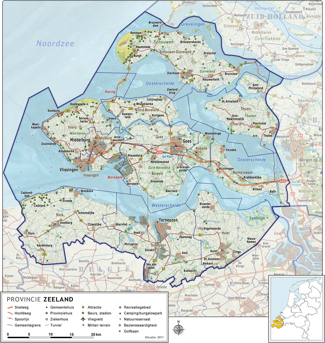
Constituent parts
From north to south, it consists of
- Schouwen-Duiveland
- Tholen
- Noord-Beveland
- Walcheren, Zuid-Beveland
- Zeeuws-Vlaanderen (Zealands Flanders)
Municipalities
 Map of Zeeland
A list of the municipalities, with links to maps:
- Borsele
- Flushing (Vlissingen)[1]
- Goes[2]
- Hulst
- Kapelle[3]
- Middelburg[4]
- Noord-Beveland[5]
- Reimerswaal[6]
- Schouwen-Duiveland[7]
- Sluis
- Terneuzen
- Tholen
- Veere[8]
Municipality Population Borsele 22,643 Goes 36,643 Hulst 27,855 Kapelle 12,423 Middelburg 48,019 Noord-Beveland 7,408 Reimerswaal 21,450 Schouwen-Duiveland 34,131 Sluis 24,093 Terneuzen 54,892 Tholen 25,410 Veere 21,932 Vlissingen 44,608 Geography
The province of Zeeland is a large river delta situated at the mouth of several major rivers. Most of the province lies below sea level and was reclaimed from the sea by inhabitants over time. What used to be a muddy landscape, flooding at high tide and reappearing at low tide, became a series of small man-made hills that stayed dry at all times. The people of the province would later connect the hills by creating dikes, which led to a chain of dry land that later grew into bigger islands and gave the province its current shape. The shape of the islands has changed over time at the hands of both man and nature. The North Sea flood of 1953 inundated vast amounts of land that were only partially reclaimed. The subsequent construction of the Delta Works also changed the face of the province. The infrastructure, although very distinct by the amount of bridges, tunnels and dams, has not shaped the geography of the province so much as the geography of the province has shaped its infrastructure. The dams, tunnels and bridges that are currently a vital part of the province's road system were constructed over the span of decades and came to replace old ferry lines. The final touch to this process came in 2003 when the Western Scheldt Tunnel was opened. It was the first solid connection between both banks of the Westerschelde and ended the era of water separating the islands and peninsulas of Zeeland.
History
County of Zeeland
Graafschap ZeelandState of the Holy Roman Empire ← 
←
1299–1581  →
→Capital Middelburg Government Monarchy Historical era Middle Ages - Personal union with
County of Holland
1299 1299- Joined Burgundian
Netherlands
1432- Habsburg Seventeen
Provinces founded
1477- Foundation of
United Provinces
26 July 1581 1581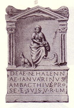
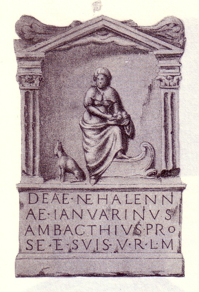
Nehalennia is a goddess of the ancient religion known around the province of Zeeland. Her worship dates back at least to the 2nd century BC,[2] and flourished in the 2nd and 3rd centuries AD.[2] She was possibly a regional goddess, either Celtic or pre-Germanic – sources differ on the culture that first worshipped her. During the Roman Era, her main function appeared to be the protection of travelers, especially seagoing travelers crossing the North Sea. Most of what is known about her comes from the remains of over 160 carved stone offerings (votives) which have been dredged up from the Oosterschelde since 1970. Two more Nehalennia offering stones have also been found in Cologne, Germany.[2]
Zeeland was a contested area between the counts of Holland and Flanders until 1299, when the count of Holland gained control of the countship of Zeeland. Since then, Zeeland followed the fate of Holland. In 1432 it became part of the Low Countries possessions of Philip the Good of Burgundy, the later Seventeen Provinces. Through marriage, the Seventeen Provinces became property of the Habsburgs in 1477. In the Eighty Years' War, Zeeland was on the side of the Union of Utrecht, and became one of the United Provinces. The area now called Zeeuws-Vlaanderen was not part of Zeeland, but a part of the countship of Flanders (still under Habsburg) that was conquered by the United Provinces, hence called Staats-Vlaanderen (see: Generality Lands). After the French occupation (see département Bouches-de-l'Escaut) and the formation of the United Kingdom of the Netherlands in 1815, the present province Zeeland was formed. During the Second World War, Zeeland was occupied by German forces between June 1940 and November 1944.[1] In 1944, Zeeland was devastated by the Battle of the Scheldt and the Walcheren Landings between British and Canadian forces, and the occupying Germans.[3] The catastrophic North Sea Flood of 1953, which killed over 1,800 people in Zeeland, led to the construction of the protective Delta Works.
Transportation
There is one passenger railway, here with municipalities and official station abbreviations:
Vlissingen (vs, vss) – Middelburg (mdb, arn) – Goes (gs) – Kapelle (bzl) – Reimerswaal (krg, kbd, rb) – connecting to Bergen op Zoom (bgn) (Noord-Brabant).
Bus connections (of Connexxion, except # 395) include:
- bus 133: Vlissingen – Middelburg – Vrouwenpolder – Oosterscheldedam – Renesse – Zierikzee – Grevelingendam – connecting to Oude-Tonge, Rotterdam-Zuidplein
- Interliner Express bus 395: Zierikzee – (Grevelingendam) – connecting to Rotterdam-Zuidplein
- bus 104: Renesse – Brouwersdam – connecting to Ouddorp – Spijkenisse
- bus 20 and 50: see Westerschelde.
Zeeland in foreign names
New Zealand
The islands of New Zealand were discovered by Dutch navigator Abel Tasman in 1642, although he did not land on New Zealand. Tasman named it Staten Landt, believing it to be part of the land of that name off the coast of Argentina. When that was shown not to be so Dutch authorities named it Nova Zeelandia in Latin, Nieuw Zeeland in Dutch. The two major seafaring provinces of the Netherlands in its Golden Age were Holland and Zeeland, and originally the Dutch explorers named the largest landmass of Oceania and the two islands to the southeast respectively Nieuw Holland and Nieuw Zeeland. The former was eventually replaced by the name Australia, but the name New Zealand remained in place for the latter. Captain James Cook of Britain subsequently called the archipelago New Zealand and soon after, British settlers arrived in New Zealand and English became the main language.
North America
The city of Zeeland in the US state of Michigan was settled in 1847 by Dutchman Jannes van de Luyster and was incorporated in 1907. The city still maintains a distinctive Dutch flavour. Flushing, a neighborhood within the borough of Queens, New York, is named after the city Flushing (Vlissingen in Dutch) in Zeeland. This dates from the period of the colony of New Netherland, when New York was still known as New Amsterdam. The Dutch colonies of Nieuw Walcheren and Nieuw Vlissingen, both on the Antillian island of Tobago, were both named after parts of Zeeland. The Canadian town of Zealand, New Brunswick, was named for the Zeeland birth place of Dutchman Philip Crouse who settled in the area in 1789.[4]
Suriname
Paramaribo, the capital and largest city of Suriname, has a Fort Zeelandia, the former Fort Willoughby during the British colonization.
Taiwan
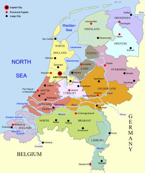 Map of the Netherlands, linking to the province articles; red dots mark provincial capitals and black dots other notable cities or towns.
Fort Zeelandia was a fortress built over ten years from 1624–1634 by the Dutch East India Company, in the town of Anping (Tainan) on the island of Formosa, present day Taiwan, during their 38-year rule over the western part of it.
See also
 New Zealand
- List of cities, towns and villages in Zeeland
- Zeeland, Michigan, USA
- Zeeland, North Dakota, USA
References
- ^ a b DeWaard, Dirk Marc (1983). Luctor et Emergo: The impact of the Second World War on Zeeland (M.A. thesis) Wilfrid Laurier University
- ^ a b c Lendering, 2006.
- ^ http://www.combinedops.com/Walcheren.htm
- ^ "Zealand, New Brunswick, Canada". University Educational Series, Fredericton, New Brunswick, Canada. http://d120788.u25.digipark.com/zealand/index.htm. Retrieved 2008-04-01.
External links
- Deltaworks Online – Flood Protection of Zeeland and Deltaregion
- Provincial Government
- Zeeland at a glance
- Zeeland Tourist Board
- Zeeland Zakelijk Links
- Zeelandforum – Discussion Forum Zeeland
 Provinces of the NetherlandsProvinces
Drenthe · Flevoland · Friesland · Gelderland · Groningen · Limburg · North Brabant · North Holland · Overijssel · South Holland · Utrecht · Zeeland


Coordinates: 51°34′N 3°45′E / 51.567°N 3.75°E
 Burgundian Circle (1512–1806) of the Holy Roman EmpireRemained
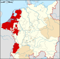
County Imperial City Besançon3Dependent territories Categories:- Former monarchies of Europe
- Former polities in the Netherlands
- States of the Holy Roman Empire
- States and territories established in 1299
- States and territories disestablished in 1581
- 1581 disestablishments
- Zeeland
- Provinces of the Netherlands
- NUTS 2 statistical regions of the European Union
- Seventeen Provinces
- Burgundian Circle


Wikimedia Foundation. 2010.