- Flevoland
Infobox Dutch Province
ename = Province of Flevoland
dname = Provincie Flevoland
common_name = Flevoland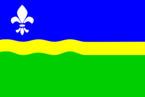

location_
Clicksensitive map of provinces of the Netherlands|province=Flevoland
capital =Lelystad
largest_city =Almere
commissioner =mr. M.J.E.M. (Michel) Jager
religion_year = 1999
religion =Protestant 25%Catholic 13%
area_land = 1,419
area_water = 993
area_rank = 11th
population_year = 2006
population = 370,656
population_rank = 12th
density = 261
density_rank = 8th
inclusion = 1986
anthem = Waar wij steden doen verrijzen...
(Where We Let Cities Arise...)
ISO = FL
website = www.flevoland.nlFlevoland pronunciation|253 Flevoland.ogg is a province of the
Netherlands . Located in the centre of the country, at the location of the formerZuiderzee , the province was established onJanuary 1 ,1986 ; the twelfth province of the country, withLelystad as its capital. The province has approximately 370,000 inhabitants (2005) and consists of 6 municipalities.After a flood in 1916, it was decided that the Zuiderzee, an inland sea within the Netherlands, would be enclosed and reclaimed: the
Zuiderzee Works started. In 1932, theAfsluitdijk was completed, which closed off the sea completely. The Zuiderzee was subsequently calledIJsselmeer (lake at the end of the riverIJssel ).The first part of the new lake that was reclaimed was the
Noordoostpolder (Northeast polder). This new land included the former islands ofUrk andSchokland and it was included in the province ofOverijssel . After this, other parts were reclaimed: the Southeastern part in 1957 and the Southwestern part in 1968. There was an important change in these post-war projects from the earlier Noordoostpolder reclamation: a narrow body of water was preserved along the old cost to prevent coastal towns from losing their access to the sea, so that Flevopolder became an artificial island joined to the mainland by bridges. The municipalities on the three parts voted to become a separate province, which happened in 1986. At Flevoland there is a large mediumwave broadcasting facility calledMediumwave transmitter Flevoland .Flevoland was named after
Lacus Flevo , a name recorded in Roman sources for a large inland lake at the southern end of the later-formedZuiderzee . Draining the Flevoland polders found many wrecks ofaircraft that crashed into the IJsselmeer during WWII, and also fossils ofPleistocene mammals.Municipalities
* [http://www.sdu.nl/staatscourant/gemeentes/gemprovin.htm#FL province map showing subdivision in municipalities, link for each municipality to basic data page]
The Flevolands,
Zuiderzee Works Eastern Flevoland ("Oostelijk Flevoland" or "Oost-Flevoland") and Southern Flevoland ("Zuidelijk Flevoland" or "Zuid-Flevoland"), unlike the
Noordoostpolder , have peripheral lakes between them and the mainland: the Veluwemeer and Gooimeer respectively, making them, together, the world's largest artificial island.They are two separate polders that have a joint hydrological infrastructure, with a dividing dike in the middle, the "Knardijk", that will keep one polder safe should the other be flooded. The two main drainage canals that traverse the dike can be closed by weirs in such an event. The pumping stations are the "Wortman" (
diesel powered) at Lelystad-Haven, the "Lovink" nearHarderwijk on the mainland and the "Colijn" (bothelectric ally powered) along the northern dike beside theKetelmeer .A new element in the design of Eastern Flevoland is the larger city
Lelystad (1966), named afterCornelis Lely , the man who had played a crucial role in designing and realising the Zuiderzee Works. Other more conventional settlements already existed by then;Dronten , the major local town, was founded in 1962, followed by two smaller satellite villages,Swifterbant andBiddinghuizen , in 1963. These three were incorporated in the new municipality ofDronten onJanuary 1 1972 .Southern Flevoland has only one pumping station, the diesel powered "De Blocq van Kuffeler". Because of the hydrological union of the two Flevolands it simply joins the other three in maintaining the water-level of both polders.
Almere relieves the housing shortage and increasing overcrowding on the old land. Almere's name was originally an early medieval name forLacus Flevo . Almere was to be divided into 3 major settlements initially; the first, "Almere-Haven" (1976) situated along the coast of the Gooimeer (one of the peripheral lakes), the second and largest was to fulfill the role of city centre as "Almere-Stad" (1980) and the third was "Almere-Buiten" (1984) to the northwest towards Lelystad. In 2003, themunicipality made a new "Structuurplan" which started development of three new settlements: "Overgooi" in the southeast, "Almere-Hout" in the east, and "Almere-Poort" in the West. In time, "Almere-Pampus" could be developed in the northwest, with possibly a new bridge over theIJmeer towardsAmsterdam .The "
Oostvaardersplassen " is a landscape of shallow pools, islets and swamps. Originally, this low part of the newpolder was destined to become an industrial area. Spontaneous settlement of interesting flora & fauna turned the area into a nature park, of such importance that the new railway-line was diverted. The recent decline in agricultural land use will in time make it possible to expand "natural" land use, and connect the Oostvaardersplassen to theVeluwe .The centre of the polder most closely resembles the pre-war polders in that it is almost exclusively agricultural. In contrast, the southeastern part is dominated by extensive forests. Here is also found the only other settlement of the polder,
Zeewolde (1984), again a more conventional town acting as the local centre. Zeewolde became a municipality at the same time as Almere onJanuary 1 1984 , which in the case of Zeewolde meant that the municipality existed before the town itself, with only farms in the surrounding land to be governed until the town started to grow.Events
*
A Campingflight to Lowlands Paradise

Wikimedia Foundation. 2010.