- Goedereede
Infobox Settlement
official_name = Goedereede

flag_size = 120x100px
image_shield = Wapen goedereede.gif
shield_size = 120x100px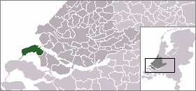
mapsize = 280px
subdivision_type = Country
subdivision_name =Netherlands
subdivision_type1 = Province
subdivision_name1 =South Holland
area_footnotes = (2006)
area_total_km2 = 153.85
area_land_km2 = 71.32
area_water_km2 = 82.53
population_as_of =1 January ,2007
population_note = Source: CBS, [http://statline.cbs.nl/ Statline] .
settlement_type = Municipality
population_total = 11646
population_density_km2 = 163
timezone = CET
utc_offset = +1
timezone_DST = CEST
utc_offset_DST = +2
latd = 51.82
latNS = N
longd = 3.98
longEW = E
website = [http://www.goedereede.nl www.goedereede.nl].
The municipality of Goedereede also includes the communities from west to east, they are
Ouddorp (withOostdijk ), Goedereede (withHavenhoofd ) andStellendam .The Brouwersdam is a dam, part of the
Delta Works , from Goedereede toSchouwen-Duiveland , inZeeland . The Haringvlietdam is a dam, also part of the Delta Works, from Goedereede to the border ofWestvoorne andHellevoetsluis on the island ofVoorne-Putten .Goedereede received city rights in
1312 .Income consists mainly of tourism and fishery. Because of the extended beach close by, Ouddorp has a large number of camping grounds. Ouddorp, Goedereede and Stellendam have all an extended fishing fleet.
External links
* [http://www.goedereede.nl Official Website]
* [http://www.rgl.nl Radio Goeree Lokaal - Local Radio Broadcast]
* [http://www.sgp-goedereede.nl SGP Goedereede - Largest political party]
*http://www.plattegronden.nl/goeree-overflakkee
* [http://www.kunststichtinggoedereede.nl Kunststichting Goedereede - Art foundation]
Wikimedia Foundation. 2010.