- Veere
Infobox Settlement
official_name = Veere
flag_size = 120x100px
image_shield = Coat of arms of Veere.png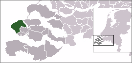
mapsize = 280px
subdivision_type = Country
subdivision_name =Netherlands
subdivision_type1 = Province
subdivision_name1 =Zeeland
area_footnotes = (2006)
area_total_km2 = 207.09
area_land_km2 = 132.94
area_water_km2 = 74.15
population_as_of =1 January ,2007
population_note = Source: CBS, [http://statline.cbs.nl/ Statline] .
settlement_type = Municipality
population_total = 21974
population_density_km2 = 165
timezone = CET
utc_offset = +1
timezone_DST = CEST
utc_offset_DST = +2Veere (Pronunciation|251 Veere.ogg) is a
municipality and acity in the southwesternNetherlands , onWalcheren in the province ofZeeland .Population centres
Aagtekerke (population as of 2003: 1,479),Biggekerke (895),Domburg (1,481),Gapinge (522),Grijpskerke (1,377),Koudekerke (3,620),Meliskerke (1,477),Oostkapelle (2,451),Serooskerke (1,833), Veere (1,520),Vrouwenpolder (1,125), Westkapelle (2,672),Zoutelande (1,593).The city of Veere
The small city of Veere (population
as of 2001 : 1,520) is located on theVeerse Meer . It received city rights in 1355. Between 1541 and 1799, Veere was thestaple port for theKingdom of Scotland . In the 17th and 18th centuries, Veere was a prosperous trading city. There were about 750 houses inside the city walls then, compared to about 300 now.External links
* [http://www.veere.nl Official Website of the City Council]
* [http://www.veere-stad.nl/ Website about the historic city of Veere]
* [http://www.decraecke.nl/ Hotel B&B Logement De Craecke]
* [http://www.plattegronden.nl/veere/ Map]
* [http://www.picturesofholland.nl/Veere/frameset.htm Pictures of Veere]
* [http://oudestraat23.googlepages.com/home3 Charming holiday house in Veere]

Wikimedia Foundation. 2010.