- Anantapur district
-
This article is about the district. For its eponymous headquarters, see Anantapur, Andhra Pradesh.
Anantapur— district — Districts of Andhra Pradesh

Coordinates 14°41′N 77°36′E / 14.68°N 77.6°ECoordinates: 14°41′N 77°36′E / 14.68°N 77.6°E Country India State Andhra Pradesh District(s) Anantapur vardhan reddy Population
• Density
3,640,478 (2001[update])
• 190 /km2 (492 /sq mi)
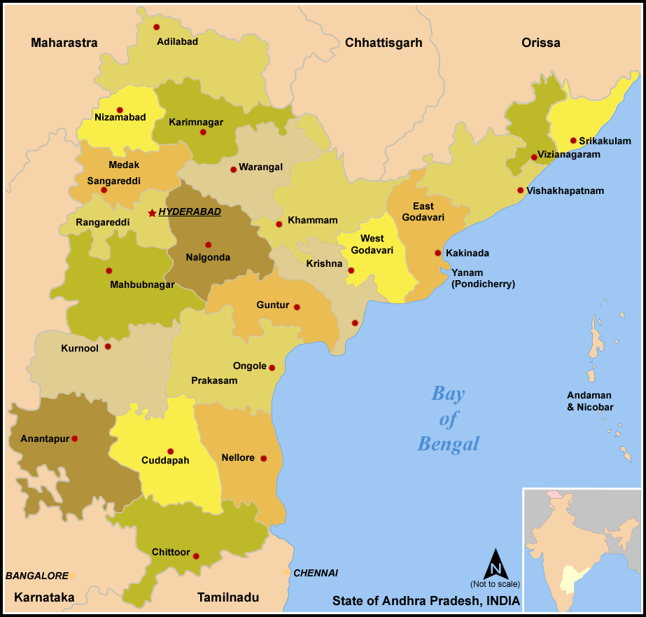
Time zone IST (UTC+05:30) Area 19,130 square kilometres (7,390 sq mi) Anantapur District Telugu: అనంతపూర్ డిస్ట్రిక్ట్, Urdu: اننت پور ضلع) is one of the 23 districts in Andhra Pradesh, India. The district headquarters is Anantapur City. It is currently a part of the Red Corridor.[1]
Contents
Geography
It is the largest district of Andhra Pradesh spanning an area of 19,130 square kilometres (7,390 sq mi),[2] comparatively equivalent to Japan's Shikoku Island.[3] It is bounded on the north by Kurnool District, on the east by Kadapa District, on the southeast by Chittoor District, and on the southwest and west by Karnataka state. It is part of Rayalaseema region on the state. Its northern and central portions are a high plateau, generally undulating, with large granite rocks or low hill ranges rising occasionally above its surface. In the southern portion of the district the surface is more hilly, the plateau there rising to 2 ft (0.61 m). above the sea. Six rivers flow within the district: Penna, Chithravathi, Vedavathi, Papagni, Swarnamukhi, and Thadakaleru. The district receives an average annual rainfall of 381 millimeters.
Anantapur city is 354 km from Capital Hyderabad, 200 km from the neighboring state capital of Bangalore. Anantapur connects Hyderabad and Bangalore through National Highway-7. Bangalore International Airport is nearest international airport to Anantapur.
Economy
The economy is principally agrarian with very few industries. With very little rainfall, the district is one of the most backward provinces in the state. Prominent crops include groundnut, sunflower, rice, cotton, maize, chillies, sesame, and sugarcane. Silk trade, limestone quarrying, iron and diamond mining constitute the few industries that are there.
In 2006 the Indian government named Anantapur one of the country's 250 most backward districts (out of a total of 640).[4] It is one of the thirteen districts in Andhra Pradesh currently receiving funds from the Backward Regions Grant Fund Programme (BRGF).[4]
Household indicators
In 2007–2008 the International Institute for Population Sciences interviewed 1009 households in 37 villages across the district.[5] They found that 94.1% had access to electricity, 99.5% had drinking water, 35.6% toilet facilities, and 61.3% lived in a pucca (permanent) home.[5] 31.4% of girls wed before the legal age of 18[6] and 88.2% of interviewees carried a BPL card.[5]
Divisions
The District has been divided into three Revenue Divisions consisting of 63 Revenue Mandals (Anantapur Division 20, Dharmavaram Division 17 and Penukonda Division 26).[7]
- Agali
- Amadagur
- Amarapuram
- Anantapur
- Atmakur
- Bathalapalle
- Beluguppa
- Bommanahal
- Brahmasamudram
- Bukkapatnam
- Bukkarayasamudram
- Chenne Kothapalle
- Chilamathur
- D.Hirehal
- Dharmavaram
- Gandlapenta
- Garladinne
- Gooty
- Gorantla
- Gudibanda
- Gummagatta
- Guntakal
- Hindupur
- Kadiri
- Kalyandurg
- Kambadur
- Kanaganapalle
- Kanekal
- Kothacheruvu
- Kudair
- Kundurpi
- Lepakshi
- Madakasira
- Mudigubba
- Nallacheruvu
- Nallamada
- Nambulapulakunta
- Narpala
- Obuladevaracheruvu
- Pamidi
- Parigi
- Peddapappur
- Peddavadugur
- Penu Konda
- Putlur
- Puttaparthi
- Ramagiri
- Raptadu
- Rayadurg
- Roddam
- Rolla
- Settur
- Singanamala
- Somandepalle
- Tadimarri
- Tadpatri
- Talupula
- Tanakal
- Uravakonda
- Vajrakarur
- Vidapanakal
- Yadiki
- Yellanur
Demographics
According to the 2011 census Anantapur district has a population of 4,083,315 ,[8] roughly equal to the nation of Lebanon[9] or the US state of Oregon.[10] This gives it a ranking of 52nd in India (out of a total of 640) and 7th in its state.[8] The district has a population density of 213 inhabitants per square kilometre (550 /sq mi) .[8] Its population growth rate over the decade 2001-2011 was 12.16 %.[8] Anantapur has a sex ratio of 977 females for every 1000 males,[8] and a literacy rate of 64.28 %.[8]
The district had a population of 3,640,478 of which 25.26% is urban as of 2001 [1]. Anantapur district includes 866 villages. Telugu is the widely spoken language in this region and it has a literacy rate of 56.69%. Urdu and Kannada are the other two widely spoken languages in the district. Telugu and Urdu are the two official languages of the district. Moreover, Anantapur is one of the 13 districts in Andhra Pradesh where Urdu is 2nd official language.[11]
Main religious groups are Hindus 3,225,156, Muslims 389,201 (10.7%), Christians 20,770.
Places of interest
1.Lepakshi.... It very famous Temple of Historical importance. Hanging pillar in the Temple is a wonder. The paintings and sculpture on the ceiling and on the pillars are more attractive. Near the Temple a very big a single stone carved NANDI Sculpture is very famous. 2. Gooty... In this Historical Town a big hill port is there known as gutti kota. 3. Penugonda is another historical place where a bit port is situated. Around this so many temples are located. Once it was the 2nd capital of Vijayanagara kings. 4. Kadiri.... This small town is famous for its Narasimhaswamy temple.
References
- ^ "83 districts under the Security Related Expenditure Scheme". IntelliBriefs. 2009-12-11. http://intellibriefs.blogspot.com/2009/12/naxal-menace-83-districts-under.html. Retrieved 2011-09-17.
- ^ Srivastava, Dayawanti et al. (ed.) (2010). "States and Union Territories: Andhra Pradesh: Government". India 2010: A Reference Annual (54th ed.). New Delhi, India: Additional Director General, Publications Division, Ministry of Information and Broadcasting (India), Government of India. pp. 1111–1112. ISBN 978-81-230-1617-7.
- ^ "Island Directory Tables: Islands by Land Area". United Nations Environment Program. 1998-02-18. http://islands.unep.ch/Tiarea.htm. Retrieved 2011-10-11. "Shikoku 18,545km2"
- ^ a b Ministry of Panchayati Raj (September 8, 2009). "A Note on the Backward Regions Grant Fund Programme". National Institute of Rural Development. http://www.nird.org.in/brgf/doc/brgf_BackgroundNote.pdf. Retrieved September 27, 2011.
- ^ a b c "District Level Household and Facility Survey (DLHS-3), 2007-08: India. Andhra Prades" (PDF). International Institute for Population Sciences and Ministry of Health and Family Welfare. 2010. http://www.rchiips.org/pdf/rch3/report/AP.pdf. Retrieved 2011-10-03.
- ^ "How Do I? : Obtain Marriage Certificate". National Portal Content Management Team, National Informatics Centre. 2005. http://india.gov.in/howdo/howdoi.php?service=3. Retrieved 2011-10-03. "To be eligible for marriage, the minimum age limit is 21 for males and 18 for females."
- ^ List of Mandals of Anantapur district in AP Online.
- ^ a b c d e f "District Census 2011". Census2011.co.in. 2011. http://www.census2011.co.in/district.php. Retrieved 2011-09-30.
- ^ US Directorate of Intelligence. "Country Comparison:Population". https://www.cia.gov/library/publications/the-world-factbook/rankorder/2119rank.html. Retrieved 2011-10-01. "Lebanon 4,143,101 July 2011 est."
- ^ "2010 Resident Population Data". U. S. Census Bureau. http://2010.census.gov/2010census/data/apportionment-pop-text.php. Retrieved 2011-09-30. "Oregon 3,831,074"
- ^ http://www.aponline.gov.in/apportal/departments/departments.asp?dep=25&org=168&category=about
External links

Bellary district, Karnataka Kurnool district Chitradurga district, Karnataka 
YSR district  Anantapur district

Tumkur district, Karnataka Chikkaballapura district, Karnataka Chittoor district  State of Andhra PradeshCapital: Hyderabad
Topics Districts - Adilabad
- Anantapur
- Chittoor
- East Godavari
- Guntur
- Hyderabad
- Karimnagar
- Khammam
- Krishna
- Kurnool
- Mahabubnagar
- Medak
- Nalgonda
- Nellore
- Nizamabad
- Prakasam
- Ranga Reddy
- Srikakulam
- Visakhapatnam
- Vizianagaram
- Warangal
- West Godavari
- YSR
Major cities Categories:- Districts of Andhra Pradesh
- 1882 establishments in India
- Anantapur district

Wikimedia Foundation. 2010.