- Chittoor district
-
This article is about the district. For its eponymous headquarters, see Chittoor.
 Chittoor is the southernmost district of Andhra Pradesh.
Chittoor District
 pronunciation (help·info) (Telugu: చిత్తూరు జిల్లా, Urdu: چتور ضلع, Tamil: சித்தூர்), also known as Chittur, is a district of India's Andhra Pradesh state. The district headquarters is Chittoor City. The district has a population of 4,170,468 according to 2011 census of India.[1] Chittoor district is famous for the Tirupati, Kanipakam and Sri Kalahasti temples. It lies in the Poini River valley of southernmost Andhra Pradesh, on the NH4 Bangalore-Chennai highway. It is a major market center for mangoes, grains, sugarcane, and peanuts. Major industries around the city are Amaron Batteries, nations leading automobile batteries, and Nutrine Confectionaries, a major chocolate/candies producer and this city is one of the major Granite, mango pulp producing centers of India.
Contents
Etymology
The word Chittoor is combination of two Tamil words Chit+oor which means Small Town in Tamil language. In ancient days, Chittoor was part of Tamil country of Thondai Nadu.
History
Chittoor District was formed on 1 April 1911, taking CHITTOOR, PALAMANER, CHANDRAGIRI from North Arcot District and MADANAPALLI, VAYALPADU from Cuddapah and PUNGANUR,SRIKALAHASTI,OLD KARVETINAGARAM FROM ZAMINDARI Provinces to form united chittoor district, later in the late 1960s about 280 villages of chittoor district were added into the CHENGALPATTU AND TIRUVALLUR district of Tamil nadu.
Geography
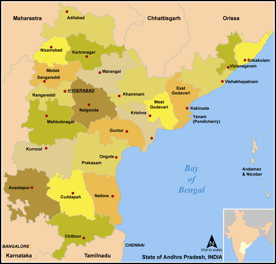
Chittoor district occupies an area of 15,359 square kilometres (5,930 sq mi),[2] comparatively equivalent to Svalbard's Nordaustlandet.[3] The district is bounded by Anantapur District to the northwest, Cuddapah District to the north, Nellore District to the northeast, Krishnagiri District, Vellore District and Tiruvallur District of Tamil Nadu state to the south, and Kolar District of Karnataka state to the west. Chittoor district lies extreme south of the Andhra Pradesh state approximately between 12°37' - 14°8' north latitudes and 78°3' - 79°55' east longitudes.30% of the total land area is covered by forests in the district.[4] Mango and tamarind groves surround the city of Chittoor, and cattle are raised in the district. The soils in the district constitute redloamy 57%, red sandy 34% and the remaining 9% is covered by black clay black loamy, black sandy and red clay[4]
Chittoor is around 180KM from Bangalore, around 160KM from Chennai, and around 590KM from Hyderabad, state capital.
Hydrology
The important rivers in the district are Ponnai and Swarnamukhi rivers which originate in eastern ghats. Other rivers include Kusasthali, Beema, Bahuda, Pincha, Kalyani, Araniyar and Pedderu. None of the rivers are perennial. Rivers include:
- Swarnamukhi
- Kalangi
- Papaghni
- Koundinya
- Paleru
- Arani
- Pinchcha
- Cheyyeru
- Neeva
- Kusasthali
Climate
The temperature in the western parts of the district like Madanapalle, Horsley Hills, Chembakur are relatively lower than the eastern parts of the Chittoor District. This is because of the higher altitude of the western parts compared to the eastern parts. The summer temperatures touches 46°C in the eastern parts where as in the western parts it ranges around 36º to 38°C. Similarly the winter temperatures of the western parts are relatively low ranging around 12°C to 14°C and in eastern parts it is 16°C to 18°C.[5]
Chittoor District receives an annual rainfall of 918.1 mm. The South West Monsoon and North East Monsoon are the major sources of rainfall for the district. On average the district receives 438.0 mm of rainfall through the South West Monsoon (From June to September) and 396.0 mm from North East Monsoon (From October to December). The rainfall received by the district in the years 2002 and 2003 are 984.2 mm and 934 mm respectively.[6]
Economy
In 2006 the Indian government named Chittoor one of the country's 250 most backward districts (out of a total of 640).[7] It is one of the thirteen districts in Andhra Pradesh currently receiving funds from the Backward Regions Grant Fund Programme (BRGF).[7]
Household indicators
In 2007–2008 the International Institute for Population Sciences interviewed 1010 households in 38 villages across the district.[8] They found that 92.7% had access to electricity, 99.6% had drinking water, 33.3% toilet facilities, and 53.8% lived in a pucca (permanent) home.[8] 29.3% of girls wed before the legal age of 18[9] and 88.2% of interviewees carried a BPL card.[8]
Divisions
Assembly Constituencies
There are 14 Andhra Pradesh Legislative Assembly MLA constituencies in Chittoor district.[10] They are
- Chandragiri
- Chittoor
- G.D.Nellore (Gangadhara Nellore)
- Kuppam
- Madanapalle
- Nagari
- Palamaner
- Pileru
- Punganur
- Puthalapattu
- Satyavedu
- Srikalahasti
- Thamballapalle and
- Tirupati
Political divisions
There are 66 Mandals in Chittoor district.[11]
- Peddamandyam
- Thamballapalle
- Mulakalacheruvu
- Peddathippasamudram
- B.Kothakota
- Kurabalakota
- Gurramkonda
- Kalakada
- Kambhamvaripalle
- Yerravaripalem
- Tirupati Urban
- Renigunta
- Yerpedu
- Srikalahasti
- Thottambedu
- Buchinaidu khandriga
- Varadaiahpalem
- Satyavedu
- Nagalapuram
- Pitchatur
- Vijayapuram
- Nindra
- K V B Puram
- Narayanavanam
- Vadamalapeta
- Tirupati Rural
- Ramachandrapuram
- Chandragiri
- Chinnagottigallu
- Rompicherla
- Pileru
- Kalikiri
- Vayalpadu
- Nimmanapalle
- Madanapalle
- Ramasamudram
- Punganur
- Chowdepalle
- Somala
- Sodam
- Pulicherla
- Pakala
- Vedurukuppam
- Puttur
- Nagari
- Karvetinagar
- Srirangarajapuram
- Palasamudram
- Gangadhara nellore
- Penumuru
- Puthalapattu
- Irala
- Thavanampalle
- Chittoor
- Gudipala
- Yadamari
- Bangarupalem
- Palamaner
- Gangavaram
- Peddapanjani
- Baireddipalle
- Venkatagirikota
- Ramakuppam
- Santhipuram
- Gudupalle
- Kuppam
Demographics
According to the 2011 census Chittoor district has a population of 4,170,468 ,[12] roughly equal to the nation of Lebanon[13] or the US state of Kentucky.[14] This gives it a ranking of 47th in India (out of a total of 640) and 6th in its state.[12] The district has a population density of 275 inhabitants per square kilometre (710 /sq mi) .[12] Its population growth rate over the decade 2001-2011 was 11.33 %.[12] Chittoor has a sex ratio of 1002 females for every 1000 males,[12] and a literacy rate of 72.36 %.[12]
The population of Chittoor District according to 1991 census was 32.5 lakhs with density of 214/km².
Telugu is the native language in the district. Urdu is second official language in the district [15] while Tamil is spoken by a significant amount of people in the eastern mandals of the district.
Culture
Notable people
- Madabhushi Ananthasayanam Ayyangar, first Deputy Speaker and second Speaker of Lok Sabha
- Chittor V. Nagaiah, Renowned Film actor, Director.
- Sir C.R. Reddy, Educationalist, Founder & Vice-chancellor of Andhra University
- Jiddu Krishnamurti, Philosopher.
- P. Chinnamma Reddy, was a prominent politician, known for building P.C.R. Junior College and Krishnavani Junior College and for establishing the Chittoor cooperative sugar factory
- Nara Chandrababu Naidu, Ex-Chief Minister of A.P.
- N.Kiran Kumar Reddy, Chief Minister of A.P.
- Dr.vempalli Gangadhar,s.v university scholar,popular writer.see www.vempalligangadhar.com
Education
This educational society is formed in memory of renowned academician LateM. SITA RAM (Ex. Principal- FAC Govt Jr. College Palamaner) by his students, friends and family members in 2001. It was registered in 2007(Regd# 84/07).
Since its formation, the society has issued Certificates of Excellence for various students for their academic performance along with cash prizes at different schools and colleges across Chittoor district. Encouraging merit students and funding the poor (rural) students for their education, is the main objective of the organization.This organization is working for improving for rural education in the district.
The prime objective of this society is to encourage the students of Govt. schools and Junior colleges across the district. Dr.Padmabhushan K.Chiranjeevi, Great Actor, Tirupati MLA The great C.M.Kirin kumar reddy, belongs to hydrabad,not chittoor dist.cm only saing..
References
- ^ http://censusindia.gov.in/2011-prov-results/data_files/andhra_pradesh/DCOAP-PAPER-1-BROCHURE.pdf
- ^ Srivastava, Dayawanti et al. (ed.) (2010). "States and Union Territories: Andhra Pradesh: Government". India 2010: A Reference Annual (54th ed.). New Delhi, India: Additional Director General, Publications Division, Ministry of Information and Broadcasting (India), Government of India. pp. 1111–1112. ISBN 978-81-230-1617-7.
- ^ "Island Directory Tables: Islands by Land Area". United Nations Environment Program. 1998-02-18. http://islands.unep.ch/Tiarea.htm. Retrieved 2011-10-11. "Nordaustlandet 14,467"
- ^ a b National Informatics Center, Chittoor
- ^ Chittoor district
- ^ Irrigation
- ^ a b Ministry of Panchayati Raj (September 8, 2009). "A Note on the Backward Regions Grant Fund Programme". National Institute of Rural Development. http://www.nird.org.in/brgf/doc/brgf_BackgroundNote.pdf. Retrieved September 27, 2011.
- ^ a b c "District Level Household and Facility Survey (DLHS-3), 2007-08: India. Andhra Prades" (PDF). International Institute for Population Sciences and Ministry of Health and Family Welfare. 2010. http://www.rchiips.org/pdf/rch3/report/AP.pdf. Retrieved 2011-10-03.
- ^ "How Do I? : Obtain Marriage Certificate". National Portal Content Management Team, National Informatics Centre. 2005. http://india.gov.in/howdo/howdoi.php?service=3. Retrieved 2011-10-03. "To be eligible for marriage, the minimum age limit is 21 for males and 18 for females."
- ^ District-wise Assembly-Constituencies in Andhra Pradesh
- ^ APOnline.Chittoor factfile
- ^ a b c d e f "District Census 2011". Census2011.co.in. 2011. http://www.census2011.co.in/district.php. Retrieved 2011-09-30.
- ^ US Directorate of Intelligence. "Country Comparison:Population". https://www.cia.gov/library/publications/the-world-factbook/rankorder/2119rank.html. Retrieved 2011-10-01. "Lebanon 4,143,101 July 2011 est."
- ^ "2010 Resident Population Data". U. S. Census Bureau. http://2010.census.gov/2010census/data/apportionment-pop-text.php. Retrieved 2011-09-30. "Kentucky 4,339,367"
- ^ http://www.languageinindia.com/april2003/urduinap.html
External links

Anantapur district YSR district Nellore district Chikkaballapura district, Karnataka
Kolar district, Karnataka
 Chittoor district

Krishnagiri district, Tamil Nadu Vellore district, Tamil Nadu Thiruvallur district, Tamil Nadu  State of Andhra PradeshCapital: Hyderabad
Topics Districts - Adilabad
- Anantapur
- Chittoor
- East Godavari
- Guntur
- Hyderabad
- Karimnagar
- Khammam
- Krishna
- Kurnool
- Mahabubnagar
- Medak
- Nalgonda
- Nellore
- Nizamabad
- Prakasam
- Ranga Reddy
- Srikakulam
- Visakhapatnam
- Vizianagaram
- Warangal
- West Godavari
- YSR
Major cities Categories:- Districts of Andhra Pradesh
- Chittoor district
- 1911 establishments in India
Wikimedia Foundation. 2010.