- La Guajira Department
-
For other uses, see Guajira (disambiguation).
Department of La Guajira
Departamento de La Guajira— Department — 
Flag
Coat of armsAnthem: Himno de La Guajira. La Guajira shown in red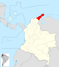
Coordinates: 11°33′N 72°54′W / 11.55°N 72.9°WCoordinates: 11°33′N 72°54′W / 11.55°N 72.9°W Country  Colombia
Region Caribbean Region Established July 1, 1965 Capital Riohacha Government - Governor Jorge Eduardo Perez Bernier[1] (El Pueblo Decide) Area - Total 20,848 km2 (8,049.5 sq mi) Area rank 25th Population (2005)[2][3] - Total 623,250 - Rank 21 - Density 29.9/km2 (77.4/sq mi) Time zone UTC-05 ISO 3166 code CO-LAG Provinces Municipalities 15 Website www.laguajira.gov.co/ La Guajira (Spanish pronunciation: [laɣwaˈxiɾa]) is a department of Colombia. It occupies most of its namesake peninsula, the Guajira Peninsula in the northeast region of the country, facing the Caribbean Sea and Venezuela in the northern most part of South America. The department capital city is Riohacha.
Various indigenous tribes populated the vast arid plains, such as the Wayuu, Guajiros, Macuiros, Anates, Wayunaiki, Cuanaos and Eneales among others prior to the Spanish arrival to the Americas. In 1498 Alonso de Ojeda navigated around the peninsula of La Guajira, but the one who disembarked in what today is La Guajira was Juan de la Cosa. During the colonial era the territory was disputed by the governors of Santa Marta and Venezuela due to deposits of pearls. English pirates, French, Germans also disputed the territory. Martin Fernandez de Enciso found the city of Nuestra Señora Santa Maria de los Remedios del Cabo de la Vela, first village in the territory but due to constant attacks, in 1535 Don Nicolas de Federman had to refounded as the village of Riohacha and in 1544 was moved present-day Riohacha. In 1871 the region is separated from the Department of Magdalena and is created La Guajira as part of the national territories. In 1898 was created the Intendance of La Guajira.[4]
In 1911 the Colombian government created the Commissary of la Guajira, followed by a wave of Middle Eastern immigrants (Christians and Maronites) from Lebanon, Syria, Palestine and Jordan, countries under the Ottoman Empire arrived to La Guajira in the c. 1930s and establishing mostly in Maicao. In 1954 was once again created the Intendance of la Guajira and Riohacha was declared a municipality. Finally in 1964 the Department of La Guajira was created.[4]
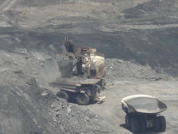
The economy of the department is mostly based on royalties from the coal mining at Cerrejón, which produced 24.9 million tons of export coal in 2004, Natural gas exploitation and salt mine. A popular tourist destination is Cabo de la Vela, a small fishing village located on the tip of the peninsula in the Guajira desert.
Contents
Etymology
The name of Guajira comes from the Carib languages. According to Picon (1996: p. 313) the word "Guajiros" was first used in the year 1600 to designate some 200 indigenous families that inhabited in the region of Riohacha, which were known for having large herds of goats. The term expanded to define all the indigenous in the peninsula who seemed to be goat herders. According to Oliver (1990: p. 84) the term "Guajiro" did not appeared on Spanish records until the year 1626 in a document by a Friar named Pedro Simón.[5]
Geography
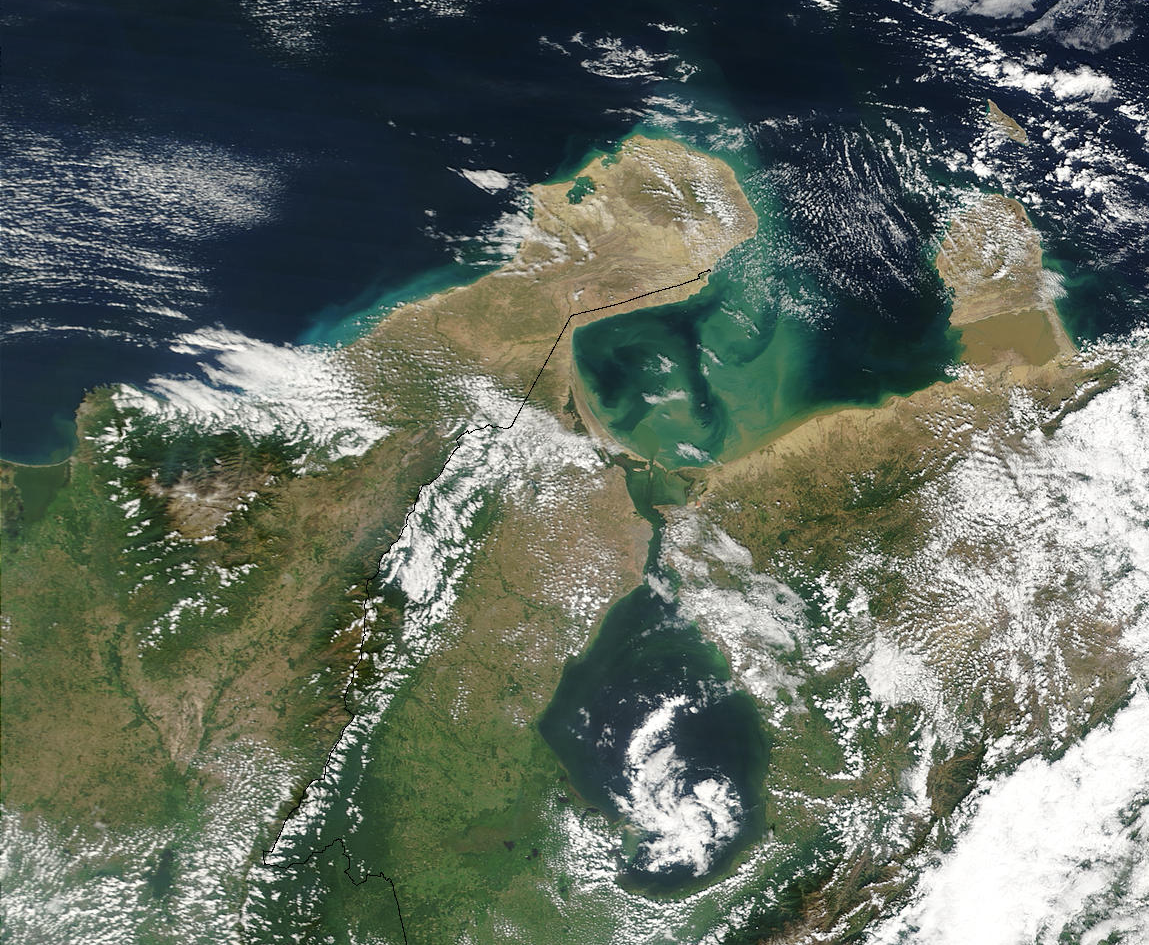
See also: Geography of Colombia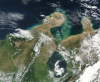 The Guajira peninsula
The northern part of the department is arid plains, the Guajira-Barranquilla xeric scrub, in the rain shadow of the Sierra Nevada de Santa Marta which rise to 5,775 meters in the south. The Sinú Valley dry forests lie in between. In the far south are the headwaters of the Cesar River which turns south towards the Magdalena River.[3]
The Rancheria River also born in the Sierra Nevada de Santa Marta crosses the Guajira Peninsula from south to north and flows through the Valley of Upar and into the Caribbean sea. The Serrania del Perija and the Montes de Oca lay on the southeastern part of the department and bordering Venezuela.[3]
The department was subdivided into three subregions based on geographical characteristics; Upper Guajira, Middle Guajira and Southern Guajira. The Upper Guajira covers the northern most area of the peninsula, mostly semi-desertic and scarce vegetation, only presenting an isolated low altitude mountain range, the Serrania de Macuira (865 m over sea level). The Middle Guajira region is mostly flat and wavy in some areas, presenting also an arid environment and the Southern Guajira covers the region of the Montes de Oca and the Serrania del Perija mountain ranges on the border with Venezuela and the valley formed with the Sierra Nevada de Santa Marta mountain range. Southern Guajira has more wetlands and more rivers.[3]
Ecoregions
The Department of La Guajira is within the Colombian Caribbean region, one of the five natural regions in Colombia.[6]
Serranía de Macuira
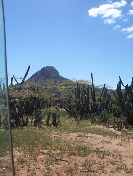
 La Teta hill, located in the municipality of Uribia, northern Guajira
The Serrania de Macuira mountain range is located to the northwest of the Guajira Peninsula occupying an are of 35,000 ha, 25,000 of which pertain to the Macuira National Park. The mountain range is an isolated ecosystem in the middle of the La Guajira Desert, near the Caribbean sea between the villages of Nazareth, Ichipa and Tawara. The mountain range works as a barrier to the trade winds which hit from the northeast charged with humidity.[6]
Sierra Nevada de Santa Marta
The Sierra Nevada de Santa Marta mountain range is located by the Caribbean sea and is also shared with the Department of Magdalena and the Department of Cesar. Most of the hydrographic reserves in the Department of La Guajira are born in this mountain range, including the Rancheria River which crosses from south to north most of the department.[6] The Sierra Nevada de Santa Marta was declared by UNESCO as a Biosphere Reserve.[7]
Cerro Pintao
The Cerro Pintao ("Painted Hill") which also covers the municipalities of San Juan del Cesar, El Molino, Villanueva and Urumita and in the Department of Cesar the municipalities of Manaure, La Paz, San Diego and Codazzi covering an area of 25,000 ha and with an altitude ranging from 1600 to 3,688 m (Paramo) giving birth to some 13 rivers in Colombia.[8]
Flamingos Fauna and Flora Sanctuary
The Santuario de Flora y Fauna los Flamencos (Flamingos Fauna and Flora Sanctuary) is located on the coastline of the municipality of Riohacha, between the village of Camarones and the Tapias River, covering 7,000 ha. The area has four lagoons (Manzanillo, Navío Quebrado, Tocoromanes and Laguna Grande) and numerous streams which serve as habitat to the Flamingos and numerous other endemic species.[9]
Flamingos Protection Area
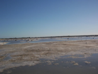
Located in the village of Musichi, the Flamingos Protection Area is within the municipality of Manaure and presents numerous lagoons which are also used by locals for the artisan exploitation of salt.[10]
Climate
Climate data for Riohacha Month Jan Feb Mar Apr May Jun Jul Aug Sep Oct Nov Dec Year Average high °F (°C) 90.1
(32.3)90.3
(32.4)90.5
(32.4)90.9
(32.7)92.3
(33.5)93.9
(34.4)95.0
(35.0)94.6
(34.8)92.1
(33.4)90.3
(32.4)89.8
(32.1)90.0
(32.2)92.6
(32.7)Average low °F (°C) 71.2
(21.8)71.8
(22.1)73.4
(23.0)75.7
(24.3)77.0
(25.0)77.7
(25.4)77.5
(25.3)77.2
(25.1)75.9
(24.4)74.8
(23.8)73.9
(23.3)72.5
(22.5)73.9
(23.0)Precipitation inches (mm) .15
(4).08
(2).11
(3).91
(23)2.71
(69)1.61
(41).59
(15)1.53
(39)5.15
(131)5.91
(150)2.28
(58).71
(18)21.77
(553)Source: Weatherbase[11][12] History
Pre-Colombian
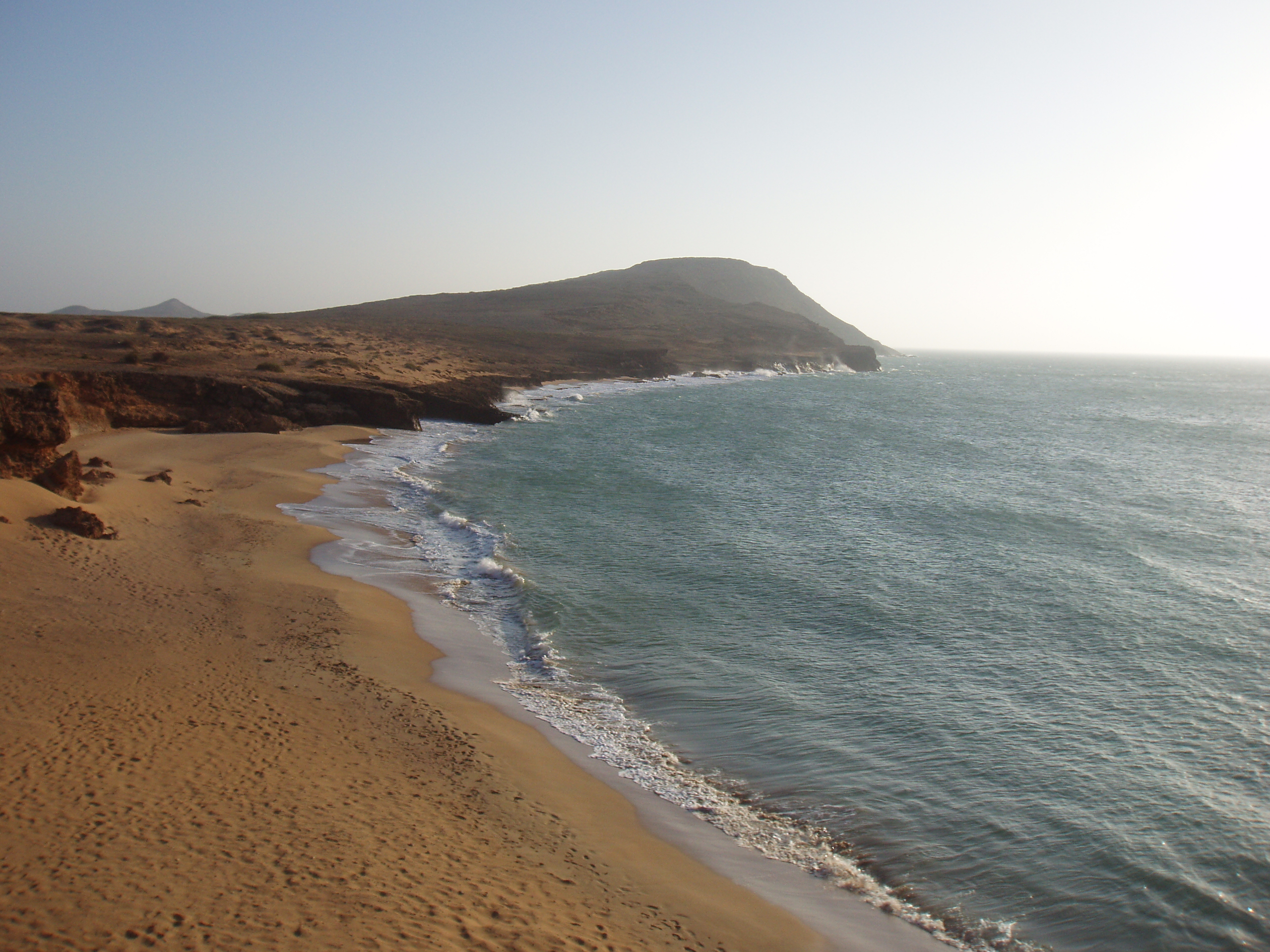
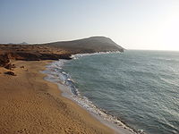 The Cabo de la Vela was one of the first sites that Spanish explorers first sighted upon their arrival to the continental Americas.
The area of present-day La Guajira was inhabited predominantly during the Pre Colombian era by indigenous tribes pertaining mostly to the Wayuu (Guajiros, Macuiros, Anates, Caquetios, Wayunaiki, Cuanaos, Onotos and Eneales) and Cocinas in the northern lower and drier areas; in the south, Koguis, Arhuacos, Guanebucanes and Chimilas ethnic groups, among others.[13] Archaeological findings have shown the presence of fishing communities with pottery on the central eastern side of the Guajira Peninsula dating to 10 BC, which also determined that these practiced pottery for the exploitation of marine resources.[14]
These groups coexisted on the Guajira Peninsula. The upper indigenous peoples were nomads, traveling across the peninsula hunting, fishing, and collecting fruits. The indigenous groups in the south were semi-sedentary, practicing agricultural techniques and exploiting coastal resources.[13]
Spanish conquest and colonization
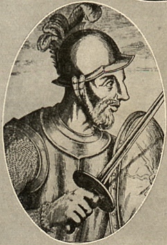
The Guajira Peninsula was first seen by Spanish explorers led by Alonso de Ojeda upon reaching the coasts of the Guajira Peninsula in 1498, but without disembarking.[15] The first Spanish expedition to disembark went in 1502 led by Juan de la Cosa at Cabo de la Vela.[16] La Guajira was one of the territories in Colombia that endured a periods of isolation during the Spanish colonization of the Americas due to the resistance of the indigenous peoples, predominantly the Wayuu. It was until the 18th century that the Spanish monarchy ordered capitulations to conquest and pacify the indigenous in the region. This did not improve after the independence and the conflict between colonizers and indigenous prevailed throughout the 19th century.[17]
In 1524 Bastidas had created the Government of Santa Marta which covered an area from Cabo de la Vela to the mouth of the Magdalena River.[18]
The foundation of the first settlements in the area was made by Martín Fernández de Enciso who founded a village near the Cabo de la Vela with the name Nuestra Señora Santa María de los Remedios del Cabo de la Vela in 1535, the first settlement in La Guajira. Due to constant attacks from the indigenous and other Spanish conquerors from neighboring Captaincy of Venezuela due to large deposits of pearls, the village was moved to present-day Riohacha in 1544 and refounded by Nikolaus Federmann.[19][20]
Between 1609 and 1640, the Spanish colonizers imported some 800 or more African slaves. Most of these later escaped and formed Palenques. In 1679 the Government of Santa Marta offered these palenques their freedom in exchange of protecting the territory from English pirates and the Government of Venezuela who pretended the Guajira Peninsula due to large reserves of pearls in the area.[17]
The Guajira rebellion
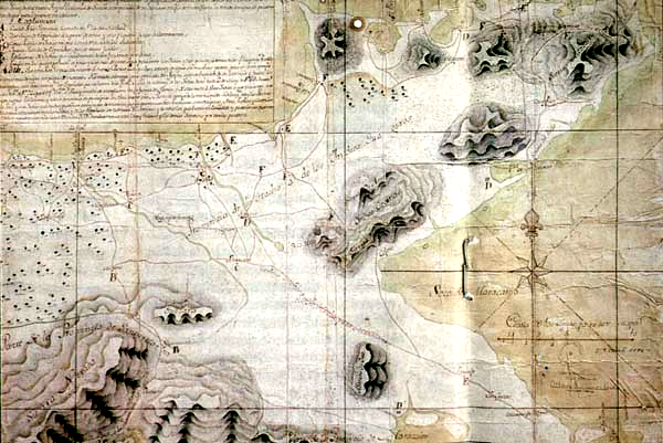
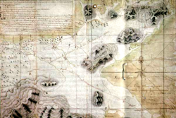 Map of La Guajira in 1769.
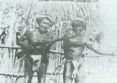
The Wayuu had never been subjugated by the Spanish. The two groups were in a more or less permanent state of war. There had been rebellions in 1701 (when they destroyed a Capuchin mission), 1727 (when more than 2,000 Indians attacked the Spanish), 1741, 1757, 1761 and 1768. In 1718 Governor Soto de Herrera called them "barbarians, horse thieves, worthy of death, without God, without law and without a king." Of all the Indians in the territory of Colombia, they were unique in having learned the use of firearms and horses.[21]
In 1769 the Spanish took 22 Wayuus captive, in order to put them to work building the fortifications of Cartagena. The reaction of the Indians was unexpected. On May 2, 1769 at El Rincón, near Río de la Hacha, they set their village afire, burning the church and two Spaniards who had taken refuge in it. They also captured the priest. The Spanish immediately dispatched an expedition from El Rincón to capture the Indians. At the head of this force was José Antonio de Sierra, a mestizo who had also headed the party that had taken the 22 Guajiro captives. The Guajiros recognized him and forced his party to take refuge in the house of the curate, which they then set afire. Sierra and eight of his men were killed.[21]
This success was soon known in other Guajiro areas, and more men joined the revolt. According to Messía, at the peak there were 20,000 Indians under arms. Many had firearms acquired from English and Dutch smugglers, sometimes even from the Spanish. These enabled the rebels to take nearly all the settlements of the region, which they burned. According to the authorities, more than 100 Spaniards were killed and many others taken prisoner. Many cattle were also taken by the rebels. The Spaniards who could took refuse in Río de la Hacha and sent urgent messages to Maracaibo, Valle de Upar, Santa Marta and Cartagena. Cartagena send 100 troops. The rebels themselves were not unified. Sierra's relatives among the Indians took up arms against the rebels to avenge his death. A battle between the two groups of Indians was fought at La Soledad. That and the arrival of the Spanish reinforcements caused the rebellion to fade away, but not before the Guajiro had regained much territory.[21]
Republican era
In 1846 the new government of the Republic of New Granada created then the "Guajiro territory" segregated from the State of Magdalena. The indigenous practiced contraband at a large scale and the problems with authority continued and the territory was once again put under the Government of Santa Marta.[17]
In 1871 once again the territory of La Guajira was segregated and became a national territory to become an intendencia in 1898 and commissary in 1911. In 1954 is demoted back to intendencia until 1964 when the Department of La Guajira was created.[19]
The Evangelization of the Indigenous Peoples
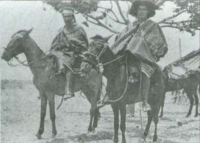 Wayuu riding on horses. 1928.
The process of evangelizing the Wayuu people restarted in 1887 with the return of the Capuchin friars under reverend friar José María de Valdeviejas. In 1905, Pope Pius X created the Vicariate of La Guajira and as first Vicar, friar Atanasio Vicente Soler y Royo attempted to "civilize" the Wayuu people.[22]
The Capuchin Friars began building orphanages for Wayuu children in 1903, beginning with La Sierrita orphanage built in the Sierra Nevada de Santa Marta mountains. The San Antonio orphanage, located by the Calancala River, was built in 1910 and the Nazareth orphanage in the Serrania de Macuira mountains in 1913. The orphanages created a direct influence over the Rancherías of Guarrachal, El Pájaro, Carazúa, Guaraguao, Murumana, Garra Patamana and Karraipía. The Nazareth Orphanage had some control over the rancherías of Taroa, Maguaipa, Guaseipá, and Alpanapause. The friars frequently visited the settlements, inviting the people to attend mass. Wayuu children in the orphanages were educated with traditional European customs. Conflicts between the Wayuu people and the Colombian government have decreased since then. In 1942 Uribia celebrated Christmas and New Year's Eve for the first time .[22]
Thousand days civil war
Main article: Thousand Days WarDuring the Thousand Days War (1899–1902) the region was affected by the struggle between liberals and conservatives. The indigenous in La Guajira sided with members of either side depending on parental affiliation or economic advantage rather than on political views. A cacique named Jose Dolores came to an agreement with Liberal radical Rafael Uribe Uribe, but later sided with the conservatives after having a parental affiliation to General Iguarán, one of the conservative commanders.[23]
Colombian armed conflict
Main article: Colombian armed conflictThe Department of La Guajira was influenced by the Colombian armed conflict since the 1970s initially by the two main guerrilla groups; the Revolutionary Armed Forces of Colombia (FARC) and the National Liberation Army (ELN) mostly in the southern Guajira between the mountain of the Sierra Nevada de Santa Marta and the Serrania del Perija bordering Venezuela. The influence in the northern Guajira was disputed with the indigenous Wayuu who since the 1970s controlled contraband in the area; mainly narcotics. In the southern Guajira the FARC operates its Caribbean Bloc's 59th Front and influences from the 19th and 41st fronts. The ELN structure in the area is called the Gustavo Palmesano Front.[24]
During the 1990s paramilitary groups set in La Guajira, mainly the United Self-Defense Forces of Colombia (AUC) and the Wayuu Resistance Front led by the Northern Bloc of the AUC and its commander alias "Jorge 40". The paramilitaries led a cleansing campaign in the early 2000s against rival communist guerrillas and rival drug trafficking groups, preventing the guerrillas from acquiring provisions, ammunitions, weapons and the cut on the illegal drug trade.[24]
In 2004 rivalries aroused between paramilitary factions between "Jorge 40" and another paramilitary commander known as "Chema Balas" for the control of the port of Bahía Portete. In April 2004 paramilitaries executed a number of people in that village, the incident became known as the Bahía Portete massacre in which some 30 members of the Wayuu were executed, 60 disappeared and some 250 forcedly displaced into Venezuela.[25] Paramilitaries pertaining to the AUC demobilized in 2006, but new drug trafficking organizations arose, such as the Aguilas Negras. Between 2000 and 2005 the FARC and the AUC perpetrated two massacres each while the ELN perpetrated one.[24]
Politics
See also: Politics of Colombia and Government of ColombiaThe Department of La Guajira is governed by the three regional representatives branches of power in Colombia. The Executive branch representative is the Governor of the Department of La Guajira elected every four years by popular vote in regional elections along with the Legislative branch by the Department Assembly of La Guajira; and the judicial branch by the regional courts under the Superior Tribunal of Riohacha whose members are appointed by the Supreme Court of Colombia. Control institutions also have their regional representatives. These institutions also have control over the 15 municipalities which are governed locally by a mayor, a town council and by the regional courts and control institutions.
Administrative divisions
The Department of La Guajira is formed by 15 municipalities, each administered by a popularly elected mayor and a city council, as well as municipal level courts. 12 of the municipalities are part of a government program called "Special Units for Frontier and Department Frontier Zone"; San Juan del Cesar, La Jagua del Pilar, Barrancas, El Molino, Fonseca, Hatonuevo, Maicao, Uribia, Urumita, Villanueva, Manaure and Riohacha. The municipalities of Dibulla, Albania, and Distracción are excluded from that classification. The Department of La Guajira is also composed by 126 corregimientos, 49 inspecciones de policía (police inspections) and 10 caseríos, all distributed within the municipalities.[26]
Municipalities
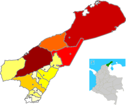
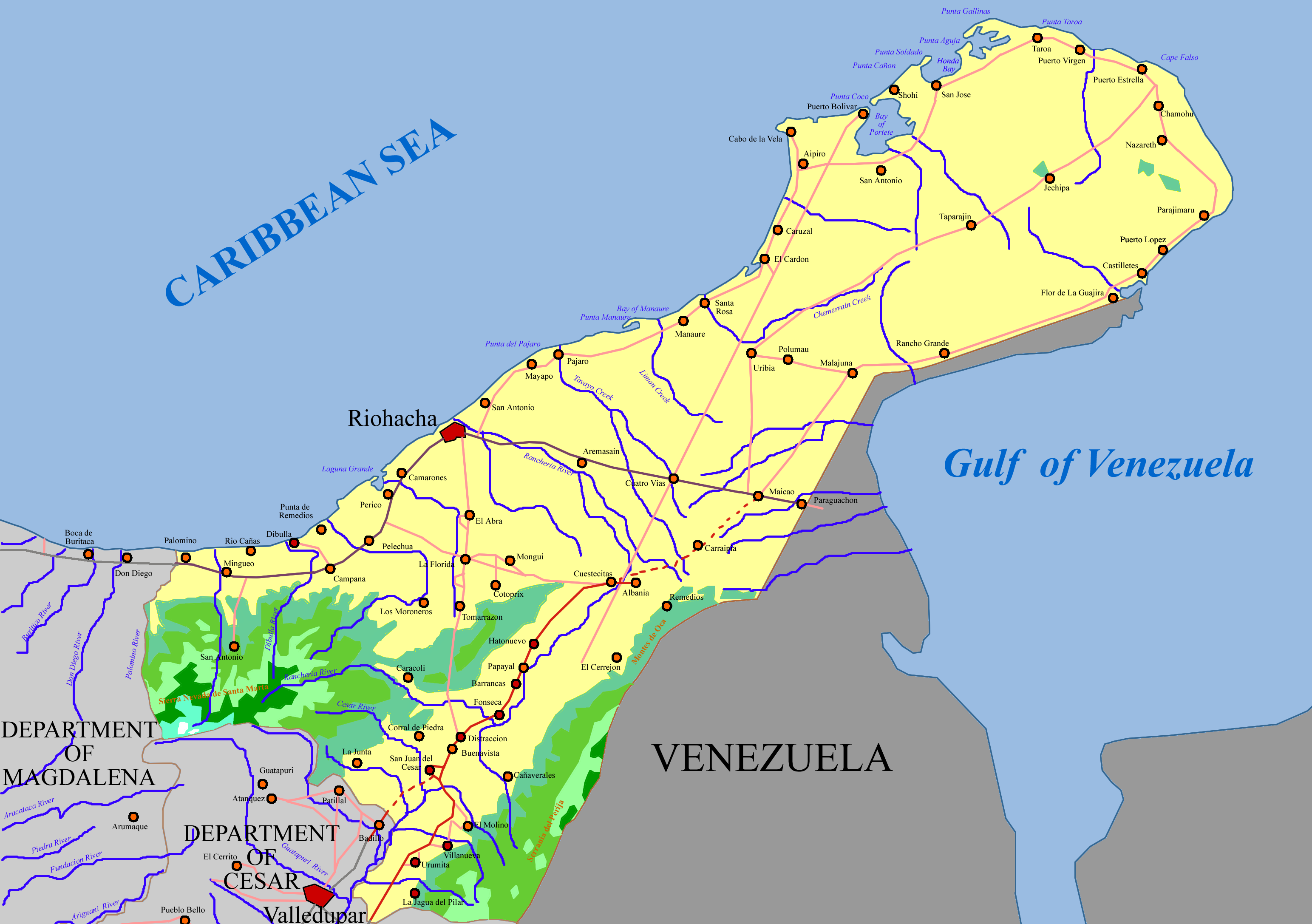
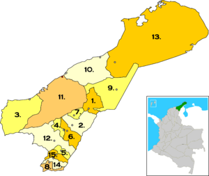 Municipalities of La Guajira Department. Municipality and city of Riohacha highlighted in dark gray and red respectively.
 Albania
 Barrancas
 Dibulla
 Distracción
 El Molino
 Fonseca
- Hatonuevo
 La Jagua del Pilar
- Maicao
 Manaure
- Riohacha
 San Juan del Cesar
- Uribia
- Urumita
 Villanueva
Defense
The Colombian National Police has a regional command post in the Department of La Guajira, usually under the command of a colonel and based in the capital of the department, Riohacha.[27] The Colombian National Army has two major units in the department, part of the 1st Division; the 2nd Mechanized Cavalry Battalion (based in Distracción) and the 6th Mechanized Battalion (Based in Riohacha).[28] The Colombian Air Force division Comando Aéreo de Combate No. 3 (CACOM-3), in Barranquilla, Atlantico, covers the Department of La Guajira using as airstrip the Almirante Padilla Airport.[29]
Demographics
According to the DANE (Colombian statistics bureau) 2005 Census, the Department of La Guajira; 44.9% of the population was indigenous pertaining to the Arhuaco, Koguis, Wiwa and Wayuu primarily; 7.5% of Afro-Colombian descent, while the remaining 47,6% of the population did not consider itself part of a particular ethnic group, except for the Middle Eastern descendants who have migrated throughout the 20th century.[30]
The Department of La Guajira contains the largest population of indigenous peoples in Colombia with 20.2% of the total and followed by the departments of Cauca and Narino with 18% and 11,2% of the total indigenous population of Colombia. The municipalities with the largest indigenous populations are those in which the Wayuu people are present Uribia (95.9%), Manaure (88.2%), and Maicao (40.1%).[30]
The population of 623,250 constituted 1.5% of the total population of Colombia (42,090,502) and 7% of the Caribbean Region of Colombia (8,910,195). The Department of La Guajira had a population density of 29.9 inhabitants per square kilometer. From those 623,250 total inhabitants 50.6% were females and 49.4% were males.[31]
 Map of La Guajira by population
 Geography of La Guajira showing the main roads and concentration of urban areas.
Municipality Population Percentage Riohacha 169,311 27.2% Uribia 116,674 18.7% Maicao 103,124 16.5% Manaure 68,578 11% San Juan del Cesar 25,587 4.1% Fonseca 22,220 3.6% Barrancas 22,207 3.6% Dibulla 21,098 3.4% Albania 20,898 3.4% Villanueva 18,804 3% Hatonuevo 9,797 1.6% Urumita 8,545 1.4% Distraccion 8,274 1.3% El Molino 5,937 1% La Jagua del Pilar 2,196 0.4% TOTAL (2005) 623,250 100% Education
Economy
 Manaure salt mine. Manaure provides approximately 80% of the Colombian market with salt.
The Economy of the Department of La Guajira is mainly based on the exploitation of mineral resources, such as coal in the Cerrejon mines, natural gas, salt mines in Manaure constituting 53.48% of the total revenues in 2005.[32]
The service industry follows including electricity, gas, potable water, transport and communications, accounting for 11.06% of the total revenue. Education, health, community service and domestic services account for 9.60% of the total.[32]
Agriculture, silviculture and fishing accounts for 7.99% of the total followed by commerce, hotel industry and restaurant industry which together account for 6.65% of the total revenues in the Department of La Guajira. In a lower scale public administration accounts for 5.47%, Construction for 3.01%, Real State with 2.21% and Industrial sector 0.52%.[32]
Agriculture
The Department of La Guajira in 2005 produced mainly tobacco, coffee, yuca, plantain, coconuts, ñame, arracacha, oil palm, sugar cane, and perico. 1,211 plantations were transitory while 59,830 plantations were of permanent production.[32]
Culture
See also: Festivals in La GuajiraCultural aspects in the Department of La Guajira have been mostly influenced by the traditions of the Wayuu culture, European culture, mainly through Roman Catholic traditions, Afro-Colombian and since the mid-20th Century from the Middle Eastern culture, including Islamic traditions.[33] There is also a great influence from Venezuela, as the Wayuu traditional territory is shared by the two nations.
Language
There are three main languages in La Guajira, the most spoken in terms of population is the Spanish language followed by the Wayuu language. The growing population of Middle Eastern immigrants has contributed with the Arabic language in the region. Koguis and Wiwas are more associated with the Chibchan languages speaking also in their own variation.[34]
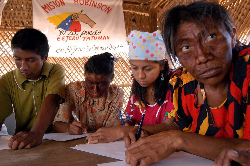
Spanish in La Guajira has developed also its own dialect by taking words from mostly the Wayuu language. The Wayuus and other indigenous grooups are also being introduced to bilingual education from their native language to Spanish. Numerous software companies such as Microsoft[35] and Ubuntu[36] have developed products in Wayuu language.[37]
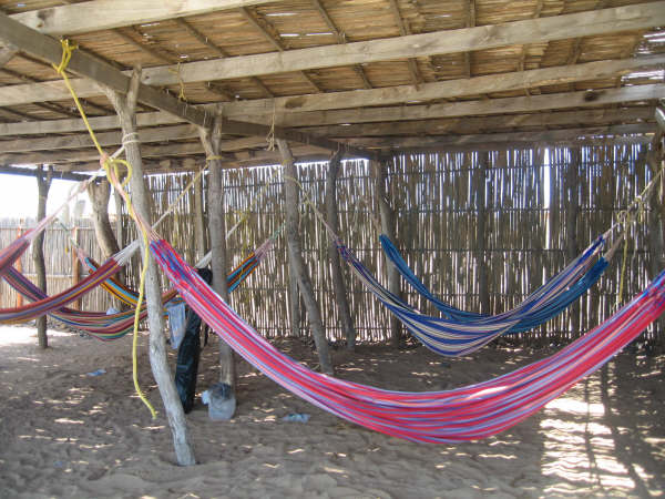
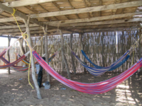 Typical Wayuu rectangular "day house" with hammocks by the Caribbean Sea. The Chinchorros hammocks are one of the most traditional items in the culture of La Guajira
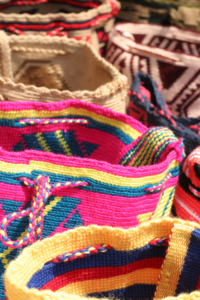 Wayuu handcrafted mochilas woolen bags have also transcended through cultures and fashion in Colombia.
Group Language Population Mestizo Spanish 300,000 Wayuu Wayuunaiki 150,000 Koguis Koguian/Tezhuan 7,100 Wiwas Dámana/Terruna shayama 3,100 Middle Eastern Arabic 3,061 Ika Ikan 800 Inga or Kingui Ingan 200 Literature
Literature in La Guajira has been both written in Spanish and Wayuunaiki, most of it describing the myths, the sacred, the tragic, the epics, the legends, heroism, the magic, the comedy and romanticism autochthonous to the region and directly influenced by the Costumbrismo, including physiology and sexuality.[38]
Wayuu tribes feature prominently in Papillon by Henri Charriere, about an escaped convict who takes refuge with one such tribe. La Guajira has been subject to numerous writings describing the culture.
Music
See also: vallenatoMusic is the Department of La Guajira has been directly associated to the indigenous peoples, as well as the influence from the Afro-Colombians and the European cultural influences. Such is the case of the vallenato music, which was allegedly originated in the region formed between Riohacha and Valledupar, some considering it larger and reaching from Riohacha to the central region of the Department of Cesar. Accordions and guitar first used for vallenato music were allegedly acquired in La Guajira as contraband arriving from the nearby island of Aruba, in the Caribbean sea.[39]
The Wayuu has contributed with their own traditional music and instrument. Their culture directly associates economy and social life with music; such as in the case of raising cattle, in which the indigenous sang to their animals. They also used music for meetings and celebrations, as well as mourning in funerals. The Yonna is the traditional dance of the Wayuu and is used to honor guests.[39]
The Wayuus created many rustic musical instruments called Kashi, Sawawa (type of flute), ma'asi, totoy and the taliraai (tubular flute), wootoroyoi (type of clarinet), among others. The Majayura or ritual of the "young wayuu virgin" in which the female dances towards the male for marriage, while other males perform rhythms with their traditional instruments until the male tumbles onto the ground.[39]
Gastronomy
Gastronomy in the Department of La Guajira is directly associated to the traditional gastronomy of the indigenous Wayuu, based on local fauna and flora, as well as some influence from the Spanish cuisine. The most representative of the Guajira cuisine is the Friche; a fried or stewed goat seasoned with salt and its own blood and guts. Arroz con camarones (Rice with shrimp); rice is cooked with a previously boiled shrimp and put to dry on the sun. The Iguana stew with coconuts. The Iguaraya; fruit from the cactus, Wayuus use this for drinking juice or wine. Turtles; cooked in a variety of ways usually with rice, in soup or stewed,[40] cooked in a similar way; deers and Capybaras.[41][42]
References
- ^ (Spanish) National Registry of the Civil State: Governor of La Guajira
- ^ (Spanish) DANE Census 2005: Population of La Guajira
- ^ a b c d (Spanish) Observatorio del Caribe Colombiano: Grupo Regional de investigación en economía y competitividad en el Caribe colombiano by Weildler Guerra, Paola Quintero, Jorge Quintero and Ana María Maldonado
- ^ a b Colombian Air Force: Guajira
- ^ (Spanish) Government of La Guajira: Guajira Development Plan - Etymology
- ^ a b c (Spanish) Government of La Guajira: Development Plan - subregions
- ^ (Spanish) UNESCO: Buritaca 200 - Ciudad Perdida - Sierra Nevada de Santa Marta
- ^ (Spanish) Government of La Guajira: Guajira Development Plan - Cerro Pintao
- ^ (Spanish) Government of La Guajira: Guajira Development Plan - Flamingos Fauna and Flora Sanctuary
- ^ (Spanish) Government of La Guajira: Guajira Development Plan - Flamingos Protection Area
- ^ "Worldweather: Riohacha, Colombia". Weatherbase. 2008. http://www.worldweather.org/057/c00884.htm. Retrieved 2008-04-08.
- ^ *Climatological information is based on monthly averages for the 30-year period 1971-2000.
- Precipitation includes both rain and snow.
- Attention: Please note that the averaging period for climatological information and the definition of "Mean Number of Precipitation/Rain Days" quoted in this web site may be different for different countries. Hence, care should be taken when city climatologies are compared.
- ^ a b (Spanish) Government of La Guajira: Guajira Development Plan - History
- ^ (Spanish) Luis Angel Arango Library: LOS APAALANCHI UNA VISIÓN DEL MAR ENTRE LOS WAYUU
- ^ (Spanish) Dibuya: History
- ^ (Spanish) Government of Riohacha: History
- ^ a b c (Spanish) La guerra de los Cárdenas y los Valdeblánquez (1970-1989) Estudio de un conflicto mestizo en La Guajira by Simón Uribe Martínez and Nicolás Cárdenas Angel
- ^ (Spanish) Juan Friede, “La conquista del territorio y el poblamiento”, Manual de Historia de Colombia, 3 Vols., Vol. 1, Bogotá, Instituto Colombiano de Cultura, 1982, pp.116-222, p.131.
- ^ a b Luis Angel Arango Library: History of La Guajira
- ^ (Spanish) LABLAA - La Guajira: History
- ^ a b c (Spanish) Luis Angel Arango Library: The Guajira rebellion
- ^ a b (Spanish) Luis Angel Arango Library: The Capuchins Mission and the Wayuu Culture
- ^ (Spanish) raicespaisas.org: The Thousand Days War; the indigenous
- ^ a b c (Spanish) Government of Colombia - Human Rights office: Department of La Guajira diagnostic
- ^ (Spanish) elmundo.es: ACNUR denuncia que cientos de indígenas colombianos se ven desplazados por los paramilitares
- ^ (Spanish) Observatorio del Caribe Colombiano: Grupo Regional de investigación en economía y competitividad en el Caribe colombiano by Weildler Guerra, Paola Quintero, Jorge Quintero and Ana María Maldonado - Administrative divisions
- ^ (Spanish) Colombian National Police: Police Department of La Guajira
- ^ (Spanish) 1st Division of the Colombian National Army: Second Brigade and Tenth Brigade
- ^ Colombian Air Force: CACOM 3 History
- ^ a b (Spanish) Observatorio del Caribe Colombiano: Grupo Regional de investigación en economía y competitividad en el Caribe colombiano by Weildler Guerra, Paola Quintero, Jorge Quintero and Ana María Maldonado - Composicion etnica
- ^ (Spanish) Observatorio del Caribe Colombiano: Grupo Regional de investigación en economía y competitividad en el Caribe colombiano by Weildler Guerra, Paola Quintero, Jorge Quintero and Ana María Maldonado - demographics
- ^ a b c d (Spanish) Government of La Guajira: Internal Agenda for Productivity and Competitiveness
- ^ (Spanish) Colombian Caribbean Observatory - Sistema educativo y realidad en La Guajira: ideas para la armonización intercultural
- ^ (Spanish) Colombian Caribbean Observatory: Language in the Department of La Guajira (Sistema educativo y realidad en La Guajira: ideas para la armonización intercultural)
- ^ The return to the Indian and the search for cultural responsiveness and responsibility in Latin American education by Luis Enrique López
- ^ Ubuntu: Ubuntu in Wayuunaiki
- ^ (Spanish) Colombian Caribbean Observatory: Language in the Department of La Guajira (Sistema educativo y realidad en La Guajira: ideas para la armonización intercultural)
- ^ (Spanish) Indymedia.org: Wayuu literature or the Myths adventures by Manuel Guillermo Ortega Sunday, Sep. 23, 2007 at 4:05 PM
- ^ a b c Taliraai: Music, Gender and Kinship in the Wayuu Culture - Jacqueline Vilchez Faria
- ^ (Spanish) viajes-exoticos.info Gastronomy of La Guajira
- ^ (Spanish) Colombiaaprende.edu.co: Gastronomy of the Caribbean Region of Colombia
- ^ (Spanish) LABLAA: Listos Ojos, Paladar y Corazon
External links
- (Spanish) Government of La Guajira official website
- (Spanish) Violence in La Guajira
- (Spanish) Colombian ministry of Education: Education in La Guajira
- (Spanish) Bank of the Republic - Colombia: Education in the Caribbean region of Colombia
- (Spanish) Bank of the Republic - La Guajira y el mito de las regalías redentoras by Adolfo Meisel Roca No. 86 Febrero, 2007
- (Spanish) UNESCO: indigenous peoples in la Guajira
- (English) Info about La Guajira - Off 2 Colombia -
Departments of Colombia  Categories:
- La Guajira Department
- Departments of Colombia
- Caribbean region of Colombia
- States and territories established in 1965


Wikimedia Foundation. 2010.