- Nariño Department
-
Department of Nariño
Departamento del Nariño— Department — 
Flag
Coat of armsMotto: La Fuerza del Cambio Continúa
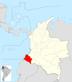
(Spanish: The Force of Change Continues)Anthem: Himno del Departamento de Nariño Nariño shown in red Coordinates: 01°10′N 77°16′W / 1.167°N 77.267°WCoordinates: 01°10′N 77°16′W / 1.167°N 77.267°W Country  Colombia
Region Pacific Region/Andes Region Established August 6, 1904 Capital Pasto Government – Governor Antonio Navarro Wolff (Alternative Democratic Pole) Area – Total 33,268 km2 (12,844.8 sq mi) Area rank 11 Population (2005)[1] – Total 1,531,777 – Rank 8 – Density 46/km2 (119.3/sq mi) Time zone UTC-05 ISO 3166 code CO-NAR Provinces 3 Municipalities 62 Website www.gobernar.gov.co Nariño (Spanish pronunciation: [naˈɾiɲo]) is a department of Colombia named after Antonio Nariño. It is in the west of the country, bordering Ecuador and the Pacific Ocean.
Its capital is Pasto, other important cities include Tumaco, Ipiales.
Municipalities
- Albán
- Aldana
- Ancuya
- Arboleda
- Barbacoas
- Belén
- Buesaco
- Chachagüí
- Colón (Génova)
- Consaca
- Contadero
- Córdoba
- Cuaspud
- Cumbal
- Cumbitara
- El Charco
- El Peñol
- El Rosario
- El Tablón
- El Tambo
- Francisco Pizarro
- Funes
- Guachucal
- Guaitarilla
- Gualmatán
- Iles
- Imues
- Ipiales
- La Cruz
- La Florida
- La Llanada
- La Tola
- La Unión
- Leiva
- Linares
- Los Andes
- Magui
- Mallama
- Mosquera
- Nariño
- Olaya Herrera
- Ospina
- Pasto
- Policarpa
- Potosí
- Providencia
- Puerres
- Pupiales
- Ricaurte
- Roberto Payán
- Samaniego
- San Bernardo
- Sandona
- San Lorenzo
- San Pablo
- San Pedro de Cartago
- Santa Barbara
- Santacruz
- Sapuyes
- Taminango
- Tangua
- Tumaco
- Tuquerres
- Yacuanquer
References
External links
- (Spanish) Government of Narino official website
Departments of Colombia  Categories:
- Nariño Department geography stubs
- Nariño Department
- Departments of Colombia
- States and territories established in 1904
Wikimedia Foundation. 2010.

