- Caldas Department
-
Department of Caldas
Departamento de Caldas— Department — 
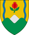
Flag
Coat of armsCaldas shown in red Coordinates: 5°06′N 75°33′W / 5.1°N 75.55°WCoordinates: 5°06′N 75°33′W / 5.1°N 75.55°W Country  Colombia
Region Andes Region Established 1905 Capital Manizales Government – Governor guido echeverry (Partido Liberal) Area – Total 7,888 km2 (3,045.6 sq mi) Area rank 28 Population (2005)[1] – Total 908,841 – Rank 16 – Density 115.2/km2 (298.4/sq mi) Time zone UTC-05 ISO 3166 code CO-CAL Provinces Municipalities 27 Website gobernaciondecaldas.gov.co Caldas is a department of Colombia named after Colombian patriotic figure Francisco José de Caldas. It's part of the Paisa Region and its capital is Manizales. The population of Caldas is 1,030,062, and its area is 7,291 km². Caldas is also part of the Colombian Coffee-Growers Axis region along with the Risaralda and Quindio departments.
Caldas experiences severe inequality and a high level of poverty (57.1%).[2] Health care is also a major issue, with 12.5% infant mortality, high levels of HIV/AIDS, high levels of malnutrition, and hazardous living conditions.[3]
Contents
Municipalities
Districts of Caldas
Caldas has 6 Districts:
Central Southern District
- Manizales (capital)
- Chinchina
- Neira
- Palestina
- Villamaría
Lower Western District
- Anserma (Capital)
- Belalcazar
- Risaralda
- San José
- Viterbo
Upper Western District
- Supía (Capital)
- Filadelfia
- La Merced
- Marmato
- Riosucio
Northern District
- Aguadas
- Aranzazu
- Pacora
- Salamina
Upper Eastern District
- Manzanares
- Marquetalia
- Marulanda
- Pensilvania
Magdalena Caldense District
- La Dorada (Capital)
- Norcasia
- Samaná
- Victoria
Dams
In Caldas is the Miel I Dam.[4]
References
External links
- (Spanish) Government of Caldas official website
Departments of Colombia  Categories:
- Caldas Department
- Departments of Colombia
- States and territories established in 1905
Wikimedia Foundation. 2010.

