- Caquetá Department
-
Department of Caquetá
Departamento del Caquetá— Department — 
Flag
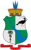
Coat of armsMotto: All, For a Better Caqueta
(Spanish: Todos por un Caquetá mejor)Caquetá shown in red Coordinates: 1°37′N 75°36′W / 1.617°N 75.6°WCoordinates: 1°37′N 75°36′W / 1.617°N 75.6°W Country  Colombia
Region Amazonas Region Established 1982 Capital Florencia Government – Governor Germán Medina Triviño Area – Total 88,965 km2 (34,349.6 sq mi) Area rank 3 Population (2005)[1] – Total 404,896 – Rank 24 – Density 4.6/km2 (11.8/sq mi) Time zone UTC-05 ISO 3166 code CO-CAQ Provinces Municipalities 15 Website agobernaciondecaqueta.gov.co Caquetá Department (Spanish pronunciation: [kakeˈta]) is a department of Colombia. Located in the Amazonas region, Caquetá borders with the departments of Cauca and Huila to the west, the department of Meta to the north, the department of Guaviare to the northeast, the department of Vaupés to the east, the departments of Amazonas and Putumayo to the south covering a total area of 88,965 km², the third largest in the country. Its capital is the city of Florencia.
Contents
Municipalities
- Albania
- Belén de Andaquies
- Cartagena del Chairá
- Curillo
- El Doncello
- El Paujil
- Florencia
- La Montañita
- Milán
- Morelia
- Puerto Rico
- San José de la Fragua
- San Vicente del Caguán
- Solano
- Solita
- Valparaíso
References
- ^ 2005 Census Results (Spanish)
External links
- (Spanish) Government of Caquetá official website
- (Spanish) Secretary of Health of Caquetá
- (Spanish) Portal de información recreativa y cultural de Florencia y el Departamento del Caquetá.
- (Spanish) Sistema de Información Ambiental Territorial de la Amazonia colombiana SIAT-AC
See also
- Caquetá Territory
Departments of Colombia  Categories:
- Caquetá Department
- Departments of Colombia
- States and territories established in 1982
- Amazonia Region (Colombia) geography stubs
Wikimedia Foundation. 2010.

