- Serranía de Macuira
-
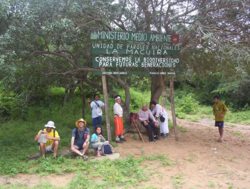 Entrance to the National Natural Park of Macuira
Serranía de Macuira is a mountain range in northern Colombia located in the municipality of Uribia, Guajira Peninsula and part of the La Guajira Department. The Serrania de Macuira stands in the middle of the La Guajira Desert at 864 meters over sea level, (2835 ft) isolated from the mountain ranges of Sierra Nevada de Santa Marta and the Cordillera Oriental of the Colombian Andes. The area is under the protection of the National Natural Park of Macuira.[1]
The Serranía de Macuira is the most western and elevated mountain range of South America and meassures some 35 km in longitude and 10 km wide, at some 10 km from the Caribbean sea. The range is made up of three mountain massifs interconnected; the highest being Cerro Paluou (864 meters over sea level), Cerro de Jibome (753 meter over sea level) covering a total area of 250 km². The area is home to numerous fauna and flora species and due its relatively high humidity caused by the trade winds and its proximity to the Caribbean sea it presents a forest of dwarf trees and cloud forests.[2]
References
- ^ Serranía de Macuira, Colombia Peakbagger Accessed 20 August 2007.
- ^ (Spanish) National Natural Parks of Colombia National Natural Parks of Colombia Accessed 20 August 2007.
External links
Categories:- Colombia geography stubs
- Mountain ranges of Colombia

Wikimedia Foundation. 2010.