- New Hey railway station
-
Newhey
Manchester Metrolink 
Location Place Newhey Local authority Rochdale Platforms 2 Fare zone information Metrolink Zone Present status Under construction History Opening c. 1863 Closed 2009 Conversion to Metrolink operation Summer 2012 Former name New Hey 

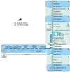
Rochdale Town Centre 

Rochdale Railway Station 


Newbold 

Kingsway Business Park 

Milnrow 

Newhey 

Shaw and Crompton 

Derker 

Oldham Mumps 


Oldham Central 

Oldham King Street 

Westwood 


Freehold 

South Chadderton 

Hollinwood 

Failsworth 

Newton Heath and Moston 

Central Park 

Monsall 
Manchester Victoria 


to Piccadilly  UK Trams portal
New Hey railway station, known by its archaist name, which opened on 2 November 1863 served Newhey, a suburb of Milnrow in the Metropolitan Borough of Rochdale, Greater Manchester, England (notice the difference in spelling between the station and town names). The station was situated on the Manchester to Rochdale via Oldham route which connected the city of Manchester to the town of Rochdale via Oldham and a number of smaller districts and suburbs including Newhey.
At the time the station opened it was as part of a new line from Oldham Mumps to Rochdale East Junction, and created a Middleton Junction to Rochdale route. In 1880 a line was built from Oldham Werneth to Thorpes Bridge Junction near Newton Heath. Subsequently the whole Thorpes Bridge Junction to Rochdale East Junction route became known as the Oldham Loop Line. The pattern of train services on the Oldham Loop Line involved a greater number of trains serving the Oldham stations, and less services continuing on to New Hey and Rochdale. In the 1960s and 1970s fewer and fewer trains ran from Oldham Mumps to Rochdale, and in May 1972 the Secretary of State for Transport announced that this part of the Oldham Loop including New Hey Station would be closed. The closure did not go ahead because what later became the Greater Manchester Passenger Transport Executive (GMPTE) agreed to fund the continuation of services. The involvement of the GMPTE also lead to a more frequent pattern of trains serving the Oldham Mumps to Rochdale section including New Hey.[1]
The station closed on 3 October 2009 for the conversion of the line to Metrolink and will re-open as Newhey Metrolink station, with the modern spelling of the town's name, in the summer of 2012.
Gallery
References
External links
Preceding station Manchester Metrolink
Following station Under Construction Shaw and Cromptontowards VictoriaOldham and Rochdale Line Milnrowtowards Rochdale Town CentreHistorical railways Milnrow L&YR
Oldham Loop LineShaw and Crompton The Oldham Loop Line Stations (anticlockwise from Manchester)
(*) Closed 3 October 2009
Dean Lane (*)
Failsworth (*)
Hollinwood (*)
Oldham Werneth (*)
Oldham Mumps (*)
Derker (*)
Shaw and Crompton (*)
New Hey (*)
Milnrow (*)Railways in Rochdale (Past, Present and Future) LegendTo Bacup 


To Calderdale Broadley 


Littleborough Shawclough and Healey 


Wardleworth 


Smithy Bridge 


Rochdale Town Centre 


Drake Street 


Rochdale 


Newbold 


Kingsway To Bury 


Milnrow Broadfield 


New Hey 


To Oldham Heywood 


Castleton 


Middleton 


Mills Hill 


To Manchester Metrolink
Stations City zoneAltrincham LineAltrincham · Brooklands · Cornbrook · Dane Road · Navigation Road · Old Trafford · Sale · Stretford · Timperley · Trafford Bar
Bury LineAbraham Moss · Besses o'th' Barn · Bowker Vale · Bury · Crumpsall · Heaton Park · Prestwich · Radcliffe · Whitefield · Woodlands Road
Eccles LineAnchorage · Broadway · Eccles · Exchange Quay · Harbour City · Ladywell · Langworthy · MediaCityUK · Pomona · Salford Quays · Weaste
South Manchester LineChorlton · Firswood · St Werburgh's Road


Operations OperatorsStagecoach Group · Transport for Greater ManchesterVehiclesFlexity Swift M5000 · T-68History Former operatorsTransferred linesClosed stationsAbandoned plansUnder Construction Bury LineQueens Road
East Manchester LineAshton Moss · Ashton Under Lyne · Ashton West · Audenshaw · Cemetery Road · Clayton Hall · Droylsden · Eastlands City Stadium · Edge Lane · Holt Town · New Islington · Velopark
Oldham & Rochdale LineCentral Park · Derker · Failsworth · Freehold · Hollinwood · Kingsway · Monsall · Milnrow · Newbold · Newton Heath and Moston · Newhey · Oldham Central · Oldham King Street · Oldham Mumps · Rochdale railway station · Rochdale Town Centre · Shaw & Crompton · South Chadderton · Westwood
South Manchester LinesBaguley · Barlow Moor Rd. · Benchill · Burton Road · Crossacres · Didsbury · East Didsbury · Hardy Farm · Haveley · Hough End · Manchester Airport · Martinscroft · Moor Road · Northern Moor · Peel Hall · Robinswood Road · Roundthorn · Sale Water Park · Shadowmoss · West Didsbury · Withington · Woodhouse Park · Wythenshawe Town Centre · Wythenshawe Park
Proposed Bury LineBuckley Wells
Trafford Centre LineImperial War Museum · Lostock Parkway · Manchester United · Parkway Circle · Port Salford · Salford Reds · Trafford Centre · Trafford Quays · Village
Stockport LineGorsey Bank · Heaton Mersey · Kings Reach · Stockport Interchange
Second City CrossingExchange Square
Transport for Greater Manchester · UK light rail systemsCoordinates: 53°36′03″N 2°05′40″W / 53.60083°N 2.09444°W
Categories:- Disused railway stations in Rochdale
- Former Lancashire and Yorkshire Railway stations
- Railway stations opened in 1863
- Railway stations closed in 2009
- Railway stations served by Northern Rail
- DfT Category F2 stations
- Proposed Manchester Metrolink stations
- Manchester Metrolink Rochdale-Manchester line stations
- Greater Manchester railway station stubs
Wikimedia Foundation. 2010.


