- Chorlton Metrolink station
-
 Chorlton
Manchester Metrolink 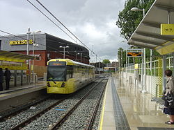
The rebuilt station, shortly after opening Location Place Chorlton-cum-Hardy Local authority City of Manchester Platforms 2 Fare zone information Metrolink Zone P Present status In operation Operations Original operator Cheshire Lines Committee Post-grouping company London, Midland and Scottish Railway
London Midland Region of British RailwaysHistory Opened 1 January 1880 Closed 2 January 1967 Conversion to Metrolink operation 7 July 2011  South Manchester Line

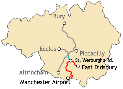
to Piccadilly and Bury 
Deansgate-Castlefield  Deansgate
Cornbrook 

to Eccles Trafford Bar to Altrincham Firswood Chorlton 
St Werburgh's Road 

to Manchester Airport 
Withington Burton Road West Didsbury Didsbury Village 
East Didsbury  UK Trams portal
Chorlton Metrolink station is a Manchester Metrolink station built on the former Cheshire Lines Committee line. The station is one of the first stations opened as part of Phase 3A of the Big Bang extension plans and is built on the site of the former railway station. The Metrolink station opened on 7 July 2011.[1]Contents
History
Railway station
The station opened as Chorlton-cum-Hardy on 1 January 1880 and closed on 2 January 1967 as part of the Beeching Axe,[2] though the line remained open to freight until the 1980s. Until the mid-20th century the station yard supplied coal to the district.[3] Land to the north-east of the track originally acquired for the purpose of doubling it was eventually sold off for development.
Chorlton station was mentioned in the 1964 song "Slow Train" by Flanders and Swann, which was written to lament the loss of stations during the Beeching cuts:
“ No churns, no porter, no cat on a seat,
At Chorlton-cum-Hardy or Chester-le-Street.” Chorlton station was subsequently demolished and a Morrisons (originally Safeway) supermarket and car-park built in its place. The track bed itself remained extant to the side of the supermarket: indeed one of the platforms survived next to the Supermarket building. The trackbed leaving the site in the direction of the former Alexandra Park railway station and Fallowfield railway station beyond the junction was converted to a cycle path managed by Sustrans, whilst northwards the way had become overgrown.
Manchester Metrolink station
Proposals to link Chorlton to a light rail system have been put forward since the 1980s,[4] but remained unfunded until recently. The line extension which was originally proposed would take over the disused tracks of the Cheshire Lines Committee as far as East Didsbury.
In 2006, it was announced that the first phase of the "Big Bang" Metrolink expansion project (Phase 3A) would go ahead, including the extension of the network as far St Werburgh's Road.[5] Following the rejection of the Greater Manchester Transport Innovation Fund in a public referendum in 2008, extension of the line as East Didsbury (Phase 3B) will now go ahead with funding from national and local government.[6][7][8]
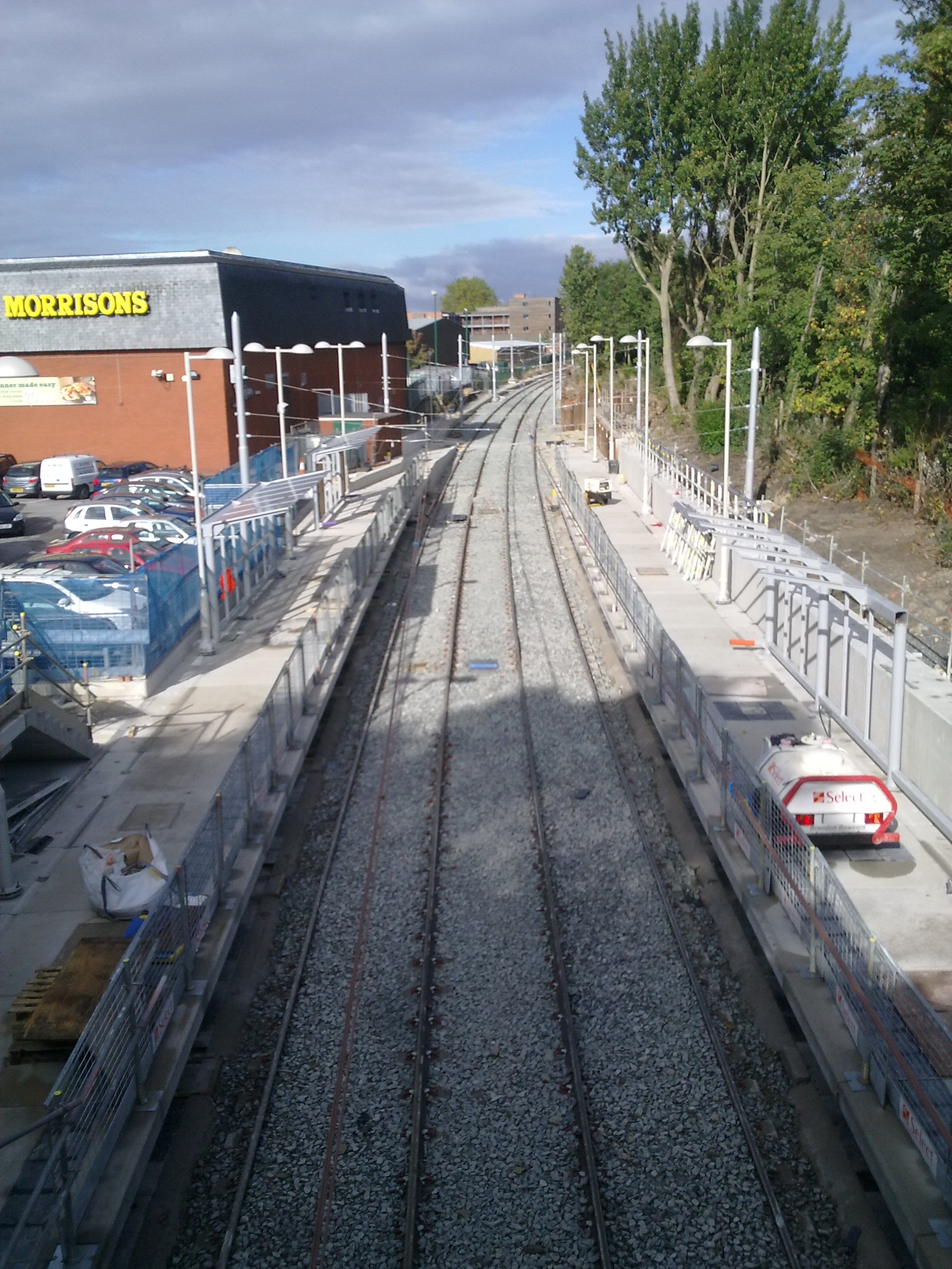
Construction of the line began in April 2009 and the new line became operational in July 2011.[1]
Services
Chorlton is located on the South Manchester Line with trams towards Victoria and St Werburgh's Road running every 12 minutes Monday-Saturdays and Sunday daytime and every 15 minutes Sunday early mornings and evenings.[9] Service will increase from 12 minutes to 6 minutes once the line to Central Park, Oldham Mumps and Rochdale opens. Services will extend from St Werburgh's Road to East Didsbury in 2013 and additional services will run between the city centre and Manchester Airport in 2016.
Service Pattern
- 5 tph to Victoria
- 5 tph to St Werburgh's Road
Gallery
-
The derelict station awaiting redevelopment
-
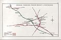
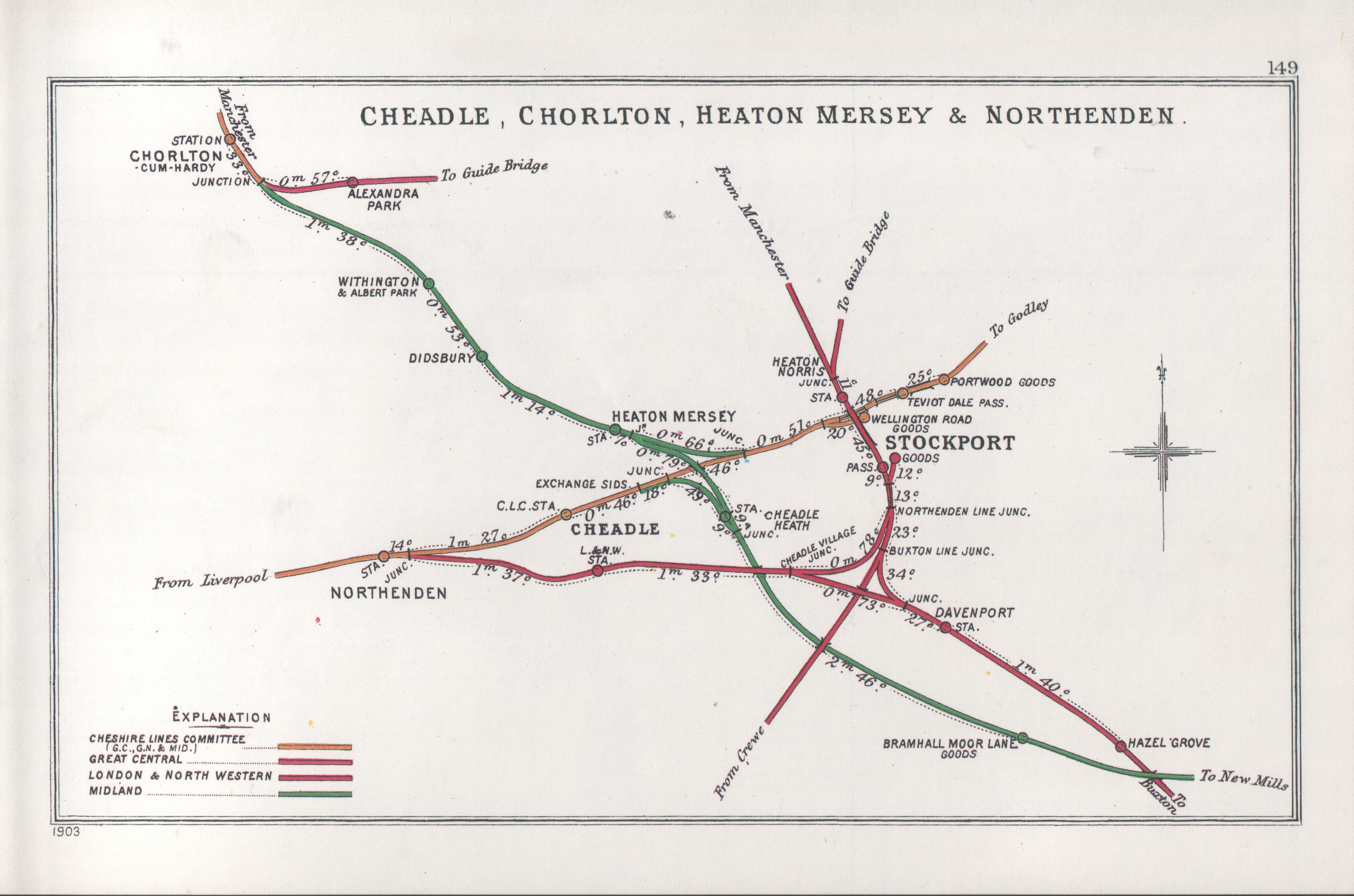
1914 map of South Manchester railways
-

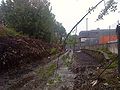
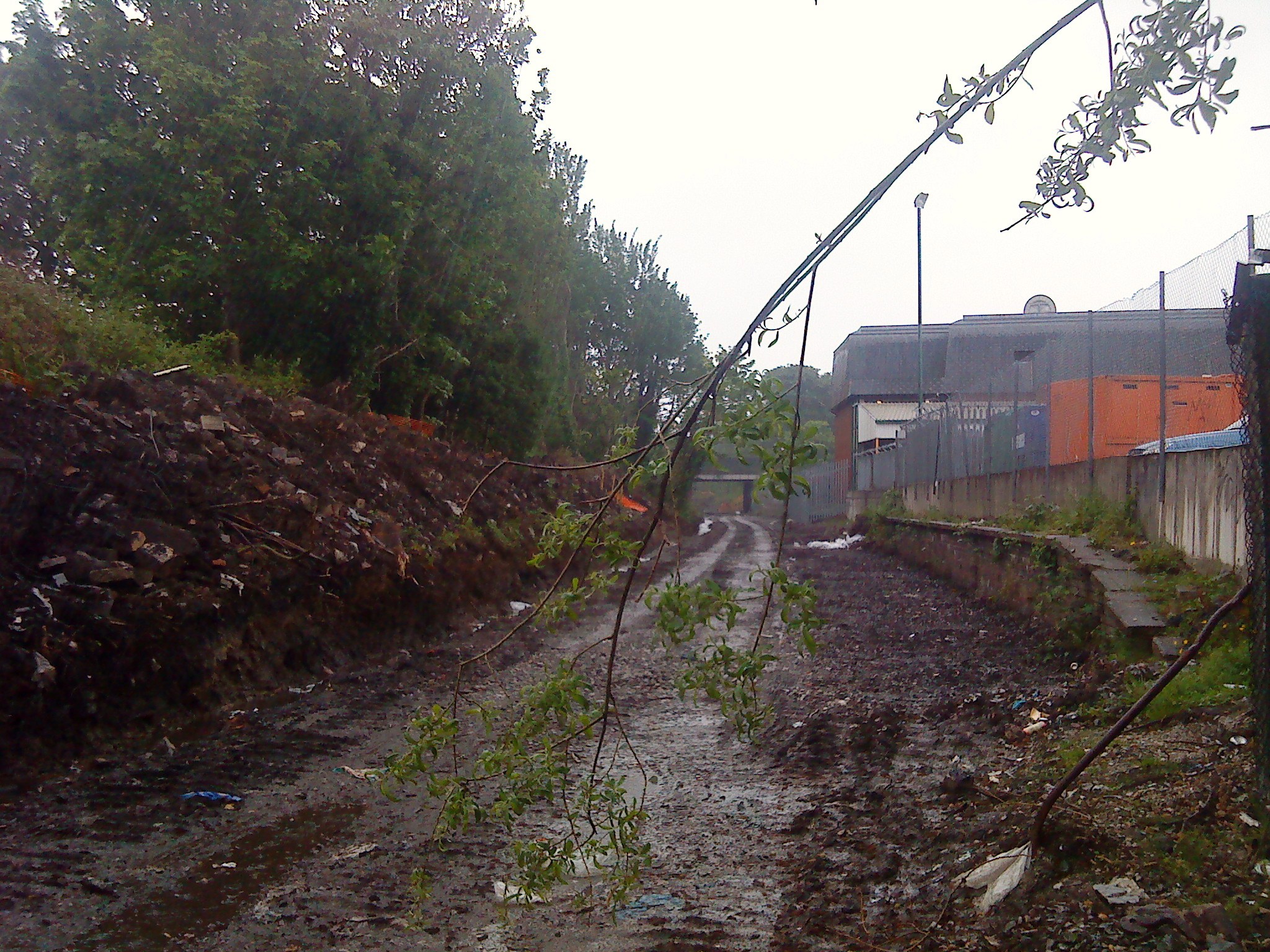
Metrolink construction work on the line near Chorlton
-

Map of the planned South Manchester line extensions
-

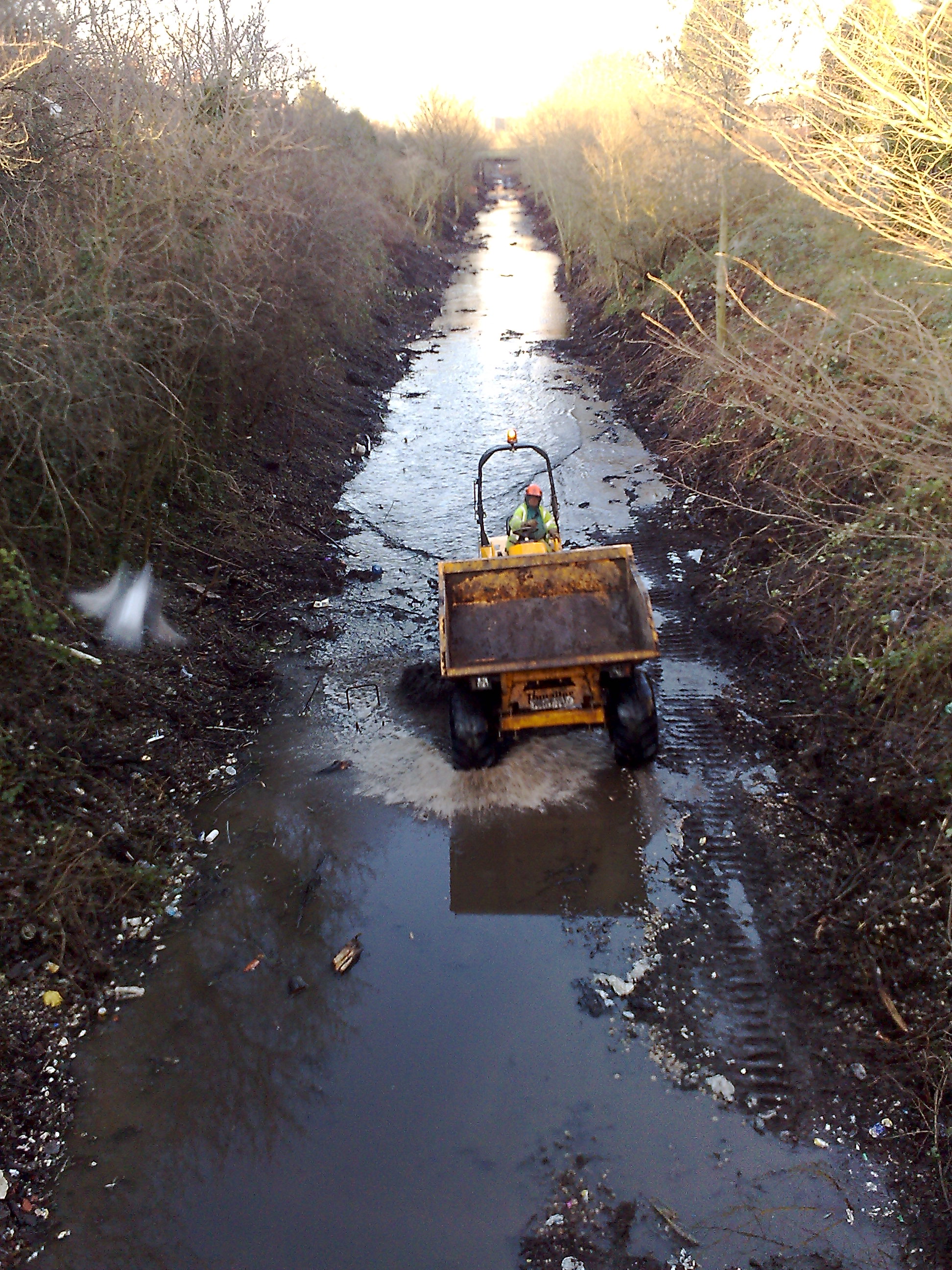
October 2010
References
- ^ a b "Metrolink's new Chorlton line opens for business". Transport for Greater Manchester. http://www.tfgm.com/2009_news.cfm?news_id=9007167?submenuheader=3. Retrieved 6 July 2011.
- ^ Price, Bevan; Wright, Paul (16 May 2009). "Disused Stations Site Record: Chorlton-cum-Hardy". http://www.subbrit.org.uk/sb-sites/stations/c/chorlton_cum_hardy/index.shtml. Retrieved 10 December 2009.
- ^ Burton, Nick (ed.) (199-) Chorlton cum Hardy and Stretford, 1905. (Old Ordnance Survey maps. Lancashire sheet 111.10) Gateshead: Alan Godfrey (includes historical survey and extracts from Slater's directory, 1910)
- ^ Greater Manchester Passenger Transport Executive (1984), Light Rapid Transit in Greater Manchester, GMPTE - publicity brochure
- ^ "Metrolink extension is announced". BBC News. 2006-07-06. http://news.bbc.co.uk/1/hi/england/manchester/5152948.stm. Retrieved 2008-12-28.
- ^ Linton, Deborah (2009-05-13). "£1.4bn transport deal unveiled". Manchester Evening News. http://www.manchestereveningnews.co.uk/news/s/1115242_14bn_transport_deal_unveiled. Retrieved 2009-05-17.
- ^ "Tram line extension is approved". BBC News. 2009-05-13. http://news.bbc.co.uk/1/hi/england/manchester/8047020.stm. Retrieved 2009-05-17.
- ^ "Metrolink: back on track?". BBC Manchester. 2009-05-13. http://www.bbc.co.uk/manchester/content/articles/2009/05/13/130509_metrolink_map_plan_b_feature.shtml. Retrieved 2009-05-17.
- ^ "Metrolink - Tram Times". Transport for Greater Manchester. http://www.metrolink.co.uk/tramtimes/. Retrieved 6 July 2011.
- Butt, R. V. J. (1995) The Directory of Railway Stations. Sparkford: Patrick Stephens. ISBN 1-85260-508-1
External links
- Manchester Metrolink Extension Project - map of the plans (Urban Transport Technology)
- Chorlton-cum-Hardy railway station in Disused Stations database
Preceding station  Manchester Metrolink
Following station TerminusSt Werburgh's Road - Victoria Line Firswoodtowards VictoriaUnder Construction towards East DidsburySouth Manchester Line Firswoodtowards Victoriatowards Manchester AirportManchester Airport Line FirswoodtowardsDisused railways Manchester Central
Line and station closedGreat Central Railway
Fallowfield LoopWilbraham Road
Line and station closedMidland Railway
South District RailwayWithington and West Didsbury
Line and station closed MetrolinkStations City zoneAltrincham LineAltrincham · Brooklands · Cornbrook · Dane Road · Navigation Road · Old Trafford · Sale · Stretford · Timperley · Trafford Bar
Bury LineAbraham Moss · Besses o'th' Barn · Bowker Vale · Bury · Crumpsall · Heaton Park · Prestwich · Radcliffe · Whitefield · Woodlands Road
Eccles LineAnchorage · Broadway · Eccles · Exchange Quay · Harbour City · Ladywell · Langworthy · MediaCityUK · Pomona · Salford Quays · Weaste
South Manchester LineChorlton · Firswood · St Werburgh's Road
Operations OperatorsVehiclesHistory Former operatorsTransferred linesClosed stationsAbandoned plansUnder Construction Bury LineQueens Road
East Manchester LineAshton Moss · Ashton Under Lyne · Ashton West · Audenshaw · Cemetery Road · Clayton Hall · Droylsden · Eastlands City Stadium · Edge Lane · Holt Town · New Islington · Velopark
Oldham & Rochdale LineCentral Park · Derker · Failsworth · Freehold · Hollinwood · Kingsway · Monsall · Milnrow · Newbold · Newton Heath and Moston · Newhey · Oldham Central · Oldham King Street · Oldham Mumps · Rochdale railway station · Rochdale Town Centre · Shaw & Crompton · South Chadderton · Westwood
South Manchester LinesBaguley · Barlow Moor Rd. · Benchill · Burton Road · Crossacres · Didsbury · East Didsbury · Hardy Farm · Haveley · Hough End · Manchester Airport · Martinscroft · Moor Road · Northern Moor · Peel Hall · Robinswood Road · Roundthorn · Sale Water Park · Shadowmoss · West Didsbury · Withington · Woodhouse Park · Wythenshawe Town Centre · Wythenshawe Park
Proposed Bury LineBuckley Wells
Trafford Centre LineImperial War Museum · Lostock Parkway · Manchester United · Parkway Circle · Port Salford · Salford Reds · Trafford Centre · Trafford Quays · Village
Stockport LineGorsey Bank · Heaton Mersey · Kings Reach · Stockport Interchange
Second City CrossingExchange Square
Categories:- Articles that include S-line templates with missing parameters
- Railway stations in Manchester
- Former Cheshire Lines Committee stations
- Railway stations opened in 1880
- Railway stations closed in 1967
- Manchester South District Line
- Manchester Metrolink stations
- Railway stations opened in 2011
- Beeching closures in England


Wikimedia Foundation. 2010.