- Chorlton-cum-Hardy
-
Not to be confused with Chorlton-on-Medlock.
Coordinates: 53°26′31″N 2°16′37″W / 53.442°N 2.277°W
Chorlton-cum-Hardy Chorlton 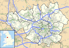
 Chorlton-cum-Hardy
Chorlton-cum-Hardy shown within Greater ManchesterPopulation 13,512 OS grid reference SJ815935 Metropolitan borough Manchester Metropolitan county Greater Manchester Region North West Country England Sovereign state United Kingdom Post town MANCHESTER Postcode district M21 Dialling code 0161 Police Greater Manchester Fire Greater Manchester Ambulance North West EU Parliament North West England UK Parliament Manchester Withington List of places: UK • England • Greater Manchester  Chorlton Green
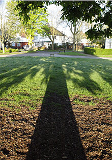
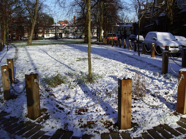
Chorlton-cum-Hardy is a suburban area of the city of Manchester, England. It is known locally as Chorlton. It is situated about four miles southwest of Manchester city centre. Pronunciation varies: /ˈtʃɔrltən/ chorl-tən and /ˈtʃɒlən/ chol-ən are both common.[1]
The area was essentially a trackless swamp for most of its history. In the late Middle Ages improved drainage methods led to population growth. In the late Victorian and Edwardian periods, its perceived rural character made it a popular upper-class suburb. Inter-war development cemented its nature as a middle-class suburb. The loss of its railway station, the conversion of larger houses into flats or bedsitters, and significant social housing development to the south of the area changed its character again in the 1970s.
Historically, Chorlton was a village on Lancashire's southern border with Cheshire, and a township within the ancient parish of Manchester. It was incorporated into the city of Manchester in 1904. Chorlton borders Stretford, Sale, Didsbury, Withington, Whalley Range and Firswood. The River Mersey runs past Chorlton along its southern boundary. The historical boundary to the north and west has been revised to remove anomalies. The area's eastern boundary has changed since the 19th century because of the creation of new parishes, incorporation into the City of Manchester, division into wards.[2]
Contents
History
Further information: History of ManchesterToponymy
The name Chorlton-cum-Hardy was established in this form in the late 19th century by combining "Chorlton" with "Hardy" by the Latin "cum" often used between two associated settlements. Some writers have derived "Chorlton" from the Old English Ceorlatun meaning "the settlement of ceorls" and "Hardy" from the Old English Ard-Ea, meaning "trees near the water"[3] However according to E. Ekwall (1936)[4] and A. D. Mills (1991)[5] the more probable derivation is from 'Ceolfrith's tun'. (All the other "Chorlton" settlement names are understood to be derived from Ceorlatun.) Ekwall says of Hardy, "Second element ĒG 'island'. The first is doubtful." The long-form name was invented by Victorian property developers, who arrived in the wake of the coming of the railway in 1880, to distinguish it from Chorlton-upon-Medlock. A village green and olde-worlde pub (the Horse and Jockey) were made out of existing buildings and garden so that the area had bucolic attractiveness, and stress was laid on distinguishing the area from the urban Chorlton-upon-Medlock.
The name has been a source of amusement. It has a disproportionate number of mentions in Hansard. Harold Wilson, in particular, expressed an affinity for "the good people of Chorlton-cum-Hardy". It was mentioned on The Goon Show, and other BBC Radio 4 comedies.
Seventh century to early Victorian period
Thomas L. Ellwood suggested 610 AD as the date of founding the settlement[6] but John Lloyd in his 1972 history considered the period 610 to 900 AD more likely. The district was part of the kingdom of Northumbria from the 7th century but settlement in the Mersey valley may well have been later. The ancient forest of Arden grew on both sides of the River Mersey which had large variations in its water level and was liable to meander. The silt of the flood plain made good land for farming.[7]
In medieval times the district formed part of the Manor of Withington an area stretching from Longford Park to Debdale Park, and south to the Mersey. Hough End (the southeastern fourth part which originally belonged to Chorlton) was removed from it in 1641. Hough End Hall replaced the old manor house of Withington; it is now a Grade II listed building. The early history of the area was linked to Stretford which had a river crossing, a market, and was on the main route to Manchester. The chapel of ease in Chorlton was linked to Stretford Parish Church, before it was linked to Didsbury.[citation needed] The estimated population in 1640 was 85; in 1714 it was 325. The 1801 census recorded 513 inhabitants, and the 1811 census 619: by 1851 it had increased to 761. The Tithe Commissioners' survey carried out in 1841 provides details of the size and tenure of every piece of land.[8] The character of the district was agricultural and Chorlton benefited from the growth of Manchester by supplying its demand for food. According to John Lloyd apple orchards were productive here.
Later Victorian period
Until the last quarter of the 19th century the population of Chorlton had increased very little though the development of public transport through Stretford had some effect. The railway came first to Stretford, and the upmarket property development that followed came up Edge Lane, a permanently flood-free area. The abolition of Withington's manorial rights in the 1840s meant that local government began to be formalised. Chorlton became part of Chorlton Poor Law Union (named after Chorlton-on-Medlock), then Withington Urban District, and was incorporated into the City of Manchester, while Stretford voted for autonomy. The building of Wilbraham Road to connect Lord Egerton's holdings across the north of the Manor of Withington, from Fallowfield to Edge Lane in Chorlton in 1869 established the nucleus of a residential area at the Barlow Moor Road crossing. A railway line from Manchester Central through Chorlton was built by the Midland Railway, and Chorlton station opened on 1 January 1880.[9] This led to considerable residential and commercial development with the establishment of a village centred on the Barlow Moor Road / Wilbraham Road crossroads, northeast of the original village with a centre at Chorlton Green and Beech Road.[10][11]
There was significant immigration in this period from Ireland and other areas of the British Isles. The Irish came to domestic service and others came in pursuit of work in the expanding industries of Manchester, moving to improve their prospects. A significant number were employed in the area's small-scale horticulture and farming. In the 1880s a member of the Fenians, a precursor of the IRA, was arrested while working in 'The Isles' between Manchester Road and Longford Park. His weapon was not recovered from its hiding-place until the foundations were being dug for Oswald Road School. The Irish community remains and the growth of Roman Catholicism originated with them. By the first decade of the 20th century the church and convent school were established on High Lane and later came the adjoining Irish Association Social Club.[12]
Because the county boundary was determined by the course of the Mersey, it traditionally did not exactly follow the river when it changed course: this happened occasionally in the period before improved flood control measures were introduced in the 1840s. Thus the Bridge Inn (commonly known as Jackson's Boat) was once in Chorlton. The myth attached to this is that it was incorporated into Lancashire to prevent illegal race-goers on Chorlton Ees escaping into Cheshire at the approach of the Lancashire Constabulary. The Manchester–Trafford boundary now follows the course of the river. The crossing here was originally by ferry boat fastened to a chain: in 1816 this was replaced by a wooden footbridge. By 1881 a steel bridge was built as the old bridge was damaged, it was washed away in October 1881.[13] For the area between Chorlton and the river, see Chorlton Ees.
20th century developments
 The Meade in Chorltonville
In 1903 Slater's Street Directory of Manchester shows that old Chorlton had hardly changed for 25 years. Around Beech Road were three farms, two inns, the parish church and the church school. In Beech Road more shops were trading and a police station had been established and a recreation ground (now Beech Road Park) had been provided and at the eastern end Bowling Green Farm remained.[14]
Further growth was aided by the arrival of Manchester Corporation's tramway before the First World War: a terminus was built on Barlow Moor Road a short distance south of the junction with High Lane. Chorltonville was developed as a garden suburb south of Chorlton Brook: the houses are mostly large and semi-detached and individual in design, standing on tree-lined roads. Alexandra Park Aerodrome (1917–1924), was Manchester's first major airfield located east of the Midland railway overbridge on Mauldeth Road West.[15] (See below, Transport).
After the World War came a period of residential development to the east of the new village either side of Wilbraham Road and a council housing estate at Merseybank. From the 1960s onwards a council estate at Nell Lane near Southern Cemetery; "Chorlton Precinct", a small shopping precinct with an office block, Graeme House (1969/70) (in 2009 rebranded as "The Square") at Wilbraham Road[16] and patchy redevelopment in other areas. There has been immigration particularly from the Indian subcontinent and from Poland. The Polish community arrived in the 1950s and 1960s, and is the origin of the existence of the 'Barbakan' delicatessen and bakery established in 1964.[17]) Chorlton Green has been designated a conservation area by the city council since 1970 and a second area was designated at Chorltonville in 1991. Chorlton Park Apartments have been recognised for the quality of their design. Beech Road has become a cultural centre, with several shops, restaurants and café bars.[18] In 2010 Manchester City Council's South Manchester Regeneration Team issued an action plan for improvements to the "Chorlton District Centre"[19] for the period 2010 to 2020. It proposes investment in the district aimed at creating "a strong, vibrant and successful centre that supports the local community and has the ability to exploit the economic potential of Metrolink".[20]
The 1980s onwards saw a new kind of resident arrive; these were people who had studied in Manchester, and had fond memories of the city's southern suburbs. The high salaries available in the upper reaches of a growing public sector were available to them and they brought with them a particular sensibility. This has rejuvenated the area's cultural life, and transformed some of its shopping areas, as mentioned above. Later arrivals consist of a large number of musicians, artists in all media, and others, and has given the area a significant 'vibe'. The part of Chorlton's population that has not benefited in the last few decades of renewal has been the residents of the large areas of social housing to the south of the district. There have been clashes of interests between groups with different lifestyles, most recently over the provision of playing fields at Chorltonville. The social housing areas score highly on indicators of social deprivation, a fact at odds with Chorlton's reputation as 'trendy' and 'green'.
Transport
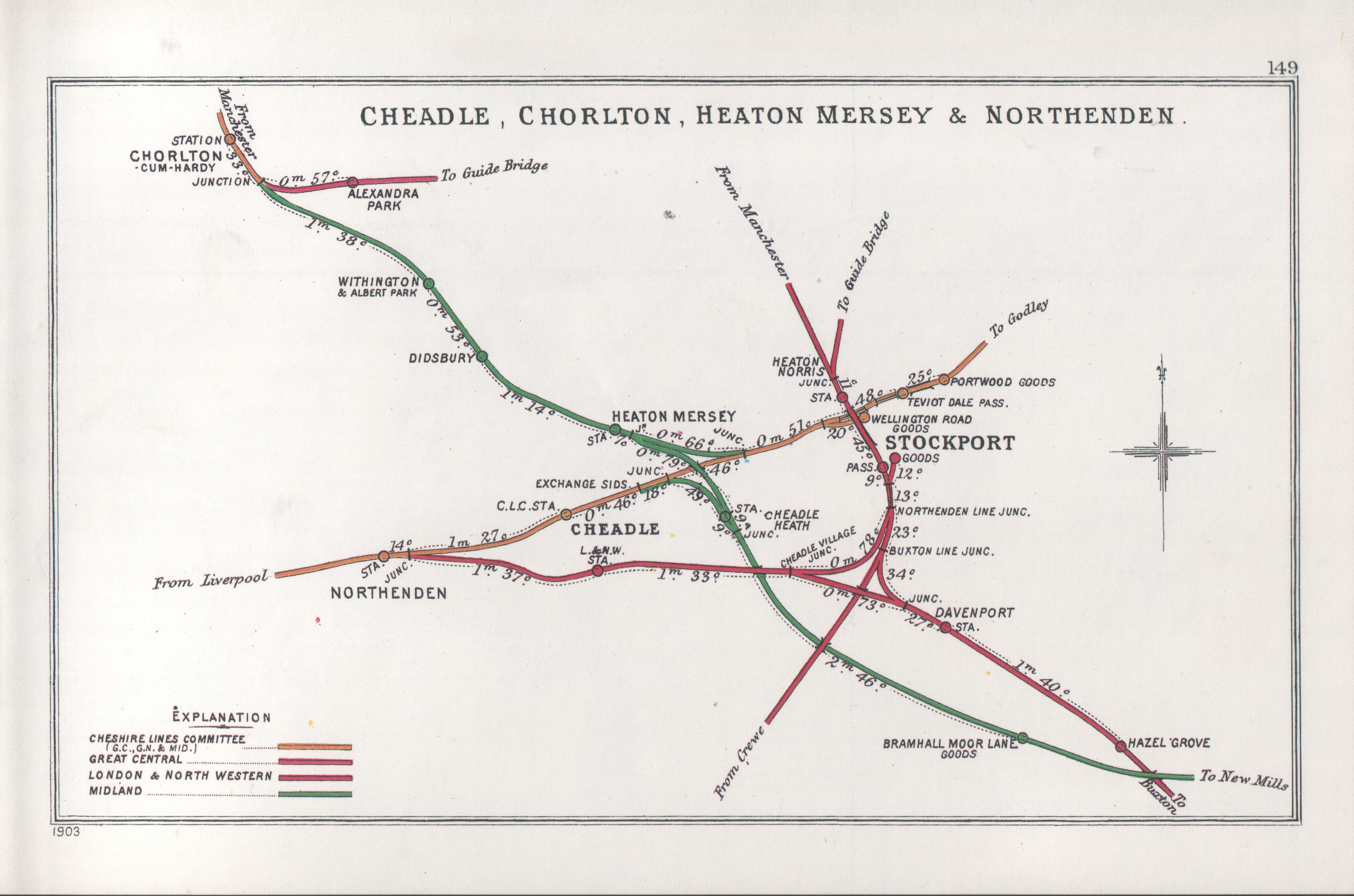
 Circa 1914 Railway Clearing House diagram of South Manchester railways showing (top) the location of the station on the Great Central line from Manchester Central to Guide Bridge, just east of Chorlton junction
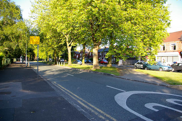
 Mauldeth Road West, near Chorlton Park Primary School
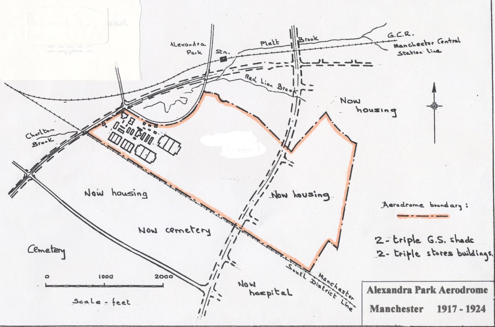
 Plan of Alexandra Park Aerodrome, 1917-24
In the 19th century, public transport was limited to the railway through the southern suburbs of Manchester and to horse buses from Chorlton Green towards Manchester city centre. In the early 20th century the electric tramway reached Chorlton and remained in service until January 1949. Motorbuses replaced horse buses and, from 1949 onwards, the trams. Passenger railway services ended at the beginning of 1967 with the closure of Chorlton-cum-Hardy station, which had provided a commuter service into Manchester Central. Bus services have been expanded and reorganized many times since then. The most frequent services run on Manchester Road and Barlow Moor Road, and Edge Lane and Wilbraham Road. In the 21st century, traffic has become a serious problem[citation needed], not helped by delays in establishing a Metrolink (tram) link to the area. From 1992 the Metrolink ran through Stretford, and conversion of the former railway line through Chorlton to a Metrolink line was planned, but failed to secure the funding needed. Work on the conversion began in 2010,[21] and it opened on 7 July 2011,[22] providing residents with a rail journey into the city centre for the first time in 44 years. The Chorlton tram stop is on the site of the old railway station. Services terminate one stop further south at St Werburgh's Road, on the site of the old Chorlton Junction signal-box.[23]
- Planned ring road
Mauldeth Road West was built as a dual-carriageway in anticipation of the expansion of motor traffic and had a central strip intended for use as a double track for electric trams.[24] When numbering of roads was introduced in the 1930s, Wilbraham Road was named as a part of the southern intermediate ring-road, the A6010, along with less suitable roads such as High Lane and Platt Lane. Mauldeth Road West was numbered the A6144, and was meant to extend along Hardy Lane, hence the latter's unusual width. It was then to cross the Mersey near Jackson's Boat, and join the rest of the A6144 at Old Hall Road, Sale, on its journey to Partington and Lymm. Its purpose was to relieve central Chorlton of the heavy traffic to Trafford Park, and from the clay pits operational in the Mersey Valley. A-Z maps showed the legend "completion in 1974" through many editions.[25]
- Hough End
Alexandra Park aerodrome at Hough End, and its secondary landing site at Turn Moss, had a life-span, from 1917 until 1924; only the Air Training Corps centre remains. First Barton, then Ringway were chosen as the municipal aerodrome instead. Local residents benefited from Alexandra Park (later Wilbraham Road) railway station, and the cutting of a dual carriageway Mauldeth Road West. Most of Hough End, the site of the original manor house, was used for building the Old Moat council estate, and the dual carriageway Princess Road and its median tram-track in 1924-25, ensured Hough End was saved as green space. The Aerodrome company reverted its lease to Lord Egerton, who donated it as an open space in perpetuity to the City of Manchester. During the Second World War, anti-aircraft batteries were located there, and German prisoners, used as workers, lived in temporary housing beside Princess Road.
Governance
The district was a township of the ancient parish of Manchester in the Salford Hundred of Lancashire, then Stretford as that grew in importance. From 1876 to 1894 it was part of the district administered by the Withington Local Board and from 1894 to 1904 part of Withington Urban District. Chorlton was absorbed into the City of Manchester in August 1904, together with the rest of the urban district.[26] A separate Withington Committee of the City Council existed between 1904 and 1914.
In 2010 Chorlton ward was represented by one Labour councillor and two Liberal Democrat councillors. Chorlton Park ward which incorporates the Mersey Bank and Nell Lane estates of south and south-east Chorlton is represented by three Liberal Democrat councillors. Whalley Range ward includes parts of Chorlton and is represented by a Labour and two Independent councillors.
South Manchester Police
Chorlton-cum-Hardy is in the South Manchester Division of Greater Manchester Police (GMP) and Chorlton Police Station was situated on Barlow Moor Road, between Beech Road and the bus station. The police station closed in October 2011 and was listed for auction in November of that year. The first police station was established in Beech Road in 1885 by the Lancashire Constabulary.
At Hough End the GMP Sports and Social Club is on the site of the former Alexandra Park Aerodrome and is where Greater Manchester Police train their dogs and horses. The GMP helicopter uses the pitches as a landing spot when patients are taken on to Wythenshawe Hospital or dog handlers need to be airlifted to incidents in the helicopter.
Religion
 Lych gate, St Clement's old churchyard
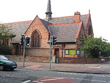 St Werburgh's Church, Wilbraham Road
Chorlton has been since 1847 in the Anglican Diocese of Manchester and Archdeaconry of Manchester; and since 1850, in the Roman Catholic Diocese of Salford. Between 1541 and 1847 it was in the Diocese of Chester and before that in the Diocese of Lichfield and Coventry. In medieval times churches were scarce in the district and the parish church was the Collegiate Church, Manchester, dependent on which was the chapel of ease at Didsbury.
Church of England
The first church was south of the present Chorlton Green, its churchyard is still in existence next to the Bowling Green Hotel though interments ceased in 1882. This chapel, dedicated to St Clement, was established early in the 16th century, probably 1512, was replaced by a brick-built chapel in 1779. For about 35 years this would have been Roman Catholic, until the separation from Rome under King Henry VIII. Among the clergy who ministered here was Peter Hordern (died 1836) who was librarian of Chetham's Library, Manchester. By 1860 there was a need for a larger church building and the new St Clement's Church was built at Edge Lane (opened 1866). Sir William Cunliffe Brooks was a benefactor to the township but he withdrew support for building a new church: two of his daughters who died in infancy are buried at the old church.[12] Another opponent was Samuel Mendel of Manley Hall, Whalley Range. The old church remained for another 90 years and was then demolished though the ground plan is still apparent (it was excavated in the 1990s). A second Anglican parish, St Werburgh's was established in 1898 in the newer part of the suburb. The church on Wilbraham Road was built in 1900–02.[27] At Hurstville Road, Hardy Lane, is St Barnabas's Church, a chapel dependent on St Clement's, opened in 1951.
Nonconformism
Methodism was probably introduced in the 1790s and a chapel was built in Beech Road in about 1805 and replaced by a larger building in 1827. It moved to the present site in 1873 when the chapel in Manchester Road was built in the neo-Gothic style, it has a First World War war memorial in the grounds. In 2010 the chapel's Sunday school building was adapted and became an arts centre.[28][29] Manley Park Methodist Church was established on Egerton Road (North); the congregation began worshipping in a tin tabernacle in 1905 and the present building was opened in 1910.[30] A smaller neighbouring chapel was used by the Welsh Methodist congregation. The first Congregational Chapel was opened in 1883 and replaced by the present chapel in 1894. This is now the United Reformed Church. The church was named the MacFadyen Memorial Church after the former minister, the Rev. J. A. MacFadyen. Some years ago the church was demolished and the congregation meets in the church hall. Other denominations established churches: the Unitarians in Wilbraham Road in 1901; the Macpherson Memorial Primitive Methodist Church built in 1896 was enlarged in 1908;[31] the Baptist Maclaren Memorial Church in 1907 (also in Wilbraham Road);[32] the Presbyterians in 1908 (again in Wilbraham Road); and the Emmanuel Free Church in 1909. The chapels of the Unitarians and Baptists have been demolished though the congregations are still in existence (the Congregationalists and Baptists have joined in the United Reformed Church in the former Congregational church hall). The Evangelical Church meets at Ivygreen Road having met previously in Beech Road.
Roman Catholic churches
Roman Catholicism was re-introduced to Chorlton after its suppression in the 16th-century Reformation when Irish immigrants arrived in the mid-19th century. The parish of St Augustine was established in 1890 at the "Priory" (formerly "Oakley"), Needham Avenue. Ten years later the priest moved into a building in High Lane which remained St Augustine's Church until 1927 (the site was on the corner of Church Road, now Chequers Road). It was replaced by the Church of Our Lady and St John but commonly known as St John's (the changes in dedication were influenced by the existence of St Augustine's, Chorlton-on-Medlock, and St Mary's, Mulberry Street, Manchester).[33] This was on a new site on the corner of High Lane and Whitelow Road.
Another church is that of St Ambrose, Barlow Moor, (architects Reynolds & Stone, 1958).[34] The dedication to St Ambrose of Milan was chosen because St Ambrose Barlow's birthplace was in the parish.[35]
Islam and Buddhism
Present day Chorlton has a population of Muslims, mostly of south Asian origin. There are mosques in Whalley Range and an Islamic high school (see below) in Chorlton. There are small numbers of Buddhists: one of their establishments is in High Lane in the former Primitive Methodist Chapel and another, the Vairochana Buddhist Centre, also in High Lane in the former Tom Mostyn's Art School. The oldest (founded 1975) belongs to the Kagyu Ling school of Tibetan Buddhism and is at Manor Drive, Merseybank.[36]
Education
 New building at Chorlton Park Primary School
The earliest record of a school in Chorlton is the will of Sir Nicholas Mosley of Hough End Hall, lord of the manor of Manchester (d. 1612) who left £100 to pay a schoolmaster annually £5 for 20 years after his death. The Wesleyan Methodists began both a Sunday school and a day school ca. 1810, whereas the Anglican Sunday school did not begin until a later date. In 1845 the Rev. William Birley was responsible for the building of a Church School at Chorlton Green. When the building was found to be inadequate it was replaced by a new building on the site in 1879. A number of private schools also existed in the late 19th century including C. C. Dadley's grammar school and Tom Mostyn's art school.[37] In 1898 a school was under construction for the Roman Catholic parish of St Augustine and in 1901 a new church school at St Clement's Road replaced the previous building but the older building continued to be used for infants and juniors until this was no longer necessary.[38] In 1904 when Chorlton was incorporated into Manchester a municipal school was opened which moved to its permanent school building in Oswald Road in 1909.[39]
At the present time the secondary schools in Chorlton are the Loreto High School,[40] Chorlton High School and the Islamic High School for Girls at High Lane. The existing building of Chorlton High School replaced the old school at Sandy Lane which was formerly Chorlton Grammar School.
Annual events
Chorlton took part in the 2010 Manchester City Council funding initiative 'U Decide', an annual event where community groups bid for up to £1000 of council money, and are selected by a vote of local residents present. Chorlton holds a variety of annual festivals which have received funding through U Decide.
The Beech Road Festival takes place on Beech Road and Chorlton Green in June or July, with commercial and educational stalls and varied entertainments. A tug-of-war between teams from local pubs is a regular fixture and there is live music in Beech Road Park.[41] The Unity Festival takes place in Chorlton Park, encouraging racial and cultural unity in the area while providing a platform for performances by dancers, musicians and singers. Each festival usually attracts some 10,000 people.[42][43] Chorlton Big Green Festival takes place in late March/April. It is an all-day event combining live music, dancing, food, real ale, cider, arts and crafts, workshops, cycling and films. The festival aims to encourage sustainable living in a fun and accessible way. It has a different theme each year and in 2011 the theme is Bike to the Future.[44] Chorlton Arts Festival takes place in May featuring a programme of events spread over nine days.[45] The Chorlton Book Festival is a series of readings, creative writing workshops and publishing talks that takes place over two weeks in the autumn.[46] Chorlton takes part in the Manchester Food & Drink Festival in early October.[47]
Creative and performing arts
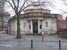 Chorlton Library
The area is populated with creative people such as artists, writers and actors. Until January 2009 Chorlton was the location for the Cosgrove Hall animation studios where the children's series Chorlton and the Wheelies and Dangermouse were created. The area is used by film crews for TV locations, such as The Second Coming[citation needed], as it retains much of its original Victorian architecture. A recent example is White Van Man shown on BBC3 Television in 2010. A number of poets and minor publishers of poetry were active in the late 20th century and a poetry group meets at Chorlton Public Library.[48] There are three amateur dramatic societies which rehearse and perform in Chorlton.[49]
Notable residents and visitors
Historic
- Saint Ambrose Barlow, a member of the notable Barlow family, was born at Barlow Hall in 1585. He suffered martyrdom for his faith.
- Joshua Brookes, curate of St Clement's church from 1782 to 1791. In 1791 he became chaplain of Manchester Collegiate Church. He was an eccentric member of an eccentric family and many stories are told of him. He is portrayed in Mrs. Linnaeus Banks's novel The Manchester Man.[50] He is commemorated locally in the name of the public house Joshua Brooks [sic], 106 Princess Street.
- Charles Peace, a notorious petty criminal who killed P. C. Nicholas Cock in 1876 (at the Old Trafford end of Manchester Road). On conviction he was hanged at Leeds.
- Alderman James Herbert Dawson, one of the promoters of the garden suburb at Chorltonville, was a long-serving councillor in Manchester and in Lytham St Annes.[51][52]
- Sir Arthur Whitten Brown, aviation pioneer who is buried at Southern Cemetery
- Henry Royce, mechanical engineer and founder of Rolls-Royce, lived here from 1893 to 1898
Modern
- HRH The Princess Anne, laid the foundation stone of the Multiple Sclerosis Society Housing Scheme on Cundiff Road in October 1989[53]
- David Bonser, the Anglican Bishop of Bolton from 1991 until 1999, was Rector of St Clement's Chorlton-cum-Hardy, 1968–72
- Sir Robert Mark, Commissioner of the Metropolitan Police, began his career with the Manchester City Police. He was born in Chorlton and was resident there until his move to Leicester in 1957.[54][55]
Public entertainment and popular music
Due to the signs (i.e. "Chorltonville") seen on the programme, Chorlton-cum-Hardy railway station was long assumed to be the venue for a notable Granada TV concert in 1964 by a number of visiting blues musicians including Muddy Waters, Sister Rosetta Tharpe, Sonny Terry and Brownie McGee, and others.[56] However recent research by C. P. Lee has identified Alexandra Park railway station, at the end of Athol Road, as the actual location.[57][58]
The Bee Gees spent nearly eight years of their childhood living in 51, Keppel Road, Chorlton: in 1958 they moved to Australia. The street also lent its name to a Bee Gees documentary in 1997. The Stone Roses were a Chorlton band, with guitarist John Squire living and working for Cosgrove Hall in the suburb. Mike Pickering of M People lived on Ryebank Road.
Dunstable-born artist and musician Damon Gough, known as Badly Drawn Boy is also resident here. In an interview with the Manchester Evening News, he was quoted as saying "Chorlton's where home is. It's the place I would want to be if the world ended". Jim Noir, another musician based in Chorlton, recorded his album 'Tower of Love' in his own house. Another local musician who resides in Chorlton is Mark Collins of long surviving rock band The Charlatans.
Notable residents have included locally born actor Warren Clarke who lived at 8, Grindley Avenue, and Freddie Garrity (of Freddie and the Dreamers). Actress Doris Speed lived in Sibson Road, and for over twenty years she played Annie Walker, landlady of the Rovers Return in the ITV soap opera Coronation Street. Harry H. Corbett, of Steptoe and Son fame, started out in the Conservative Club's Dramatic Society.[citation needed]
Quentin Crisp died in a house on Claude Road[59] shortly before his 91st birthday, on the eve of a nationwide revival of his one-man show. His body was cremated with a minimum of ceremony, and his ashes flown back to New York and scattered over Manhattan.
Sport and recreation
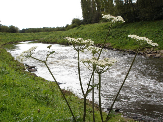
 River Mersey near Chorlton Water Park
 Chorlton Water Park
 Bowling Green Hotel (1908), St Clement's old churchyard in foreground
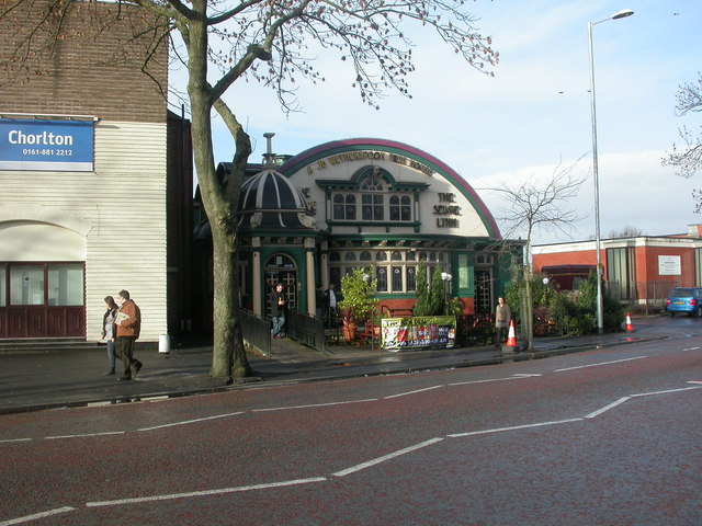
 The Sedge Lynn public house, Manchester Road, formerly a billiard hall
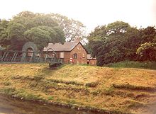 The Bridge Inn, Sale, footbridge across the River Mersey in foreground
- Association football
- Chorltonville recreation area has become a private football ground, currently owned by Chorlton & West Didsbury Football Club.[60] Many other amateur football teams are active in Chorlton and both the local Football League teams (City and United) are well-supported in the area. It was in Chorlton-cum-Hardy that George Best lodged when he first came to Manchester, on Sibson Road in the house next door but one to Doris Speed's house. Sir Matt Busby's funeral was held at St John's Church; former Manchester City footballer Nicky Reid was brought up locally. After the Second World War the Owners' Committee sold off the tennis courts and recreation area. The tennis courts were absorbed by gardens of adjoining Chorltonville houses, and the recreation area became a private football ground, currently owned by Chorlton & West Didsbury Football Club.[60]
- Rugby Union
- Broughton Park Rugby Union F.C. is one of the oldest rugby union clubs in England and was established in 1882, just one year after the Lancashire County Rugby Union was founded and eleven years after the formation of the national Rugby Football Union. The club has had a number of different grounds in its time, mainly in the Salford/Prestwich area, but also in the south of Manchester. Since 2004 its present new facility is at Hough End in Chorlton-cum-Hardy, Manchester. Originally the club had only one senior side, but now fields four senior sides and supported by one Colts (U19), four youth (U13-U17) and four mini (U8-U12) teams; a total involvement of some 220 players each week. Broughton Park R.F.C. is the City of Manchester's highest placed representative in the Rugby Union Leagues.[61]
- Rugby League
- A relative newcomer to the area, Mancunians RL are an amateur rugby league club which groundshares with Broughton Park Rugby Union F.C. at Hough End. The club was formed in 2009, and were crowned North West regional Champions in 2010. The club has recently announced that they are working closely with the Rugby Football League to become a semi-professional club and join the Co-operative Championships in 2015. Mancunians are very active in the local community and operate schools coaching programmes in partnership with The Manchester College and Greater Manchester Police.[citation needed]
- Cricket and golf
- South West Manchester Cricket Club is one of the oldest in the Manchester area and has four adult teams who all play in the Manchester and District Cricket Association: the ground is at Ellesmere Road North, the old clubhouse being what used to be Hobson's Hall Farm.[62] Chorlton cum Hardy Cricket Club is based at Hardy Lane. Barlow Hall serves as the club house of the Chorlton-cum-Hardy Golf Club.[63]
- Parks and water parks
- Stretford Stadium, within Longford Park, is the home of Trafford Athletic Club. Most of the area of the park is in Stretford but the eastern part is in Chorlton with an entrance on Ryebank Road. Also in the park are tennis courts and bowling greens. An area of Chorlton Park was used many centuries ago for horse racing. As a public park it dates from 1928: there are gardens, many trees, and recreational facilities. The Recreation Ground (Beech Park) was opened in 1896 having been donated to the community by Lord Egerton. Chorlton Water Park is on the north side of the Mersey: access from southern Chorlton is via Maitland Avenue. It may be reached from the southern banks of the River Mersey by a small footbridge. In nearby Chorlton Ees, a proposed development of football pitches and a clubhouse, while widely supported by people who work with local youth, are the subject of some local opposition. The plans were withdrawn while a committee of the City Council were considering them in January 2010.[64] In May 2010 the issue reemerged with a modified proposal from the club which has aroused middle-class incomer opposition once more. Chorltonville recreation area has become a private football ground, currently owned by Chorlton & West Didsbury Football Club.[60]
- Public houses
- The oldest public house in Chorlton is reputedly the Bowling Green (1693 but moved to a new site in 1908); the Horse and Jockey, Chorlton Green, occupies a building reputedly of the 16th century though the half-timbered look is Victorian and the licence early 19th century. Near the new centre of Chorlton are the Royal Oak (built on the site of an earlier house,actually around the earlier building, an example follwed by a modern resident of Wilbraham Road].) and the Lloyd's Hotel, Wilbraham Road (ca. 1870).[65] The Beech Inn occupies what was once the Methodist schoolroom.[66] Bowls has been for many years a popular sport in the area: many of the greens which still exist are attached to public houses, e.g. the Lloyd's Hotel and the Bowling Green Hotel. The Bridge Inn on the south bank of the Mersey was once in Chorlton but is now in Sale and is now named "Jackson's Boat" (for the origin of the name see above, History: From the Middle Ages to the Victorian Period).
- Cinemas and dance halls
- The earliest cinema was the Chorlton Pavilion in Wilbraham Road on the east side of the railway bridge at Buckingham Road which opened in the first decade of the 20th century. It was bought in 1909 by H. D. Moorhouse and became part of his HDM circuit. The Palais de Luxe Cinema opened in 1915 in Barlow Moor Road and closed ca. 1958; a little further south was the Rivoli Cinema, opened in 1937, which later became the Essoldo and later still the Classic and the Shalimar. At Manchester Road was a cinema originally named the Majestic but when opened was called the Savoy, afterwards the ABC and then the Gaumont. The Chorlton Palais de Danse in Barlow Moor Road was once very popular;[67] after becoming a nightclub the site was redeveloped as a McDonald's fast food outlet.
See also
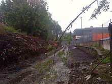 Chorlton railway station awaiting redevelopment
- Barlow Moor
- Chorlton-cum-Hardy railway station
- Chorlton Park Apartments
- Chorltonville
- Merseybank
- Parks and open spaces in Chorlton cum Hardy
- Southern Cemetery, Manchester
- Whalley Range, Manchester
References
- Notes
- ^ The latter form may derive from the historic form of the name, "Chollerton".
- ^ Historically the area east of Chorlton was also in the Manor of Withington, later divided into Withington and Moss Side Urban Districts, within which the suburbs of Whalley Range and Alexandra Park developed during the late 19th century. The ward, postal district and ecclesiastical parish boundaries do not always correspond. The western boundary with Stretford has remained the same. Estate agents often use such ambiguous and misleading descriptions as "Chorlton Borders".
- ^ As in Cooper's Manchester's Suburbs, based on John Lloyd's account in The Township of Chorlton-cum-Hardy, p. 3
- ^ Ekwall, E. (1936) The Concise Dictionary of English Place-names, 2nd ed. Oxford: Clarendon Press, 1940
- ^ Mills, A. D (1991). The Popular Dictionary of English Place-Names. Parragon Book Service Ltd & Magpie Books. ISBN 0752518518
- ^ John Lloyd says this may have been because John Whitaker gave this date as being when "the district south of Manchester was disencumbered of its ancient oaks". Lloyd (1972); pp. 1 & 6
- ^ Lloyd (1972); pp. 1-3
- ^ Lloyd 1985, p. 4
- ^ Butt 1995, p. 61
- ^ Hartwell, Clare [et al.] (2004) Lancashire: Manchester and the South-east. New Haven, CT: Yale University Press ISBN 0-300-10583-5, pp. 411–418
- ^ Cooper 2002, pp. 42–47.
- ^ a b Lloyd 1972
- ^ Lloyd 1972, pp. 69–70
- ^ "Chorlton Green and Beech Road". Slater's 1903 Street Directory [of Manchester]. Isaac Slater. 1903. p. extract. http://www.oldchorlton.me.uk/17.html. Retrieved 28 June 2010.
- ^ Scholefield 2004, pp. 216–217
- ^ [Goad shopping centre plan] (1969) Manchester – Chorlton-cum-Hardy. Old Hatfield: Charles E. Goad
- ^ City Life; 26 Jan./5 Feb 2004
- ^ Beech Road M21
- ^ Including Manchester Road and Barlow Moor Road from Kensington Road (north) to Hardy Lane (south) and Wilbraham Road from the Metrolink station (east) to Oswald Road (west).
- ^ South Manchester Regeneration Team (2010) Chorlton District Centre Action Plan 2010–2020. Manchester: City Council
- ^ "Manchester Metrolink Extension Project". urbantransport-technology.com. http://www.urbantransport-technology.com/projects/manchester/. Retrieved 2009-11-10.
- ^ "On track at last: Commuters travel on new Metrolink tram service to south Manchester for first time". Manchester Evening News. 7 July 2011. http://menmedia.co.uk/manchestereveningnews/news/transport/public_transport/s/1425987_on-track-at-last-commuters-travel-on-new-metrolink-tram-service-to-south-manchester-for-first-time.
- ^ South Manchester line, Greater Manchester Metrolink.
- ^ Yearsley, Ian (1969) The Manchester Tram. Huddersfield: Advertiser Press; p.72
- ^ Geographers A-Z
- ^ "Greater Manchester Gazetteer". Greater Manchester County Record Office. Places names – C. http://www.gmcro.co.uk/Guides/Gazeteer/gazzc.htm. Retrieved 17 June 2008.
- ^ Lloyd 1972, p. 104
- ^ The Messenger; Nov/Dec. 2010. Chorlton Methodist Church
- ^ "Waters Edge Arts Ltd". http://www.watersedgearts.com. Retrieved 19 November 2010.
- ^ Glendinning, Amy (7 June 2010). "'Tin tabernacle' turns 100". The South Manchester Reporter: p. 15. http://menmedia.co.uk/southmanchesterreporter/news/s/1242217_tin_tabernacle_turns_100.
- ^ Dates given on the front of the building; after the second World War the chapel became redundant, it is now in use as a Buddhist meditation centre
- ^ Commemorating Alexander Maclaren, a minister at the Union Chapel, Fallowfield
- ^ Lloyd 1972, p. 103
- ^ Pevsner, N. (1969) Lancashire; 1. Harmondsworth: Penguin; p. 306
- ^ Lloyd 1972, p. 46
- ^ "Kagyu Buddhism Manchester". Dechen. http://www.dechen.org/centres/northwest/manchester.html. Retrieved 7 May 2010.
- ^ Now the Vairochana Buddhist Centre, High Lane
- ^ Lloyd, John (1985) Looking Back at Chorlton-cum-Hardy. Altrincham: Willow; p. 11
- ^ Lloyd 1972, pp. 27, 54, 66, 98–99
- ^ "Loreto High School Chorlton". Find My School. http://www.findmyschool.co.uk/schooldetails.aspx?id=5574. Retrieved 9 April 2010.
- ^ Beech Road Festival
- ^ "Beech Road Park". Manchester City Council. http://www.manchester.gov.uk/info/200073/parks_and_open_spaces/1474/beech_road_park/1. Retrieved 30 April 2010.
- ^ Unity Festival
- ^ "Green Chorlton website". Green Chorlton. http://greenchorlton.org.uk/. Retrieved 2011-10-05.
- ^ Chorlton Arts Festival
- ^ Chorlton Book Festival
- ^ Manchester Food & Drink Festival
- ^ "Manky Poets". http://poetsonfire.blogspot.com/2008/11/chorlton-manky-poets-with-jeffrey.html. Retrieved 2009-10-08.
- ^ "Community Groups in Chorlton cum Hardy". Chorlton Web. http://www.chorlton.co.uk/Directory/Community_Groups.php. Retrieved 2009-10-22.
- ^ Lloyd (1972); pp. 63–64; referring to Thomas Ellwood, South Manchester Gazette, chapter XI.
- ^ Lloyd 1972, p. 93
- ^ Lloyd (1985) Looking Back; p. [38]
- ^ Chorlton Record; No. 1, 31 October 1989
- ^ Mark, Robert (1978) In the Office of Constable. London: Collins ISBN 0 00 216032 3
- ^ Hayes, Cliff (1999) Chorlton-cum-Hardy. (Britain in Old Photographs.) Stroud: Sutton ISBN 0 7509 2065 3; p. 119
- ^ Tidman, Gareth (9 November 2006). "When the Blues train rolled into Chorlton". The South Manchester Reporter. http://www.southmanchesterreporter.co.uk/news/s/519720_when_the_blues_train_rolled_into_chorlton. Retrieved 2009-02-23.
- ^ Chorlton Civic Society newsletter; February 2009, p. 6
- ^ Blues and Gospel train ticket, Wilbraham Road Railway Station, 7 May 1964. Manchester District Music Archive. Retrieved 2010-10-27.
- ^ Not in that part of the road in Chorltonville
- ^ a b c Chorlton & West Didsbury F C. "Football Club website". http://www.clubwebsite.co.uk/westdidsburychorlton/. Retrieved 2010-10-27.
- ^ "Broughton Park Rugby Union F.C.". http://www.broughton-park.org.uk/.
- ^ 1845 Tithe Map
- ^ "The Club House". Chorlton-cum-Hardy Golf Club. Archived from the original on 2007-12-17. http://web.archive.org/web/20071217181342/http://www.chorltoncumhardygolfclub.co.uk/clubhouse.html. Retrieved 2008-01-10.
- ^ "Save Chorlton Meadows". http://www.savechorltonmeadows.co.uk/. Retrieved 2009-11-21.
- ^ Built by James Platt on land owned by George Lloyd of Stockton Hall, North Riding of Yorkshire, and sometimes known as the Lloyd Platt Hotel.
- ^ Lloyd 1972, pp. 104–106
- ^ Lloyd 1972, pp. 108–109
- Bibliography
- Booker, John (1857). A History of the Ancient Chapels of Didsbury and Chorlton. Manchester: Chetham Society
- Burton, Nick (ed.) (199-) Chorlton cum Hardy and Stretford, 1905. (Old Ordnance Survey maps. Lancashire sheet 111.10) Gateshead: Alan Godfrey (includes historical survey and extracts from Slater's directory, 1910)
- Butt, R. V. J. (1995). The Directory of Railway Stations. Sparkford: Patrick Stephens. ISBN 1-85260-508-1.
- Cooper, Glynis (2002). An Illustrated History of Manchester Suburbs. Derby: Breedon Books
- Cooper, Glynis (2007). The Illustrated History of Manchester's Suburbs. Derby: Breedon Books Publishing. ISBN 978-1-85983-592-0.
- Ellwood, Thomas L. (1885-86). "History of Chorlton-cum-Hardy". South Manchester Gazette.
- Hayes, Cliff (1999). Chorlton-cum-Hardy: Britain in Old Photographs. Stroud: Sutton Publishing. ISBN 0-7509-2065-3.
- Lloyd, John M. (1972). The Township of Chorlton-cum-Hardy. Manchester: E. J. Morten. ISBN 0-901598-26-7.
- Lloyd, John M. (1985). Looking Back at Chorlton-cum-Hardy, Martledge, Barlow Moor and Hough End. Altrincham: Willow. ISBN 0-946361-14-2.
- Schofield, R. A. (2004). "Manchester's Early Airfields". In Brumhead, Derek & Wyke, Terry. Moving Manchester: aspects of the history of transport in the city and region since 1700. Manchester: Lancashire & Cheshire Antiquarian Society. OCLC 61759252
External links
- "Chorlton Civic Society". http://www.chorltoncivicsociety.org.uk/.
- "Original Chorltonville Brochure". http://www.chorltonville.org/estate/brochure/index.htm.
- "Old photographs of Chorlton". http://www.oldchorlton.me.uk/.
- "Chorlton's Councillors on Manchester City Council". http://www.manchester.gov.uk/councillors/specificWard/28/chorlton.
- "GENUKI article on Chorlton". http://www.genuki.org.uk/big/eng/LAN/ChorltoncumHardy/. Retrieved 2009-04-27.
- "Chorlton cum Hardy local history [timeline, 610 - 1909"]. Anthony F. Walker, ed.. http://www.oldchorlton.me.uk/3.html. Retrieved 2011-10-05.
The City of Manchester About Manchester Architecture · (Tallest buildings · Grade I buildings) · Cuisine · Culture · Economy · History · Media · (Television programmes) · Music · (Pop music) · People · Politics · Science · Sociology · Sport · Streets · Symbols · TransportDistricts Ancoats · Ardwick · Ardwick Green · Baguley · Belle Vue · Benchill · Beswick · Blackley · Bradford · Burnage · Castlefield · Cheetham Hill · Chinatown · Chorlton-cum-Hardy · Chorlton-on-Medlock · Chorltonville · City Centre · Clayton · Collyhurst · Crumpsall · Didsbury · Fallowfield · Gay Village · Gorton · Harpurhey · Hulme · Levenshulme · Longsight · Lower Crumpsall · Miles Platting · Moss Side · Moston · Newall Green · New Islington · New Moston · Newton Heath · Northenden · Northern Moor · Northern Quarter · Openshaw · Peel Hall · Piccadilly Village · Ringway · Rusholme · Sharston · Spinningfields · Whalley Range · Withington · Woodhouse Park · WythenshaweCategories:- Districts of Manchester
- Manchester City Council Wards


Wikimedia Foundation. 2010.