- Chorlton-on-Medlock
-
Coordinates: 53°28′00″N 2°13′00″W / 53.466667°N 2.216667°W
Chorlton-on-Medlock 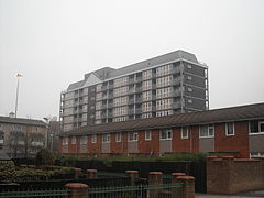
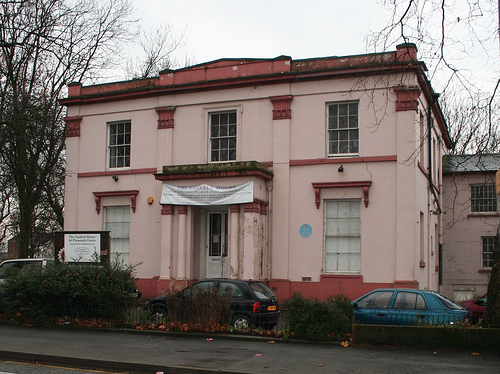
A view in Chorlton-on-Medlock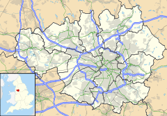
 Chorlton-on-Medlock
Chorlton-on-Medlock shown within Greater ManchesterOS grid reference SJ856967 Metropolitan borough Manchester Metropolitan county Greater Manchester Region North West Country England Sovereign state United Kingdom Post town MANCHESTER Postcode district M12,13 Dialling code 0161 Police Greater Manchester Fire Greater Manchester Ambulance North West EU Parliament North West England UK Parliament Manchester Central List of places: UK • England • Greater Manchester Chorlton-on-Medlock is an inner city area of Manchester, England.
Historically a part of Lancashire, the northern border of Chorlton-on-Medlock (a former township) is the River Medlock which runs immediately south of Manchester city centre. Its other borders roughly correspond to Stockport Road, Hathersage Road, Moss Lane East and Boundary Lane. Neighbouring districts are Hulme to the west, Ardwick to the east and Victoria Park, Rusholme and Moss Side to the south. A large portion of the district along Oxford Road is occupied by the campuses of the University of Manchester, Manchester Metropolitan University, and the Royal Northern College of Music. To the south of the university's Oxford Road campus a considerable area is occupied by a group of contiguous hospitals including Manchester Royal Infirmary, to the west of which is Whitworth Park.
Contents
History
From Medieval times the district was known as Chorlton Row and was a township of the ancient parish of Manchester in the Salford Hundred of Lancashire. Towards the end of the 18th century it was developed as a residential suburb of Manchester and in the extreme north of the township a number of cotton mills were established: in 1820 the parish church of All Saints was built. Development began in 1793–94: most of the important streets were given impressive names, Oxford Street, Cambridge Street and Grosvenor Street being three of these.
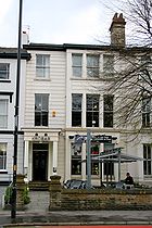 Kro Bar, 325 Oxford Road, Chorlton-on-Medlock
Over the next thirty years residential development spread southwards as far as Tuer Street: and by the mid-1840s to High Street. Very few dwellings of that period remain today: they include Waterloo Place, 323, 325, 327 & 333 Oxford Road, and Grove House (316–324).[1]
In 1830 the town hall on Cavendish Street was built to the designs of Richard Lane (see below). On the creation of the municipal borough of Manchester in 1838 the township was absorbed into the borough. At this time the southern area was still partly rural with some larger dwellings of wealthy people (e.g., John Owens in Nelson Street). After the Poor Law Reform of 1834 the district became part of the Chorlton Poor Law Union and the offices of the Board of Guardians were built in Cavendish Street (these are now the Ormond Building of the Metropolitan University). The arrival of Owens College in 1873 was the beginning of a different kind of development leading to the academic campus of today.
Though most of the township was originally middle class in character by the early 20th century it was very much a working class district. The housing conditions were described in 1931 by the Manchester and District Social Survey Society.[2]
Geography
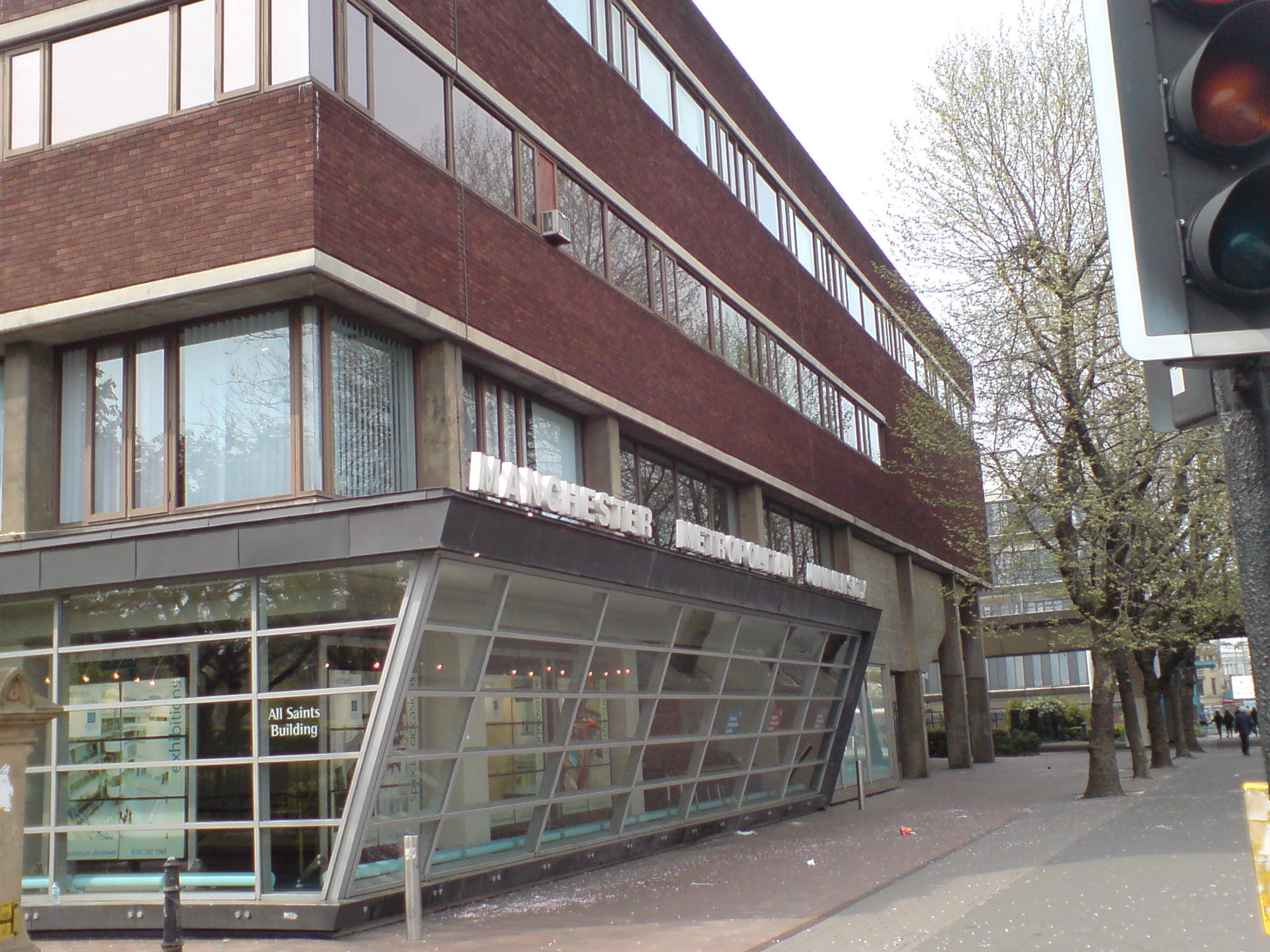
 The All Saints Building on the Manchester Campus of the Metropolitan University
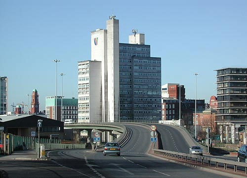
 A view of the Mancunian Way elevated motorway near what was UMIST campus
The historic boundaries are as described in the introductory text: however those who think more about postal areas and university campuses often include the area east of Boundary Lane and west of the Dental Hospital in Hulme because it has M15 postcodes and think of Greenheys (now in Moss Side ward) as an area of Moss Side rather than Chorlton on Medlock. Much of the area can also be included in a district referred to as "Central Manchester" in modern directories and publicity. Once the River Medlock is crossed that is Manchester City Centre which includes the Sackville Street campus of the University (or confusingly "North Campus" rather than "South Campus"). A large area of Chorlton on Medlock south-west of this is occupied by the Manchester Metropolitan University. The M13 postcode district comprehends Ardwick and Chorlton on Medlock (roughly speaking).
Brunswick is an area located around Brunswick Street in Chorlton-on-Medlock. It is the area south of Manchester Piccadilly railway station and north of the Manchester Royal Infirmary: its western edge is dominated by campus buildings of Manchester University east of Oxford Road. These have all been built in the period since 1957 and several large new buildings have appeared since the inauguration of the present University in 2004, such as University Place on the site of the former Mathematics Building.
- Transport
Chorlton on Medlock is crossed by the Mancunian Way (opened 1967), running west to east through its northern part. The main routes through the suburb to south Manchester are (west to east) Cambridge Street (leading to Higher Cambridge Street, Lloyd Street North and Upper Lloyd Street), Oxford Road (leading to Wilmslow Road; the busiest route, both for private and public transport), and Upper Brook Street (dual carriageway continuing from Princess Street and leading to Anson Road).
Landmarks
 Manchester Royal Eye Hospital, 1886–2009
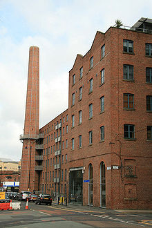 Chorlton New Mill
The front of the former Chorlton-upon-Medlock Town Hall can be seen at its original location on Cavendish Street at All Saints. The building, with its Doric portico, dates from 1830–31 and was designed by Richard Lane.[3] The original interior was removed and a new structure added to the rear in 1970. A red plaque on the building commemorates the Fifth Pan-African Congress, which was held there from 15–21 October 1945. Decisions taken at that conference led to independence for a number of African and Caribbean countries. In Nelson Street the former home of the Pankhurst family is now the Pankhurst Centre. The Ormond Building of the Manchester Metropolitan University was originally the home of the Chorlton Union Board of Guardians (responsible under the 1834 Poor Law for most of what is now south Manchester). Next to the town hall building is the original building of the Manchester College of Art (1880–81: architect George T. Redmayne) in a Gothic revival style.
Further down Oxford Road are the University of Manchester (frontage built 1888–1902), the former Manchester Royal Eye Hospital (1886), Manchester Royal Infirmary (1908) and the Whitworth Art Gallery (1898–1908).
Religion
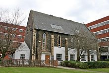 German Protestant Church (now Stephen Joseph Studio)
The parish church of All Saints (1820) and the earlier Church of St Luke (founded before 1804 but a new church was built by John Lowe in 1865; part of Old Chorlton Hall was used as the rectory)[4] (to the east) have been demolished as have several other Anglican churches in this area. The oldest Roman Catholic church in Chorlton-on-Medlock was the Church of the Holy Name on Oxford Road (built between 1869 and 1871), a fine example of the work of the architect Joseph Aloysius Hansom. St Augustine's, Granby Row (demolished to allow expansion at the Municipal College of Technology) was replaced by a second St Augustine's in York Street, Chorlton on Medlock (ruined by bombing in World War II): its successor is at Lower Ormond Street on the Manchester Metropolitan University campus in a building which serves also as a chaplaincy to the University. This church was built in dark brick to the designs of Desmond Williams & Associates in 1967–68.[5] The Armenian church in Upper Brook Street was the first purpose-built Armenian church in Western Europe. It is dedicated to the Holy Trinity and opened at Easter 1870. The architects were Royle & Bennett, 1869–70, and they chose an eclectic neo-Gothic style. At the east end is a rounded apse and the interior is simple though the altar is elaborate.[6][7] Anglican churches which are disused include St Stephen's (E. H. Shellard, 1853), St Paul's (Clegg & Knowles, 1862), and St Ambrose (H. C. Charlewood, 1884):[8] these have all been demolished apart from St Ambrose which is used by the University of Manchester as an Islamic prayer room.
There were also many Nonconformist chapels (most of them now demolished) such as the Congregational Chapel, Cavendish Street (architect Edward Walters, 1847), the Union Chapel, Oxford Road and a Presbyterian chapel at All Saints. The chapel in Cavendish Street was a particularly fine neo-Gothic building but was demolished in the early 1970s to allow expansion by Manchester Polytechnic. It has replaced an earlier chapel in Mosley Street. The Welsh Baptist Chapel, on Upper Brook Street, was designed in the early 19th century by Sir Charles Barry, who designed the Palace of Westminster shortly afterwards. In Greenheys there was formerly an Anglican church of St Clement on Denmark Road (architect Henry R. Price, 1881, decorated by John Lowe, 1886[9]) and a German Protestant Church in Wright Street (ca. 1871).
Notable residents
See also List of people from Manchester
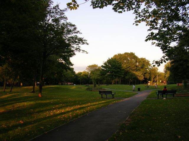
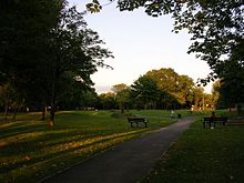 Swinton Grove Park (near 84 Plymouth Grove)
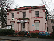
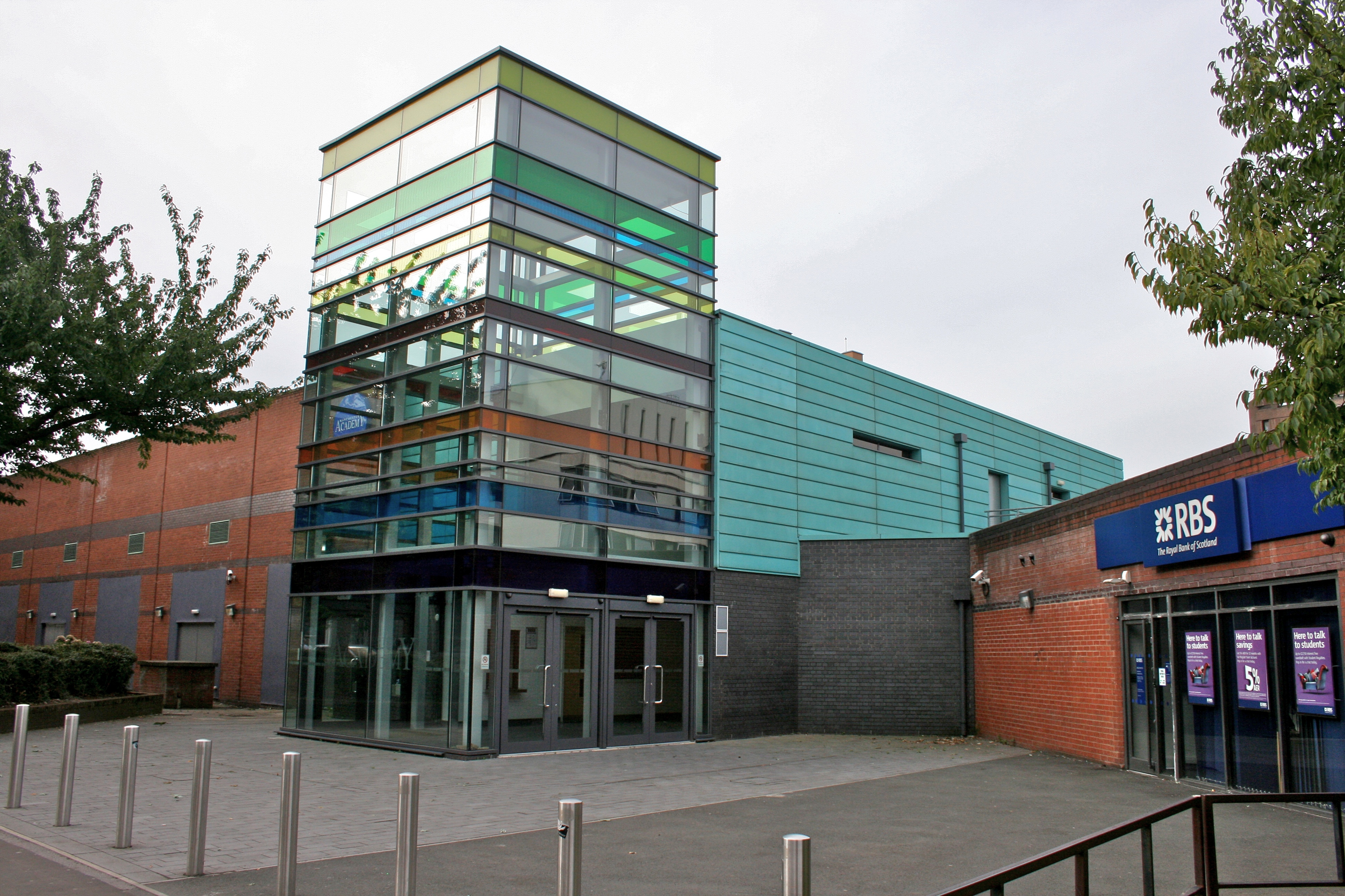
 The Manchester Academy, south of Manchester University Students' Union, Oxford Road
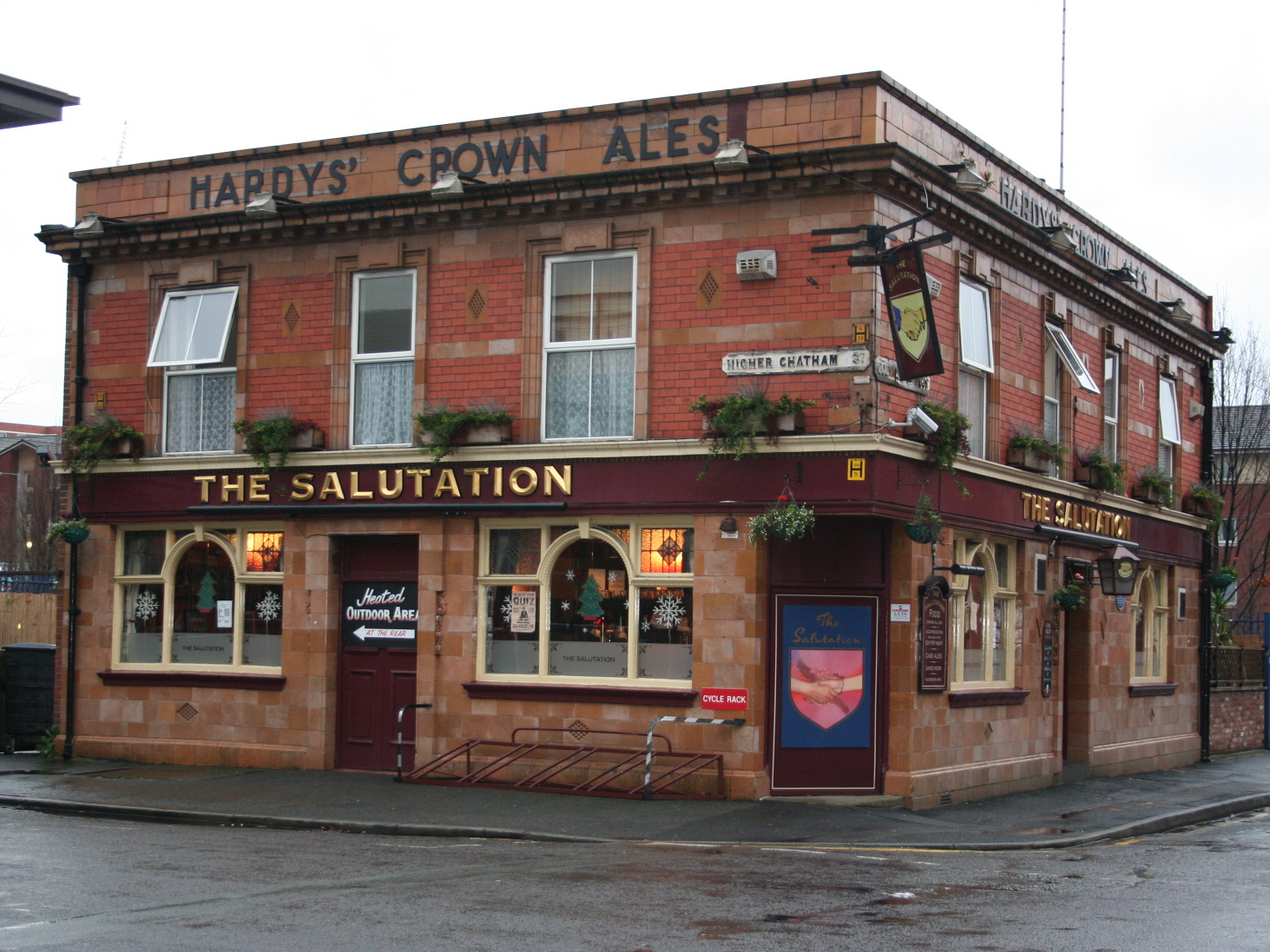
 The Salutation public house in Higher Chatham Street
Nineteenth century
- Friedrich Engels, German social scientist and philosopher, lived here for a time; the site of his lodging is commemorated by a plaque on Aberdeen House, Whitworth Park Halls of Residence.
- John Owens the merchant (after whom Owens College was named) lived in Nelson Street.
- Elizabeth Gaskell lived in a house at 84, Plymouth Grove for the last 15 years of her life[10]
- William Gaskell, Nonconformist minister and writer, husband of Elizabeth Gaskell
- Charles Hallé, musician, lived at Greenheys for a time
- Thomas De Quincey, writer, also lived at Greenheys: he was born at Cross Street, Manchester
- Walter Arthur Copinger, lawyer and scholar, lived in Greenheys[11]
Twentieth century
- John Cassidy, sculptor, worked at a studio in Lincoln Grove, also lodged in the district
- Catherine Chisholm, GP and paediatrician: the first woman to study medicine at Manchester Medical School, practised in Oxford Road[12] and was medical officer of the Manchester High School for Girls in Dover Street, 1908–38[13] She retired in 1948 having founded the Manchester Babies' Hospital (afterwards the Duchess of York Hospital) in 1914. Originally this was in Chorlton-on-Medlock but soon moved to Levenshulme and then to Burnage.[14]
- David Lloyd George, British Prime Minister, was born here but his family soon returned to Wales
- Emmeline Pankhurst, a founder of the British suffragette movement, lived in Nelson Street, Chorlton-on-Medlock, following her husband's death.
- Eugene Halliday, artist, 1911–1987, founder of the Institute for the Study of Hierological Values (now Eugene Halliday Society), lived as a child in Chorlton-on-Medlock. He studied at the Manchester School of Art in All Saints (see Landmarks above). A prolific writer, during the mid 1950s he wrote for the Cavendish Magazine, published by the Congregational Chapel on Cavendish Street, Chorlton-on-Medlock (see Religion, above).
References
Notes
- ^ Hartwell (2001)
- ^ Housing Group of the St James', Birch, Fellowship (1931) Some Housing Conditions in Chorlton-on-Medlock, Manchester.
- ^ Pevsner, The Buildings of England: South Lancashire
- ^ Fleetwood-Hesketh, Peter (1955) Murray's Lancashire Architectural Guide. London: John Murray; p. 160
- ^ Hartwell, Clare; Hyde, Matthew & Pevsner, Nikolaus (2004) Lancashire: Manchester and the South-East. New Haven: Yale University Press; p. 420
- ^ Hartwell (2004); pp. 421–22
- ^ "The Holy Trinity Armenian Church of Manchester". Holy Trinity Armenian Church. 2009. http://www.armenianchurchmanchester.org/. Retrieved 14 December 2010.
- ^ Fleetwood-Hesketh, Peter (1955) Murray's Lancashire Architectural Guide. London: John Murray; p. 160
- ^ Fleetwood-Hesketh, Peter (1955) Murray's Lancashire Architectural Guide. London: John Murray; p. 160
- ^ "Elizabeth Gaskell House, 84 Plymouth Grove". http://www.elizabethgaskellhouse.org.
- ^ Scragg, Brenda J.. "Manchester book collectors". http://homepage.ntlworld.com/brenda.scragg/MANCHESTER%20BOOK%20COLLECTORS.htm. Retrieved 2009-06-13.
- ^ "Catherine Chisholm". http://www.mosi.org.uk/media/612328/dr%20catherine%20chisholm%20(large%20print).rtf. Retrieved 2009-05-14.
- ^ Manchester High School for Girls, 1874–1974.
- ^ Mohr, Peter D. (2003) "Dr Catherine Chisholm (1879–1952) of the Manchester Babies' Hospital", in: Manchester Memoirs; vol. 140 (2001/02), pp. 21–30
Bibliography
- Pevsner, Nikolaus (1969). The Buildings of England: South Lancashire. Penguin. ISBN 0-14-071036-1.
- Coates, Su (=S. D. F. Thomas) (1991) Manchester's German Gentlemen ... 1840–1920. In: Manchester Region History Review, vol. 5, no. 2, 1991/2
- "Account of Chorlton on Medlock in 1841". http://www.mancuniensis.info/ChorltonRowFP.htm.
- "Description of Chorlton on Medlock". Manchester City Council. http://www.manchesterhomefinder.org/info/chorlton-on-medlock/chorlton-on-medlock.shtm.
Further reading
- Makepeace, Chris (1995) Looking Back at Hulme, Moss Side, Chorlton on Medlock & Ardwick. Altrincham: Willow
- Potts, Bob (1997) The Old Pubs of Hulme and Chorlton-on-Medlock. Radcliffe: Neil Richardson
The City of Manchester About Manchester Architecture · (Tallest buildings · Grade I buildings) · Cuisine · Culture · Economy · History · Media · (Television programmes) · Music · (Pop music) · People · Politics · Science · Sociology · Sport · Streets · Symbols · TransportDistricts Ancoats · Ardwick · Ardwick Green · Baguley · Belle Vue · Benchill · Beswick · Blackley · Bradford · Burnage · Castlefield · Cheetham Hill · Chinatown · Chorlton-cum-Hardy · Chorlton-on-Medlock · Chorltonville · City Centre · Clayton · Collyhurst · Crumpsall · Didsbury · Fallowfield · Gay Village · Gorton · Harpurhey · Hulme · Levenshulme · Longsight · Lower Crumpsall · Miles Platting · Moss Side · Moston · Newall Green · New Islington · New Moston · Newton Heath · Northenden · Northern Moor · Northern Quarter · Openshaw · Peel Hall · Piccadilly Village · Ringway · Rusholme · Sharston · Spinningfields · Whalley Range · Withington · Woodhouse Park · WythenshaweCategories:- Districts of Manchester
- Academic enclaves


Wikimedia Foundation. 2010.