- Didsbury
-
For the town in Canada, see Didsbury, Alberta.
Coordinates: 53°25′00″N 2°13′52″W / 53.4166°N 2.2311°W
Didsbury 
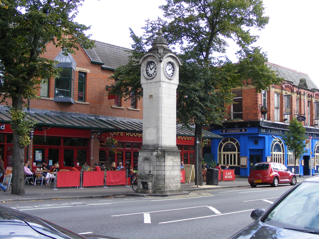
The Clock Tower in Didsbury village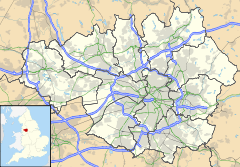
 Didsbury
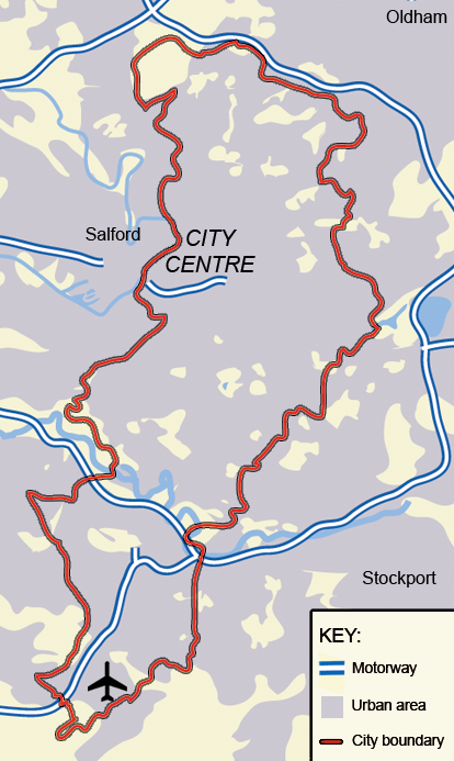
Didsbury shown within Greater ManchesterPopulation 14,292 (Census 2001) - Density 5,276 /sq mi (2,037 /km2) OS grid reference SJ8491 Metropolitan borough Manchester Metropolitan county Greater Manchester Region North West Country England Sovereign state United Kingdom Post town MANCHESTER Postcode district M20 Dialling code 0161 Police Greater Manchester Fire Greater Manchester Ambulance North West EU Parliament North West England UK Parliament Manchester Withington List of places: UK • England • Greater Manchester Didsbury (
 /ˈdɪdzbəri/) is a suburban area of the City of Manchester, in Greater Manchester, England.[1] It lies on the north bank of the River Mersey, 4.5 miles (7.2 km) south of Manchester city centre, in the southern half of the Greater Manchester Urban Area. It is a dormitory community with a resident population of just over 14,000 people.
Historically a part of Lancashire, there are records of Didsbury existing as a small hamlet as early as the 13th century.[2] Its early history was dominated by its association with Withington under a feudal estate, which covered other areas in what is now the south of Manchester. During the 18th century, Didsbury was being described as a township separate from outside influence.[3] In 1745 Charles Edward Stuart crossed the Mersey at Didsbury in the Jacobite march south from Manchester to Derby, and again in the subsequent retreat.[4][5]
Didsbury was largely rural until the mid-19th century, when it underwent development and urbanisation during the Industrial Revolution. Introduced into the inner boundaries of Manchester in 1904,[1] Didsbury was integrated into the city 45 years after Manchester gained city status, perhaps in part to the improvements made to, and the gradual increase in use of, the railway network.[2]
The Royal Society for the Protection of Birds was formed in Didsbury in 1889.[6]
Contents
History
Further information: History of ManchesterToponymy
Didsbury derives its name from the Anglo-Saxon Dyddi's burg, probably referring to a man known as Dyddi whose stronghold or township it was[7] on a low cliff overlooking a place where the river Mersey could be forded. In the 13th century Didsbury was variously referred to as Dydesbyre, Dydesbiri, Didsbury, or Dodesbury.[5]
Parish Church
A charter granted in about 1260 shows that a corn-grinding mill was operating in Didsbury, along the River Mersey,[5] but the earliest reference to Didsbury is in a document dating from 1235, recording a grant of land for the building of a chapel.[8] The church was originally called St Oswald's, renamed as St James's Church in 1855. It underwent major refurbishment in 1620 and again in the 19th century, although most of the stonework visible today dates from the 17th century.[9] A parsonage was built next to one of the two public houses that flanked the nearby village green, Ye Olde Cock Inn, so-called because of the cock fighting that used to take place there. The parsonage soon gained a reputation for being haunted; servants refused to sleep on the premises, and it was abandoned in 1850. Local alderman Fletcher Moss bought the house in 1865, and lived in it for more than 40 years. In 1902, he installed wrought iron gates at the entrance to the parsonage's garden, which, because of the building's reputation, became known locally as "the gates to Hell". The parsonage became a museum, now closed, but the gardens are still open to the public.[10] The area around St James Church has the highest concentration of listed buildings in Manchester, outside the city centre.[11]
River Mersey
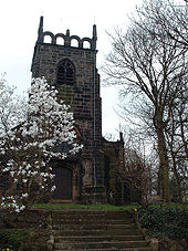 St James Parish Church, in 2007
Didsbury was one of the few places between Stretford and Stockport where the River Mersey could be forded, which made it significant for troop movements during the English Civil War, in which Manchester was on the Parliamentarian side. The Royalist commander, Prince Rupert, stationed himself at Didsbury Ees, to the south of Barlow Moor. It is also likely that Bonnie Prince Charlie crossed the Mersey at Didsbury in 1745, in the Jacobite march south from Manchester to Derby, and again in the subsequent retreat.[4]
Immigration from Europe
Jewish immigrants started to arrive in Manchester from the late-18th century, initially settling mainly in the suburbs to the north of the city. From the 1890s onwards, many of them moved to what were seen as the more "sophisticated" suburbs in the south, such as Withington and Didsbury.[12] The influx of Jewish immigrants led to West Didsbury being nicknamed "Yidsbury" and Palatine Road, a main road through West Didsbury, "Palestine Road".[13]
19th and 20th centuries
During the Victorian expansion of Manchester, Didsbury developed as a prosperous settlement; a few mansions from the period still exist on Wilmslow Road between Didsbury Village and Parrs Wood to the east and Withington to the north, but they have now been converted to nursing homes and offices. The opening of the Midland Railway line in 1880 contributed greatly to the rapid growth in the population of Didsbury, with stations at Didsbury and Withington and West Didsbury offering easy rail connections to Manchester Central. The line closed in 1967, although Didsbury station building remained standing until its demolition in the 1980s. The station clock and water fountain have survived, dedicated to local doctor and campaigner for the poor, Dr. J. Milson Rhodes.[3]
On 28 April 1910, French pilot Louis Paulhan landed his Farman biplane in Barcicroft Fields, Pytha Fold Farm, on the borders of Withington, Burnage and Didsbury, at the end of the first flight from London to Manchester in under 24 hours, with one short overnight stop at Lichfield. Arriving at 5:30 am, Paulhan beat the British contender, Claude Grahame-White, winning a £10,000 prize offered by the Daily Mail.[14] This was the first powered flight into Manchester from any point outside the city. Two special trains were chartered to the newly-built but unopened Burnage Station to take spectators to the landing, many of whom had stood throughout the night. Paulhan's progress was followed throughout by a special train carrying his wife, Henri Farman and his mechanics. Afterwards his train took the party to a civic reception given by the Lord Mayor of Manchester in the Town Hall. A house in Paulhan Road, constructed in the 1930s near the site of his landing, is marked by a blue plaque to commemorate his achievement.[15]
Governance
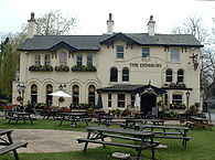 Formerly the "Ring O' Bells", The Didsbury Inn, was at the heart of judicial and leisure activities in 18th-century Didsbury.[16]
Civic history
In the early 13th century, Didsbury lay within the manor of Withington, a feudal estate that also included the townships of Withington, Chorlton-cum-Hardy, Moss Side, Rusholme, Burnage, Denton and Haughton, ruled by the Hathersage, Longford and Tatton families,[17] and within the historic county boundaries of Lancashire.[1] Didsbury remained within the manor of Withington for several centuries.
By 1764, Didsbury was described as a township in its own right.[3] It became a civil parish in 1866, and in 1876 was incorporated into the Withington Urban Sanitary District, superseded in 1894 by the creation of Withington Urban District.[18] Withington Urban District was a subdivision of the administrative county of Lancashire, created as part of the provisions of the Local Government Act 1894. In 1904, Withington Urban District was amalgamated into the city and county borough of Manchester, and so Didsbury was absorbed into Manchester, although it remained a civil parish until 1910. Following the Local Government Act 1972, Manchester became a metropolitan borough of the metropolitan county of Greater Manchester.
Political representation
Didsbury is in the parliamentary constituency of Manchester Withington, and is represented by John Leech MP, a member of the Liberal Democrats.
Until 2004, most of the area formed the Didsbury ward of Manchester City Council with a section of West Didsbury contained within the Barlow Moor ward. However, boundary changes in 2004 resulted in Didsbury being split mainly between the two new wards of Didsbury East and Didsbury West while a small section of West Didsbury was incorporated into the new ward of Chorlton Park.[19] Didsbury East is represented by Labour councillor Andrew Simcock and Liberal Democrat councillors Andrew Taylor and David Sandiford.[20] Didsbury West is represented by Labour councillor David Ellison and Liberal Democrat councillors Graham Shaw and Mark Clayton.[21] All wards within Manchester elect in thirds on a four yearly cycle.
Geography
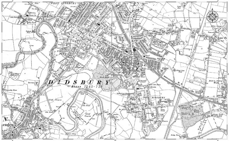
Further information: Geography of Greater Manchester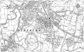 Ordnance survey map of Didsbury from 1905
Didsbury, at 53°24′59″N 2°13′51″W / 53.41639°N 2.23083°W (53.4166, −2.2311), is located south of the midpoint of the Greater Manchester Urban Area, 4.5 miles (7.2 km) south of Manchester city centre. To the north, Didsbury is bordered by Withington, Chorlton-cum-Hardy and Burnage, to the west by Northenden, to the east and south-east by Heaton Moor and Cheadle, and by Gatley to the south.
The River Mersey forms Didsbury's southern and southwestern boundaries and certain stretches of the river also demarcate the boundaries of the City of Manchester. The area is generally considered to be roughly enclosed by Princess Parkway to the west, Kingsway to the east and the Ball Brook, just north of Lapwing Lane/Fog Lane to the north. This northern boundary is marked by a boundary stone in the front garden wall of a house on the west side of Wilmslow Road. A "country trail" passes from West Didsbury to East, named the Trans Pennine Trail (National Cycle Route 62). It was sited along a disused railway track, as part of a nationwide initiative to promote cycling.[22]
Didsbury's built environment has developed around the areas of East Didsbury, West Didsbury, and Didsbury Village, which separates the two. The Albert Park conservation area, covering much of West Didsbury, places planning restrictions on development, alterations to buildings, and pruning of trees. The areas adjacent to the Mersey lie within the river's flood plain, and so have historically been prone to flooding after heavy rainfall.[23] The last major flooding was in the late 1960s. In the 1970s extensive flood mitigation work carried out along the Mersey Valley through Manchester has helped to speed up the passage of floodwater. Fletcher Moss Botanical Garden also acts as an emergency flood basin, storing floodwater until it can be safely released back into the river.[24]
Demography
Didsbury Compared[25][26] UK Census 2001 Didsbury Manchester England Total population 14,292 392,819 49,138,831 Born outside Europe 8% 10% 6% White 88% 81% 91% Asian 8% 9% 5% Black 1% 5% 2% Over 75 years old 10% 6% 8% The United Kingdom Census 2001 recorded Didsbury as having a population of 14,292, of whom 87% were born in the United Kingdom.[27] A large majority of residents, 88%, identified themselves as white, 8% as Asian, 2% as mixed ethnicity, 1% black, and 1% Chinese or other ethnic group.[25] The under-16s accounted for 17% of the population, and the over-65s for 15%. The population density in 2001 was 5,276/square mile (2,037/km²).[28]
Economy
 Sir William Siemens House, Siemens offices in DidsburySee also: Economy of Manchester
As of the UK's 2001 census, Didsbury had an estimated workforce of 10,755 or 75% of the population. Economic status in Didsbury was: 48% in full-time employment, 11% retired, 10% self-employed, 8% in part-time employment, 4% full-time student (without job), 4% housewife/husband or carer, 4% permanently sick or disabled, 4% unemployed, and 2% economically inactive for unstated reasons.[25] Didsbury's 48% rate of full-time employment compares with 33% in Manchester and 41% across the whole of England.[25] The area's 4% unemployment rate is in contrast to Manchester's rate of 9%, and broadly in line with the 5% rate of unemployment for England.[25]
In 2001, the main industries of employment in Didsbury were 20% property and business services, 15% education, 15% health and social work, 10% retail and wholesale, 9% manufacturing, 6% transport and communications, 5% financial services, 4% hotels and restaurants, 4% construction, 4% public administration and defence, and 8% other.[25] These figures were similar to those from surrounding areas, but Didsbury did have a relatively larger education sector than other nearby wards, perhaps explained by the high density of schools in the area. A significant number of people (12%) commute to areas outside Didsbury; at the 2001 census there were 6,555 jobs in Didsbury, compared with the 7,417 employed residents.[29]
Siemens occupies the Sir William Siemens House in West Didsbury and in 2009 employed 800 people. The head office of BA CityFlyer is in Didsbury.[30] British Airways has an office with 300 employees in Pioneer House on the 292,000 square feet (27,100 m2), Dutch owned Towers Business Park. In 2005, other tenants of the business park included Cisco, Logica, Regus, and Thorn Lighting.[31][32]
Didsbury is considered to form a "stockbroker belt",[33] as it is Manchester's "swankiest" suburb.[34]
Culture
Didsbury Village, the central shopping area along Wilmslow Road, has developed a European-like cafe culture over recent years, with the opening of many new bars, cafes and delicatessens.[35] The original site of Didsbury Village is in the conservation area now known as Didsbury St James, about half a mile (1 km) to the south of what is today's village centre.[36]
The traditional independent retailers are gradually being replaced by multi-national firms, raising fears that Didsbury may lose its individual identity and become a "clone town".[37] The 200-year-old Peacock's Funeral Parlour, one of the few pre-Victorian buildings in the village and regarded by some as the centrepiece of the village,[38] was demolished in the summer of 2005. The owner, United Co-op, blamed changing demographics for the closure of the funeral parlour; with more and more homes being occupied by young professional people, the death rate was falling in the area.[39]
Green areas
The Fletcher Moss Botanical Garden is a 21-acre (85,000 m2) recreational park south of the village centre. It is named after local Alderman Fletcher Moss, who donated the park to the city of Manchester in 1919.[40] In 2008, it won the Green Flag Award, the national standard for parks and green spaces in England,[41] an award it has held since 2000.[42]
Didsbury Park was also a winner of the Green Flag Award in 2008.[43] It is a community park in Didsbury village centre that comprises a bowls area, crèche, football pitch and play area. Once a year, at the Didsbury Festival, pupils from local schools dress up to a theme and meet in the playground of St. Catherine's Primary School, in East Didsbury, from where they parade to Didsbury Park.
Marie Louise Gardens is a relatively small park to the west of the centre of Didsbury. The park was originally owned by the Silkenstadt family as part of the grounds of their house. The land was bequeathed to the people of Manchester by Mrs Silkenstadt in 1904 in memory of her daughter, Marie Louise.[44] The park was at the centre of controversy in 2007 after Manchester City Council proposed to sell a portion of it to a private property developer.[45]
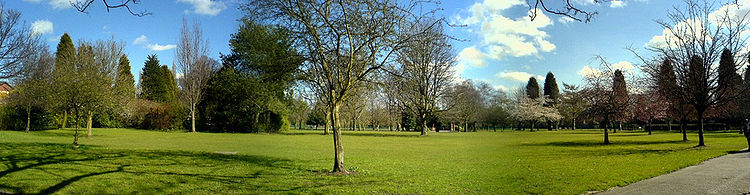 Panorama of Didsbury Park in March 2008
Media
See also: Media in Manchester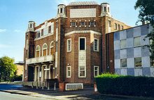 ABC Weekend Television's northern studios in Didsbury
Between 1956 and 1969, the old Capitol Theatre at the junction of Parrs Wood Road and School Lane served as the northern studios of ITV station ABC Weekend Television. Early episodes of The Avengers and programmes such as Opportunity Knocks were made in the studios. ABC ceased to use the site in 1968 when it lost its ITV franchise, on its merger with fellow ITV company Rediffusion. The site was then used briefly by Yorkshire Television until its own facilities in Leeds were ready.[46] In 1971, the studios were acquired by Manchester Polytechnic, who used it for cinema, television studies and theatre.[47] The building was demolished in the late 1990s to make way for a residential development,[46] but the name lives on in the form of a new theatre space in the heart of the M.M.U. campus in the All Saints area along Oxford Road, just to the south of Manchester city centre.[48]
Until 2009 Didsbury was the base for one of the Manchester Evening News subsidiaries, the South Manchester Reporter.[49]
Transport
See also: Transport in Manchester
 DidsburyDidsbury, shown within Manchester.
Didsbury is close to junction 5 of Manchester's ring road, the M60 motorway. Manchester Airport, the busiest airport in the UK outside London,[50] is about 4 miles (6.5 km) to the south.
Didsbury is served by several bus routes into Manchester city centre, The Trafford Centre, Northenden, and other destinations. Wilmslow Road provides Didsbury with a regular bus service due to the strong demand for travel by students along the corridor. The service is cheap and passengers rarely have to wait more than a couple of minutes. According to some analysts, Wilmslow Road is the busiest bus corridor in Europe.[51]
East Didsbury and Burnage are the nearest railway stations, on the line between Manchester Piccadilly and Manchester Airport. Between 1880 and 1967 the area had been served by two other railway stations, Didsbury station and West Didsbury station, both on the South Manchester lines into Manchester Central station. The entire line was shut in 1967 following the Beeching Axe.
Metrolink
Proposals have existed since the 1980s to re-open the disused railway line which passes through Didsbury as part of the Manchester Metrolink light rail system.[52] Under these proposals, Didsbury Station was to re-open under the name of Didsbury Central or Didsbury Village.
These extension plans were rejected by the government in 2004, due to escalating costs.[53][54] New plans were drawn up in 2007, with at least some of the money required for the construction of the line planned to come from the proposed Manchester Congestion Charge,[55] which was overwhelmingly rejected by public vote in 2008.
In May 2009, AGMA agreed to the provision of additional funding that will secure the construction of Metrolink to the area. This will include additional stops at Withington, Burton Road, West Didsbury, Didsbury Village and East Didsbury.[56]
Final government approval for government funding for the Chorlton cum Hardy - East Didsbury Metrolink extension using a closed railway line was granted in March 2010 by Transport Minister Sadiq Khan. Construction is underway, with the line expected to open through to East Didsbury in 2013.[57]
Education
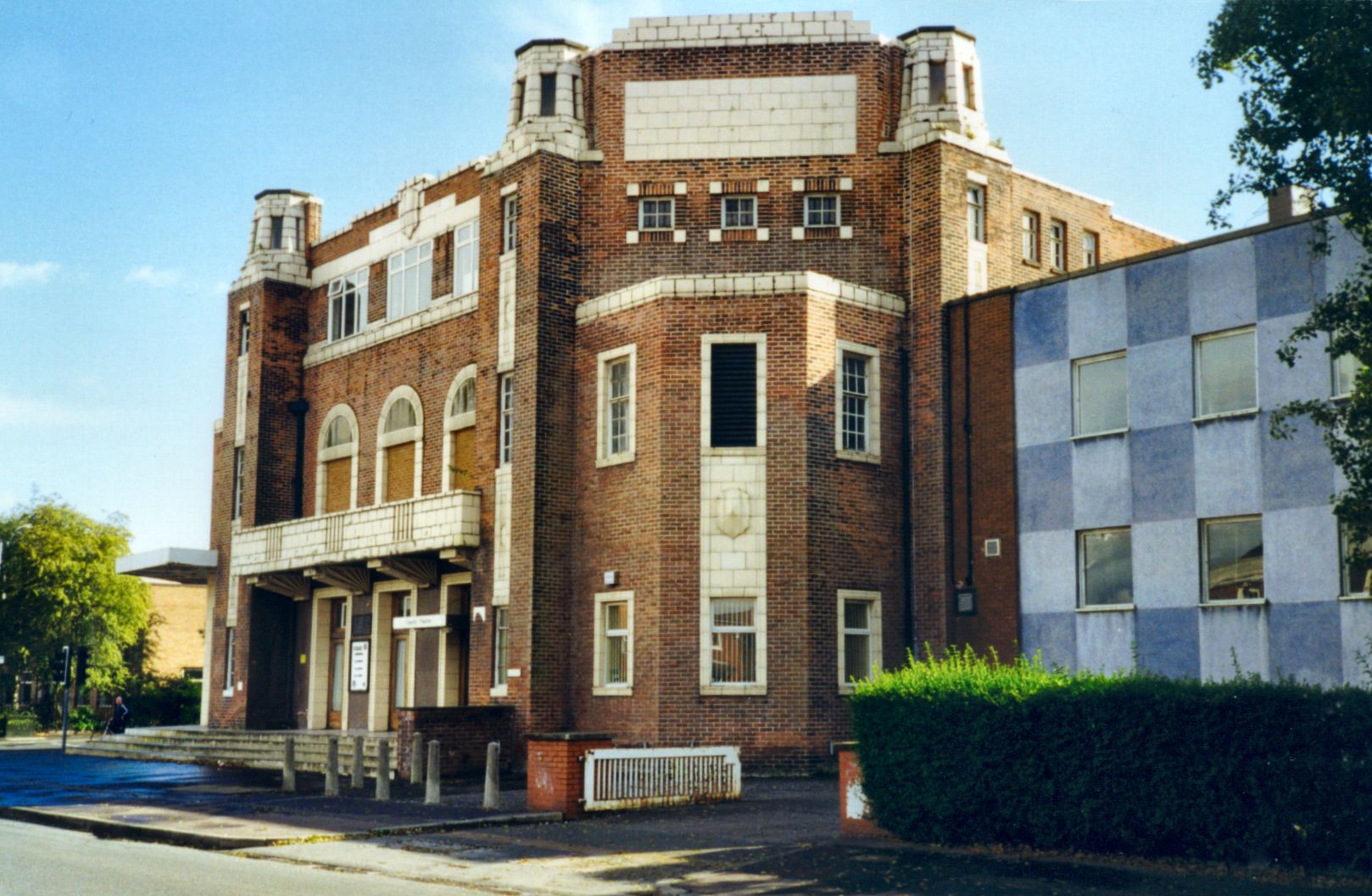
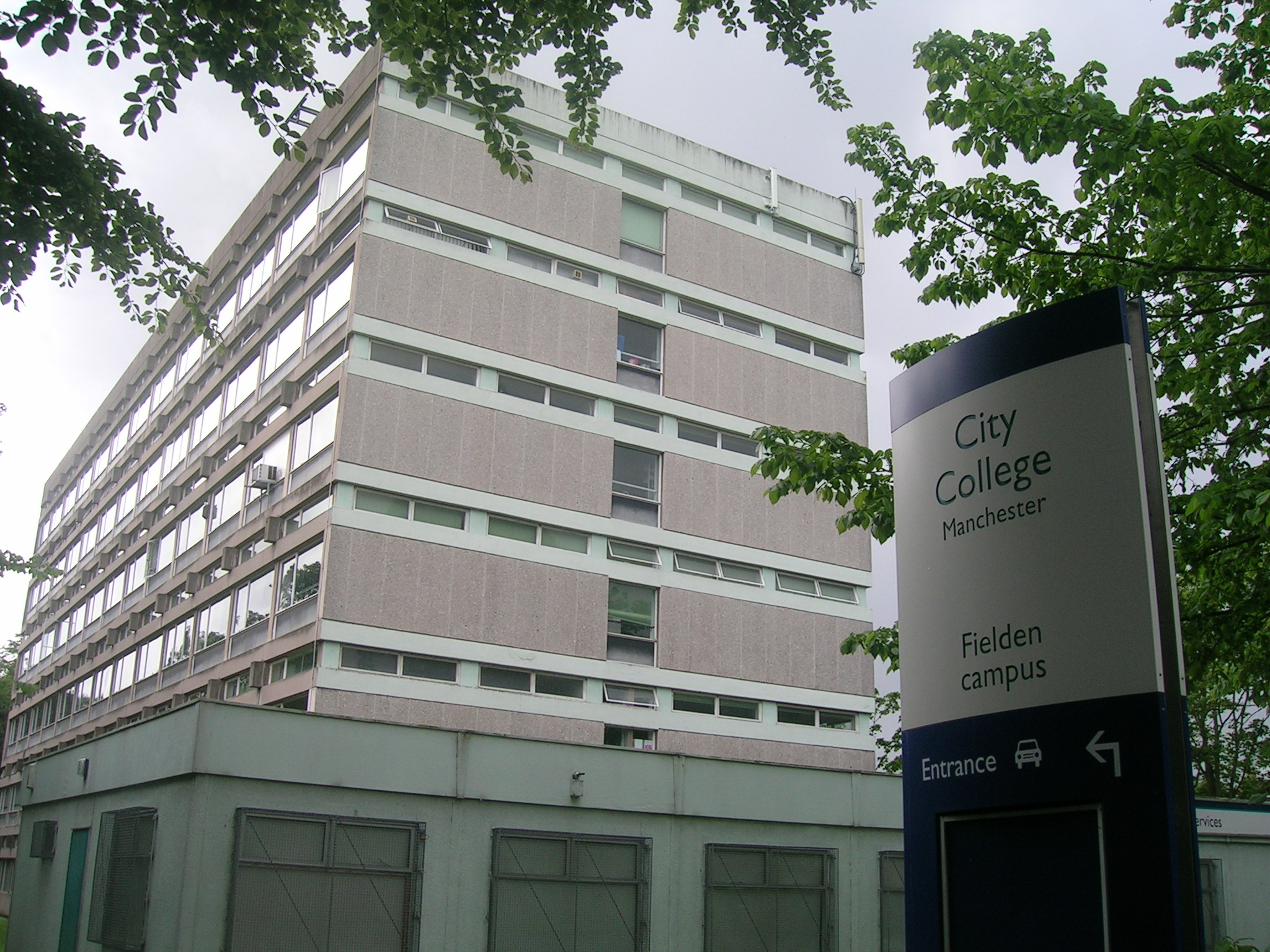
Further information: List of schools in Manchester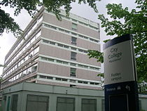 Fielden Park Campus, Manchester College
Didsbury has a non-selective education system, assessed by the SATs exam. There are seven primary schools and two state comprehensive secondary schools. The Barlow RC High School is one of those chosen by Manchester Council to benefit from funding made available in wave 4 of the government's Building Schools for the Future programme, a national scheme for the refurbishment and remodelling of every secondary school in England.[58] It is planned to replace all the current buildings, which date back to 1951. Parrs Wood and The Barlow were two of only six schools in Manchester to achieve the Manchester Inclusion Standard in 2007, awarded by Manchester Council to those schools doing innovative work to ensure that all their pupils are able to participate fully in the school’s activities.[59]
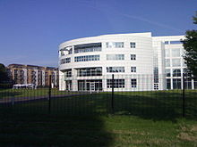
There are two centres of further and higher education in Didsbury: The Manchester College, (formerly City College Manchester) Fielden Campus, which was opened in 1972 by Margaret Thatcher,[60] offers a variety of courses including communication and technology; and Manchester Metropolitan University's Didsbury Campus, the former Didsbury School of Education, is home to the faculties of health, social care, and education, along with the Broomhurst Hall of Residence.[61]
Primary schools
- Beaver Road Primary School
- Didsbury C.E. Primary School
- St Catherine's R.C. Primary School
- Ewing School
- Broad Oak Primary School
Secondary schools
- Parrs Wood High School
- Barlow R.C. High School
Parrs Wood, with about 2,000 pupils on its register, is much larger than the average, and is regularly over-subscribed in Year 7.[62] In its 2007 inspection report by the Office for Standards in Education, Children's Services and Skills (Ofsted) the school was criticised for "failing to give its students an acceptable standard of education", and for providing "unsatisfactory" value for money.[63] The Barlow RC High School is an average size secondary school, with about 1,000 pupils. It too is regularly over-subscribed. It was described in its October 2003 Ofsted report as "a successful and effective school that is providing a good education for its pupils".[64]
Religion
Further information: List of churches in DidsburyReligion Percentage of
population[25]Christian 62% No religion 20% Not stated 7% Muslim 6% Jewish 2% Hindu 2% It is uncertain when the first chapel was built in Didsbury, but it is thought to have been before the middle of the 13th century. When the plague reached the village in 1352 the chapel yard was consecrated to provide a cemetery for the victims, it being "inconvenient to carry the dead all the way to Manchester".[65]
The BBC Radio 4 Daily Service programme of Christian worship – the world's oldest continuous radio programme – is often broadcast from Emmanuel Church, on Barlow Moor Road.[66][67] Two of Didsbury's religious buildings are Grade II listed: Didsbury Methodist Church of St Paul,[68] and the Nazarene Theological College.[69]
Didsbury is in the Church of England Diocese of Manchester.[70] and the Roman Catholic Diocese of Salford.[71] It is not as religiously diverse as some other areas of Manchester, but it has the second largest Jewish population in the borough and two synagogues: the Shaare Hayim Synagogue and the Sha'are Sedek Synagogue.[72]
Didsbury has a medium-sized Muslim population in comparison with areas such as Rusholme, Longsight and Levenshulme; a converted church in West Didsbury houses the Didsbury Mosque and Islamic Centre.[73]
Sports
Didsbury Sports Centre, on Wilmslow Road, is a part of the Manchester Metropolitan University campus. It provides a fitness suite and classes and facilities for badminton and tennis.
Didsbury has two rugby union clubs, Toc H R.F.C. and Old Bedians. Toc H, founded in 1924, plays at Simons Fields, on Ford Lane.[74] Its first team plays in the North Lancashire and Cumbria league. The club runs four senior teams and a youth section, and has run a 10-a-side competition every May since 1951, as a charity fund raiser for local hospices. Old Bedians is based in East Didbury, and was founded in 1954. It regularly fields three senior teams as well as a junior section. Desmond Pastore, believed to be the oldest rugby player in the world, was a founder member of the club, and later became its president.[75] Formerly a player for Sale and Cheshire, Desmond played his last game for Manchester club Egor on his 91st birthday.[76]
Didsbury Cricket Club fields three Saturday teams and two Sunday teams. The first eleven plays in the Cheshire County ECB Premier League. As well as the five senior teams, the club also has a junior section catering for plyers between 7 and 18 years of age, and has recently formed a Women's section. It is also home to Manchester Waconians Lacrosse Club and Didsbury Grey's Women's Hockey Team, which do not actually play at the site but at grounds in Belle Vue, that were designed for the XVII Commonwealth Games.[77] Northern Tennis Club, in West Didsbury, is one of Manchester's few racquet clubs; it annually plays host to an Association of Tennis Professionals tournament in July.
Public services
Withington Community Hospital, opened in 2005, occupies part of the site of the former (and much larger) Withington Hospital, developed on the site of a workhouse some of whose buildings are still evident.
Didsbury is covered by the South Manchester Division of Greater Manchester Police. The local Neighbourhood Policing Team is the Didsbury Neighbourhood Policing Team, which covers Didsbury, Old Moat, Withington and Burnage and is headed up by Inspector Dave Nutsey. Didsbury Police Station is situated in the heart of Didsbury village on Wilmslow Road.
The Towers, now known as the Shirley Institute, was once the home of engineer Daniel Adamson – the driving force behind the Manchester Ship Canal project – and the venue where the decision to build the canal was taken.[78] The house was designed by Salford architect Thomas Worthington, for the editor and proprietor of the Manchester Guardian, John Edward Taylor.
Notable people
Further information: List of people from Manchester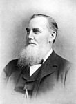 Daniel Adamson
Daniel Adamson, promoter of the Manchester Ship Canal, lived at The Towers (blue plaque – now the Shirley Institute) on Wilmslow Road from 1874 until his death in 1890. His Grade II listed home, designed by Thomas Worthington for John Edward Taylor, the editor and proprietor of the Manchester Guardian, was the venue for the 1882 meeting at which it was decided to construct the Ship Canal project.[79] Sidney Bernstein and Denis Forman who created Granada Television Manchester also lived in Didsbury during their work requirements at the Granada Studios in Manchester.[80] Kirsty Howard was the final runner to carry the Queen's Baton at the opening of the 2002 Commonwealth Games, when she was chaperoned by England football captain David Beckham. Born with a rare condition in which her heart is back-to-front, she has been a resident in Didsbury's Francis House Hospice, for which she has raised over £5 million.[81] Lord Marcus Joseph Sieff, the chairman of Marks & Spencer from 1972 to 1982, was born in Didsbury in 1913. Francis French, author and noted space historian, grew up in Didsbury, and attended the same school as noted poet and novelist Sophie Hannah. Carol Anne Duffy, the first female Poet Laurelate, lives in West Didsbury as of 2009.[82]
References
- Notes
- ^ a b c "Greater Manchester Gazetteer". Greater Manchester County Record Office. Places names - D to F. http://www.gmcro.co.uk/Guides/Gazeteer/gazzd.htm. Retrieved 2 October 2007.
- ^ a b "History of the Didsbury St James Conservation Area". Manchester City Council. 2007. http://www.manchester.gov.uk/site/scripts/documents_info.php?categoryID=511&documentID=924&pageNumber=2. Retrieved 2008-07-22.
- ^ a b c France, E.; Woodall, T. F. (1976). A New History of Didsbury. Manchester: E. J. Morten. p. 203. ISBN 0-85972-035-7.
- ^ a b "Didsbury Village: Didsbury its Lives and Times". Didsbury Civic Society. Archived from the original on May 15, 2008. http://web.archive.org/web/20080515002354/http://www.didsburycivicsociety.org.uk/dynamic.php?key=VILLAGE-INTRO. Retrieved 2007-09-20.
- ^ a b c "History of the Village". British History. http://www.british-history.ac.uk/report.asp?compid=41426&strquery=didsbury#p1. Retrieved 2007-09-20.
- ^ "Milestones". Royal Society for the Protection of Birds. http://www.rspb.org.uk/about/history/milestones.asp. Retrieved 2007-09-29.
- ^ "Didsbury: Districts & Suburbs of Manchester". Manchester UK. Papillon Graphics. http://www.manchester2002-uk.com/districts/didsbury.html. Retrieved 2007-09-14.
- ^ "History". Didsbury St James Conservation Area. Manchester City Council. http://www.manchester.gov.uk/site/scripts/documents_info.php?documentID=924&pageNumber=2. Retrieved 2007-09-20.
- ^ Sussex, Gay; Halm, Peter (1988). Looking back at Withington & Didsbury. Altrincham: Willow Publishing. p. 40. ISBN 0-946361-25-8.
- ^ Cooper 2003, pp. 36–39.
- ^ "Didsbury St James and its buildings today". Didsbury St James Conservation Area. Manchester City Council. http://www.manchester.gov.uk/site/scripts/documents_info.php?documentID=924&pageNumber=3. Retrieved 2007-09-20.
- ^ "The Moves to the Suburbs". Moving Here, Bill Williams. http://www.movinghere.org.uk/galleries/histories/jewish/settling/manchester_jewry_9.htm#. Retrieved 2007-10-08.
- ^ Zenner 2000, p. 72.
- ^ Vivian 2004, pp. 132–133.
- ^ Scholefield 2004, p. 211
- ^ "The Didsbury "Our History"". The Didsbury. http://www.thedidsbury.co.uk/history.html.
- ^ Sussex & Helm (1988). Looking Back at Withington and Didsbury. Willow. p. 45. ISBN 0-946361-25-8.
- ^ "Didsbury Civil Parish". Vision of Britain. http://www.visionofbritain.org.uk/relationships.jsp;jsessionid=444D3D2594618948477A24DA9961CE99?u_id=10347804. Retrieved 2007-09-20.
- ^ Ellery, Kirsty (2003-12-19). "Boundary name row rumbles on". South Manchester Reporter (MEN Media). http://www.southmanchesterreporter.co.uk/news/s/367563_boundary_name_row_rumbles_on. Retrieved 2008-05-10.
- ^ "Councillors by Ward: Didsbury East". Manchester City Council. http://www.manchester.gov.uk/site/scripts/councillors.php?viewBy=specificWard&wardID=48. Retrieved 2007-10-04.
- ^ "Councillors by Ward: Didsbury West". Manchester City Council. http://www.manchester.gov.uk/site/scripts/councillors.php?viewBy=specificWard&wardID=50. Retrieved 2007-10-04.
- ^ "Signed Cycle Routes in Manchester". Manchester City Council. http://www.manchester.gov.uk/site/scripts/documents_info.php?categoryID=100011&documentID=732&pageNumber=4. Retrieved on 19 September 2008.
- ^ "Flooding". SaleCommunityWeb. http://www.salecommunityweb.co.uk/rivermersey.htm. Retrieved 2007-09-16.
- ^ "Exploring Greater Manchester" (PDF). Manchester Geographical Society. 1998. http://www.mangeogsoc.org.uk/egm/5_1.pdf. Retrieved 2007-05-06.
- ^ a b c d e f g United Kingdom Census 2001 (2001). "Area: Didsbury (Ward)". neighbourhood.statistics.gov.uk. http://neighbourhood.statistics.gov.uk/dissemination/LeadDatasetList.do?a=3&b=5941645&c=didsbury&d=14&g=351419&i=1001x1003&m=0&enc=1&domainId=16&extendedList=false. Retrieved 2007-07-10.
- ^ United Kingdom Census 2001 (2001). "Greater Manchester (Health Authority)". neighbourhood.statistics.gov.uk. http://neighbourhood.statistics.gov.uk/dissemination/LeadPage.do?pageId=1003&tc=1184106419348&a=7&b=789833&c=M7+4FU&d=14&e=6&f=90&g=353838&i=1x1003x1004x1005&l=179&o=1&m=0&enc=1. Retrieved 2007-07-10.
- ^ "2001 UK Census (Ethnicity)". http://neighbourhood.statistics.gov.uk/dissemination/LeadTableView.do?a=3&b=5941645&c=didsbury&d=14&e=16&g=351419&i=1001x1003x1004&m=0&r=1&s=1191669271360&enc=1&dsFamilyId=85. Retrieved 2007-10-06.
- ^ "Didsbury Ward" (PDF). Manchester City Council. http://www.manchester.gov.uk/downloads/N15_Didsbury.pdf. Retrieved 2007-10-05.
- ^ "Distance Travelled to Work – Workplace Population (UV80)". Area: Didsbury (Ward). Office for National Statistics. http://neighbourhood.statistics.gov.uk/dissemination/LeadTableView.do?a=3&b=5941645&c=didsbury&d=14&e=16&g=351419&i=1001x1003x1004&m=0&r=1&s=1191932022466&enc=1&dsFamilyId=189. Retrieved 2007-10-08.
- ^ BA City Flyer. BA City. http://www.bacityflyerjobs.com/templates/BACity/locations.aspx?raparam=6B4C5648425533566E7059514A4C3762414B4B624A6767734341644D584F726B. Retrieved 2010-03-12
- ^ BA. BA web. http://www.britishairwaysjobs.com/baweb1/?newms=info85. Retrieved 2010-03-12
- ^ Didsbury Towers is going Dutch. Manchester Evening News. http://www.manchestereveningnews.co.uk/news/business/s/172/172697_didsbury_towers_is_going_dutch.html. Retrieved 2010-03-12
- ^ South Manchester reporter (March 2002). "£1m house puts Didsbury into the stockbroker belt". Manchester Evening News. http://www.southmanchesterreporter.co.uk/news/s/365256_1m_house_puts_didsbury_into_the_stockbroker_belt. Retrieved 15 April 2010.
- ^ Jill Burdett (May 25, 2005). "Didsbury's first £1m apartments". Manchester Evening News. http://www.manchestereveningnews.co.uk/property/s/160/160095_didsburys_first_1m_apartments.html. Retrieved 15 April 2010.
- ^ "Didsbury guidebook". FindaProperty.com. http://www.findaproperty.com/areaguidebook.aspx?edid=03&salerent=1&storyid=10137&areaid=1098. Retrieved 2007-09-18.
- ^ "Townscape". Didsbury St James Conservation Area. Manchester City Council. http://www.manchester.gov.uk/site/scripts/documents_info.php?documentID=924&pageNumber=4. Retrieved 2007-09-20.
- ^ Towle, Nick (2005-12-08). "Fears over ‘clone town’ Didsbury". South Manchester Reporter. http://www.southmanchesterreporter.co.uk/news/s/507020_fears_over_clone_town_didsbury. Retrieved 2007-09-18.
- ^ "Dying to Save Peacocks". BBC. 2006-02-20. http://www.bbc.co.uk/dna/actionnetwork/A9379560. Retrieved 2007-09-16.
- ^ Towle, Nick (2005-05-05). "Death of a funeral parlour". South Manchester Reporter. http://www.southmanchesterreporter.co.uk/news/s/378568_death_of_a_funeral_parlour. Retrieved 2007-09-16.
- ^ "History of Fletcher Moss Gardens". Manchester City Council. http://www.manchester.gov.uk/site/scripts/documents_info.php?documentID=2236&pageNumber=4. Retrieved 2007-10-21.
- ^ "Fletcher Moss Gardens". Green Flag Award. Archived from the original on February 7, 2008. http://web.archive.org/web/20080207082527/http://www.greenflagaward.org.uk/winners/GSP000967/. Retrieved 2007-09-29.
- ^ "About Fletcher Moss Gardens". Manchester City Council. http://www.manchester.gov.uk/site/scripts/documents_info.php?documentID=2236&pageNumber=1. Retrieved 2007-09-29.
- ^ "Didsbury Park". Green Flag Award. Archived from the original on February 7, 2008. http://web.archive.org/web/20080207083255/http://www.greenflagaward.org.uk/winners/GSP001143/. Retrieved 2007-09-29.
- ^ "Manchester Parks and Gardens". John Moss, Papillon Graphics. http://www.manchester2002-uk.com/daytrips/parks-gardens.html. Retrieved 2007-09-21.
- ^ Wright, Susannah (2007-06-07). "Hands off our park, say 5,000 residents". South Manchester Report. http://www.southmanchesterreporter.co.uk/news/s/228/228817_hands_off_our_park_say_5000_residents.html. Retrieved 2007-09-21.
- ^ a b Graham, Russ J.. From the North. Transdiffusion Broadcasting System. http://www.transdiffusion.org/tmc/abc/studios/didsbury.php. Retrieved 2007-10-03
- ^ Rudyard & Wyke 1994, p. 29
- ^ About us. Manchester School of Theatre. http://www.capitoltheatre.mmu.ac.uk/about.php. Retrieved 20 September 2010
- ^ SMR Profile. South Manchester Reporter. 2007-04-03. Archived from the original on September 19, 2007. http://web.archive.org/web/20070919102958/http://www.southmanchesterreporter.co.uk/about/s/0/45_south_manchester_reporter.html. Retrieved 2007-09-04
- ^ Wilson, James (26 April 2007). "A busy hub of connectivity". Financial Times – FT report – doing business in Manchester and the NorthWest (The Financial Times Limited).
- ^ O'Rourke, Aidan (2006-10-26). "Didsbury as the "busiest bus corridor"". EyeOnManchester. http://www.eyeonmanchester.com/oxford-rd-manchester-buses/. Retrieved 2007-09-03.
- ^ Greater Manchester Passenger Transport Executive (1984), Light Rapid Transit in Greater Manchester, GMPTE – publicity brochure
- ^ Williams, Tony (2007-05-30). "Manchester to Chorlton and East Didsbury". Light Transit Association. http://www.lrta.org/Manchester/funding.html#ph.three. Retrieved 2009-01-01.
- ^ Cronshaw, Andy (22 July 2004). "Fight for Metrolink will go on". South Manchester Reporter. http://www.southmanchesterreporter.co.uk/news/s/377967_fight_for_metrolink_will_go_on. Retrieved 2007-10-04.
- ^ Towle, Nick (3 May 2007). "Bigger bang plan". South Manchester Reporter. http://www.southmanchesterreporter.co.uk/news/s/527337_bigger_bang_plan. Retrieved 2007-10-04.
- ^ "Tram line extension is approved". BBC. 2009-05-13. http://news.bbc.co.uk/1/hi/england/manchester/8047020.stm. Retrieved 2009-06-11.
- ^ Ashton and Didsbury Metrolink extensions funded. Railway Gazette. http://www.railwaygazette.com/news/single-view/view/10/ashton-and-didsbury-metrolink-extensions-funded.html. Retrieved 2010-03-13
- ^ "New boost for education in Manchester as council gets funding to rebuild more secondary Schools". Manchester City Council. 2006-12-18. http://www.manchester.gov.uk/site/scripts/news_article.php?newsID=2128. Retrieved 2007-09-16.
- ^ "Manchester Inclusion Standard". Manchester City Council. http://www.manchester.gov.uk/site/scripts/news_article.php?newsID=2840. Retrieved 2007-08-07.
- ^ "Fielden Campus". City College Manchester. Archived from the original on June 1, 2008. http://web.archive.org/web/20080601230024/http://www.ccm.ac.uk/ccm_gateway.asp?NavID=748. Retrieved 2007-10-08.
- ^ "ManMet Campus". MMU. http://www.mmu.ac.uk/about/locations/didsbury.php. Retrieved 2007-09-18.
- ^ "Parrs Wood Campus and Facilities". Parrs Wood High School. http://www.parrswood.manchester.sch.uk/school/campus.html. Retrieved 22 February 2010.
- ^ "Parrs Wood High School" (PDF). Ofsted. http://www.ofsted.gov.uk/oxedu_providers/full/(urn)/105556. Retrieved 2009-02-20.
- ^ "The Barlow RC High School" (PDF accessdate=2007-10-07). Ofsted. http://www.ofsted.gov.uk/reports/pdf/?inspectionNumber=258800&providerCategoryID=8192&fileName=\\school\\105\\s10_105581_20040525.pdf.[dead link]
- ^ "Didsbury". A History of the County of Lancaster: Volume 4. British history Online. http://www.british-history.ac.uk/report.aspx?compid=41426&strquery=didsbury. Retrieved 2007-10-18.
- ^ "Religion & Ethics". BBC. http://www.bbc.co.uk/religion/programmes/dailyservice/index.shtml. Retrieved 2007-10-16.
- ^ "Regional Churches". manchesteronline.co.uk. http://www.manchesteronline.co.uk/tourist/regionalsightseeing/s/63/63722_regional_churches.html. Retrieved 2007-10-16.
- ^ "Listed buildings in Manchester by street (W)". Manchester City Council. http://www.manchester.gov.uk/site/scripts/documents_info.php?documentID=1908&pageNumber=22. Retrieved 2007-10-17.
- ^ "Listed buildings in Manchester by street (D)". Manchester City Council. http://www.manchester.gov.uk/site/scripts/documents_info.php?documentID=1908&pageNumber=4. Retrieved 2007-10-17.
- ^ "The Church of England Diocese of Manchester". http://www.manchester.anglican.org/default.asp. Retrieved 2007-05-07.
- ^ "Parishes of the Diocese". Catholic Diocese of Salford. Archived from the original on May 2, 2007. http://web.archive.org/web/20070502121806/http://www.salforddiocese.org.uk/parishes/masstimes.html. Retrieved 2007-05-07.
- ^ "Places of Worship". didsburylife.com. http://www.didsburylife.com/category/33/places-of-worship.html?pageNum=4. Retrieved 2007-10-17.
- ^ "SJ8391: Church near to West Didsbury, Manchester, Great Britain". Geograph British Isles. geograph. http://www.geograph.org.uk/photo/49584. Retrieved 2007-10-17.
- ^ "Team Profile". DidsburyRFC. Archived from the original on May 15, 2008. http://web.archive.org/web/20080515131915/http://www.didsburyrfc.co.uk/about. Retrieved 2007-09-18.
- ^ "History". Old Bedians. http://www.oldbedians.co.uk/content/history.htm. Retrieved 2007-09-17.
- ^ "Rugby star, 91, honoured by Queen". BBC News. 2006-06-16. http://news.bbc.co.uk/1/hi/england/manchester/5089008.stm. Retrieved 2007-09-17.
- ^ "Didsbury Sports (Page 2 – Bottom left)" (PDF). DidsburyCCsports. http://www.didsburyccsports.co.uk/dcc.pdf. Retrieved 2007-09-18.
- ^ "The Towers History". http://fungus.org.uk/cv/towers.htm. Retrieved 2007-10-02.
- ^ "The Towers". manchester2002-uk. http://www.manchester2002-uk.com/buildings/academic.html. Retrieved 2007-09-18.
- ^ Forman, Denis (1997). Persona Granada. Andre Deutsch. ISBN 0-233-98987-0.
- ^ "Kirsty Howard hits £5m target". Manchester Evening News. 30 October 2006. http://www.manchestereveningnews.co.uk/news/s/275/275433_kirsty_howard_hits_5m_target.html. Retrieved 2007-10-03.
- ^ "The bisexual single mother, 53, with a poem that was banned for glorifying knife crime... She's the new Poet Laureate". Mail Online (Associated News). 2 May 2009. http://www.dailymail.co.uk/news/article-1176509/The-bisexual-single-mother-53-poem-banned-glorifying-knife-crime--Shes-new-Poet-Laureate.html. Retrieved 2009-09-03
- Bibliography
- Cooper, Glynis (2003). Hidden Manchester. Breedon Books Publishing. ISBN 1-85983-401-9
- Rudyard, Nigel; Wyke, Terry (1994). Manchester Theatres. Bibliography of North West England. ISBN 0-947969-18-7
- Scholefield, R. A. (2004). Manchester's Early Airfields, an extended article in Moving Manchester. Lancashire & Cheshire Antiquarian Society. ISSN 0950-4699
- Vivian, E. Charles (2004). A History of Aeronautics. Kessinger Publishing. ISBN 1-4191-0156-0
- Zenner, Walter P. (2000). A Global Community: The Jews from Aleppo, Syria. Wayne State University Press. ISBN 0-8143-2791-5
External links
The City of Manchester About Manchester Architecture · (Tallest buildings · Grade I buildings) · Cuisine · Culture · Economy · History · Media · (Television programmes) · Music · (Pop music) · People · Politics · Science · Sociology · Sport · Streets · Symbols · TransportDistricts Ancoats · Ardwick · Ardwick Green · Baguley · Belle Vue · Benchill · Beswick · Blackley · Bradford · Burnage · Castlefield · Cheetham Hill · Chinatown · Chorlton-cum-Hardy · Chorlton-on-Medlock · Chorltonville · City Centre · Clayton · Collyhurst · Crumpsall · Didsbury · Fallowfield · Gay Village · Gorton · Harpurhey · Hulme · Levenshulme · Longsight · Lower Crumpsall · Miles Platting · Moss Side · Moston · Newall Green · New Islington · New Moston · Newton Heath · Northenden · Northern Moor · Northern Quarter · Openshaw · Peel Hall · Piccadilly Village · Ringway · Rusholme · Sharston · Spinningfields · Whalley Range · Withington · Woodhouse Park · WythenshaweCategories:- Districts of Manchester
- Didsbury


Wikimedia Foundation. 2010.