- Miles Platting
-
Coordinates: 53°29′21″N 2°12′57″W / 53.489167°N 2.215833°W
Miles Platting 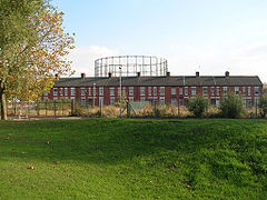
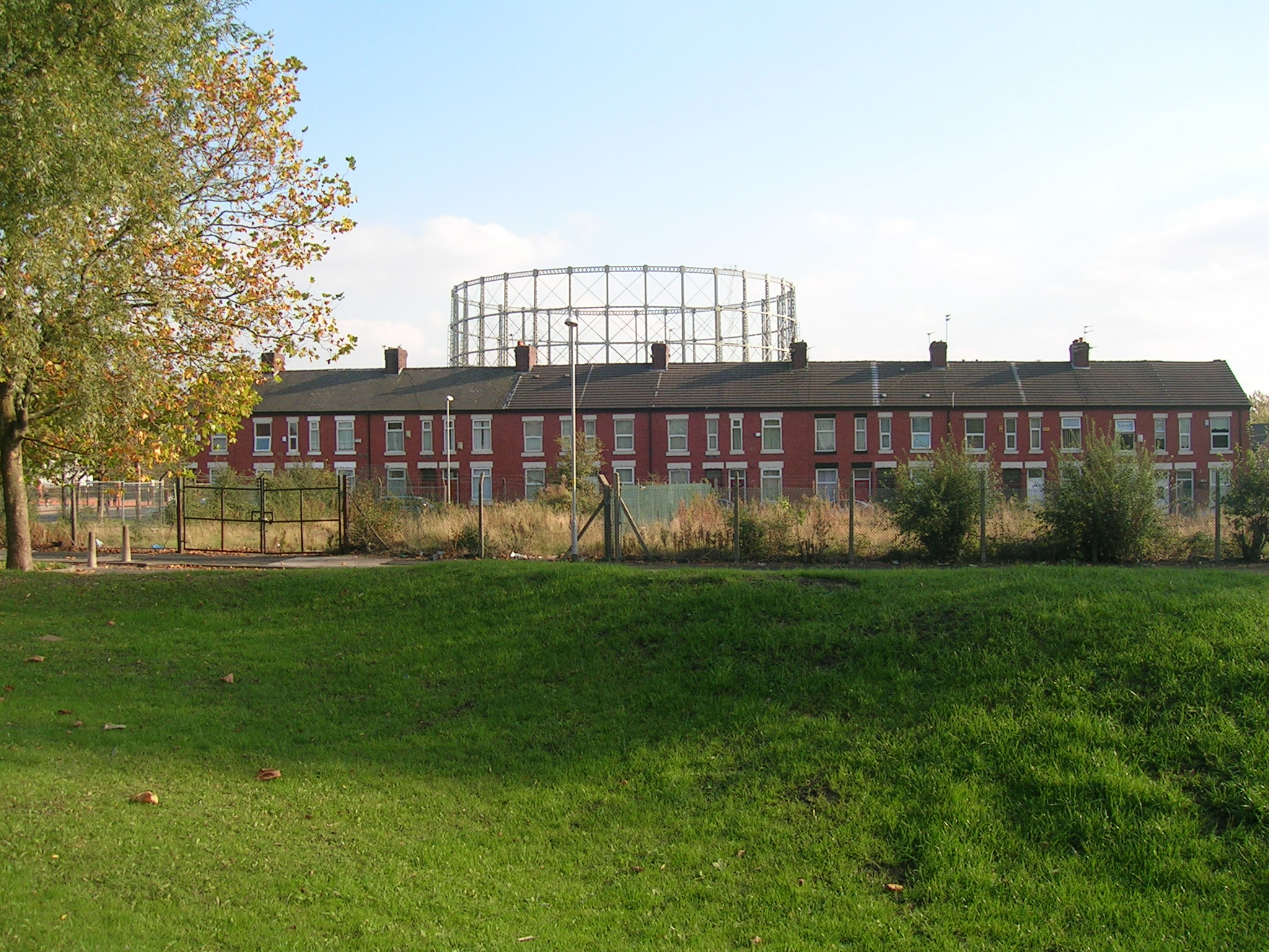
A row of terraced houses in Miles Platting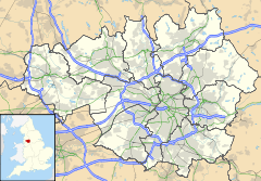
 Miles Platting
Miles Platting shown within Greater ManchesterOS grid reference SJ856992 - London 163 mi (262 km) SE Metropolitan borough Manchester Metropolitan county Greater Manchester Region North West Country England Sovereign state United Kingdom Post town MANCHESTER Postcode district M40 Dialling code 0161 Police Greater Manchester Fire Greater Manchester Ambulance North West EU Parliament North West England UK Parliament Manchester Blackley List of places: UK • England • Greater Manchester Miles Platting is an inner city district of Manchester, England. It is 1.4 miles (2.3 km) east-northeast of Manchester city centre, along the course of the Rochdale Canal and A62 road. It is bound by the localities of Monsall, Collyhurst, Newton Heath, Bradford and Ancoats.
Historically a part of Lancashire, and formerly a part of the township of Newton Heath, Miles Platting began to appear on maps in the 1820s, when it had begun to expand into a factory district as a result of the Industrial Revolution. That industrial growth resulted in a population that became very large for the size of the district, resulting in densely packed back-to-back housing that had degenerated into slums by 1950.
Today, Miles Platting is part of the East Manchester Regeneration Scheme and is undergoing extensive redevelopment and regeneration as some of the last vestiges of the Industrial Revolution are removed.
Contents
History
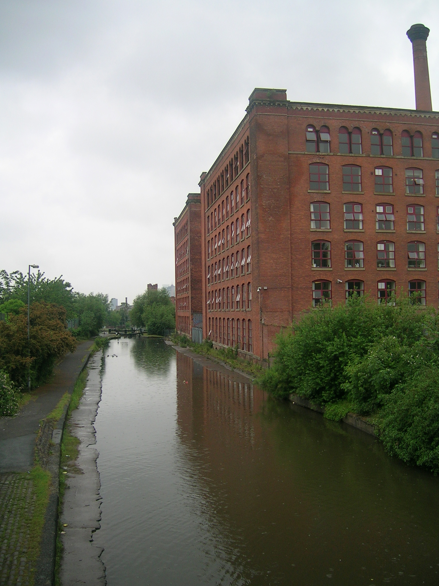
Further information: History of Manchester The Rochdale Canal is routed through Miles Platting.
No early records have been found of Miles Platting, and indeed the area seems not to have appeared on maps until the 1820s.[citation needed] Therefore the origin of the name remains uncertain, but one suggestion is that it may derive from the word platt, meaning a small piece of ground, with miles being a corruption of mills. Hence Miles Platting may mean "mills on a small piece of ground".
Miles Platting certainly did have many mills by the middle of the 19th century; Holland Mill, Victoria Mill and Ducie Mill being amongst the largest. By the 1870s a chemical works, timber yard, gas works and a tannery were also operating in the area alongside the many mills. This volume of industry in such a relatively small area inevitably led to the construction of densely packed back-to-back housing to provide homes for the necessary workforce. By the middle of the 20th century, with the decline in manufacturing industry and the closure of its local industries, Miles Platting had become a slum area inhabited by a deprived, largely white, community. Today, Miles Platting contains just under 2,000 housing units, many of them managed by Manchester City Council, including 12 multi-storey blocks.[1] The area, once recognised as being amongst the most deprived in the UK, has benefited greatly from the very substantial urban regeneration scheme for east Manchester initiated in the late 1990s.
Miles Platting railway station lay at the junction of the lines from Manchester Victoria to Oldham and Stalybridge, but this closed in 1995, and the station was subsequently demolished. The railway line, which remains open for passenger traffic, separates Miles Platting from Collyhurst and Monsall.
Between 1839 and 1844, the area was also the location of Oldham Road railway station, the original terminus for the Manchester and Leeds Railway until the line was extended to Manchester Victoria station in the latter year. The station was then converted to become a major railway goods depot by the Lancashire and Yorkshire Railway, remaining in use until the 1960s.
Governance
Miles Platting was incorporated into the City of Manchester in 1838.[citation needed]
Geography
Further information: Geography of Greater ManchesterNeighbouring areas, districts and suburbs. 
Cheetham Hill Collyhurst Newton Heath Strangeways 
Clayton  Miles Platting

Ancoats Ardwick Bradford Landmarks
A prominent building of Miles Platting is Victoria Mill, a huge former cotton mill which looms over the district and now houses offices and apartments. Its restoration was directed by Fr Dominic Kirkham of Corpus Christi.
Religion
Further information: List of churches in Greater ManchesterHistorically, much of the population of Miles Platting was of Irish Catholic or Italian descent[citation needed], as evidenced by the large Corpus Christi Priory on Varley Street. The basilica has been served since 1889 by the Norbertine (Premonstratensian) Order, becoming an independent canonry of the order in 2004. Due to falling numbers and mounting repair and maintenance costs the basilica is now closed, the final Mass being celebrated by the Bishop of Salford on April 27 2007.
The basilica has now been converted to the Usmania Banqueting Hall. ,ref.http://usmaniabanqueting.com/ | last =
| first =
| authorlink =
| coauthors =
| title = Basilica closes after 118 years
| work =
| publisher = BBC
| date =2007-04-27
| url = http://news.bbc.co.uk/1/hi/england/manchester/6600483.stm
| accessdate = 2007-05-18}}</ref>
From 1880, until the slum clearances of the 1970s, a Salvation Army corps existed here in Cash Street.
Miles Platting is in the Roman Catholic Diocese of Salford,[2] and the Anglican Diocese of Manchester.[3]
References
- ^ "Miles Platting". New East Manchester. http://www.neweastmanchester.com/area_map/3_-_miles_platting/. Retrieved 2007-05-18.
- ^ "Catholic Diocese of Salford". http://www.salforddiocese.org.uk/. Retrieved 2007-05-07.
- ^ "The Church of England Diocese of Manchester". http://www.manchester.anglican.org/default.asp. Retrieved 2007-05-07.
The City of Manchester About Manchester Architecture · (Tallest buildings · Grade I buildings) · Cuisine · Culture · Economy · History · Media · (Television programmes) · Music · (Pop music) · People · Politics · Science · Sociology · Sport · Streets · Symbols · TransportDistricts Ancoats · Ardwick · Ardwick Green · Baguley · Belle Vue · Benchill · Beswick · Blackley · Bradford · Burnage · Castlefield · Cheetham Hill · Chinatown · Chorlton-cum-Hardy · Chorlton-on-Medlock · Chorltonville · City Centre · Clayton · Collyhurst · Crumpsall · Didsbury · Fallowfield · Gay Village · Gorton · Harpurhey · Hulme · Levenshulme · Longsight · Lower Crumpsall · Miles Platting · Moss Side · Moston · Newall Green · New Islington · New Moston · Newton Heath · Northenden · Northern Moor · Northern Quarter · Openshaw · Peel Hall · Piccadilly Village · Ringway · Rusholme · Sharston · Spinningfields · Whalley Range · Withington · Woodhouse Park · WythenshaweCategories:- Districts of Manchester

Wikimedia Foundation. 2010.