- Chorlton Poor Law Union
-
Chorlton Poor Law Union was founded in January 1837 as a consequence of the Poor Law Amendment Act 1834, also known as the New Poor Law.[1] It was overseen by an elected board of 19 guardians representing the 12 parishes in the area it served: Ardwick, Burnage, Chorlton-upon-Medlock, Chorlton with Hardy, Didsbury, Gorton, Hulme, Levenshulme, Mosside, Rusholme, Stretford, and Withington, all in south Manchester, England.[2]
Contents
Background
The Poor Law Amendment Act 1834 placed a legal responsibility on parishes to take responsibility for the poor in their areas by organising into poor law unions, each of which was to have at least one workhouse. The Act discouraged the provision of poor relief except through entry into workhouses,[3] and signalled the construction of more than 500 across England and Wales during the next 50 years.[4]
Early history
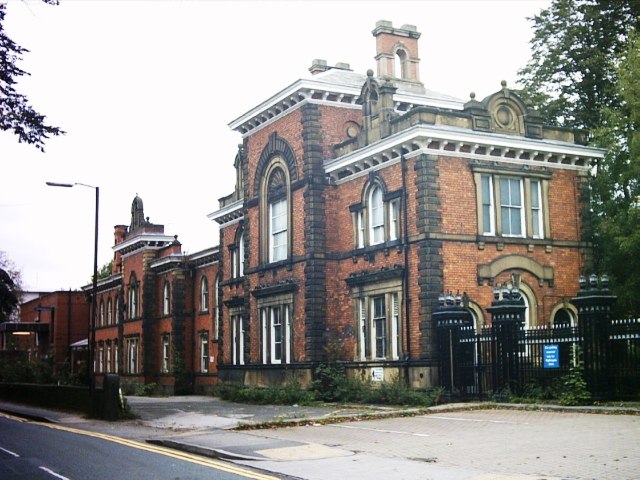
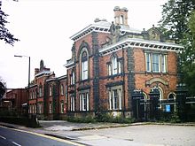 Withington Hospital, 2005
The union's first workhouse, the Stretford Road Workhouse, offered accommodation for 300 inmates, with segregated living areas for various categories of paupers, such as children, lunatics, the elderly, and the sick; female inmates were housed in the west of the building and males in the east, separated by a central communal dining hall and chapel[2]. The population of the area served by the Chorlton Poor Law Union had been 46,465 at the time of the 1831 census, but as it rapidly increased during Manchester's industrialisation it became clear that the capacity of the Stretford Road Workhouse was inadequate for the demands placed on it. As the Stretford Road site offered no scope for expansion the guardians decided to commission the construction of a second workhouse, the Withington Workhouse.[2] Opened in 1855,[5] and costing £53,000 to build, the new workhouse was able to accommodate up to 1500 inmates.[2] The site also included a new cemetery to serve the union's area, the Chorlton Union Cemetery, which remained in use until 1920.[5]
Later developments
In 1910 the Chorlton Union was consolidated into the South Manchester Township,[6] which in turn became part of a unified Manchester Union in 1915, and the workhouse was renamed Withington Hospital.[2]
References
- Notes
- ^ "Poor Law and Workhouse Records: The Poor Law Unions 1834–1929", Manchester City Council, http://www.manchester.gov.uk/info/448/archives_and_local_studies/3812/poor_law_and_workhouse_records/3, retrieved 5 November 2011
- ^ a b c d e "Chorlton, Lancashire", workhouses.org.uk, http://www.workhouses.org.uk/Chorlton/, retrieved 5 November 2011
- ^ Fowler 2007, p. 242
- ^ Fraser 2009, pp. 63–64
- ^ a b "Withington Workhouse and Hospital", National Archives, http://yourarchives.nationalarchives.gov.uk/index.php?title=Withington_Workhouse_and_Hospital, retrieved 5 November 2011
- ^ 1938, p. 136
- Bibliography
- Fowler, Simon (2007), Workhouse: The People: The Places: The Life Behind Closed Doors, The National Archives, ISBN 978-1-905615-28-5
- Fraser, Derek (2009), The Evolution of the British Welfare State (4 ed.), Palgrave Macmillan, ISBN 978-0-230-22466-7
- Simon, Sheena D. (1938), A Century of City Government; Manchester, 1838–1938, G. Allen & Unwin
Categories:- Former subdivisions of England
- Poor Law
Wikimedia Foundation. 2010.