- Oldham Mumps railway station
-
 Oldham Mumps
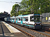
Manchester Metrolink 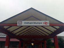
Former railway station's entrance Location Place Oldham Local authority Metropolitan Borough of Oldham Platforms 2 Fare zone information Metrolink Zone Present status Under construction History Opening 1847 Closed 2009 Conversion to Metrolink operation February/March 2012 (temporary station)
2014 (permanent station) Oldham and Rochdale Line

Rochdale Town Centre 
Rochdale Railway Station 
Newbold Kingsway Business Park Milnrow Newhey Shaw and Crompton Derker Oldham Mumps 


Oldham Central 
Oldham King Street 
Westwood 

Freehold South Chadderton Hollinwood Failsworth Newton Heath and Moston Central Park Monsall 

Manchester Victoria 
to Piccadilly  UK Trams portal
Oldham Mumps Railway Station opened on 1 November 1847 and served the town of Oldham, Greater Manchester, England. The station was a primary station located on the Oldham Loop Line 71⁄2 mi (12 km) north east of Manchester Victoria operated and managed by Northern Rail.The name of the station is taken from its situation within the Mumps area of Oldham, which itself probably derived from the archaic word "mumper", slang for a beggar.[1]
The station closed due to the conversion of the line to Metrolink on 3 October 2009 and, by May 2010, had been completely demolished.[2] The station canopy has been saved. It was bought by the East Lancashire Railway after a successful public fundraising campaign.[3][4] It is hoped that the canopy will be installed at Bury Bolton Street.
In June 2010, the Greater Manchester Passenger Transport Executive (GMPTE) announced that as part of the conversion work on the former Oldham loop, it would submit a planning application for a temporary Metrolink terminus at Oldham Mumps, close to the site of the former railway station. The temporary terminus will open by March 2012 and remain in place until a permanent stop is built in 2014, which will be built on the site of the former B&Q store and creating a interchange with buses at Mumps, which is part of the future Metrolink extension through Oldham town centre.[5]
Contents
Description
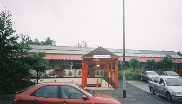
The station was reached across the dual-carriageway Oldham bypass, a difficult walk from the town centre. A pedestrian underpass led to the island platform,where there was a ticket office.
Gallery
-

Station entrance in 1989
-

Station entrance in 2007
-

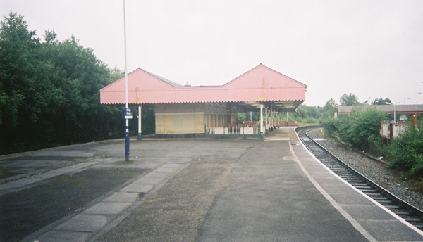
Oldham Mumps 2007
References
- ^ Gibb, Robert (2005). Greater Manchester: A panorama of people and places in Manchester and its surrounding towns. Myriad. p. 28. ISBN 1-904736-86-6.
- ^ http://www.disused-stations.org.uk/o/oldham_mumps/index.shtml
- ^ "East Lancs offered Oldham canopy - but needs your help" (PDF). Railway Herald (211). 2010-02-08. http://www.railwayherald.org/magazine/pdf/RHUK/Issue211.pdf. Retrieved 2010-02-09.
- ^ "Historic canopy saved for railway". BBC News. 2010-02-23. http://news.bbc.co.uk/1/hi/england/manchester/8530283.stm. Retrieved 2010-03-29.
- ^ "Major milestone in construction of Metrolink Interchange". Transport for Greater Manchester. http://www.tfgm.com/2009_news.cfm?news_id=9006985?submenuheader=3. Retrieved 22 June 2011.
External links
The Oldham Loop Line Stations (anticlockwise from Manchester)
(*) Closed 3 October 2009
Dean Lane (*)
Failsworth (*)
Hollinwood (*)
Oldham Werneth (*)
Oldham Mumps (*)
Derker (*)
Shaw and Crompton (*)
New Hey (*)
Milnrow (*)Oldham Lines - Past, Present and Future Legend
To Huddersfield Delph 

Diggle Measurements 


Dobcross 

Saddleworth 

Moorgate Halt 
Uppermill Greenfield 
Friezland To Rochdale 


To Tameside Shaw and Crompton 
Royton 

To Tameside Grasscroft Royton Junction Grotton and Springhead Derker Lees Oldham Mumps Oldham Glodwick Road 
Oldham Central Oldham Central; Oldham Clegg Street King Street To Ashton Westwood Oldham Werneth Chadderton 


MJOB To Middleton and Rochdale 

Freehold Middleton Junction South Chadderton To Manchester 
Hollinwood Failsworth 
To Manchester Preceding station  Manchester Metrolink
Following station Under Construction towards VictoriaOldham and Rochdale Line Derkertowards Rochdale Town CentreProposed towards VictoriaOldham and Rochdale Line Derkertowards Rochdale Town CentreHistorical railways Derker London Midland Region of British Railways
Oldham Loop LineOldham Central Terminus L&YR Oldham Clegg Street MetrolinkStations City zoneAltrincham LineAltrincham · Brooklands · Cornbrook · Dane Road · Navigation Road · Old Trafford · Sale · Stretford · Timperley · Trafford Bar
Bury LineAbraham Moss · Besses o'th' Barn · Bowker Vale · Bury · Crumpsall · Heaton Park · Prestwich · Radcliffe · Whitefield · Woodlands Road
Eccles LineAnchorage · Broadway · Eccles · Exchange Quay · Harbour City · Ladywell · Langworthy · MediaCityUK · Pomona · Salford Quays · Weaste
South Manchester LineChorlton · Firswood · St Werburgh's Road
Operations OperatorsStagecoach Group · Transport for Greater ManchesterVehiclesFlexity Swift M5000 · T-68History Former operatorsTransferred linesClosed stationsAbandoned plansUnder Construction Bury LineQueens Road
East Manchester LineAshton Moss · Ashton Under Lyne · Ashton West · Audenshaw · Cemetery Road · Clayton Hall · Droylsden · Eastlands City Stadium · Edge Lane · Holt Town · New Islington · Velopark
Oldham & Rochdale LineCentral Park · Derker · Failsworth · Freehold · Hollinwood · Kingsway · Monsall · Milnrow · Newbold · Newton Heath and Moston · Newhey · Oldham Central · Oldham King Street · Oldham Mumps · Rochdale railway station · Rochdale Town Centre · Shaw & Crompton · South Chadderton · Westwood
South Manchester LinesBaguley · Barlow Moor Rd. · Benchill · Burton Road · Crossacres · Didsbury · East Didsbury · Hardy Farm · Haveley · Hough End · Manchester Airport · Martinscroft · Moor Road · Northern Moor · Peel Hall · Robinswood Road · Roundthorn · Sale Water Park · Shadowmoss · West Didsbury · Withington · Woodhouse Park · Wythenshawe Town Centre · Wythenshawe Park
Proposed Bury LineBuckley Wells
Trafford Centre LineImperial War Museum · Lostock Parkway · Manchester United · Parkway Circle · Port Salford · Salford Reds · Trafford Centre · Trafford Quays · Village
Stockport LineGorsey Bank · Heaton Mersey · Kings Reach · Stockport Interchange
Second City CrossingExchange Square
Transport for Greater Manchester · UK light rail systemsCoordinates: 53°32′28″N 2°06′08″W / 53.5410°N 2.1022°W
Categories:- History of Oldham
- Disused railway stations in Oldham
- Former Lancashire and Yorkshire Railway stations
- Railway stations opened in 1847
- Railway stations closed in 2009
- Railway stations served by Northern Rail
- DfT Category E stations
- Proposed Manchester Metrolink stations
- Manchester Metrolink Rochdale-Manchester line stations
- Greater Manchester railway station stubs
-


Wikimedia Foundation. 2010.