- Cheadle LNW railway station
-
Cheadle LNW railway station was a railway station that served Cheadle, Cheshire between 1866 and its closure in 1917.
Contents
Construction, location and facilities
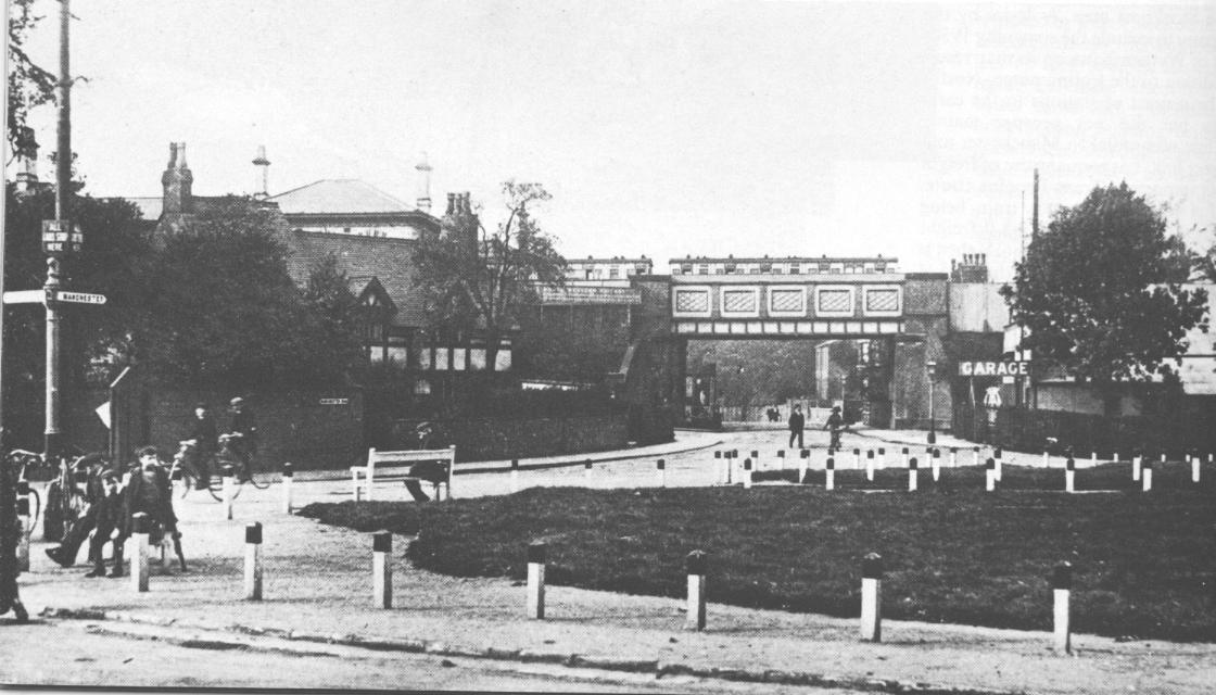
 Cheadle LNW railway station circa 1905, viewed looking south down Manchester Road from Cheadle High Street. The roof of the main station building is seen above a cottage and an LNWR local train stands in the platform. An LNWR sign is affixed to the left hand side of the bridge, promoting services from the station.
The London and North Western Railway completed its line from Stockport Edgeley to Northenden in 1866. The station was opened on 1 August 1866[1] and was located 100 yards (90 m) north of Cheadle High street at the point where the line (still in use) crossed Manchester Road on an over-bridge. The station was located on the western side of the road and was reached by steps leading up to it.[2]. Two platforms were provided. The northern platform handled trains from Warrington to Stockport and the southern side was for trains heading west to Warrington and Liverpool.
Train services and closure
On the opening of the line and the station in 1866, the LNWR immediately commenced operating a passenger train service from Stockport Edgeley, via Cheadle and Northenden to Broadheath, Warrington Arpley and on to Liverpool Lime Street. The service was discontinued on 1 January 1917 and the station was closed that day.[1]
LNWR (and from 1923, London Midland and Scottish Railway) goods trains continued to use the line through the station's site from 1917 until 1948. From that date, the trains were operated by British Railways London Midland Region.
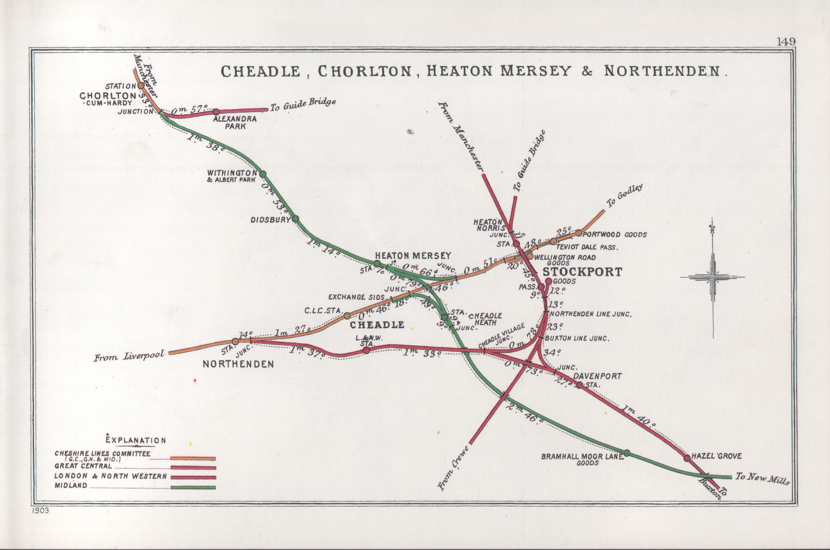
Railway diagram showing Cheadle LNW station and the line to Stockport
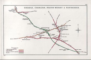 1903 Railway Clearing House diagram of railways through Cheadle showing the L&NWR station and Cheadle CLC to its north.
References
- Notes
- Bibliography
Categories:- Disused railway stations in Stockport
- Former London and North Western Railway stations
Wikimedia Foundation. 2010.