- Manitoba Highway 1
-
Highway 1
Trans-Canada Highway Route information Length: 490 km (304 mi) Existed: 1942 – present Major junctions West end: Hwy 1 towards Whitewood, Saskatchewan  PTH 83 near Virden
 PTH 10 in Brandon
 PTH 5 near Carberry
 PTH 16 near Portage la Prairie
 PTH 75 in Winnipeg
 PTH 12 near Ste. Anne
East end:  Highway 17 towards Kenora, Ontario
Location Major cities: Brandon, Portage la Prairie, Winnipeg Towns: Elkhorn, Virden, MacGregor, Elie, Ste. Anne, Falcon Lake Highway system ←  PTH 110
PTH 1A  →
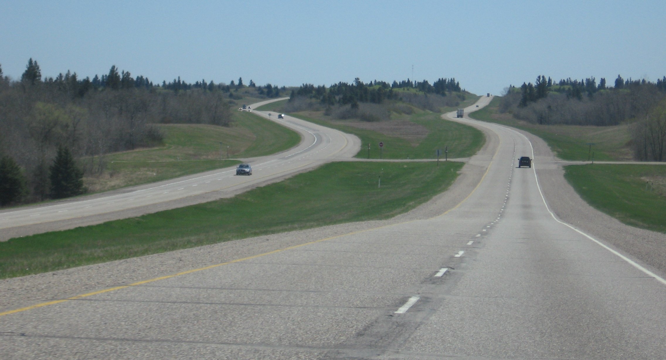
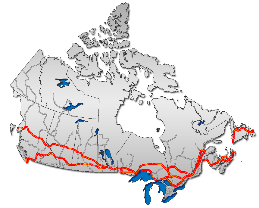
→Provincial Trunk Highway 1 (PTH 1) is the Manitoba section of the Trans-Canada Highway mainline route. It is a heavily used, 4-lane divided highway, with the exception of a short 18 km section in the southeastern corner of the province. It is the main link between southern Manitoba's largest cities, and also serves as the province's main transportation link to the neighbouring provinces of Saskatchewan (to the west) and Ontario (to the east). The highway is the only major east-west divided highway in Manitoba, and carries a large majority of east-west traffic within and through the province. It has full freeway status sections at Portage La Prairie and Winnipeg. The total distance of the Trans-Canada Highway in Manitoba is 490 km (300 mi).
Manitoba Highway 1 is a very important part of the national highway system in Canada, as it is the sole highway linking the eastern and western regions of the country. It is the only road that links the province of Manitoba with the province of Ontario, making it a major section of Canada's primary commercial and leisure route for all traffic travelling between Canada's largest cities, from Toronto and Montreal in the east to Calgary and Vancouver in the west.
Contents
Routing

The highway is routed from west to east across the province of Manitoba. It begins at the western provincial border with Saskatchewan, connecting with Saskatchewan's Highway 1 to become Manitoba Trans-Canada 1. The highway is designated as T-C 1 throughout Manitoba until it reaches the eastern provincial border with Ontario, where it continues as the main route to Kenora, Ontario and the rest of Eastern Canada as Highway 17.
The entire length of the Trans-Canada Highway in the province of Manitoba is a 4-lane divided highway, with the exception of the Winnipeg city route and an 18 kilometre section in eastern Manitoba between the town of Falcon Lake and the Manitoba-Ontario provincial border which is a two-lane highway.
Manitoba PTH 1 has full expressway status on the routes around Winnipeg on the Perimeter Highway, and around Portage La Prairie. Plans do exist to bring the entire length of Highway 1 (except the Winnipeg city route) to full expressway status in the future (mentioned at the list of Manitoba expressways). Currently, exit numbers only exist at two interchanges,[citation needed] and only small sections of Highway 1 and the Perimeter Highway have freeway status.
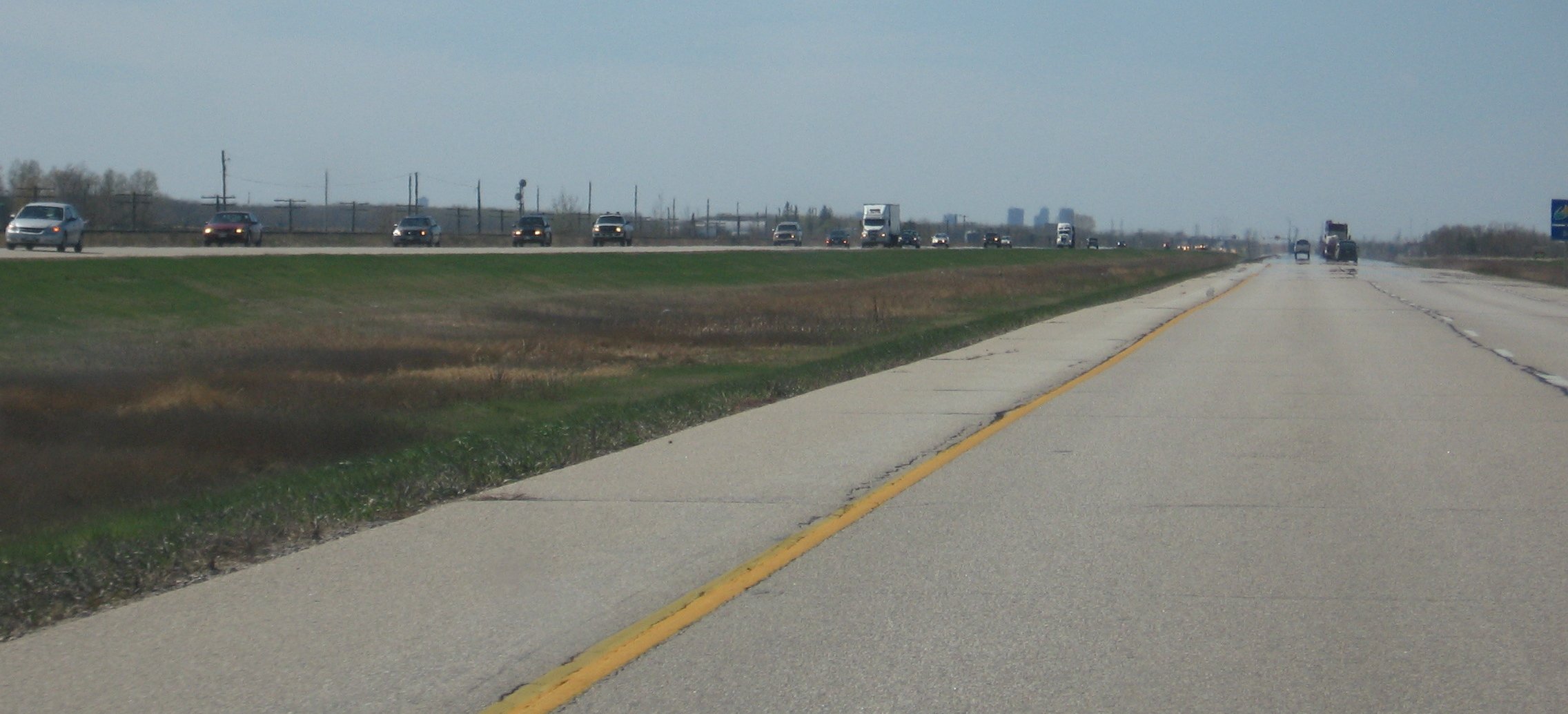
In the Winnipeg metro area, the Trans-Canada Highway has two official routes. The main route passes directly through the city of Winnipeg on city streets, entering the city from the west and continuing along Portage Avenue, Broadway, Main Street, Queen Elizabeth Way, St.Mary's Road, St.Anne's Road, and Fermor Avenue where it re-joins the Perimeter Highway (T-C 100) and continues east on TC 1. An alternate routing exits the main T-C 1 route on the western edge of Winnipeg onto the Perimeter Highway (T-C 100), which by-passes the city completely. The Perimeter Highway is a ring road which encircles Winnipeg and is frequently used by commuters and through traffic on the Trans Canada Highway wishing to avoid congested city streets.
History
The first provincial trunk highways in Manitoba were numbered in 1926.[1] The original highway 1 was one of nine highways fanning out from Winnipeg, but was different in that it fanned out from the west and the east. Highway 1 was routed via many already-existing highways and provincial secondary roads. (From west to east), these are [2][3][4]:
- Highway 1A into and out of Brandon
- Provincial Road 351 into and out of Carberry
- Highway 1A through Portage la Prairie
- Highway 26 from Portage la Prairie to Headingley
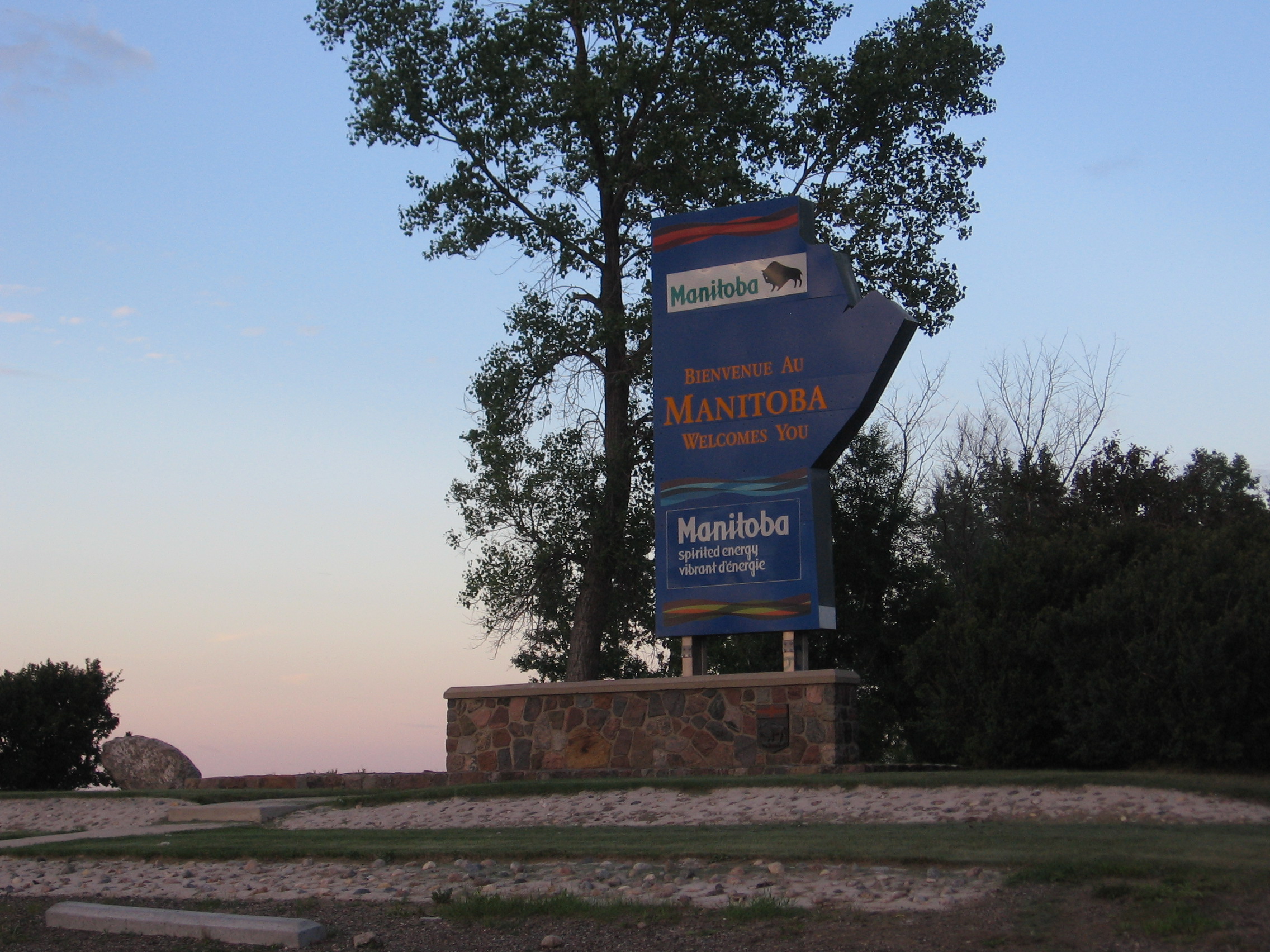
 The "Welcome to Manitoba" sign, entering Manitoba from Saskatchewan at the provincial border on TCH 1.
- Highway 59 from downtown Winnipeg to Highway 44
- Highway 44 to Whiteshell Provincial Park
By the early 1950s, Highway 1 had become an important east-west route in all of the western provinces. Most of the provincial highways that Highway 1 originally traversed on were re-numbered and designated as Highway 4 in the mid-1960s, and the #1 was relocated to its present route. In 1962, the Trans-Canada Highway in Manitoba was fully completed, and Highway 1 across all of the western provinces was incorporated as part of the Trans-Canada Highway.
In 1955, most intra-city traffic in the Winnipeg area was diverted onto the (then) newly-built Perimeter Highway. Later that year, the Perimeter Highway's southern (PTH 100) section was merged with the Trans-Canada Highway system, due to the amount of traffic using it to bypass the city. That section of the highway was highly used, and still is today.
Recent History
On October 6, 2006 the Trans-Canada Highway Portage La Prairie by-pass was closed due to a structural defect found in the bridge over the CN Rail Line. On October 31, 2007, a $19 million project to rebuild the bridge was completed, and the by-pass was fully re-opened to traffic.
On October 25, 2007, a major federal/provincial construction project twinning the highway in western Manitoba between the Saskatchewan-Manitoba provincial border and the town of Hargrave was completed, with 34 kilometres (21 mi) of newly divided highway lanes opened to traffic.
On April 9, 2008, the Government of Manitoba announced that construction of a new interchange will begin in the summer of 2008 at the intersection of Highway 16 (the Yellowhead Highway) and the Trans Canada Highway mainline route, located a short distance west of Portage la Prairie.[5]
Speed limits
On February 27, 2008 the Manitoba Highway Traffic Board approved a request by the Government of Manitoba to raise the speed limit on the Trans Canada Highway in Manitoba to 110 km/h along the section between the Saskatchewan-Manitoba border and Winnipeg.[6] The speed limit was officially raised on July 1, 2009, though it was only raised on one portion of the highway between the Saskatchewan border to Virden.[7] The remainder of the highway is still at 100 km/h, but this may change in the future.
Saskatchewan border to Virden- 110 km/h (68 mph)
Virden- 80 km/h (50 mph)
Western Manitoba- 100 km/h (60 mph)
Brandon- 80 km/h (50 mph)
Portage La Prairie (Freeway)- 100 km/h (60 mph)
Elie- 80 km/h (50 mph)
Headingley-70 km/h (40 mph)
Winnipeg bypass (Perimeter Hwy. PTH #100) - 100 km/h (60 mph)
Winnipeg city route
Portage Ave. - 60 km/h (35 mph) (50 km/h (30 mph) in downtown)
Broadway - 50 km/h (30 mph)
Queen Elizabeth Way. (S. Main Street) - 60 km/h (35 mph)
St. Mary's Rd. - 60 km/h (35 mph)
St. Annes Rd. - 60 km/h (35 mph)
Fermor Ave. (To Lagimodiere Blvd.) - 70 km/h (40 mph)
Fermor Ave. (To Perimeter Hwy.) - 90 km/h (55 mph)
Eastern Manitoba- 100 km/h (60 mph)
All at-grade intersections with traffic lights -80 km/h (50 mph)
List of exits/intersections
The following is a list of exits/intersections along PTH 1. Only named (in cities and towns only) and numbered highway intersections are included. (In Winnipeg, only major road intersections are included). This list is routed from West to East, starting at the Saskatchewan-Manitoba border to the Manitoba-Ontario border.
Saskatchewan border to Brandon
km Municipality Location Interescting highway Notes 0 Wallace R.M. Saskatchewan-Manitoba Border Manitoba section of Trans-Canada Highway
PTH 1 begins6 Kirkella  PTH 41 north – McAuley, St. Lazare, Binscarth
PR 542 south – Kola18 Elkhorn PR 256 (Cavendish St.) – McAuley, Cromer, Pierson 19 Maharg Rd. 20 Richhill Ave. / Mile 66N formerly PR 441 east 32 Hargrave Mile 158W formerly PR 252 south 35 PTH 83 north – Miniota, Birtle, Russellbegin PTH 83 south concurrence 40 PR 259 east – Lenore, Kenton 41 PTH 83 south – Pipestone, Melita, Minotend PTH 83 south concurrence 44 Virden Thomas Dr. 45 King St. Secondary access to PR 259 east – Lenore, Kenton 48 PR 257 west – Kola 62 Sifton R.M. PR 254 south – Oak Lake Beach begin PR 254 north concurrence 67 Oak Lake PR 254 north – Lenore end PR 254 north concurrence 80 Griswold  PTH 21 – Shoal Lake, Hamiota, Hartney, Deloraine
92 Whitehead R.M. Alexander PR 250 north – Rivers, Newdale begin PR 250 south concurrence 96 PR 250 south – Souris end PR 250 south concurrence 104 PTH 1A east – Brandon (City Route)PTH 1 turns northeast and descends into Grand Valley
trucks required to stay on PTH 1 due to a substandard railway underpass east of Kemnay on PTH 1A
PTH 1A is known as Victoria Avenue and 1st Street inside Brandon city limits109 PR 459 east (Grand Valley Rd.) – Brandon PTH 1 passes over the Assiniboine River and turns east after ascending out of Grand Valley 112 Elton R.M. / Cornwallis R.M. PR 270 north – Rapid City, Basswood Brandon
km City Location Interescting highway Notes 120 Brandon PTH 10 south – Boissevain, International Peace Garden18 Street N.
begin PTH 10 north concurrence121 Black St. 122 PTH 10 north – Minnedosa, Wasagaming, Dauphin
PTH 1A west – City Center1 Street N.
end PTH 10 north concurrenceBrandon to Portage La Prairie
km Municipality Location Interescting highway Notes 130 Elton R.M. / Cornwallis R.M. PTH 110 south / PR 468 – Justice, Chater138 PR 340 south – Douglas, Shilo, Wawanesa 146 North Cypress R.M. PR 464 north – Brookdale 147 PR 351 east – Carberry 163 PTH 5 – Neepawa, Carberry, Glenboro, Cartwright181 PR 351 west – Melbourne, Carberry 183 North Norfolk R.M. Sidney PR 352 – Edrans, Arden, Birnie 195 Austin  PTH 34 – Gladstone, Holland, Pilot Mound
208 MacGregor PR 350 – Woodside, Katrime, Lavenham 218 Bagot PR 242 – Westbourne, Treherne, Somerset 230 Portage La Prairie R.M. Bloom PTH 16 west (YH) – Gladstone, Neepawa, Minnedosa, Russell
PR 305 south – Hood BridgeYellowhead Highway (not numbered)
continues along PTH 1 to WinnipegPortage La Prairie
km City Location Interescting highway Notes 238 Portage La Prairie PTH 1A east – Portage La Prairie (City Route)Saskatchewan Avenue W. 247 PR 240 – Delta Beach, Portage La Prairie, St. Claude River Rd. 252 PTH 1A west – Portage La Prairie (City Route)Saskatchewan Avenue E.
westbound exit only253  PTH 26 east – Poplar Point, St. François Xavier
Portage La Prairie to Winnipeg
km Municipality Location Interescting highway/road/street Notes 268 Portage La Prairie R.M.  PTH 13 south – Oakville, Elm Creek, Carman
PR 430 north – Poplar Point, St. Ambroise276 Fortier Road formerly PR 331 west 279 Cartier R.M. Benard Benard Road formerly PR 426 north 287 Elie PR 248 – Marquette, St. Eustache, Fannystelle 296 PR 332 south – Dacotah, Starbuck, Brunkild 304 PR 424 – St. Eustache, Springstein formerly PR 241 306 PTH 26 west – St. François Xavier, Poplar Point311 Headingley Gaol Road Gaol Road access to Headingley Correctional Centre 313 PR 334 north (Dobbs Road) – Rosser begin PR 334 south concurrence 314 Hudson St 314 PR 334 south (Monterey Road) – Sanford end PR 334 south concurrence 315 Lyons Street / Bresaylor Road 316 Cameron Street / Inglenook Road 318 Race Track Road / McCarthy Street Race Track Road access to Assiniboia Downs 319 
 PTH 101 north / PTH 100 east – Falcon Lake, Kenora
Perimeter Highway
PTH 1 enters Winnipeg with Route 85 as Portage AvenueWinnipeg
(Major roads only, as there are many local roads PTH 1 intersects.)
km Municipality Location Interescting highway/route/street Notes 319.5 Winnipeg Buchanan Blvd. 320.5 Cavalier Dr.
321 Westwood Dr. 323 Sturgeon Rd. 325 Route 96 south – Moray St 327 Route 90 – Century St northbound access to Winnipeg International Airport 327.5 Empress St northbound access to Polo Park Shopping Centre and Canad Inns Stadium 329 Broadway PTH 1 diverts right on to Broadway from Portage Avenue
Yellowhead Highway continues along Portage Avenue and ends at Main St329.5 Route 70 south – Maryland St 329.5 Route 70 north – Sherbrook St 330.5 Route 62 – Osborne St Manitoba Legislature is located on south-east corner 331 Route 42 south – Donald St 331 Route 42 north – Smith St 331.5 Route 52 – Main St PTH 1 turns right on Main St. 332 joins Queen Elizabeth Way, from the Main Street Bridge to the Norwood Bridge PTH 1 crosses the Assiniboine River and the Red River;
route now becomes St. Mary's Road332 Route 115 east – Marion St 335 St. Anne's Rd PTH 1 turns left from St. Mary's Rd 337 Route 135 – Fermor Ave. / Route 150 south – St. Anne's Rd PTH 1 turns left on Fermor Ave. 339 Route 30 north – Archibald St. access to St. Boniface and the Winnipeg Stock Yards 342  PTH 59 / Route 20 – Lagimodiere Blvd.
southbound access to the Royal Canadian Mint 345 Plessis Rd. 349 PTH 101 north / PTH 100 west – Portage la Prairie, BrandonPerimeter Highway
PTH 1 leaves WinnipegWinnipeg to Ontario border
km Municipality Location Interescting highway Notes 351 Springfield R.M. PR 207 – Birds Hill, Lorette, Ste. Anne 359 Taché R.M. PR 206 north – Dugald, Oakbank begin PR 206 south concurrence 362 PR 206 south – Landmark end PR 206 south concurrence 366 PR 501 east – Ste. Geneniéve, Ross 373 Ste. Anne R.M. PTH 12 – Beausejour, Ste. Anne, Steinbach, Piney, Warroad385 PR 207 west – Ste. Anne, Lorette 392 Richer PR 302 – Beausejour, La Broquerie, Vita 418 Reynolds R.M. Forestry Rd. formerly PR 506 north 432  PTH 11 north – Elma, Whitemouth, Lac Du Bonnet, Powerview-Pine Falls
434 PR 503 east 440 PR 506 north (Birch River Road) 454 PR 308 south – East Braintree, Moose Lake, Sprague 476 Whiteshell Provincial Park PR 301 east – Falcon Lake, Star Lake 486  PTH 44 west – West Hawk Lake, Whitemouth, Beausejour, Lockport
490 Manitoba-Ontario Border PTH 1 ends
Trans-Canada Highway continues as Highway 17 to Kenora and Thunder BaySee also
References
- ^ "A.C. Emmett and the Development of Manitoba's Highways". The Government of Manitoba. http://www.gov.mb.ca/chc/hrb/plaques/plaq0348.html. Retrieved 2008-02-03.
- ^ "Official map of Western Canada, 1946". The H.M. Gousha Company. http://www.ontarioroadmaps.ca/Oil_Companies/Shell/1946/Maps/WCanada.jpg. Retrieved 2008-02-03.
- ^ "Route map of central and west North America, 1938". R. V. Droz. Archived from the original on 2009-10-26. http://www.webcitation.org/query?url=http://www.geocities.com/rvdroz/us38nw.jpg&date=2009-10-26+01:56:48. Retrieved 2008-02-03.
- ^ "The Atlas of Canada -- Major Roads, 1955". The Atlas of Canada. http://atlas.nrcan.gc.ca/site/english/maps/archives/3rdedition/economic/transportationandcommunications/085?w=4&h=4&l=2&r=0&c=0. Retrieved 2008-02-03.
- ^ Province of Manitoba | News Releases | Budget 2008 Charts Steady Course: Selinger
- ^ http://www.etrucker.com/apps/news/article.asp?id=67017 Manitoba to raise speed limit
- ^ http://www.gov.mb.ca/chc/press/top/2009/03/2009-03-25-150700-5575.html
Preceded by
SK Highway 1Trans-Canada Highway
MB Highway 1Succeeded by
 ON Highway 17
Preceded by
MB Highway 16Preceded by
MB Highway 100Succeeded by
MB Highway 100Highways in Manitoba Primary Secondary Winnipeg City Routes  Portions of the Trans-Canada Highway
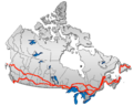 British Columbia: Highway 1 • Highway 5 • Highway 16 | Alberta: Highway 1 • Highway 16
Saskatchewan: Highway 1 • Highway 16 | Manitoba: Highway 1 • Highway 16 • Highway 100
Ontario: Highway 17 • Highway 69 • Highway 400 • Highway 12 • Highway 7 • Highway 71 • Highway 11 • Highway 66 • Highway 417
Quebec: Autoroute 40 • Autoroute 25 • Autoroute 20 • Autoroute 85 • Route 185 • Route 117 • Autoroute 15
New Brunswick: Route 2 • Route 16 | Confederation Bridge | Prince Edward Island: Route 1 | Nova Scotia: Highway 104 • Highway 105 • Highway 106
Newfoundland: Route 1 Category ·
  Portal ·
  WikiProjectCategories:
- Manitoba provincial highways
- Expressways in Manitoba
- Trans-Canada Highway

Wikimedia Foundation. 2010.