- National Register of Historic Places listings in South Side Chicago
-
For places listed on the National Register in the rest of Chicago, see National Register of Historic Places listings in North Side Chicago, National Register of Historic Places listings in Central Chicago or National Register of Historic Places listings in West Side Chicago, for Cook County, see National Register of Historic Places listings in Cook County, Illinois.
There are 78 sites on the National Register of Historic Places listings in South Side Chicago, out of 326 listings in the City of Chicago. The South Side is defined for this article as the area west of Lake Michigan and south of 26th Street and the Chicago Sanitary and Ship Canal to the southern Chicago city limits.
Contents
South Side Chicago listings on the National Register
The listed properties are distributed across 19 of the 77 well-defined community areas of Chicago.
-
- This National Park Service list is complete through NPS recent listings posted November 10, 2011.[1]
[2] Landmark name[3] Image Date listed[3] Location[3] Neighborhood Description 1 Robert S. Abbott House 
December 8, 1976 4742 S. Dr. Martin Luther King Jr. Drive
41°48′36″N 87°36′58″W / 41.81°N 87.61611°WGrand Boulevard Home of Robert S. Abbott, founder of the Chicago Defender newspaper 2 Armour Square 
August 19, 2003 Bounded by W. 33rd Street, W. 34th Place, S. Wells Street and S. Shields Avenue
41°50′1″N 87°38′2″W / 41.83361°N 87.63389°WArmour Square 3 AVR 661 November 19, 1980 Calumet Harbor
41°39′43″N 87°34′30″W / 41.66194°N 87.575°WSouth Deering 4 Belmonte Flats February 5, 1998 4257-4259 S. Dr. Martin Luther King Jr. Drive, and 400-412 E. 43rd Street
41°49′0″N 87°36′17″W / 41.816667°N 87.60472°WGrand Boulevard 5 Calumet Park 
August 21, 2003 9801 S. Avenue G
41°43′0″N 87°31′41″W / 41.716667°N 87.52806°WEast Side 6 Chicago Beach Hotel 
May 14, 1986 5100-5110 S. Cornell Avenue
41°48′8″N 87°35′13″W / 41.80222°N 87.58694°WHyde Park 7 Chicago Bee Building 
April 30, 1986 3647-3655 S. State Street
41°49′41″N 87°37′34″W / 41.82806°N 87.62611°WDouglas 8 Arthur H. Compton House 
May 11, 1976 5637 S. Woodlawn Avenue
41°47′31″N 87°35′47″W / 41.79194°N 87.59639°WHyde Park 9 Cornell Square August 11, 2005 1809 W. 50th Street
41°48′8″N 87°40′16″W / 41.80222°N 87.67111°WNew City 10 Davis Square August 18, 2003 Roughlu bounded by W. 44th Street, W, 45th Street, S. Marshfield Avenue and S. Hemitage Avenue
41°48′47″N 87°40′3″W / 41.81306°N 87.6675°WNew City 11 Oscar Stanton De Priest House 
May 15, 1975 4536-4538 S. Dr. Martin Luther King, Jr. Drive
41°48′42″N 87°37′5″W / 41.81167°N 87.61806°WGrand Boulevard 12 Douglas Tomb State Memorial 
May 28, 1976 636 E. 35th Street
41°49′54″N 87°36′30″W / 41.83167°N 87.60833°WDouglas 13 East Park Towers 
May 14, 1986 5236-5252 S. Hyde Park Boulevard
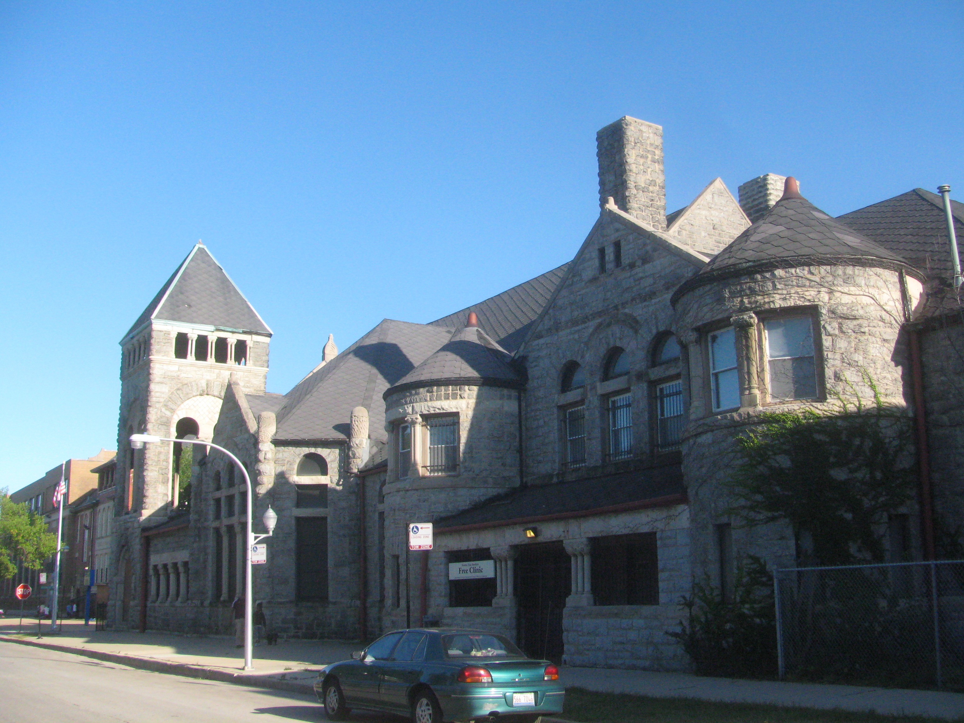
41°47′59″N 87°35′4″W / 41.79972°N 87.58444°WHyde Park 14 Eighth Regiment Armory 
April 30, 1986 3533 S. Giles Avenue
41°49′50″N 87°37′10″W / 41.83056°N 87.61944°WDouglas 15 Site of First Self-Sustaining Nuclear Reaction 
October 15, 1966 S. Ellis Avenue between E. 56th Street and 57th Street
41°47′33″N 87°36′4″W / 41.7925°N 87.60111°WHyde Park 16 Flamingo-on-the-Lake Apartments 
May 14, 1986 5500-5520 S. Shore Drive
41°47′41″N 87°34′51″W / 41.79472°N 87.58083°WHyde Park 17 Four Nineteen Building August 12, 1999 419 E. 83rd Street
41°44′41″N 87°36′8″W / 41.74472°N 87.60222°WChatham 18 Fuller Park November 20, 2002 331 W. 45th Street
41°48′46″N 87°38′3″W / 41.81278°N 87.63417°WFuller Park 19 Garden Homes Historic District February 28, 2005 Roughly bounded by S. Wabash Avenue, E. 87th Street, S. Indiana Avenue and E. 89th Street
41°44′11″N 87°37′18″W / 41.73639°N 87.62167°WChatham 20 Goldblatt Bros. Department Store 
November 15, 2006 4700 S. Ashland Avenue
41°48′30″N 87°39′55″W / 41.80833°N 87.66528°WNew City 21 Grand Crossing Park August 8, 2006 7655 S. Ingleside Avenue
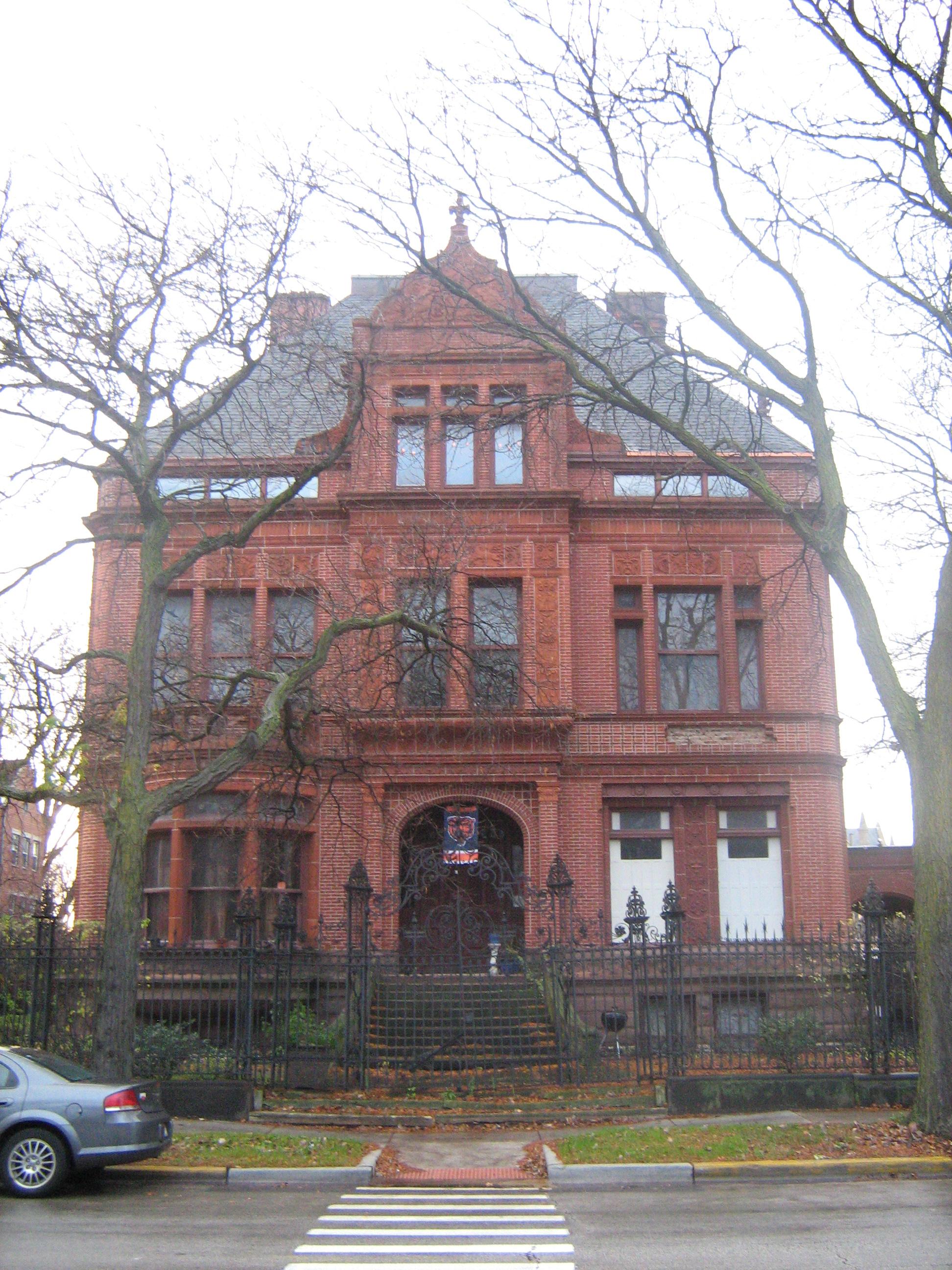
41°45′25″N 87°36′1″W / 41.75694°N 87.60028°WGreater Grand Crossing 22 John W. Griffiths Mansion 
March 5, 1982 3806 S. Michigan Avenue
41°49′32″N 87°37′26″W / 41.82556°N 87.62389°WDouglas 23 Hamilton Park April 20, 1995 513 W. 72nd Street
41°45′42″N 87°38′14″W / 41.76167°N 87.63722°WEnglewood 24 Anton E. Hanson House February 9, 2006 7610 S. Ridgeland Avenue
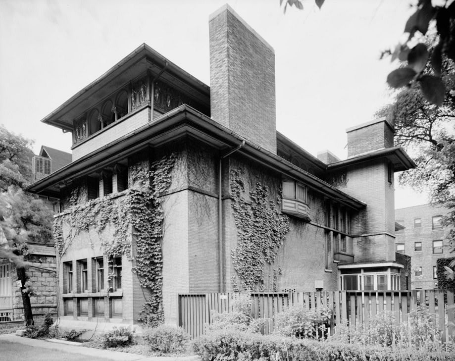
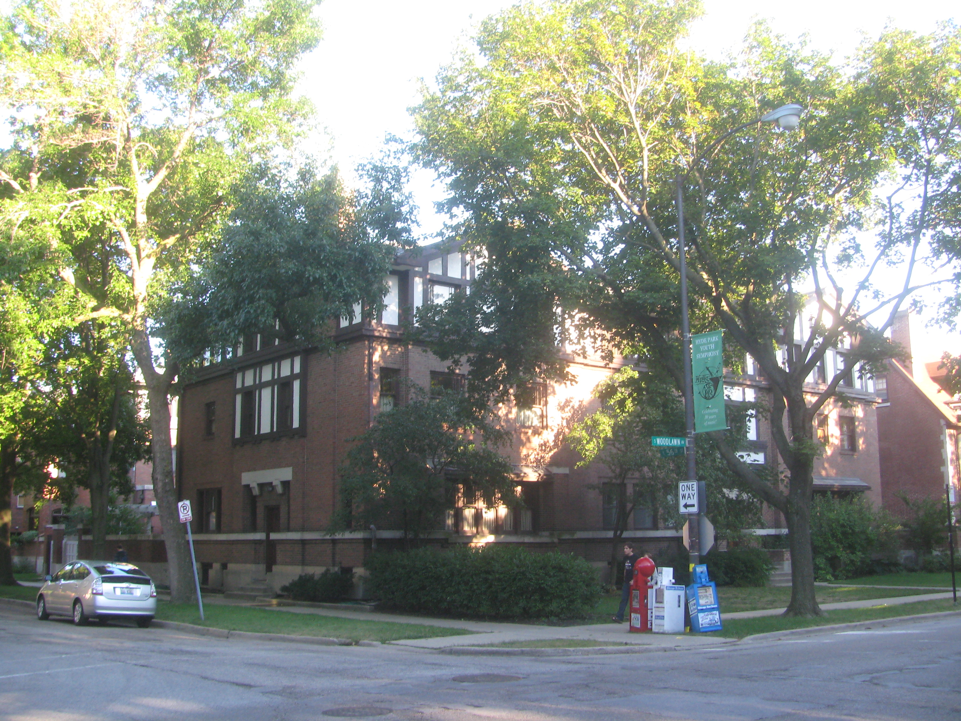
41°45′31″N 87°34′57″W / 41.75861°N 87.5825°WSouth Shore 25 Isadore H. Heller House 
March 16, 1972 5132 S. Woodlawn Avenue
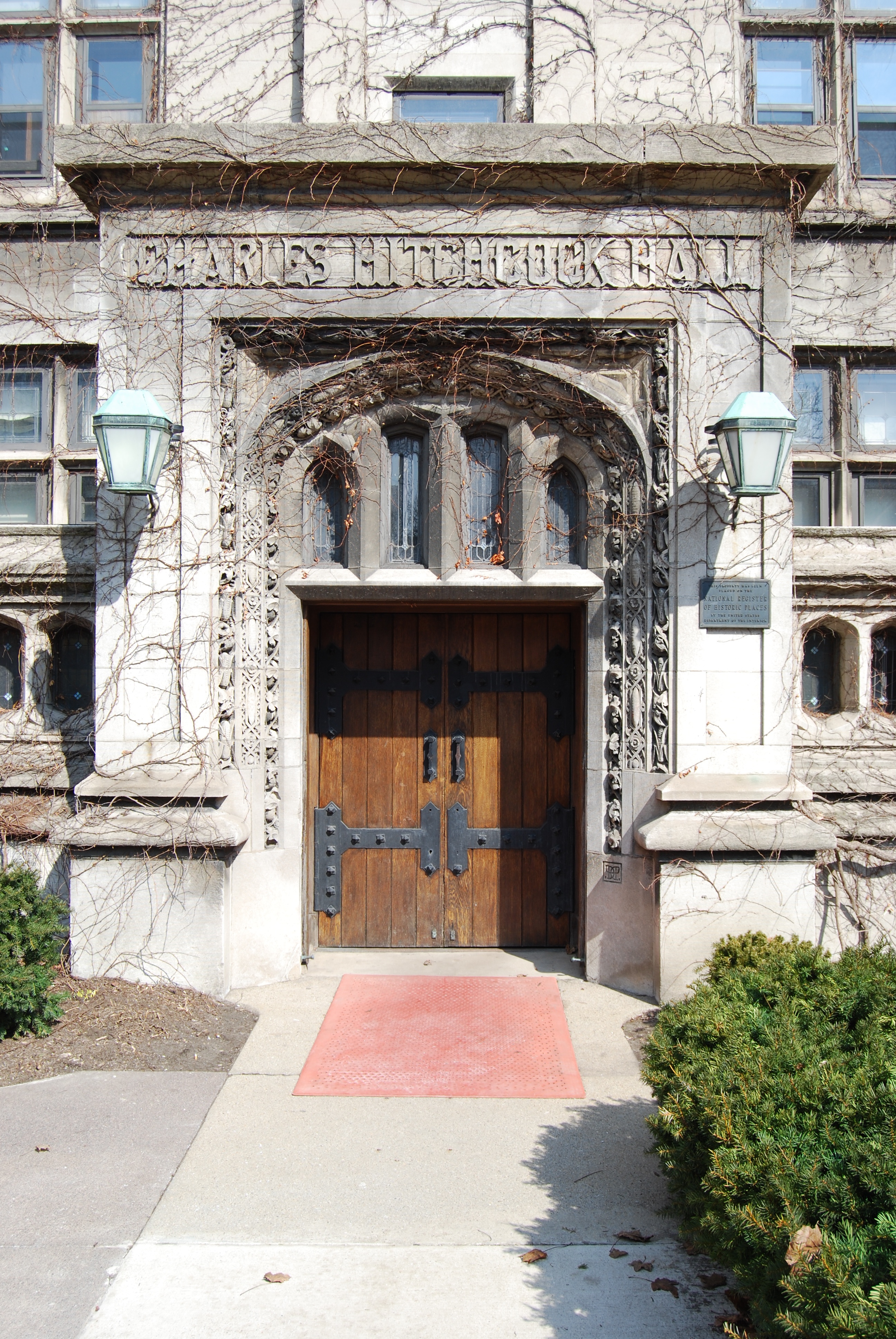
41°48′5″N 87°35′35″W / 41.80139°N 87.59306°WHyde Park 26 Charles Hitchcock Hall 
December 30, 1974 1009 E. 57th Street
41°47′28″N 87°36′3″W / 41.79111°N 87.60083°WHyde Park 27 Hotel Del Prado 
May 14, 1986 5307 S. Hyde Park Boulevard
41°47′58″N 87°35′2″W / 41.79944°N 87.58389°WHyde Park 28 Hotel Windermere East 
October 19, 1982 1642 E. 56th Street
41°47′35″N 87°35′0″W / 41.79306°N 87.583333°WHyde Park 29 Hyde Park-Kenwood Historic District February 14, 1979 Roughly bounded by E. 47th Street and E. 59th Street, S. Cottage Grove Avenue and S. Lake Park Avenue; also 821-829 and 816-826 E. 49th Street; also 825-833 and 837-849 E. 52nd Street
41°47′53″N 87°35′51″W / 41.79806°N 87.5975°WHyde Park and Kenwood Second and third sets of boundaries represent boundary increases of August 16, 1984 and May 16, 1986 respectively 30 Illinois Institute of Technology Academic Campus 
August 12, 2005 Roughly bounded by 31st Street, State Street, 35th Street and the Dan Ryan Expressway
41°50′6″N 87°37′42″W / 41.835°N 87.62833°WDouglas 31 Jackson Park Historic Landscape District and Midway Plaisance 
December 15, 1972 Jackson and Washington Parks and Midway Plaisance roadway
41°46′48″N 87°34′38″W / 41.78°N 87.57722°WHyde Park, Washington Park and Woodlawn 32 Jackson Shore Apartments 
April 12, 2010 5490 S. Shore Drive
41°47′43.80″N 87°34′51.10″W / 41.7955°N 87.580861°WHyde Park 33 Jeffery-Cyril Historic District May 5, 1986 7146-7148, 7128-7138 S. Cyril Avenue, 7144-7148, 7147 and 7130 S. Jeffrey Boulevard, and 1966-1974 E. 71st Place
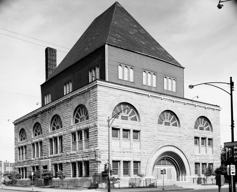
41°45′53″N 87°34′36″W / 41.76472°N 87.57667°WSouth Shore 34 Kehilath Anshe Ma'ariv Synagogue 
April 26, 1973 3301 S. Indiana Avenue
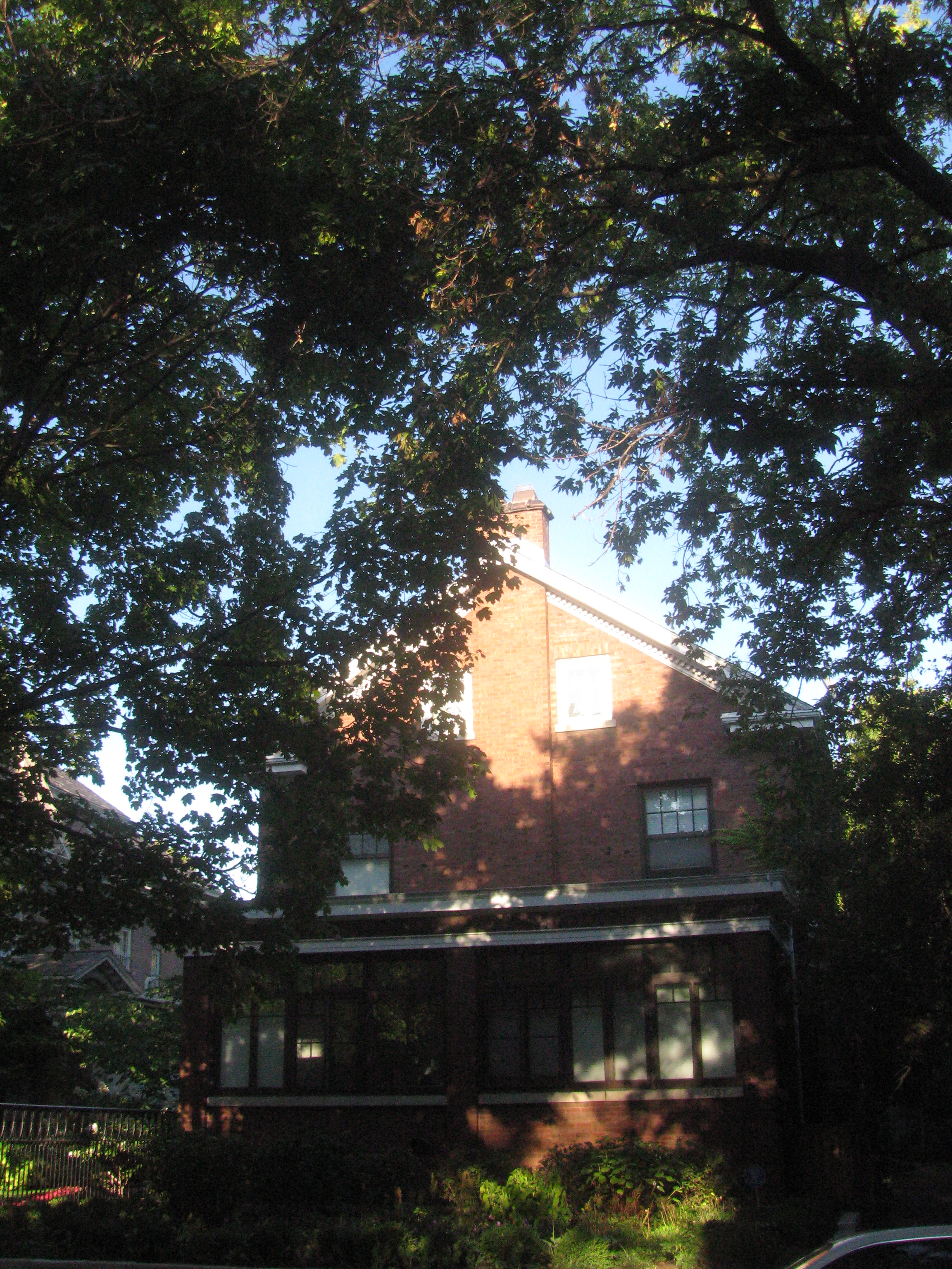
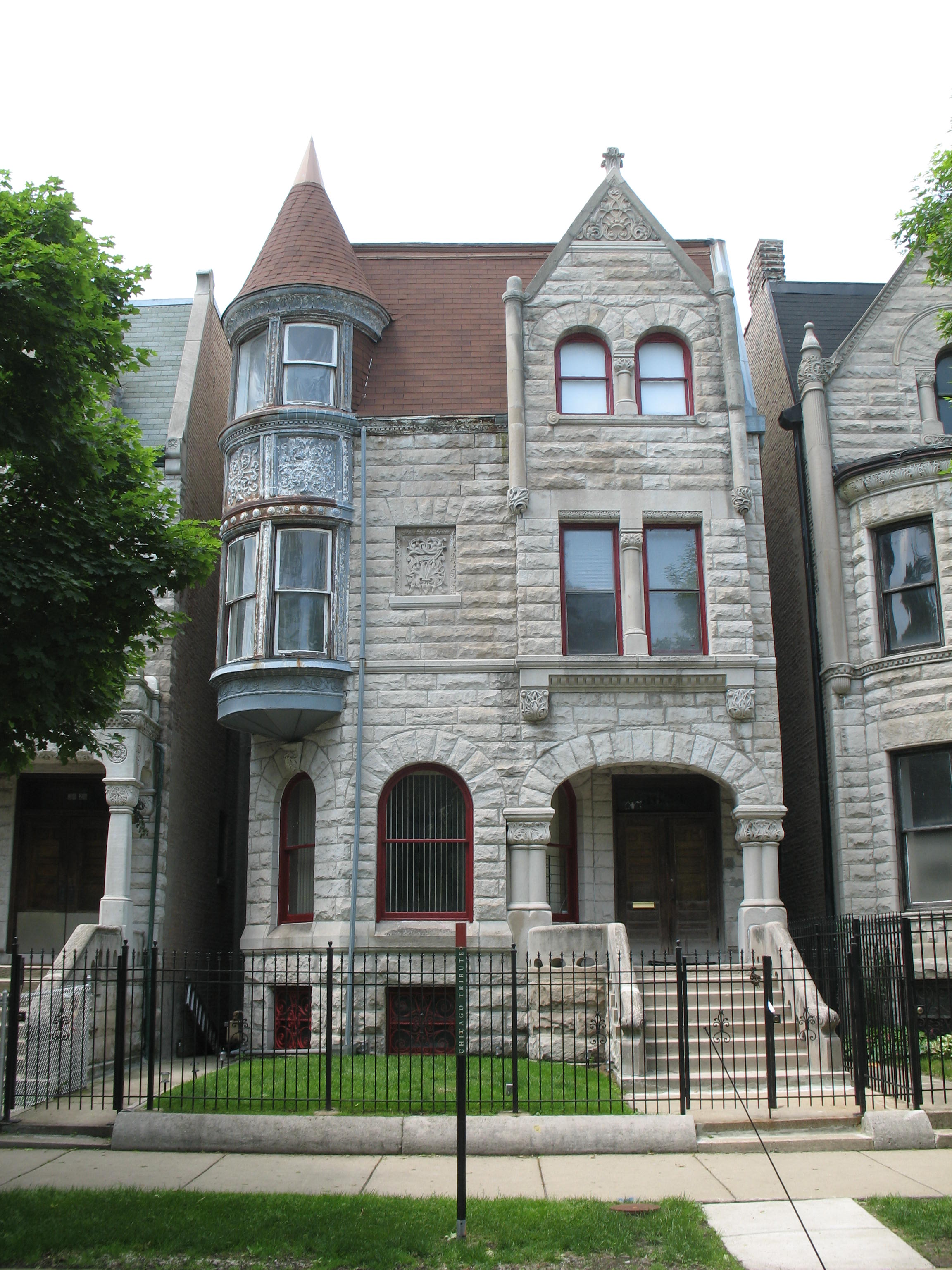
41°50′4″N 87°37′20″W / 41.83444°N 87.62222°WDouglas 35 Sydney Kent House 
November 17, 1977 2944 S. Michigan Avenue
41°50′26″N 87°37′27″W / 41.84056°N 87.62417°WDouglas 36 Kenwood Evangelical Church 
May 16, 1991 4600-4608 S. Greenwood Avenue
41°48′41″N 87°36′0″W / 41.81139°N 87.6°WKenwood 37 Lake-Side Terrace Apartments November 13, 1984 7425-7427 S. South Shore Drive
41°45′44″N 87°33′25″W / 41.76222°N 87.55694°WSouth Shore 38 Frank R. Lillie House 
May 11, 1976 5801 S. Kenwood Avenue
41°47′22″N 87°35′34″W / 41.78944°N 87.59278°WHyde Park 39 Mayfair Apartments May 14, 1986 1650-1666 E. 56th Street
41°47′43″N 87°35′3″W / 41.79528°N 87.58417°WHyde Park 40 Allan Miller House August 23, 1991 7121 S. Paxton Avenue
41°45′57″N 87°34′16″W / 41.76583°N 87.57111°WSouth Shore 41 Robert A. Millikan House 
May 11, 1976 5605 S. Woodlawn Avenue
41°47′34″N 87°35′47″W / 41.79278°N 87.59639°WHyde Park 42 The Narragansett 
April 18, 2005 1640 E. 50th Street
41°48′16″N 87°35′5″W / 41.80444°N 87.58472°WKenwood 43 Old Stone Gate of Chicago Union Stockyards 
December 27, 1972 W. Exchange Avenue & S. Peoria Street
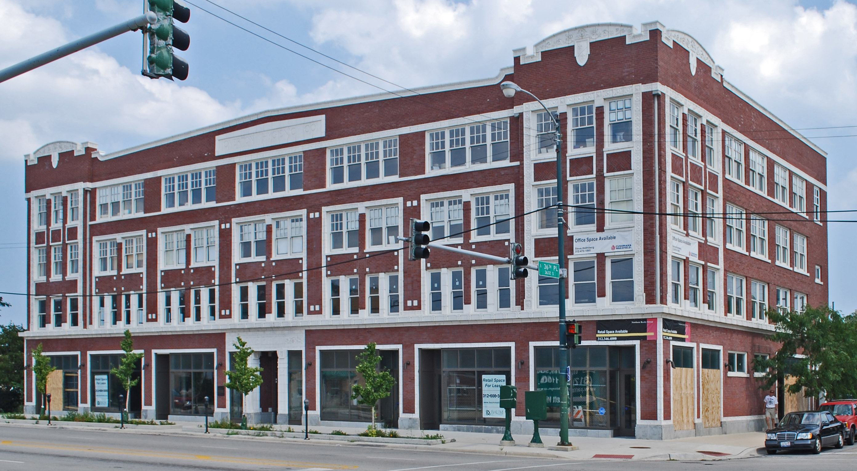
41°49′7″N 87°38′54″W / 41.81861°N 87.64833°WNew City 44 Overton Hygienic Building 
April 30, 1986 3619-3627 S. State Street
41°49′41″N 87°37′34″W / 41.82806°N 87.62611°WDouglas 45 Palmer Park August 30, 2007 201 E. 111th Street
41°41′33.35″N 87°37′5.62″W / 41.6925972°N 87.6182278°WRoseland 46 Poinsettia Apartments 
May 14, 1986 5528 S. Hyde Park Boulevard
41°47′39″N 87°35′3″W / 41.79417°N 87.58417°WHyde Park 47 Promontory Apartments 
November 21, 1996 5530-5532 S. Shore Drive
41°47′39″N 87°34′51″W / 41.79417°N 87.58083°WHyde Park 48 Pullman Historic District 
October 8, 1969 Bounded by E. 103rd Street, C.S.S. and S.B. Railroad spur tracks, E. 115th Street and S. Cottage Grove Avenue
41°41′50″N 87°36′34″W / 41.69722°N 87.60944°WPullman 49 Ridge Historic District 
May 28, 1976 Roughly bounded by RR tracks, W. 87th Street, S. Prospect Avenue, S. Homewood Avenue, W. 115th Street, S. Lothair Avenue, S. Hamilton Avenue, and S. Western Avenue
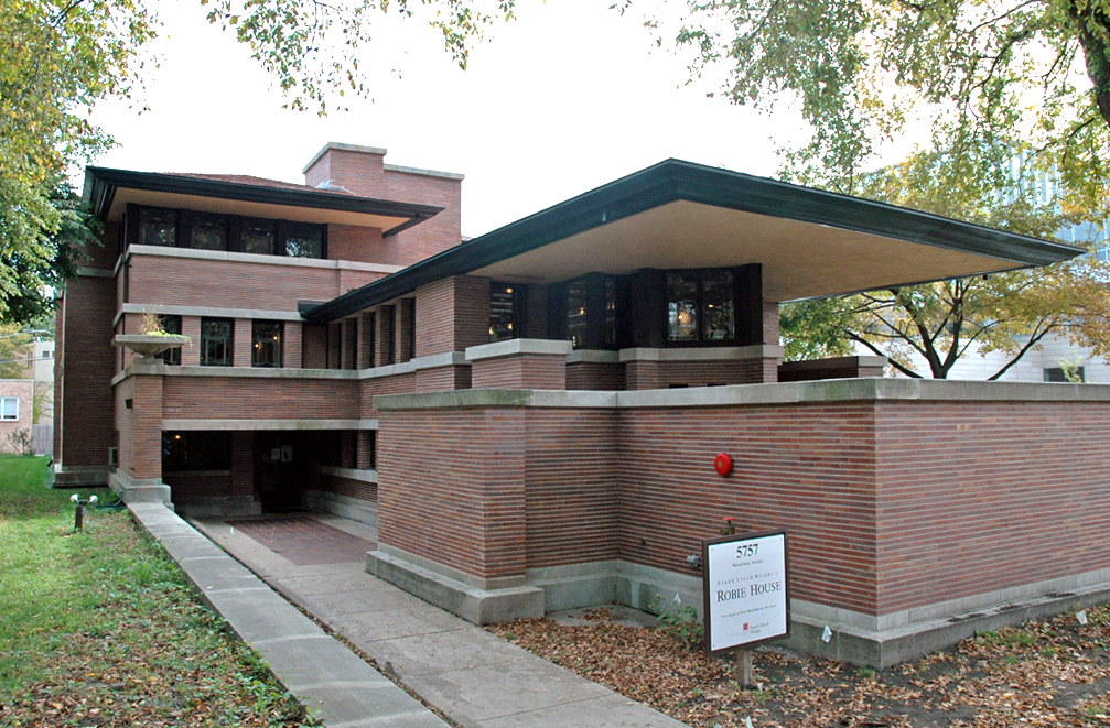
41°42′36″N 87°40′13″W / 41.71°N 87.67028°WBeverly and Morgan Park 50 Frederick C. Robie House 
October 15, 1966 5757 S. Woodlawn Avenue
41°47′23″N 87°35′45″W / 41.78972°N 87.59583°WHyde Park 51 Martin Roche-John Tait House 
November 8, 2000 3614 S. Dr. Martin Luther King Jr. Drive
41°49′46″N 87°37′4″W / 41.82944°N 87.61778°WDouglas 52 Robert Roloson Houses 
June 30, 1977 3213-3219 S. Calumet Avenue
41°50′8″N 87°37′4″W / 41.83556°N 87.61778°WDouglas 53 Room 405, George Herbert Jones Laboratory, The University of Chicago 
May 28, 1967 S. Ellis Avenue between E. 57th Street and 58th Street
41°47′25″N 87°36′4″W / 41.79028°N 87.60111°WHyde Park 54 Rosenwald Apartment Building August 13, 1981 4618 - 4646 S. Michigan Avenue
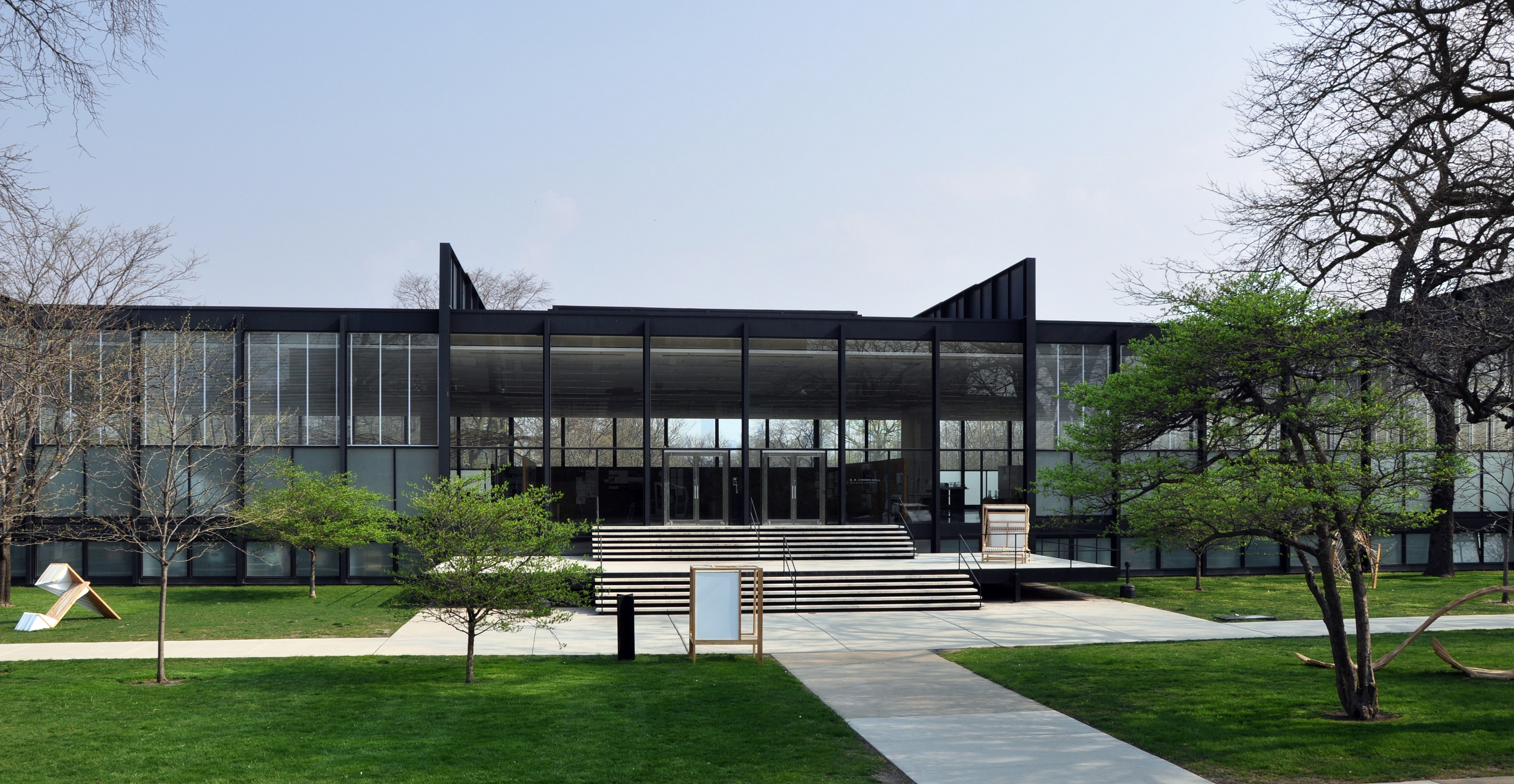
41°48′37″N 87°37′26″W / 41.81028°N 87.62389°WGrand Boulevard 55 S.R. Crown Hall 
August 7, 2001 3360 S. State Street
41°50′0.9″N 87°37′36.3″W / 41.833583°N 87.62675°WDouglas 56 St. Thomas Church and Convent 
December 18, 1978 5472 S. Kimbark Avenue
41°47′44″N 87°35′43″W / 41.79556°N 87.59528°WHyde Park 57 Schulze Baking Company Plant 
November 12, 1982 40 E. Garfield Boulevard
41°47′44″N 87°37′29″W / 41.79556°N 87.62472°WWashington Park 58 Sherman Park 
May 21, 1990 Bounded by W. 52nd Street, S. Racine Avenue, W. Garfield Boulevard, and S. Loomis Street
41°47′48″N 87°39′18″W / 41.79667°N 87.655°WNew City 59 Shoreland Hotel 
May 14, 1986 5450-5484 S. Shore Drive
41°47′45″N 87°34′52″W / 41.79583°N 87.58111°WHyde Park 60 South Park Manor Historic District February 25, 2004 Roughly bounded by S. Dr. Martin Luther King Jr. Drive., S. State Street, E. 75th Street and E. 79th Street
41°45′25″N 87°37′9″W / 41.75694°N 87.61917°WGreater Grand Crossing 61 South Shore Beach Apartments June 9, 1976 7321 S. South Shore Drive
41°45′50″N 87°33′34″W / 41.76389°N 87.55944°WSouth Shore 62 South Shore Bungalow Historic District December 10, 2008 Bounded roughly by S. Crandon Avenue on the East, E. 78th Street on the South, S. Clyde Avenue on the West, E. 75th Street on the North
41°45′12.61″N 87°34′7.18″W / 41.7535028°N 87.5686611°WSouth Shore 63 South Shore Country Club 
March 4, 1975 7059 S. South Shore Drive
41°46′11″N 87°33′46″W / 41.76972°N 87.56278°WSouth Shore 64 Spiegel Office Building 
February 18, 2009 1038 W. 35th Street
41°49′50″N 87°39′9″W / 41.83056°N 87.6525°WBridgeport 65 Sutherland Hotel May 4, 2011 4659 S. Drexel Blvd.
41°48′35″N 87°36′12″W / 41.80972°N 87.60333°WKenwood 66 Swift House June 9, 1978 4500 S. Michigan Avenue
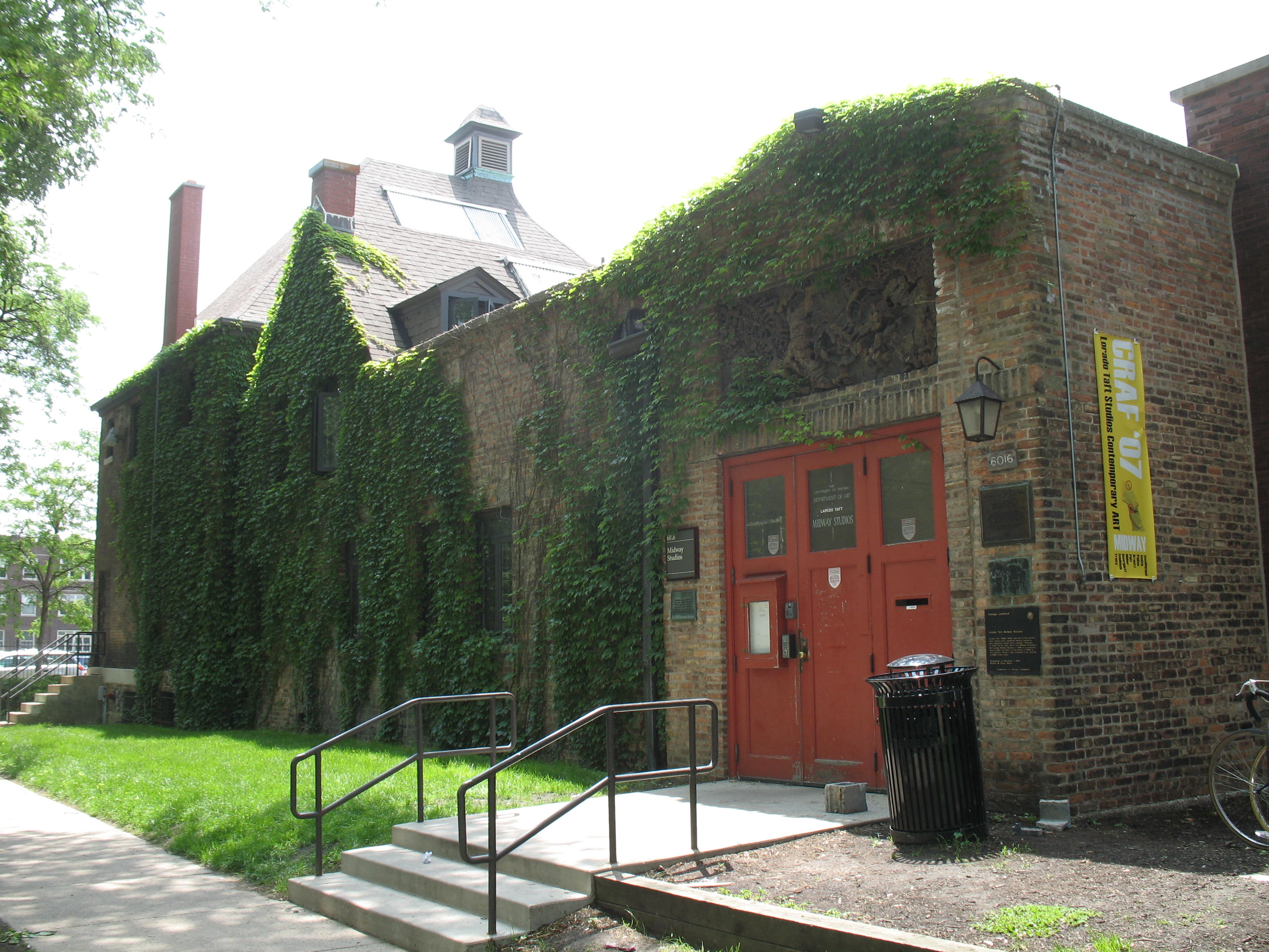
41°48′47″N 87°37′24″W / 41.81306°N 87.62333°WGrand Boulevard 67 Lorado Taft Midway Studios 
October 15, 1966 6016 S. Ingleside Avenue
41°47′8″N 87°36′13″W / 41.78556°N 87.60361°WWoodlawn 68 Trumbull Park April 20, 1995 2400 E. 105th Street
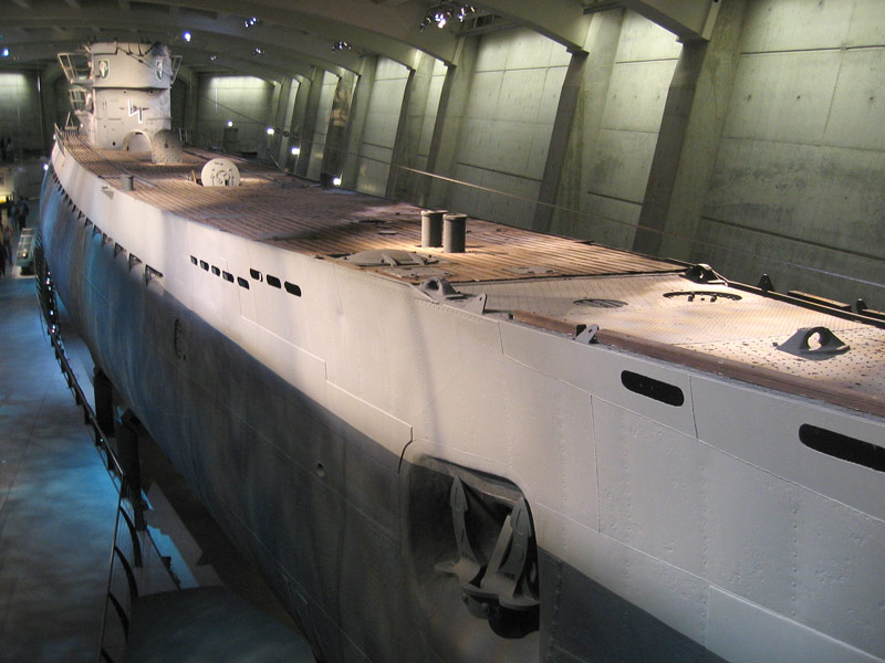
41°42′23″N 87°33′52″W / 41.70639°N 87.56444°WSouth Deering 69 German submarine U-505 
June 29, 1989 Jackson Park
41°47′31″N 87°34′55″W / 41.79194°N 87.58194°WHyde Park 70 Unity Hall 
April 30, 1986 3140 S. Indiana Avenue
41°50′16″N 87°37′21″W / 41.83778°N 87.6225°WDouglas 71 University Apartments 
December 22, 2005 1401 and 1451 E. 55th Street;1401 and 1450 E. 55th Place
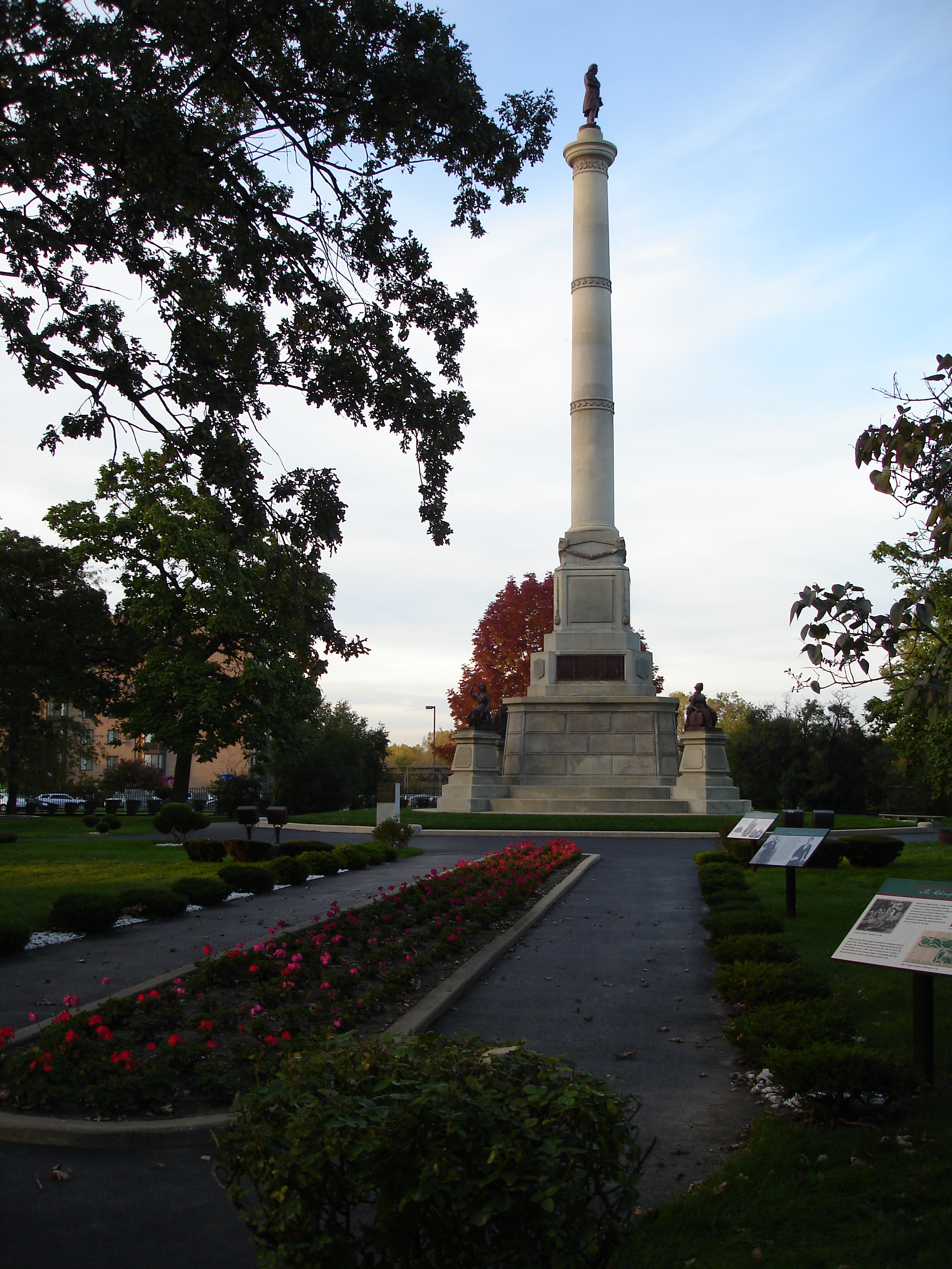
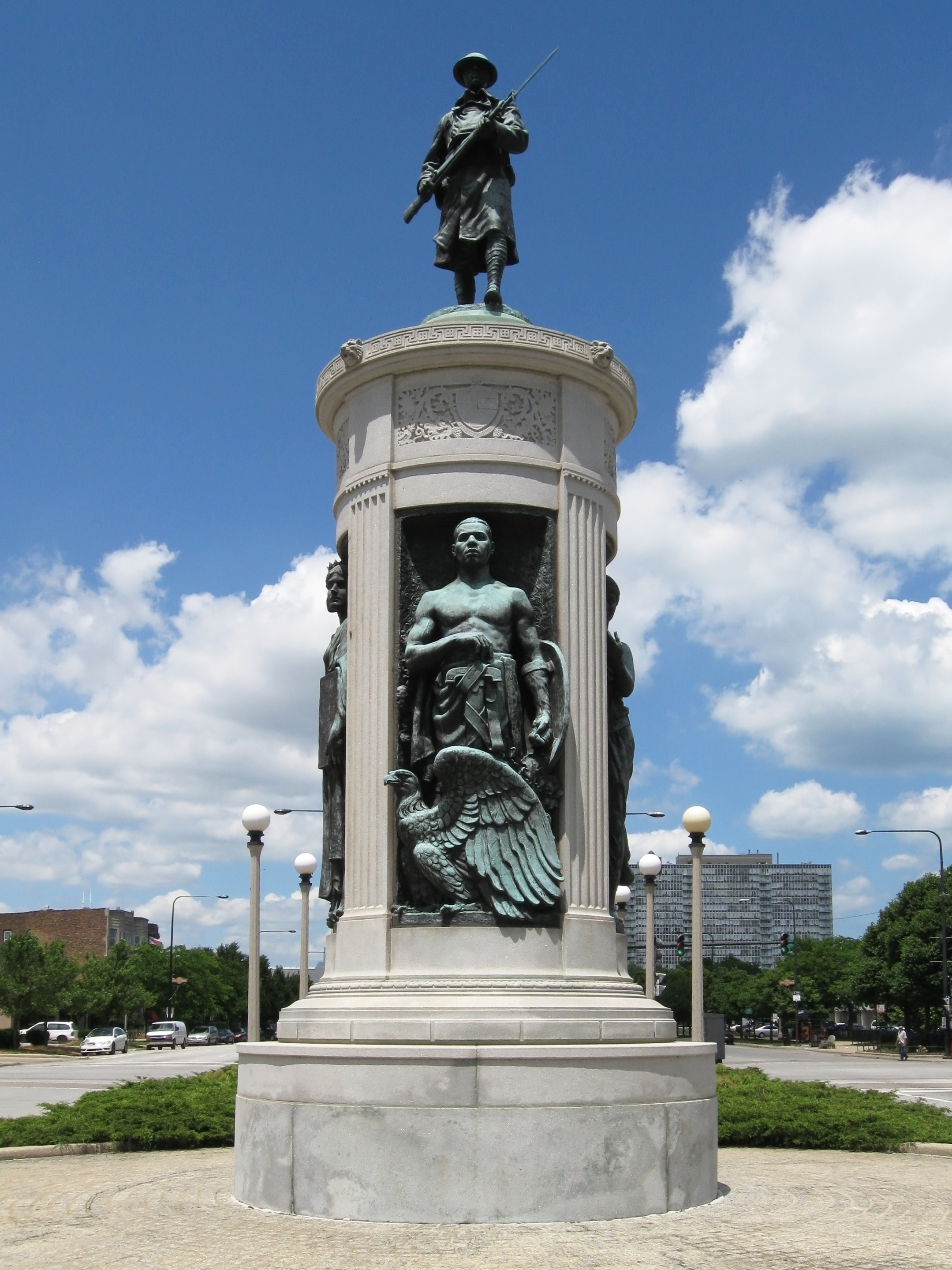
41°47′50″N 87°35′27″W / 41.79722°N 87.59083°WHyde Park 72 Victory Sculpture 
April 30, 1986 E. 35th Street at S. Dr. Martin Luther King Jr. Drive
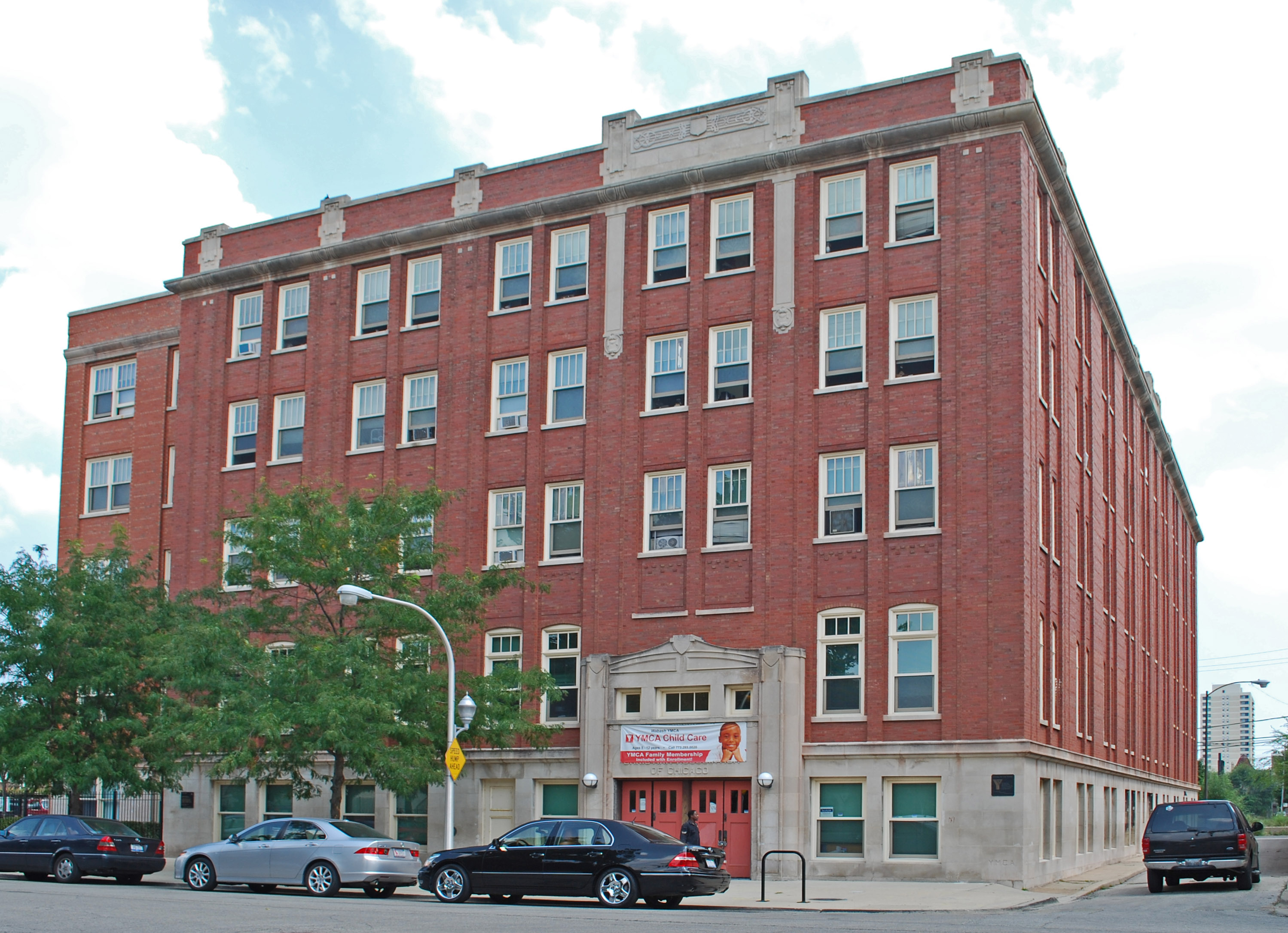
41°49′52″N 87°37′3″W / 41.83111°N 87.6175°WDouglas 73 Wabash Avenue YMCA 
April 30, 1986 3763 S. Wabash Avenue
41°49′33″N 87°37′29″W / 41.82583°N 87.62472°WDouglas 74 Washington Park 
August 20, 2004 5531 S. Dr. Martin Luther King Jr. Drive
41°47′45″N 87°36′40″W / 41.79583°N 87.61111°WWashington Park 75 Ida B. Wells-Barnett House 
May 30, 1974 3624 S. Martin Luther King Jr. Drive
41°49′47″N 87°37′3″W / 41.82972°N 87.6175°WDouglas 76 West Chatham Bungalow Historic District April 19, 2010 Bounded roughly by S. Perry Ave (E), 82nd St. (S), S. Stewart Ave. (W), and W. 79th St. (N)
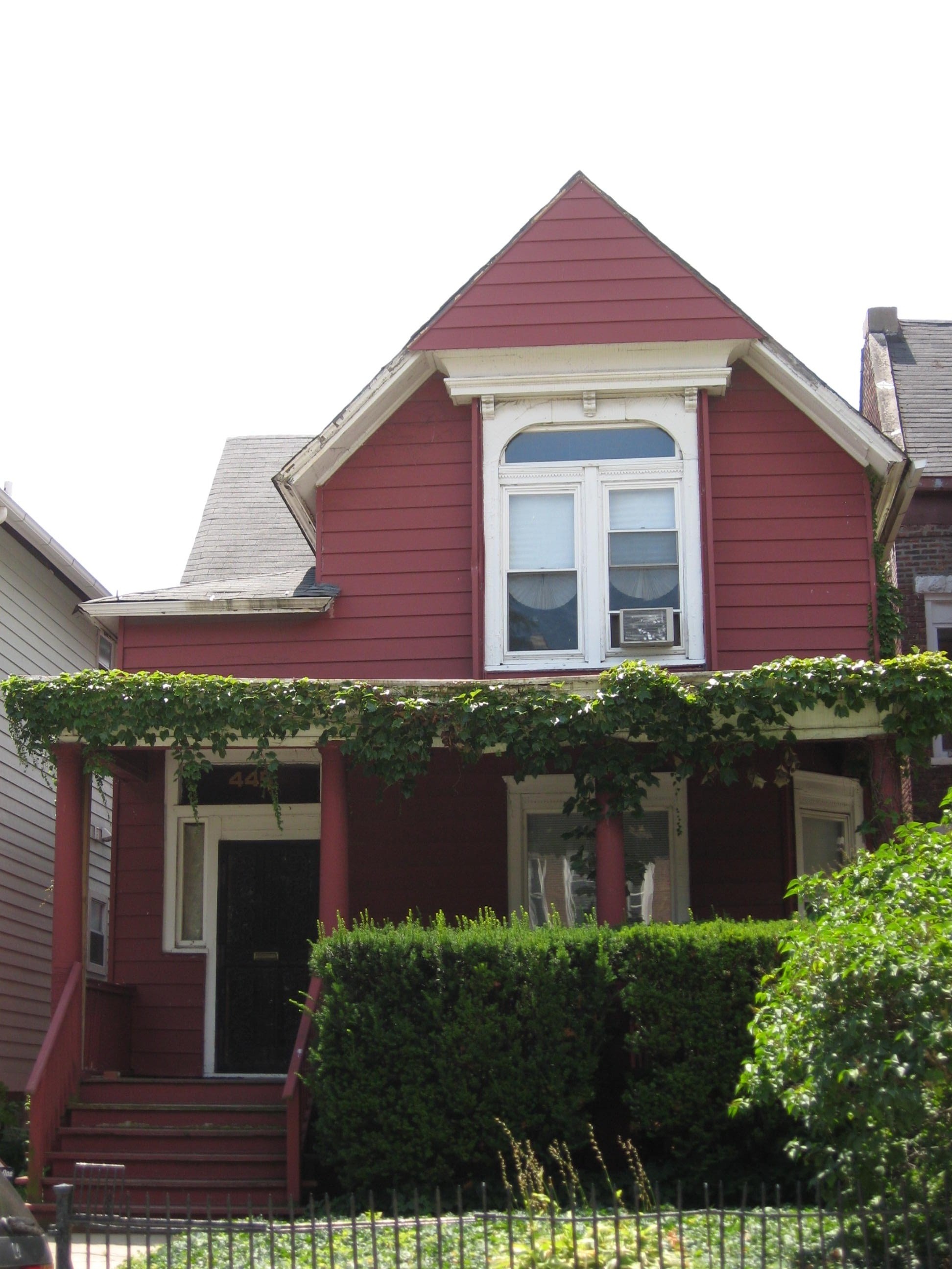
41°44′53.43″N 87°37′50.08″W / 41.748175°N 87.6305778°WChatham 77 Dr. Daniel Hale Williams House 
May 15, 1975 445 E. 42nd Street
41°49′7″N 87°36′55″W / 41.81861°N 87.61528°WGrand Boulevard 78 The Yale 
March 5, 1998 6565 S. Yale Avenue
41°46′28″N 87°37′53″W / 41.77444°N 87.63139°WEnglewood Key
NRHP-listed ∞ NRHP-listed Historic district * National Historic Landmark and NRHP-listed ∞ National Historic Landmark and NRHP-listed Historic district See also
- List of Chicago Landmarks
- List of Registered Historic Places in Illinois
- List of National Historic Landmarks in Illinois
References
- ^ "National Register of Historic Places: Weekly List Actions". National Park Service, United States Department of the Interior. Retrieved on November 10, 2011.
- ^ Numbers represent an alphabetical ordering by first significant word. Various colorings, defined here, differentiate the Historic Districts, National Historic Landmarks, and National Historic Landmark Districts from other NRHP buildings, structures, sites or objects.
- ^ a b c "National Register Information System". National Register of Historic Places. National Park Service. 2008-04-24. http://nrhp.focus.nps.gov/natreg/docs/All_Data.html.
External links
- Chicago Listing on the National Register of Historic Places, February 10, 2009, City of Chicago, Richard M. Daley, Mayor.
- Cook County, Illinois listings at NRHP.COM, a private site repackaging government NRHP data
- National Register Information System[dead link], National Park Service.
U.S. National Register of Historic Places Topics Lists by states Alabama • Alaska • Arizona • Arkansas • California • Colorado • Connecticut • Delaware • Florida • Georgia • Hawaii • Idaho • Illinois • Indiana • Iowa • Kansas • Kentucky • Louisiana • Maine • Maryland • Massachusetts • Michigan • Minnesota • Mississippi • Missouri • Montana • Nebraska • Nevada • New Hampshire • New Jersey • New Mexico • New York • North Carolina • North Dakota • Ohio • Oklahoma • Oregon • Pennsylvania • Rhode Island • South Carolina • South Dakota • Tennessee • Texas • Utah • Vermont • Virginia • Washington • West Virginia • Wisconsin • WyomingLists by territories Lists by associated states Other City of Chicago Architecture · Beaches · Climate · Colleges and Universities · Community areas · Culture · Demographics · Economy · Flag · Freeways · Geography · Government · History · Landmarks · Literature · Media · Music · Neighborhoods · Parks · Public schools · Skyscrapers · Sports · Theatre · Transportation
 Category ·
  PortalCategories:
- NRHP articles with dead external links
- National Register of Historic Places in Chicago, Illinois
- Chicago-related lists
-


Wikimedia Foundation. 2010.