- Englewood, Chicago
-
Englewood — Community area — Community Area 68 - Englewood Location within the city of Chicago
Coordinates: 41°46′47.23″N 87°38′41.2″W / 41.7797861°N 87.644778°WCoordinates: 41°46′47.23″N 87°38′41.2″W / 41.7797861°N 87.644778°W Country United States State Illinois County Cook City Chicago Neighborhoods list- Englewood
- Hamilton Park
Area – Total 3.1 sq mi (8.00 km2) Population (2000) – Total 40,222 – Density 13,021.8/sq mi (5,027.8/km2) population down 15.0% from 1990 Demographics – White 0.44% – Black 97.8% – Hispanic 0.86% – Asian 0.07% – Other 0.79% Time zone CST (UTC-6) – Summer (DST) CDT (UTC-5) ZIP Codes part of 60621 Median income $18,955 Source: U.S. Census, Record Information Services 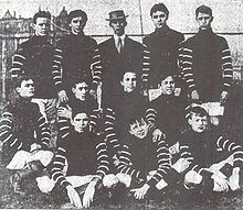 Soccer team 1908
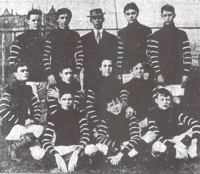
 Shopping Center, circa 1974
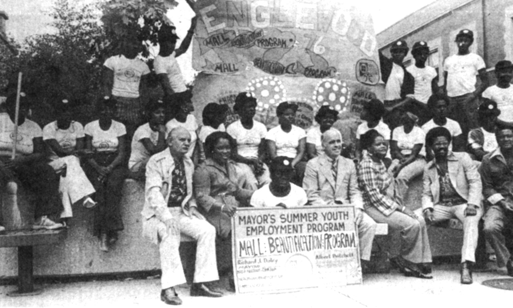
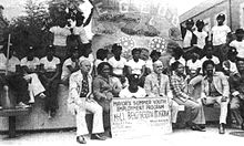 Mall Beautification Program Kick-off, 1976
Englewood, once known as "Junction Grove" [1], is one of the 77 official community areas of Chicago. At its height, over 97,000 people lived in its approximately 3 square miles [2], but the neighborhood's population has since dropped dramatically. In 2000, it had a population of approximately 40,000 inhabitants, and the 2010 census indicated that its population has further declined to approximately 30,000 [3]. Englewood is bordered by 55th Street on the north, 75th Street on the south, Racine Ave on the west, and State St on the east. Both the Red Line (Chicago Transit Authority) and Green Line (Chicago Transit Authority) run through Englewood, as does the Dan Ryan Expressway. It is located on the southwest side of Chicago, Illinois.
Contents
History of Englewood
The original inhabitants of what is now Englewood were Mascouten Indians. The land was swampy. In 1840, Englewood was officially documented as habitable land to the United States Government Land Office in Chicago. In the 1850s and 1860s, as Chicago was becoming a city of railroad tracks and economic prosperity, Englewood was just another supporting neighborhood. But in 1871, when the Great Chicago Fire destroyed a large portion of Chicago, residents moved to the outskirts. Englewood's railroad connections to downtown Chicago made it a convenient location, and the neighborhood's population grew rapidly. Englewood Station once served many railroad passengers; at one point over 1,000 trains would pass through Englewood every day in 1889.
Englewood was the home of Dr. H. H. Holmes, one of the first publicized serial murderers in America. His hotel located at Wallace and 63rd streets was the scene of most of his crimes. His story is featured in the best selling book "Devil in the White City" by Erik Larson.
Englewood Shopping District
The Englewood community[4] was largely defined by the Englewood Shopping Center, (63rd & Halsted) a large pedestrian mall. The City, social services, and mall management worked with community leaders and groups to integrate the mall with the community. The goal was to make the mall a vital part of the community, and a central part of everyday life. It was the site of numerous community events, parades, outdoor concerts, live radio broadcasts and the like. This was spearheaded by the Englewood Business Men's Association and its Director, Richard Drew. Mr. Drew died in 1978, and with his passing the Association lost its community focus.
Kennedy-King College
In 1999, this 30 year decline was finally addressed, when Mayor Richard M. Daley announced a $256 million revitalization plan for the area. The keystone of the program is the relocation of Kennedy-King College to the former site of the Englewood Shopping Center. Shortly thereafter the city began an aggressive buyout and relocation program for mall merchants. The campus includes the Washburne Culinary Institute.[5]
Groundbreaking for the new location occurred on November 9, 2005. This marked the end of an era for the community, and the beginning of what many hope will be a rebirth. The 40-acre (160,000 m2) campus opened in 2007.
The future
The area is in dire need of improvement. The infrastructure is crumbling and there is a decided lack of medical care available. Crime is still among the highest in the country. The railroad junction at Englewood, where Metra (the former Rock Island) crosses Norfolk Southern (the former Pennsylvania) has long been a cause of delay. In March 2010 a $133 million reconstruction project was announced which will improve operations by replacing the diamond crossing between Metra and NS with a flyover for Metra. The project is expected to be completed in 2014.[6]
Attempts For Change
Since the 81 murders in Englewood, which took place between January and April, 1991, a small group of adults has stepped up to create a safe place for the youth in Englewood. The main goal for this center, named P.E.A.C.E. (People Educating Against Crime In Englewood), is to provide an intermediate place for kids ranging from 8 years of age to 18, focusing on preventing crime and drug abuse by occupying children's time with activities and a loving family-like atmosphere. A square meal is served each day to the children who attend (free of charge), with an emphasis on healthy eating habits. For some of the kids, this is the only full meal they will receive that day. While the PEACE center attempts to subvert crime, its facilities are lacking. With a full gym and theatre on the second level, PEACE has great potential, but the lack of community generated funds prevents the improvement efforts.
Education
Chicago Public Schools operates public schools. Paul Robeson High School is in Englewood.[7][8]
The community is also home to the Urban Prep Academies Englewood Campus.[9]
Notes
- ^ "Chicago History Encyclopedia: Englewood". http://encyclopedia.chicagohistory.org/pages/426.html.
- ^ "Chicago History Encyclopedia: Englewood". http://encyclopedia.chicagohistory.org/pages/426.html.
- ^ "Englewood by the Numbers". redeyechicago.com. 2011-07-15. http://www.redeyechicago.com/news/ct-red-0718-englewood-numbers-20110717,0,3421678.story.
- ^ "Brief History of Englewood". chicagoreporter.com. 2009-07-12. http://www.chicagoreporter.com/index.php/c/Sidebars/d/A_Brief_History_of_Englewood.
- ^ "Washburne Culinary Institute Homepage". http://kennedyking.ccc.edu/washburne/home.asp. Retrieved 2010-01-02.
- ^ Vance, Steven. "Englewood Flyover broke ground today – will save 7,500 hours of Metra delays annually". Grid Chicago. http://gridchicago.com/2011/englewood-flyover-broke-ground-today-will-save-7500-hours-of-metra-delays-annually/. Retrieved 11 November 2011.
- ^ "contact." Paul Robeson High School. Retrieved on Retrieved on October 21, 2009.
- ^ Hartman, Krystin. "Why Did 1 In 7 Girls Get Pregnant At Robeson High?." CBS 2 Chicago. October 15, 2009. Retrieved on October 21, 2009.
- ^ "Englewood Campus." Urban Prep Academies. Retrieved on December 10, 2010.
External links
- Official City of Chicago Englewood Community Map
- Englewood Map during the 1920s-1930s
- Team Englewood Non-Profit Group
- New security measures
- Crime Study
- Chicago Housing Website, Englewood area
- History of the Englewood "L"
- Kennedy King College Architects
- History of Englewood from Jazz Age Chicago
- Chicago murder rate
- Area crime rates, updated daily
- Book about Englewood
City of Chicago Architecture · Beaches · Climate · Colleges and Universities · Community areas · Culture · Demographics · Economy · Flag · Freeways · Geography · Government · History · Landmarks · Literature · Media · Music · Neighborhoods · Parks · Public schools · Skyscrapers · Sports · Theatre · Transportation
 Category ·
  Portal
Community areas in Chicago Far North side Rogers Park · West Ridge · Uptown · Lincoln Square · Edison Park · Norwood Park · Jefferson Park · Forest Glen · North Park · Albany Park · O'Hare · EdgewaterNorth side Northwest side Central, Near North, and Near South side West and Near West side Southwest side Garfield Ridge · Archer Heights · Brighton Park · McKinley Park · New City · West Elsdon · Gage Park · Clearing · West Lawn · Chicago Lawn · West Englewood · EnglewoodSouth side Armour Square · Douglas · Oakland · Fuller Park · Grand Boulevard · Kenwood · Washington Park · Hyde Park · Woodlawn · South Shore · Bridgeport · Greater Grand CrossingFar Southwest side Far Southeast side Chatham · Avalon Park · South Chicago · Burnside · Calumet Heights · Roseland · Pullman · South Deering · East Side · West Pullman · Riverdale · Hegewisch
New City, Chicago Fuller Park, Chicago 
Washington Park, Chicago West Englewood, Chicago  Englewood, Chicago

Auburn Gresham, Chicago Greater Grand Crossing, Chicago Categories:- Community areas of Chicago, Illinois
- Populated places in Illinois with African American majority populations


Wikimedia Foundation. 2010.