- Transportation in Chicago
-
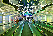 Michael Hayden's neon installation "Sky's the Limit" (1987) in a subterranean walkway at O'Hare Airport. Sometimes called "The Gershwin Tunnel", the walkway connects concourses B and C of Terminal 1, which is operated by United Airlines.
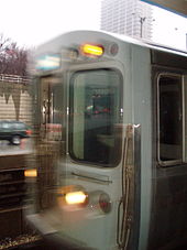
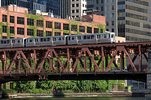 A westbound 'L' train crosses the south fork of the Chicago River
Chicago, Illinois, is the third largest city in the United States and a major transportation hub. The city is served by two major airports, and is the main freight rail hub of North America.
Mass transit in much of the Chicago metropolitan area is managed through the Regional Transportation Authority (RTA), which was installed by referendum in 1974. The RTA provides transportation services through the funding of three subordinate agencies, the Chicago Transit Authority, Metra, Pace.
Contents
Roads and freeways
Main article: Roads and freeways in ChicagoAirports
- O'Hare International Airport, which is the second busiest airport in the world by one measure, is a major airport serving numerous domestic and international destinations. It is a hub for United Airlines and American Airlines. Construction is underway for a major expansion.
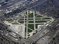
- Chicago Midway International Airport serves primarily domestic destinations. It is a major hub for Southwest Airlines, as well as a focus city for AirTran Airways.
There are several minor airports in the Chicago area with either limited or proposed commercial service. These include:
- Gary/Chicago International Airport in Gary, Indiana, located about 25 miles from the Chicago loop. Gary/Chicago is operating as the "third airport" for the Chicago area. While Gary/Chicago Int. Airport's current operations include no scheduled commercial passenger service, it is currently undergoing facility improvements, and the administration is courting airlines aggressively. Boeing and White Lodging Services already base their corporate fleets here. The National Guard has constructed facilities to base their Chicago metropolitan area air operation here as well.
- Chicago Rockford International Airport in Rockford, supports scheduled airline service to Denver, Cancun, Punta Cana, West Palm Beach, Punta Gorda, Las Vegas, Orlando-Sanford, Phoenix/Mesa, and St. Petersburg/Clearwater. Rockford officials are positioning the airport to attract customers from Chicago's western suburbs. More information is available at http://www.flyrfd.com
Name IATA Airport Code ICAO Airport Code Location Clow International Airport 1C5 K1C5 Bolingbrook, Illinois DuPage Airport DPA KDPA West Chicago, Illinois Gary/Chicago International Airport GYY KGYY Gary, Indiana Chicago Midway International Airport MDW KMDW Chicago O'Hare International Airport ORD KORD Chicago Chicago Executive Airport (formerly Palwaukee) PWK KPWK Wheeling, Illinois Schaumburg Regional Airport 06C (none) Schaumburg, Illinois Waukegan Regional Airport UGN KUGN Waukegan, Illinois Lewis University Airport LOT KLOT Romeoville, Illinois Aurora Municipal Airport AUZ KARR Sugar Grove, Illinois Proposed airports
There have been two airports proposed to be built from scratch in the last twenty years:
- Calumet Airport was to have been built in what is now Lake Calumet on the South Side of Chicago as a replacement for O'Hare. Plans were shelved in favor of a plan for expanding O'Hare.
- A Proposed Chicago south suburban airport has been proposed as a regional airport in far-south-suburban Peotone, Illinois.
Transit systems
The Chicago Transit Authority or CTA, operates the second largest public transportation system in the United States (to New York's Metropolitan Transportation Authority) and covers the City of Chicago and 40 surrounding suburbs. The CTA operates 24 hours a day and, on an average weekday, 1.6 million rides are taken on the CTA.
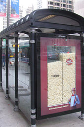
City of Chicago bus stop, served by CTA buses, with 3D ad
CTA has approximately 2,000 buses that operate over 152 routes and 2,273 route miles (3,658 km). Buses provide about 1 million passenger trips a day and serve more than 12,000 posted bus stops. CTA's 1,190 rapid transit cars operate eight routes and 222 miles (357 km) of track. CTA trains provide about 650,000 customer trips each day and serve 144 stations in Chicago, Evanston, Skokie, Wilmette, Rosemont, Forest Park, Oak Park and Cicero. The rapid transit system is known as the "Chicago 'L'" or variations of 'L,' "El," or "el" to Chicagoans.
Chicago is one of the few cities in the United States that provides rapid transit service to two major airports. From the downtown area the CTA's Blue Line takes riders to O'Hare International Airport in about 40 minutes and the Orange Line takes customers to Chicago Midway International Airport in about 30 minutes from the Loop.
Suburban buses
Pace operates a primarily-suburban bus service that also offers some routes into Chicago.
RTA
The RTA offers a trip planner on its web site that provides information for public transit in Chicago and surrounding areas. It is multi-modal, combining schedule information for buses, trains, and commuter rail. Riders enter their intended origin and destination, along with optional time, date, and other information, and the trip planner displays itineraries showing the stops, departure and arrival times, and times to get from the origin to the destination. Additionally, public transit directions for the Chicago metropolitan area are available from Google Maps.
Rail
See also: Railroad terminals of ChicagoCommuter
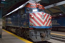 Metra train at Ogilvie Transportation Center
The Northeastern Illinois Regional Commuter Railroad Corporation, under its trademark Metra, operates eleven commuter rail lines that serve 200+ stations across the RTA's six-county service area. Unlike the 'L' lines, fare pricing is based on zones instead of a flat boarding fee. In addition, being mainly commuter rail service, frequent service is generally only provided during rush hours, although Metra is known for its speed and reliability. The eleven lines (while there are eleven, the Metra Electric line has three different branches) connect into one of four different downtown stations: Union Pacific North, West, and Northwest arrive in the Richard B. Ogilvie Transportation Center (known more casually as the "Northwestern Station"); Milwaukee District North and West, North Central Service, Southwest Service, Burlington Northern, and Heritage Corridor converge in Union Station (along with being the nexus of Amtrak); the Rock Island Line arrives in the LaSalle Street Station; and the Metra Electric arrives in Millennium Station (formerly Randolph Street Terminal).
The Metra Electric Line is Chicago's oldest continuing commuter train (1856), and shares the railway with the South Shore Line, operated by the Northwest Indiana Commuter Transit District ("NICTD"), which is a separate but analogous quasi-governmental entity from the RTA. The South Shore Line is an interurban railroad that operates between Chicago and South Bend, Indiana. Like the Metra Electric Line, it arrives and departs from Millennium Station.
Inter-city
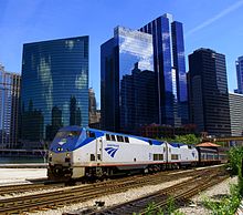
Amtrak owns and operates Union Station which is a major intercity passenger rail hub with connections to Metra and the L.
Tourist trolleys
The City of Chicago offered free tourist trolleys that served the downtown area.[1] The "trolleys" were actually buses painted to look like historical streetcars. They ran every 20 to 30 minutes and served areas popular with tourists that didn't have 'L' stations, such as the Museum Campus, Navy Pier, and the Magnificent Mile. The Free Trolley service was permanently discontinued in 2009.
The free trolleys shouldn't be confused with the private-sector Chicago Trolley Company, which offers guided tours and charge fares. They serve different routes but largely the same downtown area. Their vehicles are also buses rather than real trolleys.
Taxis
Chicago is mandating that its entire fleet of taxicabs go green by January 1, 2014.[2]
Boats
Shoreline Sightseeing offers water taxi service along the Chicago River with stops at Navy Pier, Michigan Avenue and Adams Street. They offer a separate route from Navy Pier to The Museum Campus. Shoreline Sightseeing also offers architecture cruises departing from Navy Pier.[3]
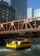
Wendella Boats operates the Chicago Water Taxi which offers service along the Chicago River with stops at Michigan Avenue, Clark Street and Madison Street. On weekends, Chicago Water Taxi service extends to Ping Tom Park in Chinatown. Wendella Boats also offers architecture cruises departing from Michigan Avenue.[4]
Bicycling
Main article: Bicycling in Chicago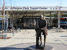 Monument of Thomas Jefferson in front of the Jefferson Park Transit Center
Bicycles are permitted on CTA buses during all operating hours, and on CTA trains every weekday except from 7:00 a.m. to 9:00 a.m. and 4:00 p.m. to 6:00 p.m.(during rush hour) On Saturdays, Sundays and holidays, bicycles are allowed on trains all day. If you board the train with your bicycle before the hours listed above and your trip extends into those hours, the CTA allows you to finish your trip. If trains are crowded, the use of trains by cyclists may be restricted by the rail operator as appropriate. Bicycles are not permitted on trains July 3 due to Independence Day celebrations. Folding bikes may be brought aboard CTA trains and buses during all operating periods, including rush hour.
A maximum of two bicycles are allowed per train car. For example, if the train is four cars in length, a total of eight bicycles are allowed on that train.
Transit operators have the discretion to deny access to anyone with a bike if they decide that conditions are too crowded. The CTA's entire bus fleet is now equipped with bike racks in front which can accommodate two bicycles. All CTA trains accept bicycles, although bikes are discouraged on the 2200-series rail cars with "blinker doors" (if they were turned sideways, they would look like a blinking eye when opening and closing). Only standard-size bicycles are allowed on all CTA vehicles; tandems are not allowed.[5]
See also
References
- ^ "Chicago free trolleys". http://egov.cityofchicago.org/city/webportal/portalContentItemAction.do?BV_SessionID=@@@@0081815226.1196990642@@@@&BV_EngineID=cccfaddmjlljilfcefecelldffhdfhg.0&contentOID=536935323&contenTypeName=COC_EDITORIAL&topChannelName=Dept&blockName=Transportation%2FChicago%27s+Free+Trolleys%2FI+Want+To&context=dept&channelId=0&programId=0&entityName=Transportation&deptMainCategoryOID=-536896085.
- ^ "Aldermen want all cabs hybrid by 2014; Push for New York-type law upsets taxi drivers". Chicago Sun-Times, Inc via LexisNexis. 2008-06-12. http://www6.lexisnexis.com/publisher/EndUser?Action=UserDisplayFullDocument&orgId=101846&topicId=103840033&docId=l:805842855. Retrieved 2008-08-08.
- ^ "Shoreline Sightseeing". http://www.shorelinesightseeing.com.
- ^ "Chicago Water Taxi". http://www.chicagowatertaxi.com/.
- ^ Helpful tips and the full guide to transporting bicycles on CTA trains can be found at http://www.transitchicago.com/welcome/biketran.txt
External links
- Chicago Transit Authority - official site, including trip planner and system maps.
- This is Grand - Stories of Chicago's Rapid Transit
- Metra and CTA on Google Maps
- Chicago Water Taxi - official site
- Fly Chicago
- The Chicago Airport System
City of Chicago Chicago metropolitan area · State of Illinois · United States of America Architecture · Beaches · Climate · Colleges and Universities · Community areas · Culture · Demographics · Economy · Flag · Freeways · Geography · Government · History · Landmarks · Literature · Media · Music · Neighborhoods · Parks · Public schools · Skyscrapers · Sports · Theatre · Transportation
 Category ·
  PortalCategories:
- Transportation in Chicago, Illinois
Wikimedia Foundation. 2010.

