- National Register of Historic Places listings in Saginaw County, Michigan
-
The following is a list of Registered Historic Places in Saginaw County, Michigan.
-
- This National Park Service list is complete through NPS recent listings posted November 10, 2011.[1]
[2] Landmark name [3] Image Date listed Location City or town Summary 1 Bearinger Building July 9, 1982 124 N. Franklin
43°25′27″N 83°58′24″W / 43.424167°N 83.973333°WSaginaw 2 Bliss Park 
December 7, 1995 SW of jct. of Houghton St. and N. Michigan Ave.
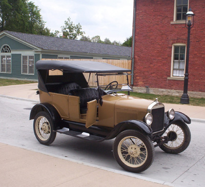
43°25′42″N 83°57′13″W / 43.428333°N 83.953611°WSaginaw 3 Abel Brockway House July 9, 1982 1631 Brockway
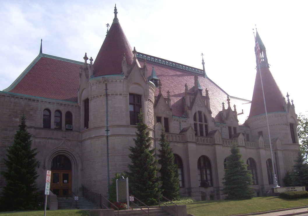
43°25′03″N 83°59′00″W / 43.4175°N 83.983333°WSaginaw 4 Bugai Site (20SA215) October 29, 1982 Address Restricted Bridgeport 5 Castle Station 
January 13, 1972 S. Jefferson at Federal St.
43°25′43″N 83°56′09″W / 43.428611°N 83.935833°WSaginaw Now known as Castle Museum of Saginaw County History 6 Center Road-Tittabawassee River Bridge November 30, 1999 Center Rd. over Tittabawassee River
43°23′37″N 84°00′54″W / 43.393611°N 84.015°WJames Township 7 Central Warehouse 
July 9, 1982 1800 N. Michigan
43°26′01″N 83°56′57″W / 43.433611°N 83.949167°WSaginaw 8 Benjamin Cushway House July 9, 1982 1404 S. Fayette
43°24′34″N 83°58′32″W / 43.409444°N 83.975556°WSaginaw 9 Davis Carriage House July 9, 1982 519 N. Fayette
43°25′16″N 83°57′39″W / 43.421111°N 83.960833°WSaginaw 10 East Genesee Historic Business District July 9, 1982 Bounded by Federal, Weadock, 2nd and Jones Sts.
43°25′48″N 83°55′58″W / 43.43°N 83.932778°WSaginaw 11 East Saginaw Historic Business District July 9, 1982 Roughly bounded by Federal, N. Water, N. Washington and N. Franklin Sts.
43°26′01″N 83°56′18″W / 43.433611°N 83.938333°WSaginaw 12 Flint and Pere Marquette Railroad East Saginaw Depot November 29, 1996 501 Potter St.
43°26′26″N 83°55′58″W / 43.440556°N 83.932778°WSaginaw 13 Fosters Site (20SA74) October 29, 1982 Address Restricted Fosters 14 The Grove July 9, 1982 S. Washington
43°24′58″N 83°57′04″W / 43.416111°N 83.951111°WSaginaw 15 Gugel Bridge 
March 15, 2000 Beyer Rd. at the Cass River
43°19′44″N 83°46′35″W / 43.328889°N 83.776389°WFrankenmuth Township 16 House at 1514 N. Michigan Street 
July 9, 1982 1514 N. Michigan St.
43°25′46″N 83°57′02″W / 43.429444°N 83.950556°WSaginaw 17 Mahoney Site (20SA193) October 29, 1982 Address Restricted St. Charles 18 Michigan Bell Building July 9, 1982 309 S. Washington
43°25′50″N 83°56′25″W / 43.430556°N 83.940278°WSaginaw 19 Morseville Bridge April 5, 1990 Burt Rd. at Flint River
43°14′12″N 83°52′06″W / 43.236667°N 83.868333°WTaymouth Township 20 Mower Road-Cole Drain Bridge December 17, 1999 Mower Rd. over Cole Drain
43°19′38″N 83°58′07″W / 43.327222°N 83.968611°WSpaulding Township 21 North Jefferson Avenue Historic District July 9, 1982 Carroll and Jefferson Aves.
43°26′14″N 83°56′03″W / 43.437222°N 83.934167°WSaginaw 22 North Michigan Avenue Historic District July 9, 1982 Roughly bounded by Monroe, Fayette, N. Hamilton and W. Remington Sts.
43°25′21″N 83°57′24″W / 43.4225°N 83.956667°WSaginaw 23 Parshallburg Bridge 
October 12, 1994 Ditch Rd. over the Shiawassee River, Chesaning Township
43°08′38″N 84°08′07″W / 43.143889°N 84.135278°WOakley 24 Passolt House October 18, 1972 1105 S. Jefferson Ave.
43°25′10″N 83°56′28″W / 43.419444°N 83.941111°WSaginaw 25 Charles Peters Sr. House July 9, 1982 130 N. 6th
43°25′56″N 83°55′34″W / 43.432222°N 83.926111°WSaginaw 26 Roethke Houses June 8, 2001 1759 and 1805 Gratiot Ave.
43°25′00″N 83°59′14″W / 43.416667°N 83.987222°WSaginaw 27 Russell Sackett House July 9, 1982 1604 Ct.
43°25′27″N 83°58′24″W / 43.424167°N 83.973333°WSaginaw 28 Saginaw Armory March 13, 2002 234 S. Water St.
43°25′53″N 83°56′26″W / 43.431389°N 83.940556°WSaginaw 29 Saginaw Central City Expansion District July 9, 1982 Off M-13
43°25′23″N 83°55′59″W / 43.423056°N 83.933056°WSaginaw 30 Saginaw Central City Historic Residential District February 1, 1979 Roughly bounded by Federal Ave., S. Baum St., Park and Hoyt Aves.
43°25′37″N 83°56′02″W / 43.426944°N 83.933889°WSaginaw 31 Saginaw City Historic Business District July 9, 1982 Roughly bounded by Saginaw River, S. Michigan, Cleveland and Van Buren Aves.
43°25′02″N 83°57′46″W / 43.417222°N 83.962778°WSaginaw 32 Schmidt Site July 27, 1973 Address Restricted Bridgeport 33 Schultz Site (20SA2) Green Point Site (20SA1) December 8, 1978 Address Restricted Spaulding Township 34 South Jefferson Avenue Historic District July 9, 1982 Off M-13
43°25′04″N 83°56′20″W / 43.417778°N 83.938889°WSaginaw 35 South Michigan Avenue Historic District July 9, 1982 Roughly bounded by Fayette, Lyon, Lee and S. Hamilton Sts.
43°24′44″N 83°58′14″W / 43.412222°N 83.970556°WSaginaw 36 St. John's Episcopal Church July 9, 1982 509 Hancock
43°25′06″N 83°57′51″W / 43.418333°N 83.964167°WSaginaw 37 State Street Bridge 
November 29, 1995 State St. (Fort Rd.) over the Cass River
43°21′29″N 83°52′57″W / 43.358056°N 83.8825°WBridgeport 38 Wenzel House July 9, 1982 1203 S. Fayette
43°24′44″N 83°58′22″W / 43.412222°N 83.972778°WSaginaw 39 West Side Historic Residential District July 9, 1982 Roughly bounded by Mason, Madison, Harrison and Lyon Sts.
43°25′13″N 83°58′06″W / 43.420278°N 83.968333°WSaginaw 40 Ammi and William Wright House July 9, 1982 207 Garden Lane
43°24′49″N 83°59′08″W / 43.413611°N 83.985556°WSaginaw See also
- List of Registered Historic Places in Michigan
References
- ^ "National Register of Historic Places: Weekly List Actions". National Park Service, United States Department of the Interior. Retrieved on November 10, 2011.
- ^ Numbers represent an ordering by significant words. Various colorings, defined here, differentiate National Historic Landmark sites and National Register of Historic Places Districts from other NRHP buildings, structures, sites or objects.
- ^ "National Register Information System". National Register of Historic Places. National Park Service. . http://nrhp.focus.nps.gov/natreg/docs/All_Data.html.
National Register of Historic Places sites in metropolitan Detroit Topics Architecture • Celebrities • Culture • Detroit • Economy • History • Historic places • International Riverfront • Lake St. Clair • Media • Metro Detroit • Music • Parks and beaches • Sports • Theatre • Tourism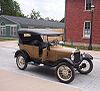
Historic places in central city Historic places by county in MSA Historic places by county in CSA U.S. National Register of Historic Places Topics Lists by states Alabama • Alaska • Arizona • Arkansas • California • Colorado • Connecticut • Delaware • Florida • Georgia • Hawaii • Idaho • Illinois • Indiana • Iowa • Kansas • Kentucky • Louisiana • Maine • Maryland • Massachusetts • Michigan • Minnesota • Mississippi • Missouri • Montana • Nebraska • Nevada • New Hampshire • New Jersey • New Mexico • New York • North Carolina • North Dakota • Ohio • Oklahoma • Oregon • Pennsylvania • Rhode Island • South Carolina • South Dakota • Tennessee • Texas • Utah • Vermont • Virginia • Washington • West Virginia • Wisconsin • WyomingLists by territories Lists by associated states Other  Category:National Register of Historic Places •
  Portal:National Register of Historic PlacesCategories:
- National Register of Historic Places in Michigan by county
- Saginaw County, Michigan
- Buildings and structures in Saginaw County, Michigan
-


Wikimedia Foundation. 2010.