- National Register of Historic Places listings in Genesee County, Michigan
-
The following is a list of Registered Historic Places in Genesee County, Michigan.
-
- This National Park Service list is complete through NPS recent listings posted November 10, 2011.[1]
[2] Landmark name [3] Image Date listed Location City or town Summary 1 Robert P. Aitken Farm House November 26, 1982 1110 N. Linden Rd.
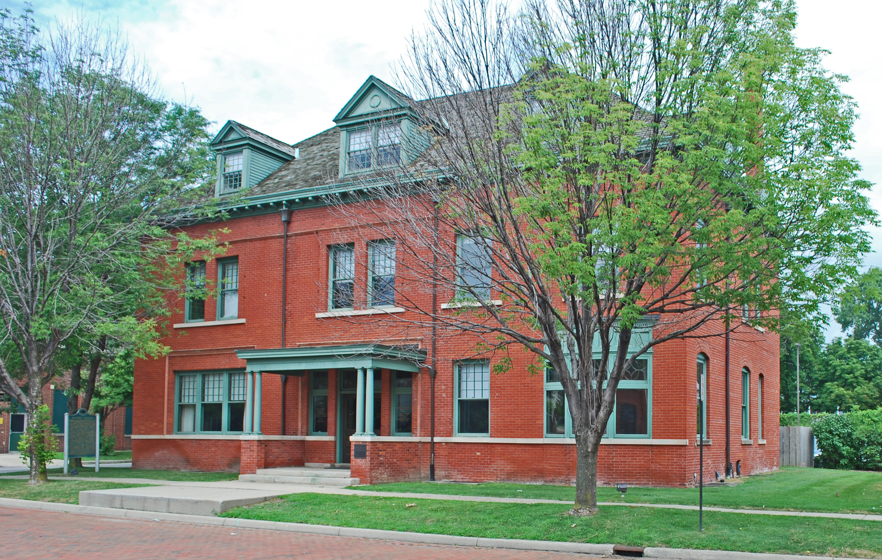
43°01′10″N 83°46′21″W / 43.019444°N 83.7725°WFlint Township 2 Applewood April 16, 1979 1400 E. Kearsley St.
43°01′26″N 83°40′24″W / 43.023889°N 83.673333°WFlint 3 Atlas Grange Hall November 26, 1982 8530 Perry Rd.
42°58′05″N 83°33′13″W / 42.968056°N 83.553611°WAtlas 4 Benjamin Bangs House 
November 26, 1982 819 S. Leroy St.
42°47′21″N 83°42′17″W / 42.789167°N 83.704722°WFenton 5 Barn at 4277 Irish Road November 26, 1982 4277 Irish Rd.
42°58′05″N 83°33′13″W / 42.968056°N 83.553611°WDavison 6 Beach-Garland Street-Flint River Bridge 
December 9, 1999 Beach and Garland Sts. over Flint R.
43°01′11″N 83°41′39″W / 43.019722°N 83.694167°WFlint 7 Berridge Hotel 
March 27, 2008 421 Garland St.
43°01′10″N 83°41′44″W / 43.019444°N 83.695556°WFlint 8 Bird/Boyd Farm House November 26, 1982 14215 Bird Rd.
42°49′40″N 83°53′58″W / 42.827778°N 83.899444°WByron 9 Frank D. Bloss and Sons Farm House November 26, 1982 8380 Reid Rd.
42°55′39″N 83°50′44″W / 42.9275°N 83.845556°WSwartz Creek 10 Bridge Street-Broad Street Historic District November 26, 1982 3 Central blocks of Broad St., 2 blocks Bridge St.
42°48′38″N 83°46′53″W / 42.810556°N 83.781389°WLinden 11 Jesse H. Buck Farm House November 26, 1982 6095 Baldwin Rd.
42°53′02″N 83°47′33″W / 42.883889°N 83.7925°WSwartz Creek 12 Capitol Theatre Building January 31, 1985 140 E. 2nd St.
43°00′55″N 83°41′18″W / 43.015278°N 83.688333°WFlint 13 William Carmer House November 26, 1982 10448 Washburn Rd.
43°02′39″N 83°47′25″W / 43.044167°N 83.790278°WOrtonville 14 Volney Church-Carlos B. Shotwell House 
November 26, 1982 812 S. Adelaide St.
42°47′20″N 83°42′26″W / 42.788889°N 83.707222°WFenton 15 Civic Park Historic District September 7, 1979 Roughly bounded by Welch and Brownell Blvds., Trumbull Ave., Dupont and Dartmouth Sts.
43°02′15″N 83°43′11″W / 43.0375°N 83.719722°WFlint 16 Clio Depot 
June 20, 1983 300-308 W. Vienna Rd.
43°10′39″N 83°44′15″W / 43.1775°N 83.7375°WClio 17 David B. Colwell House 
November 26, 1982 901 S. Leroy St.
42°47′16″N 83°42′17″W / 42.787778°N 83.704722°WFenton 18 Dibbleville-Fentonville Historic District 
November 26, 1982 Roughly bounded by Shiawassee, Riggs, Holly and George Sts.
42°47′31″N 83°42′20″W / 42.791944°N 83.705556°WFenton 19 Durant-Dort Carriage Company Office 
September 2, 1975 316 W. Water St.
43°01′02″N 83°41′46″W / 43.017222°N 83.696111°WFlint 20 Elks Lodge Building October 4, 1978 142 W. 2nd St.
43°00′50″N 83°41′28″W / 43.013889°N 83.691111°WFlint 21 Fenton Railroad Depot 
June 20, 1983 207 Silver Lake Rd.
42°47′50″N 83°42′09″W / 42.797222°N 83.7025°WFenton 22 Fenton Seminary 
November 26, 1982 309 High St.
42°47′16″N 83°42′34″W / 42.787778°N 83.709444°WFenton 23 First Baptist Church of Grand Blanc June 20, 1983 6101 S. Saginaw St.
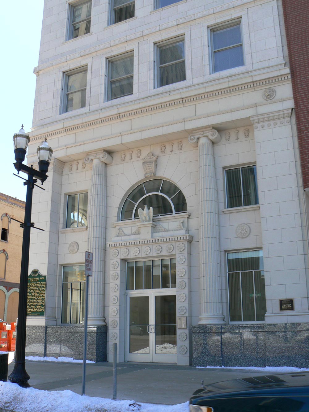
42°56′32″N 83°38′53″W / 42.942222°N 83.648056°WGrand Blanc 24 First National Bank and Trust Company Building 
June 27, 2007 460 South Saginaw St.
43°00′54″N 83°41′25″W / 43.015°N 83.690278°WFlint 25 Flint Brewing Company April 10, 1980 2001 S. Saginaw St.
43°00′14″N 83°40′39″W / 43.003889°N 83.6775°WFlint 26 Genesee Avenue-Walker Street Historic District June 20, 1983 Roughly bounded by Washington, Elm, Lord Sts., and RR Tracks
42°52′21″N 83°54′48″W / 42.8725°N 83.913333°WGaines 27 Genesee County Courthouse and Jail May 24, 1990 920 S. Saginaw St.
43°00′42″N 83°41′17″W / 43.011667°N 83.688056°WFlint 28 Horace Gilbert/Morgan and Enos Miller House November 26, 1982 5023 Holland Dr.
42°57′24″N 83°49′54″W / 42.956667°N 83.831667°WSwartz Creek 29 Glenwood Cemetery September 22, 2010 2500 W Court St.
43°00′25″N 83°43′17″W / 43.006944°N 83.721389°WFlint 30 Alanson Green Farm House November 26, 1982 11226 Green Rd.
42°54′15″N 83°29′07″W / 42.904167°N 83.485278°WGoodrich 31 Hegel Road Historic District November 26, 1982 Hegel Rd. between Seneca and the Goodrich Millpond
42°55′00″N 83°30′18″W / 42.916667°N 83.505°WGoodrich 32 Col. J. Hinckley House 
November 26, 1982 210 High St.
42°47′16″N 83°42′11″W / 42.787778°N 83.703056°WFenton 33 Hotel Durant 
March 17, 2009 607 East 2nd Avenue
43°01′13″N 83°41′39″W / 43.020278°N 83.694167°WFlint 34 House at 10410 Stanley Road November 26, 1982 10410 Stanley Rd.
43°06′13″N 83°53′18″W / 43.103611°N 83.888333°WFlushing 35 House at 1339 Cummings Road November 26, 1982 1339 Cummings Rd.
43°01′47″N 83°29′20″W / 43.029722°N 83.488889°WDavison 36 House at 4305 South Linden Road November 26, 1982 4305 S. Linden Rd.
42°57′52″N 83°46′16″W / 42.964444°N 83.771111°WFlint 37 House at 4344 Frances Road November 26, 1982 4344 Frances Rd.
43°08′03″N 83°46′02″W / 43.134167°N 83.767222°WClio 38 House at 5556 Flushing Road November 26, 1982 5556 Flushing Rd.
43°02′39″N 83°47′25″W / 43.044167°N 83.790278°WFlushing 39 House at 6112 Carpenter Road November 26, 1982 6112 Carpenter Rd.
43°05′03″N 83°35′34″W / 43.084167°N 83.592778°WFlint 40 House at 7066 Lobdell Road November 26, 1982 7066 Lobdell Rd.
42°47′29″N 83°48′28″W / 42.791389°N 83.807778°WLinden 41 Industrial Savings Bank Building April 19, 1984 432 N. Saginaw St.
43°01′12″N 83°41′35″W / 43.02°N 83.693056°WFlint 42 H. N. Jennings House 
November 26, 1982 800 S. East St.
42°47′16″N 83°42′07″W / 42.787778°N 83.701944°WFenton 43 Abner C. Johnson House February 19, 1987 625 East St.
43°01′02″N 83°40′58″W / 43.017222°N 83.682778°WFlint 44 Morris A. Knight House July 29, 1982 1105 Church ST.
43°00′33″N 83°41′17″W / 43.009167°N 83.688056°WFlint 45 Linden Mill August 21, 1972 Tickner St.
42°48′55″N 83°46′54″W / 42.815278°N 83.781667°WLinden 46 Main Street Historic District June 20, 1983 Main St. from Maple to 628 Main St.
43°03′47″N 83°51′01″W / 43.063047°N 83.850144°WFlushing 47 Mauk & Hammer/Houghton Elevator November 26, 1982 315 W. Vienna St.
43°10′37″N 83°44′16″W / 43.176944°N 83.737778°WClio 48 John McAra House November 26, 1982 2157 Irish Rd.
43°00′03″N 83°33′17″W / 43.000833°N 83.554722°WDavison 49 William Henry and Lucinda McCaslin Farm House November 26, 1982 15237 McCaslin Lake Rd.
42°48′25″N 83°51′18″W / 42.806944°N 83.855°WLinden 50 Alexander McClew Farm House November 26, 1982 7115 Farrand Rd.
43°11′41″N 83°34′35″W / 43.194722°N 83.576389°WMillington 51 Isaac R. Middlesworth Farm House November 26, 1982 11355 Rolston Rd.
42°49′29″N 83°53′58″W / 42.824722°N 83.899444°WByron 52 James H. Murray House November 26, 1982 7232 Silver Lake Rd.
42°48′39″N 83°48′52″W / 42.810833°N 83.814444°WLinden 53 Daniel O'Sullivan House/Halfway House November 26, 1982 5035 Flushing Rd.
43°02′21″N 83°46′29″W / 43.039167°N 83.774722°WFlushing 54 Parker and Dunstan Hardware/Dr. E. D. Lewis Building November 26, 1982 129-133 W. Main St.
43°09′57″N 83°31′31″W / 43.165833°N 83.525278°WOtisville 55 William A. Paterson Factory Complex February 16, 1984 126 E. 3rd St.
43°00′51″N 83°41′17″W / 43.014167°N 83.688056°WFlint 56 Superintendent's Cottage July 7, 1975 Michigan School for the Deaf campus
43°00′20″N 83°42′08″W / 43.005556°N 83.702222°WFlint 57 E. S. Swayze Drugstore/Otisville Mason Lodge No. 401 November 26, 1982 106 Main St.
43°10′00″N 83°31′27″W / 43.166667°N 83.524167°WOtisville 58 H. Elmer Thayer House November 26, 1982 G-3202 Court St.
43°00′27″N 83°44′28″W / 43.007428°N 83.741008°WFlint 59 Harry C. Tinker House November 26, 1982 12030 Lewis Rd.
43°10′46″N 83°40′46″W / 43.179444°N 83.679444°WClio 60 Tinlinn Apartments 
March 27, 2008 413 Garland St.
43°01′09″N 83°41′43″W / 43.019167°N 83.695278°WFlint 61 Edwin Trump House 
November 26, 1982 801 S. East St.
42°47′16″N 83°42′04″W / 42.787778°N 83.701111°WFenton 62 John Van Buskirk Farm House June 20, 1983 7348 Coldwater Rd.
43°05′29″N 83°33′53″W / 43.091389°N 83.564722°WDavison 63 Vermont House and Fenton Grain Elevator 
May 15, 1980 302 and 234 N. Leroy St.
42°47′54″N 83°42′17″W / 42.798333°N 83.704722°WFenton 64 West Second Street-Swartz Creek Bridge December 9, 1999 West Second St. over Swartz Creek
43°00′38″N 83°41′58″W / 43.010556°N 83.699444°WFlint 65 West Vienna United Methodist Church June 20, 1983 5461 Wilson Rd.
43°09′45″N 83°47′30″W / 43.1625°N 83.791667°WClio 66 Robert J. Whaley House May 15, 1980 624 E. Kearsley St.
43°01′11″N 83°41′04″W / 43.019722°N 83.684444°WFlint See also
References
- ^ "National Register of Historic Places: Weekly List Actions". National Park Service, United States Department of the Interior. Retrieved on November 10, 2011.
- ^ Numbers represent an ordering by significant words. Various colorings, defined here, differentiate National Historic Landmark sites and National Register of Historic Places Districts from other NRHP buildings, structures, sites or objects.
- ^ "National Register Information System". National Register of Historic Places. National Park Service. . http://nrhp.focus.nps.gov/natreg/docs/All_Data.html.
U.S. National Register of Historic Places Topics Lists by states Alabama • Alaska • Arizona • Arkansas • California • Colorado • Connecticut • Delaware • Florida • Georgia • Hawaii • Idaho • Illinois • Indiana • Iowa • Kansas • Kentucky • Louisiana • Maine • Maryland • Massachusetts • Michigan • Minnesota • Mississippi • Missouri • Montana • Nebraska • Nevada • New Hampshire • New Jersey • New Mexico • New York • North Carolina • North Dakota • Ohio • Oklahoma • Oregon • Pennsylvania • Rhode Island • South Carolina • South Dakota • Tennessee • Texas • Utah • Vermont • Virginia • Washington • West Virginia • Wisconsin • WyomingLists by territories Lists by associated states Other Categories:- National Register of Historic Places in Michigan by county
- Genesee County, Michigan
- Buildings and structures in Genesee County, Michigan
-


Wikimedia Foundation. 2010.