- National Register of Historic Places listings in Chippewa County, Michigan
-
The following is a list of Registered Historic Places in Chippewa County, Michigan.
-
- This National Park Service list is complete through NPS recent listings posted November 10, 2011.[1]
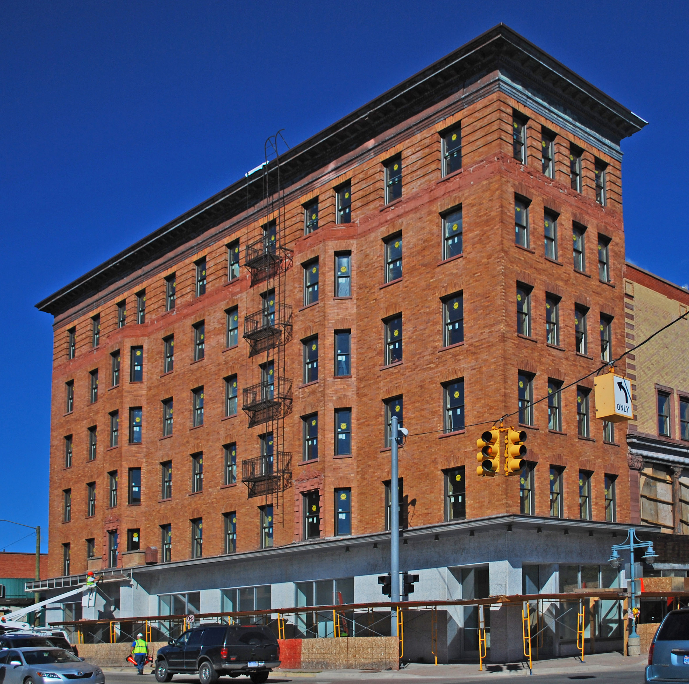
[2] Site name[3] Image Date listed Location City or Town Summary 1 Adams Building 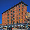
April 27, 2010 418 Ashmun St.
46°29′53.91″N 84°20′49.42″W / 46.4983083°N 84.3470611°WSault Ste. Marie 2 Birch Lodge Hospital and Summer Resort Sanitarium November 29, 1996 County Route H-40, 0.6 miles west of M-123
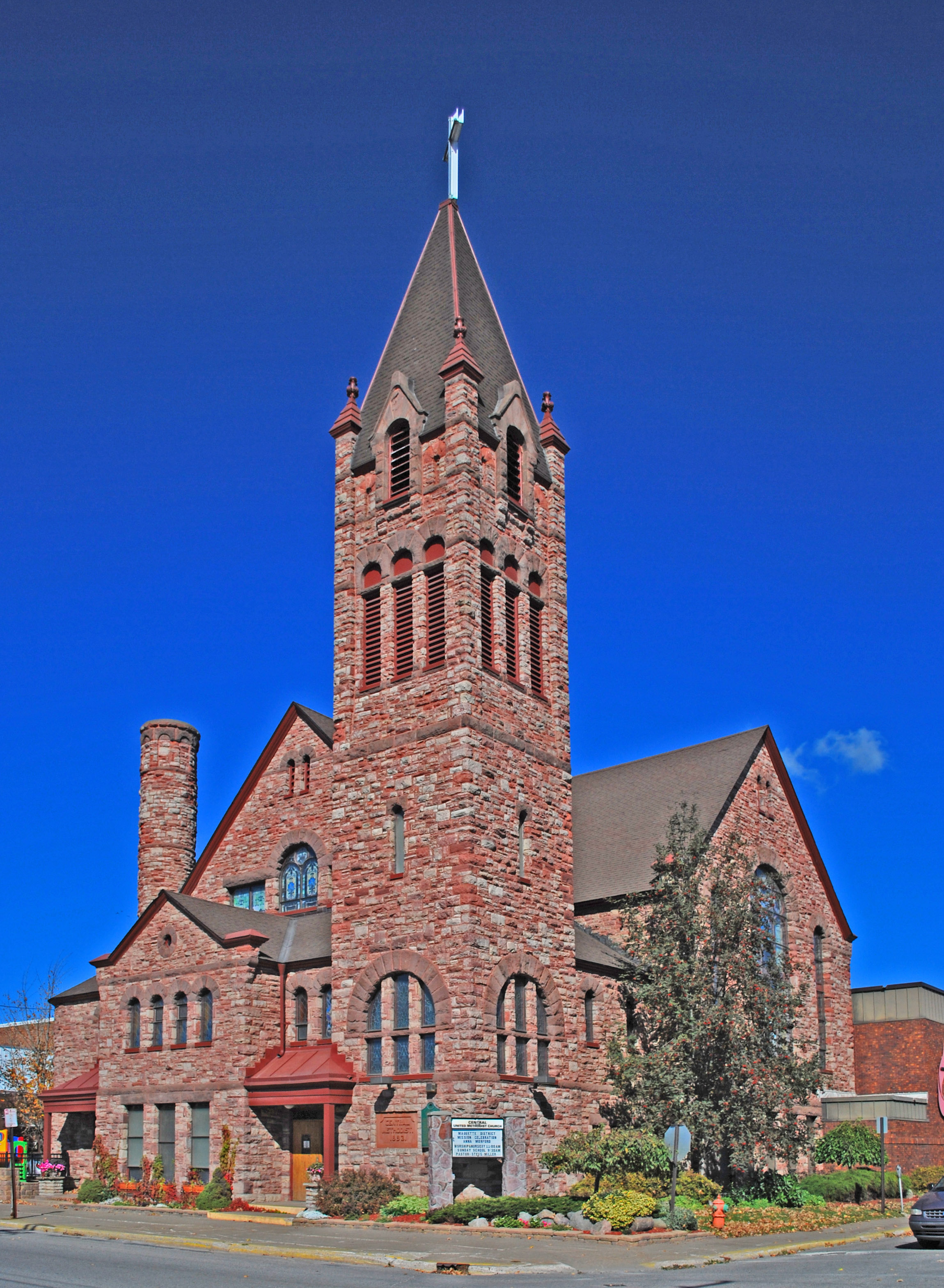
46°11′26″N 85°1′58″W / 46.19056°N 85.03278°WTrout Lake 3 Central Methodist Episcopal Church 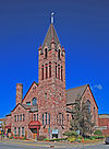
December 27, 1984 111 E. Spruce St.
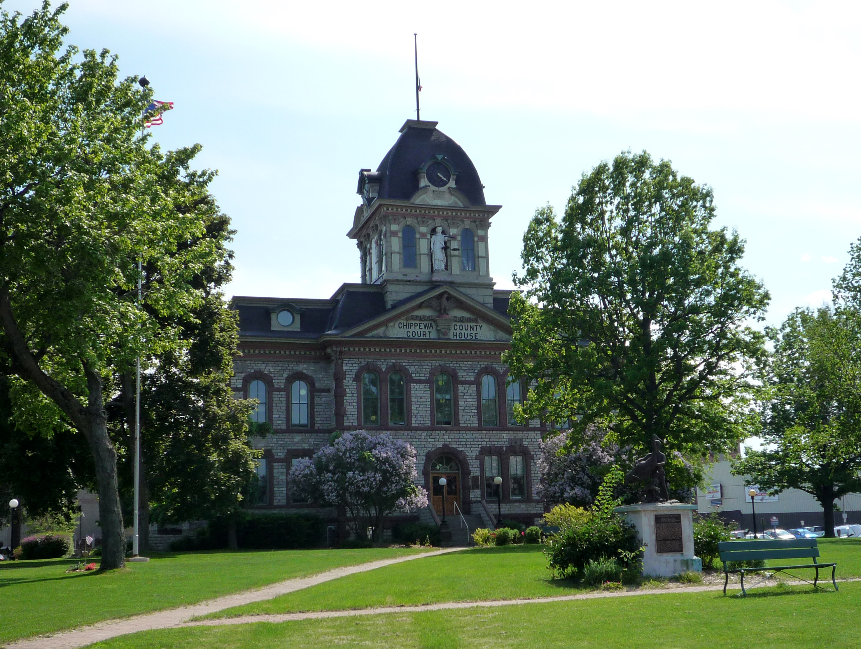
46°29′52″N 84°20′47″W / 46.49778°N 84.34639°WSault Ste. Marie 4 Chippewa County Courthouse 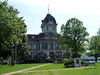
September 13, 1984 Court St.
46°29′53″N 84°20′44″W / 46.49806°N 84.34556°WSault Ste. Marie 5 Church of Our Saviour, Friend of Children July 8, 1982 Payment Settlement and Sugar Island
46°31′45″N 84°9′4″W / 46.52917°N 84.15111°WSault Ste. Marie 6 Philetus S. Church House November 24, 1982 North Shore Rd.
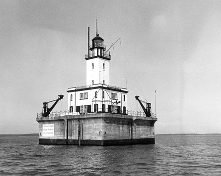
46°31′16″N 84°7′21″W / 46.52111°N 84.1225°WSugar Island 7 DeTour Reef Light Station 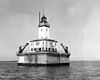
March 15, 2005 3.0 mi (4.8 km) south of M-134 ferry dock
45°56′56″N 83°54′11″W / 45.94889°N 83.90306°WDeTour Township 8 Elmwood 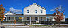
February 25, 1974 705 E. Portage Ave.
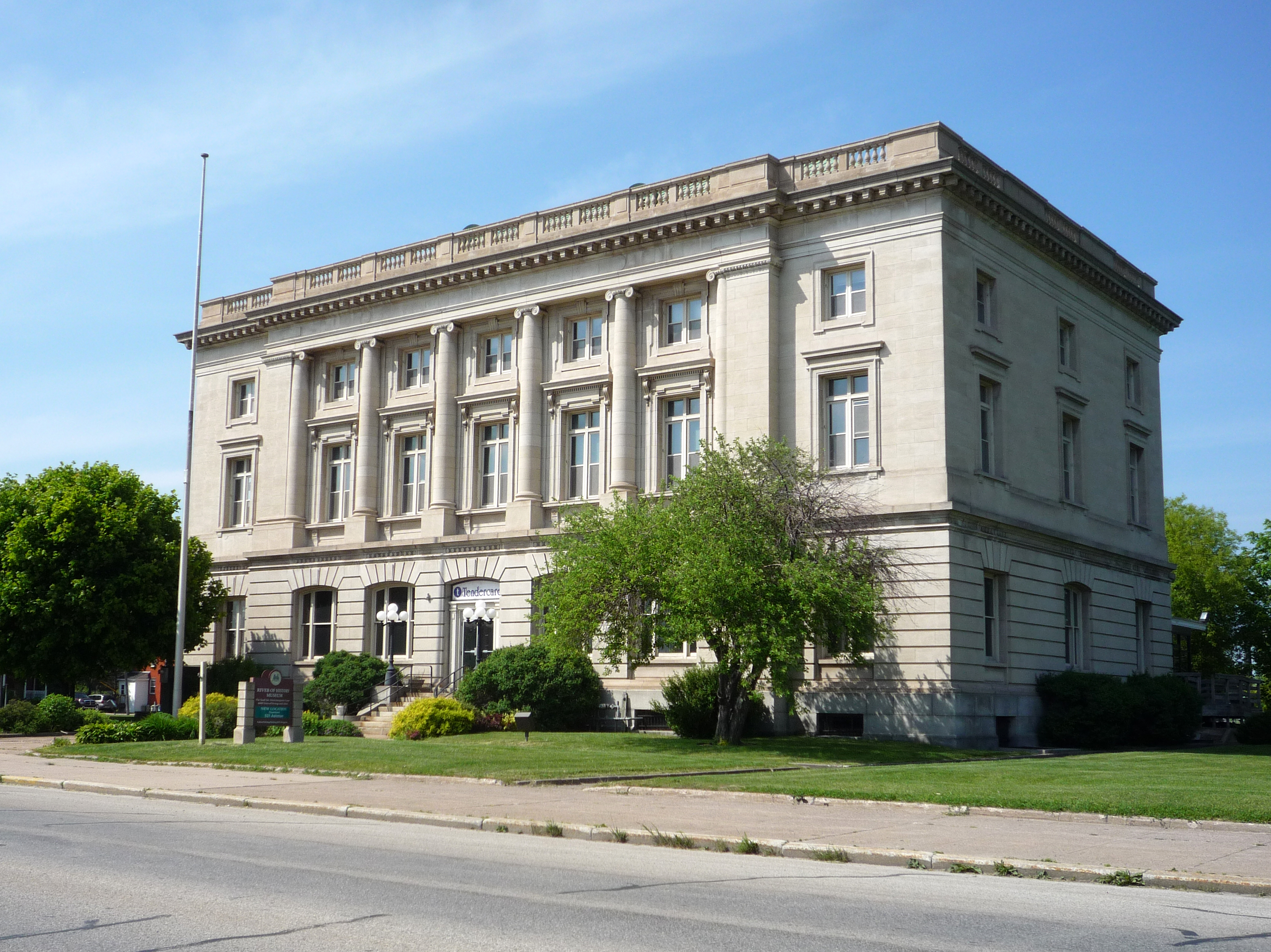
46°29′45″N 84°19′53″W / 46.49583°N 84.33139°WSault Ste. Marie 9 Federal Building 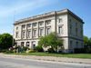
September 9, 1977 209 E. Portage Ave.
46°29′58″N 84°20′33″W / 46.49944°N 84.3425°WSault Ste. Marie 10 First United Presbyterian Church 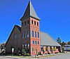
December 27, 1984 309 Lyon St.
46°29′41″N 84°20′47″W / 46.49472°N 84.34639°WSault Ste. Marie This church was destroyed by fire in 2000 and rebuilt 2002. 11 Fort Drummond October 1, 1969 Western end of Drummond Island
45°58′29″N 83°52′16″W / 45.97472°N 83.87111°WDrummond Island 12 Gowan Block 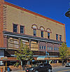
April 27, 2010 416 Ashmun St.
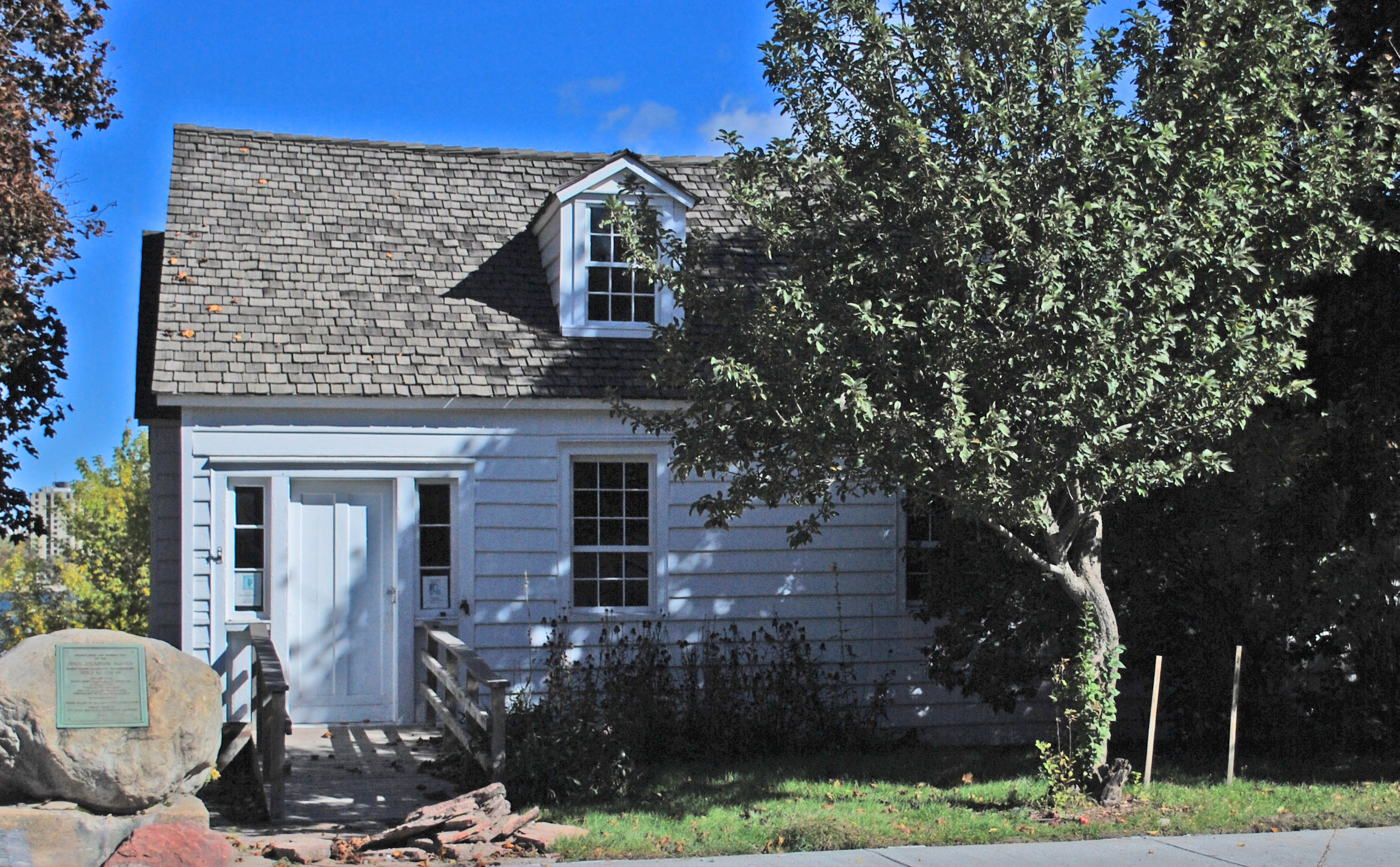
46°29′53.96″N 84°20′49.38″W / 46.4983222°N 84.34705°WSault Ste. Marie 13 John Johnston House 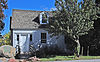
July 8, 1970 415 Park Pl.
46°29′57″N 84°20′19″W / 46.49917°N 84.33861°WSault Ste. Marie 14 Kinross Township Hall and School February 4, 2004 7305 W. Kinross Rd.
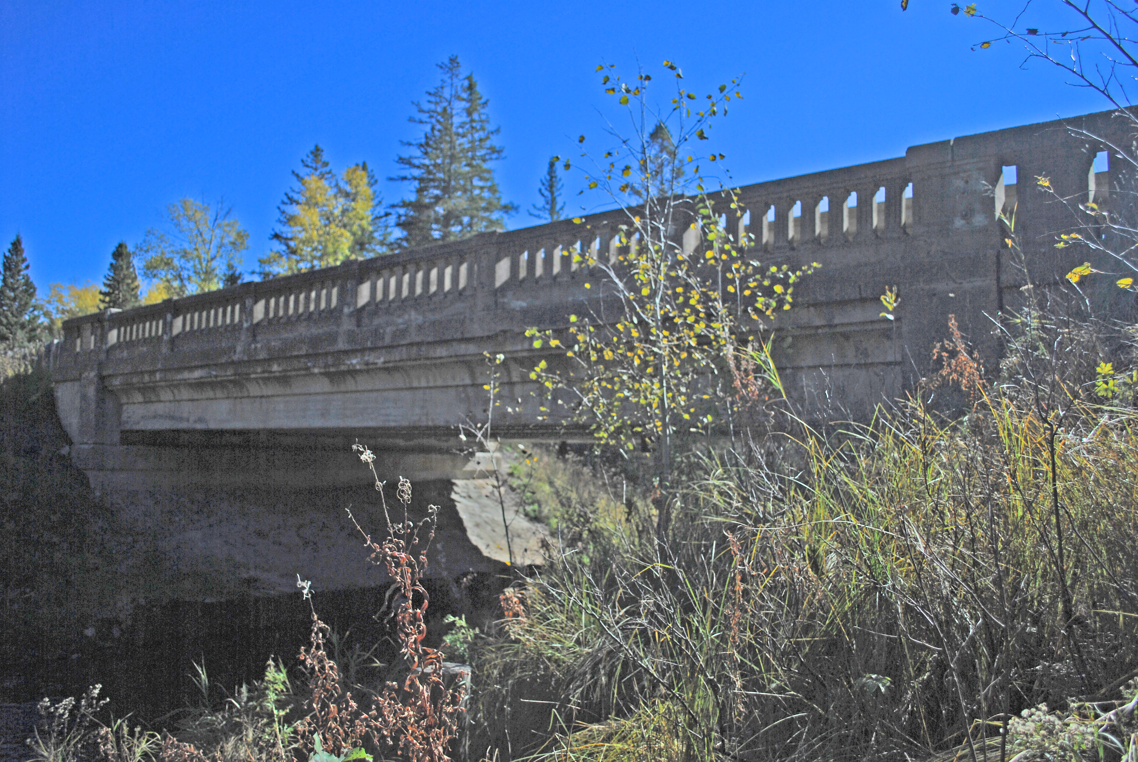
46°16′36″N 84°30′56″W / 46.27667°N 84.51556°WKinross Township 15 M-28-Tahquamenon River Bridge 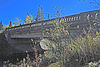
November 30, 1999 M-28 over Tahquamenon River
46°20′46″N 84°57′32″W / 46.34611°N 84.95889°WChippewa Township 16 Naomikong Point Site April 16, 1971 Address Restricted Bay Mills Township 17 New Fort Brady 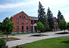
January 13, 1972 Lake Superior State College campus
46°29′36″N 84°21′50″W / 46.49333°N 84.36389°WSault Ste. Marie 18 Old Fort Brady 
March 11, 1971 Bounded by the C.O.E. Service Plaza on the north, Portage St. on the south, Brady St. on the east, and Bingham St. on the west
46°29′56″N 84°20′33″W / 46.49889°N 84.3425°WSault Ste. Marie 19 Parker Road-Charlotte River Bridge January 28, 2000 Parker Rd. over Charlotte River
46°21′45″N 84°17′24″W / 46.3625°N 84.29°WBruce Township 20 Point Iroquois Light Station 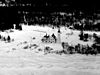
May 30, 1975 6 mi (9.7 km) northwest of Brimley in the Hiawatha National Forest
46°29′5″N 84°37′51″W / 46.48472°N 84.63083°WBrimley 21 S.S. VALLEY CAMP 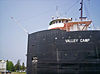
February 1, 1972 Old Union Carbide Dock
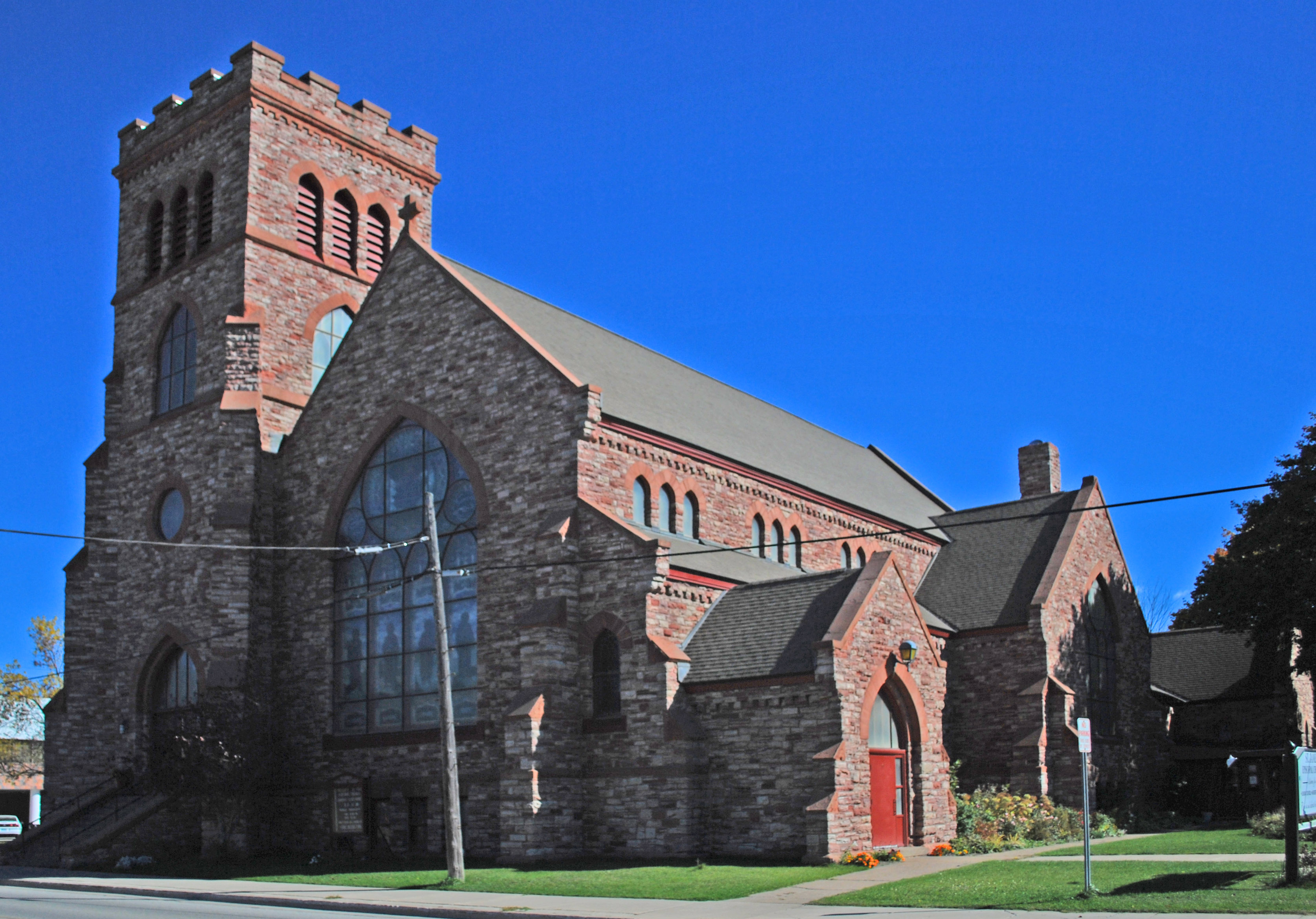
46°29′58″N 84°20′6″W / 46.49944°N 84.335°WSault Ste. Marie 22 Saint James' Episcopal Church 
April 1, 1998 533 Bingham Ave.
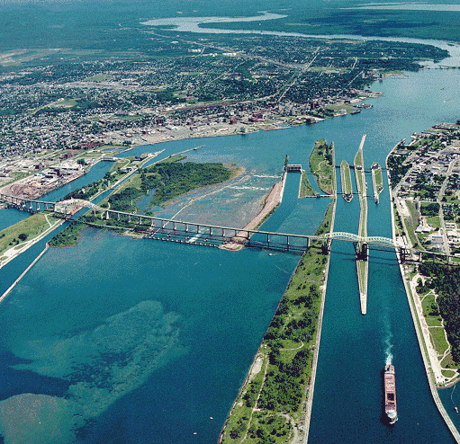
46°29′44″N 84°20′48″W / 46.49556°N 84.34667°WSault Ste. Marie 23 St. Mary's Falls Canal 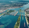
November 13, 1966 Portage St.
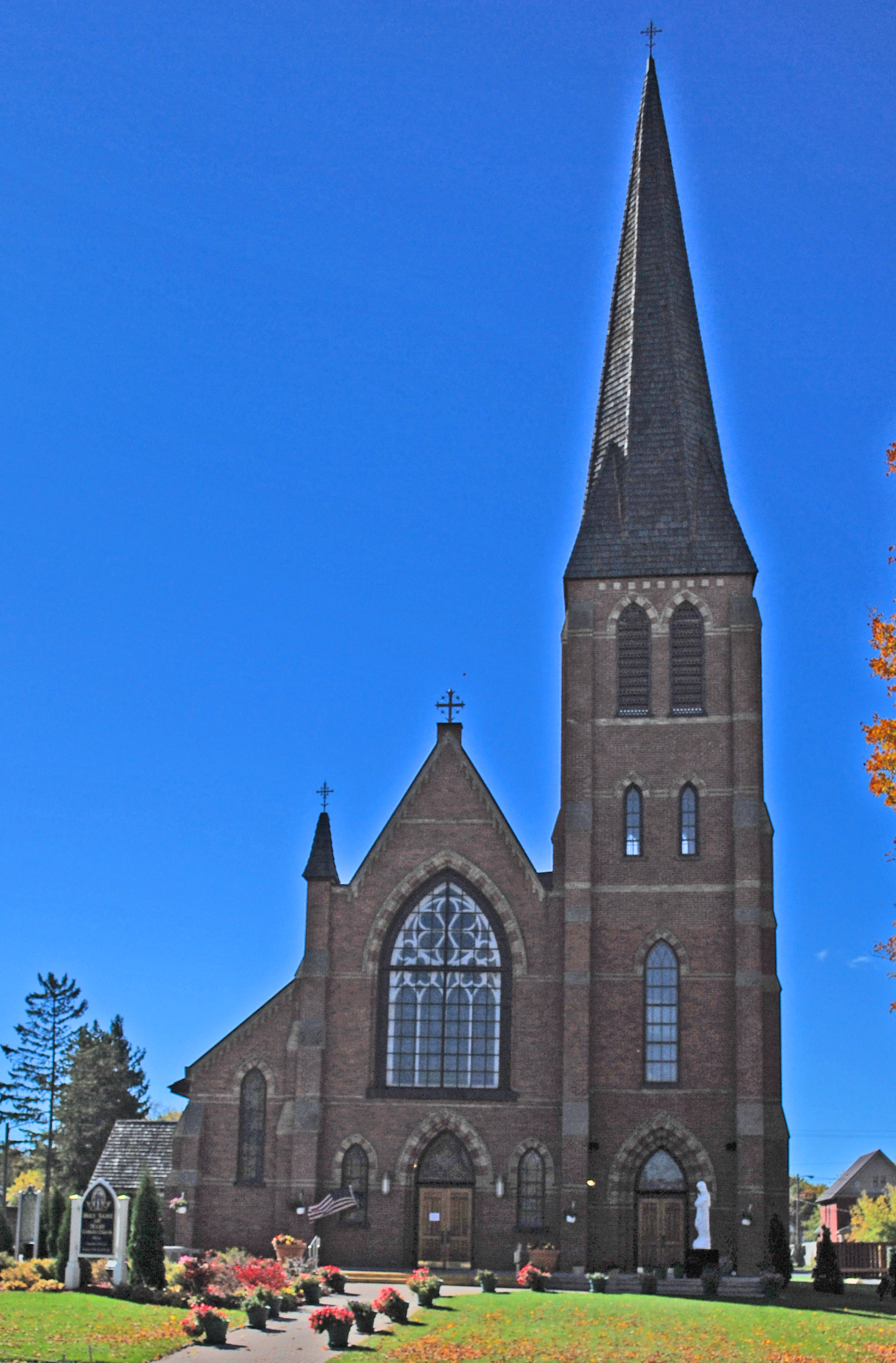
46°30′2″N 84°21′40″W / 46.50056°N 84.36111°WSault Ste. Marie 24 St. Mary's Pro-Cathedral 
December 27, 1984 320 E. Portage Ave.
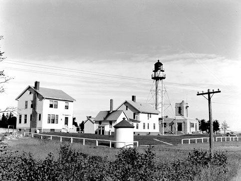
46°29′55″N 84°20′29″W / 46.49861°N 84.34139°WSault Ste. Marie 25 Whitefish Point Lighthouse 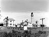
February 28, 1973 5 mi (8.0 km) northeast of Shelldrake on Whitefish Rd.
46°46′16″N 84°57′16″W / 46.77111°N 84.95444°WShelldrake See also
- List of Registered Historic Places in Michigan
References
- ^ "National Register of Historic Places: Weekly List Actions". National Park Service, United States Department of the Interior. Retrieved on November 10, 2011.
- ^ Numbers represent an ordering by significant words. Various colorings, defined here, differentiate National Historic Landmark sites, a [[National Historic Site (United States)|]], and several National Register of Historic Places Districts from other NRHP buildings, structures, sites or objects.
- ^ "National Register Information System". National Register of Historic Places. National Park Service. 2008-04-24. http://nrhp.focus.nps.gov/natreg/docs/All_Data.html.
U.S. National Register of Historic Places Topics Lists by states Alabama • Alaska • Arizona • Arkansas • California • Colorado • Connecticut • Delaware • Florida • Georgia • Hawaii • Idaho • Illinois • Indiana • Iowa • Kansas • Kentucky • Louisiana • Maine • Maryland • Massachusetts • Michigan • Minnesota • Mississippi • Missouri • Montana • Nebraska • Nevada • New Hampshire • New Jersey • New Mexico • New York • North Carolina • North Dakota • Ohio • Oklahoma • Oregon • Pennsylvania • Rhode Island • South Carolina • South Dakota • Tennessee • Texas • Utah • Vermont • Virginia • Washington • West Virginia • Wisconsin • WyomingLists by territories Lists by associated states Other  Category:National Register of Historic Places •
  Portal:National Register of Historic PlacesCategories:
- National Register of Historic Places in Michigan by county
- Buildings and structures in Chippewa County, Michigan
-


Wikimedia Foundation. 2010.