- National Register of Historic Places listings in Mackinac County, Michigan
-
The following is a list of Registered Historic Places in Mackinac County, Michigan.
-
- This National Park Service list is complete through NPS recent listings posted November 10, 2011.[1]
[2] Landmark name [3] Image Date listed Location City or town Summary 1 John Chambers House 
April 22, 1982 90 N. State St.
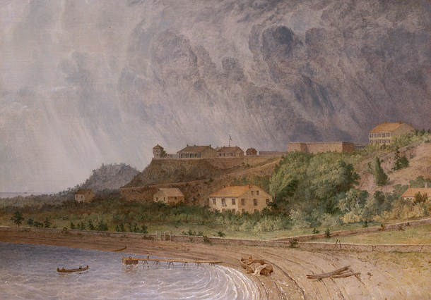
45°52′02″N 84°43′24″W / 45.867222°N 84.723333°WSt. Ignace 2 Fort Mackinac 
July 8, 1970 Huron Rd.
45°51′08″N 84°37′02″W / 45.852222°N 84.617222°WMackinac Island 3 Mathew Geary House 
May 6, 1971 Market St.
45°51′02″N 84°37′05″W / 45.850556°N 84.618056°WMackinac Island 4 Grand Hotel 
May 5, 1972 Grand Ave.
45°51′03″N 84°37′33″W / 45.850833°N 84.625833°WMackinac Island 5 Gros Cap Archaeological District 
October 29, 1982 Address Restricted Moran Township 6 Gros Cap Cemetery 
April 16, 1971 Southeast of Gros Cap on US 2
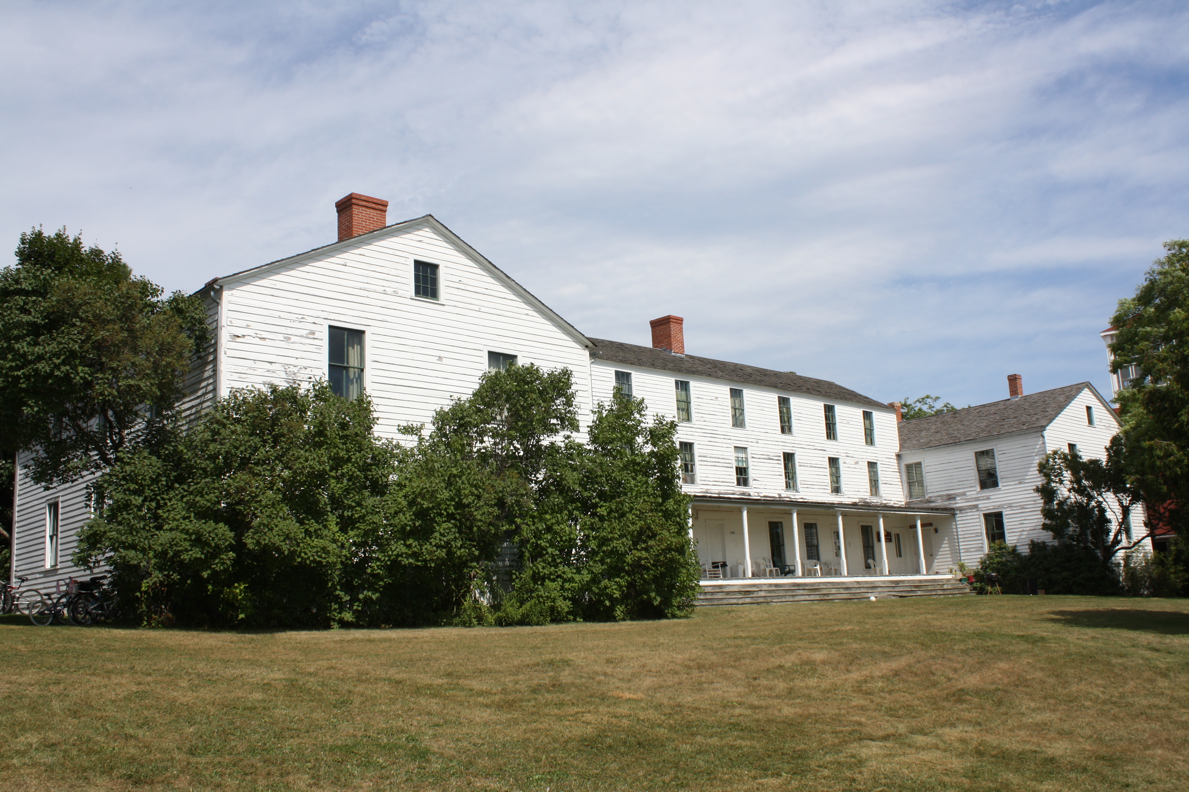
45°52′13″N 84°47′57″W / 45.870278°N 84.799167°WGros Cap Site was probably a cemetery for the nearby Ottawa village in the 17th century. Still in use. 7 Indian Dormitory 
November 5, 1971 Huron St.
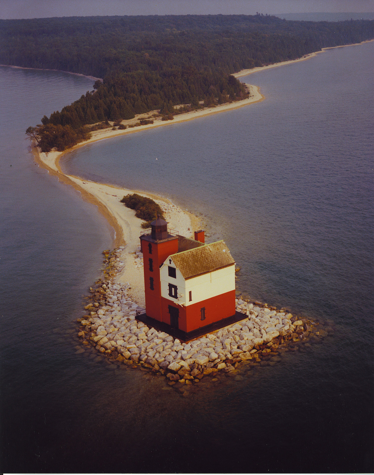
45°51′04″N 84°36′55″W / 45.851111°N 84.615278°WMackinac Island 8 Juntunen Site March 21, 1978 Address Restricted Pointe Aux Pins 9 Lansing Shoals Light Station 
September 6, 2005 Northeastern Lake Michigan, 6.3 mi (10.1 km) southeast of Point Patterson
45°54′12″N 85°33′42″W / 45.903333°N 85.561667°WNewton Township 10 Lasanen Site May 6, 1971 Address Restricted St. Ignace 11 Mackinac Island 
October 15, 1966 Northeast across the Straits of Mackinac from Mackinaw City
45°51′51″N 84°37′46″W / 45.864183°N 84.629583°WMackinac Island 12 Mackinac Trail-Carp River Bridge December 17, 1999 Mackinac Trail over the Carp River
46°01′06″N 84°43′06″W / 46.018333°N 84.718333°WSt. Ignace Township 13 Marquette Street Archaeological District October 29, 1982 Address Restricted St. Ignace 14 Martin Reef Light Station 
July 27, 2005 Northern Lake Huron, 4.3 mi (6.9 km) south of Cadogan Point
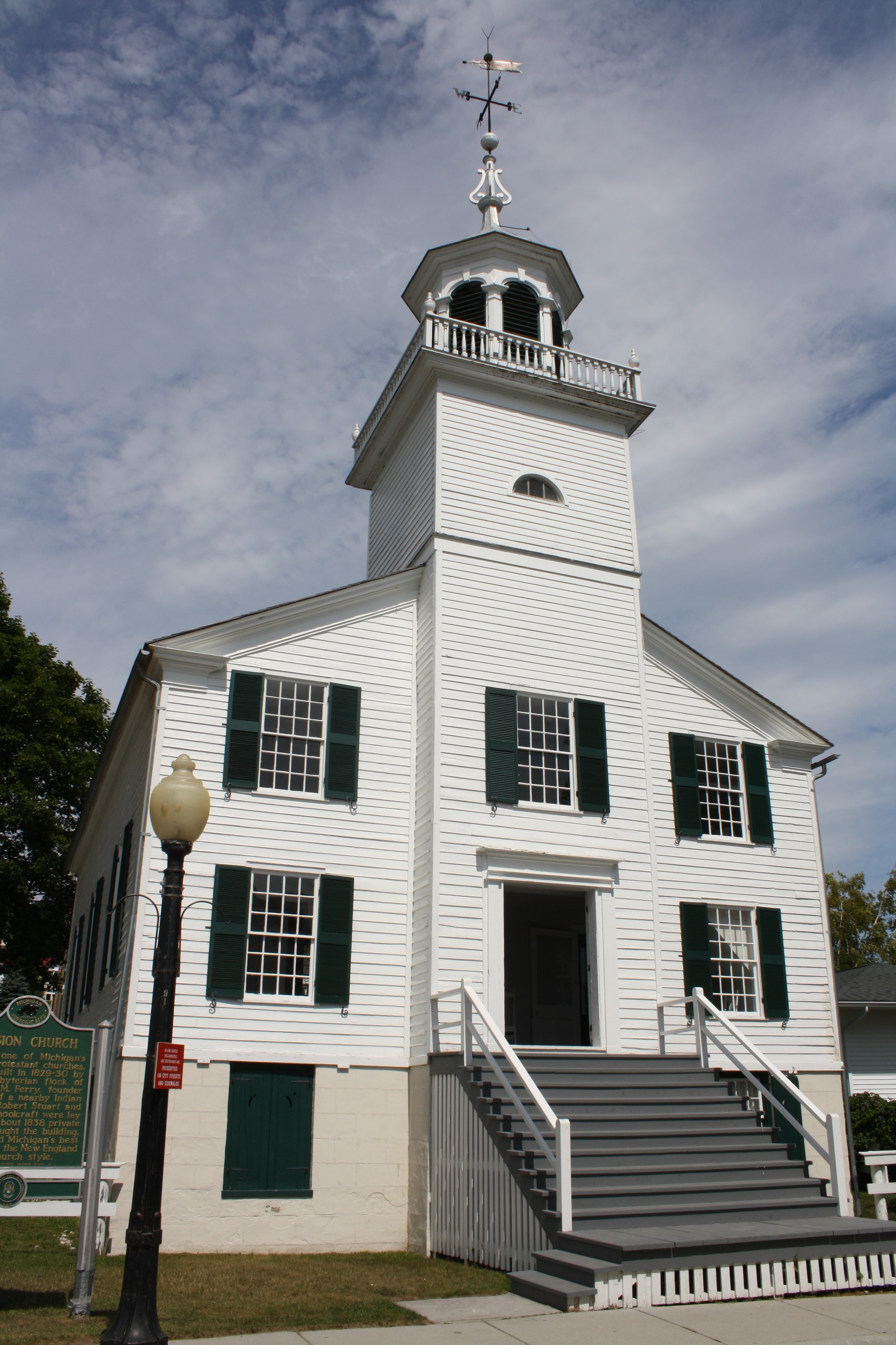
45°54′48″N 84°08′54″W / 45.913333°N 84.148333°WClark Township 15 Mission Church 
January 25, 1971 Huron St.
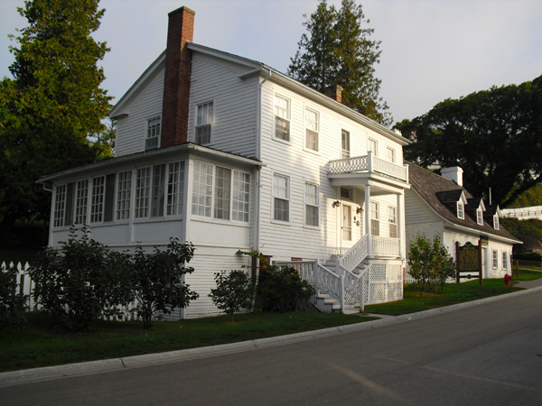
45°51′00″N 84°36′32″W / 45.85°N 84.608889°WMackinac Island 16 Mission House 
April 16, 1971 Huron St.
45°51′04″N 84°36′26″W / 45.851111°N 84.607222°WMackinac Island 17 Round Island Lighthouse 
August 21, 1974 South of Mackinac Island in Hiawatha National Forest
45°50′14″N 84°37′00″W / 45.837222°N 84.616667°WMackinac Island 18 Scott Point Site July 30, 1976 Address Restricted Gould City 19 St. Helena Island Light Station 
April 27, 1988 St. Helena Island, Lake Michigan
45°51′18″N 84°51′48″W / 45.855°N 84.863333°WSt. Ignace 20 St. Ignace Mission 
October 15, 1966 State and Marquette Sts., Marquette Park
45°52′18″N 84°44′38″W / 45.871667°N 84.743889°WSt. Ignace 21 Robert Stuart House 
April 16, 1971 Market St.
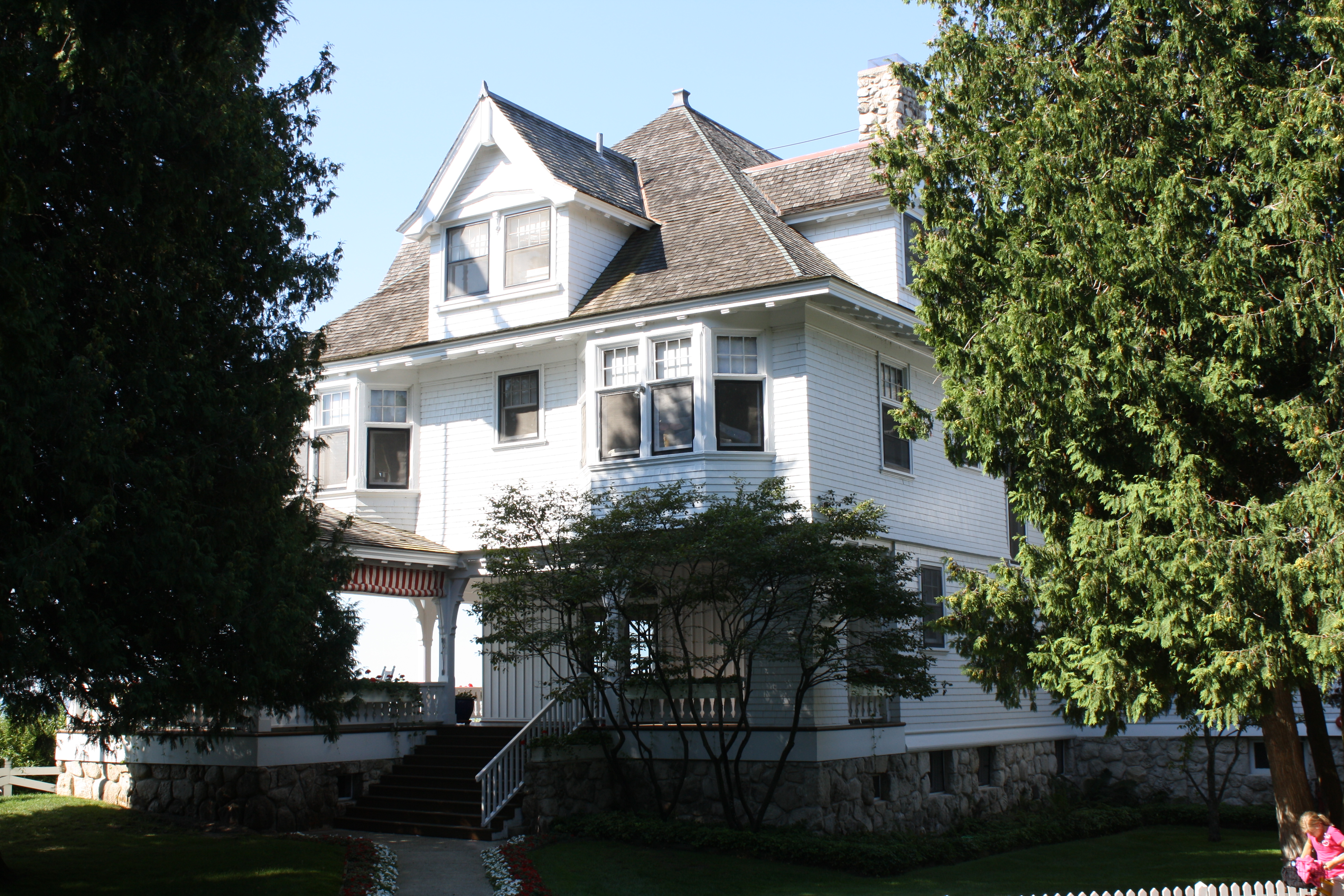
45°50′59″N 84°37′07″W / 45.849722°N 84.618611°WMackinac Island 22 Lawrence Andrew Young Cottage 
November 17, 1997 Junction of Fort Hill and Huron Rd.
45°51′06″N 84°37′13″W / 45.851667°N 84.620278°WMackinac Island The Michigan Governor's Summer Residence See also
- List of Registered Historic Places in Michigan
References
- ^ "National Register of Historic Places: Weekly List Actions". National Park Service, United States Department of the Interior. Retrieved on November 10, 2011.
- ^ Numbers represent an ordering by significant words. Various colorings, defined here, differentiate National Historic Landmark sites and National Register of Historic Places Districts from other NRHP buildings, structures, sites or objects.
- ^ "National Register Information System". National Register of Historic Places. National Park Service. . http://nrhp.focus.nps.gov/natreg/docs/All_Data.html.
U.S. National Register of Historic Places Topics Lists by states Alabama • Alaska • Arizona • Arkansas • California • Colorado • Connecticut • Delaware • Florida • Georgia • Hawaii • Idaho • Illinois • Indiana • Iowa • Kansas • Kentucky • Louisiana • Maine • Maryland • Massachusetts • Michigan • Minnesota • Mississippi • Missouri • Montana • Nebraska • Nevada • New Hampshire • New Jersey • New Mexico • New York • North Carolina • North Dakota • Ohio • Oklahoma • Oregon • Pennsylvania • Rhode Island • South Carolina • South Dakota • Tennessee • Texas • Utah • Vermont • Virginia • Washington • West Virginia • Wisconsin • WyomingLists by territories Lists by associated states Other Categories:- National Register of Historic Places in Michigan by county
- Mackinac County, Michigan
- Buildings and structures in Mackinac County, Michigan
-


Wikimedia Foundation. 2010.