| [4] |
Landmark name[2] |
Image |
Date listed |
Location |
Summary |
| 1 |
Baker's Island Light Station |
 |
01976-11-21 November 21, 1976 |
East of Salem on Baker's Island
42°32′11″N 70°47′11″W / 42.53639°N 70.78639°W / 42.53639; -70.78639 (Baker's Island Light Station) |
|
| 2 |
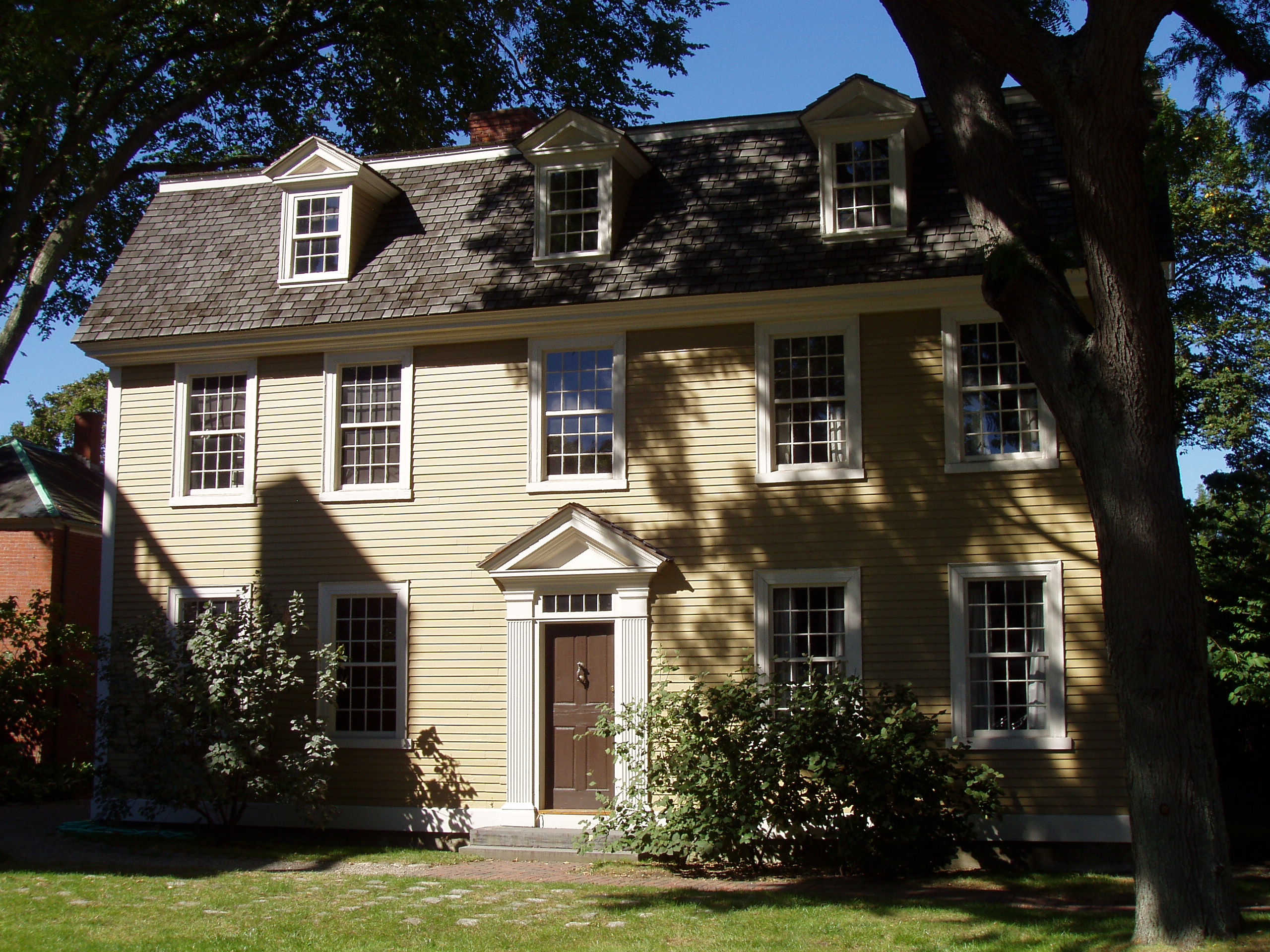
Nathaniel Bowditch House |
 |
01966-10-15 October 15, 1966 |
North St.
42°31′18″N 70°53′58″W / 42.52167°N 70.89944°W / 42.52167; -70.89944 (Bowditch, Nathaniel, House) |
|
| 3 |
Bowker Place |
 |
01983-07-29 July 29, 1983 |
144-156 Essex St.
42°31′19″N 70°53′35″W / 42.52194°N 70.89306°W / 42.52194; -70.89306 (Bowker Place) |
|
| 4 |
Bridge Street Neck Historic District |
|
02002-07-19 July 19, 2002 |
Bridge St. and side streets between March/Osgood Sts., and Howard/Webb Sts.
42°31′48″N 70°53′19″W / 42.53°N 70.88861°W / 42.53; -70.88861 (Bridge Street Neck Historic District) |
|
| 5 |
Charter Street Historic District |
 |
01975-03-10 March 10, 1975 |
Bounded by Liberty, Derby, Central, and Charter Sts.
42°31′13″N 70°53′34″W / 42.52028°N 70.89278°W / 42.52028; -70.89278 (Charter Street Historic District) |
|
| 6 |
Chestnut Street District |
 |
01973-08-28 August 28, 1973 |
Bounded roughly by Broad, Flint, Federal, and Summer Sts.
42°31′13″N 70°54′8″W / 42.52028°N 70.90222°W / 42.52028; -70.90222 (Chestnut Street District) |
|
| 7 |
Rufus Choate House |
 |
01982-11-12 November 12, 1982 |
14 Lynde St.
42°31′21″N 70°53′48″W / 42.5225°N 70.89667°W / 42.5225; -70.89667 (Choate, Rufus, House) |
|
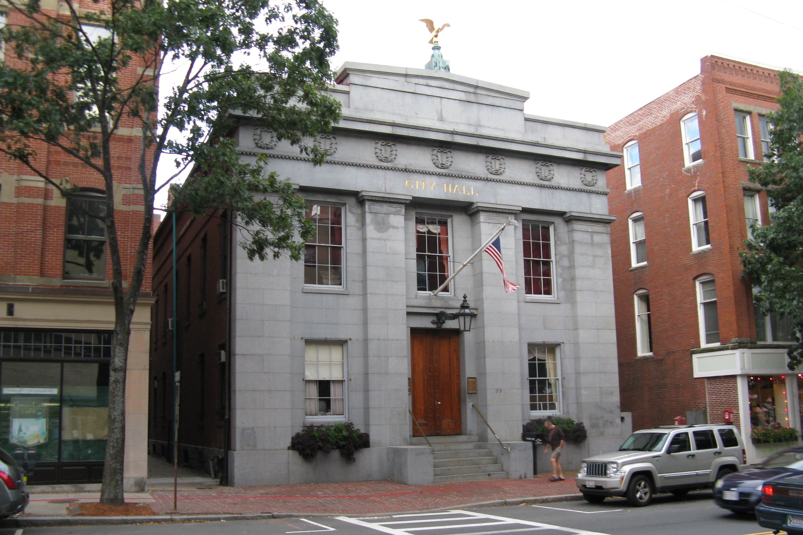
| 8 |
City Hall |
 |
01973-04-03 April 3, 1973 |
93 Washington St.
42°31′19″N 70°53′45″W / 42.52194°N 70.89583°W / 42.52194; -70.89583 (City Hall) |
|
| 9 |
Crombie Street District |
 |
01983-09-16 September 16, 1983 |
7-15 and 16-18 Crombie St., and 13 Barton St.
42°31′14″N 70°53′52″W / 42.52056°N 70.89778°W / 42.52056; -70.89778 (Crombie Street District) |
|
| 10 |
Derby Waterfront District |
 |
01976-05-17 May 17, 1976 |
Derby St. from Herbert St. to Block House Sq., waterfront streets between Kosciusko and Blaney Sts.
42°31′18″N 70°53′6″W / 42.52167°N 70.885°W / 42.52167; -70.885 (Derby Waterfront District) |
|
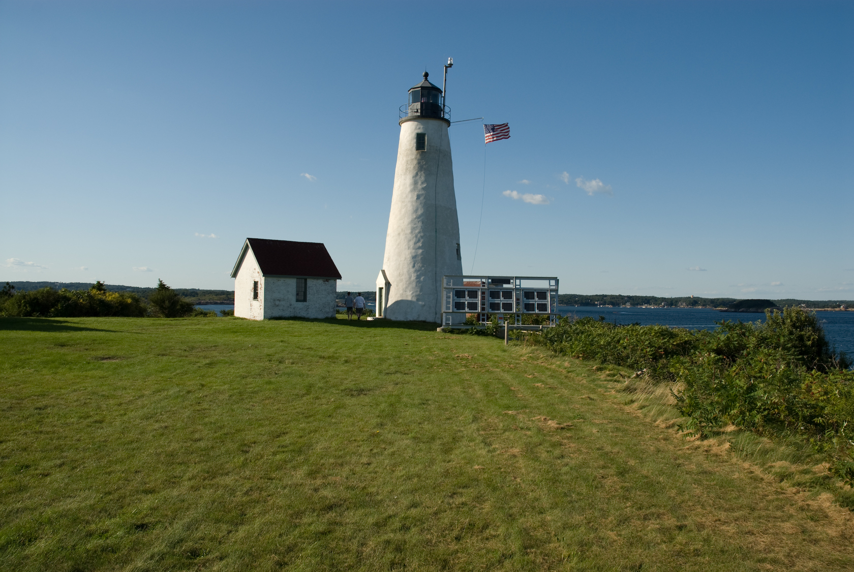
| 11 |
Derby Wharf Light Station |
 |
01987-06-15 June 15, 1987 |
Derby Wharf
42°30′52″N 70°53′4″W / 42.51444°N 70.88444°W / 42.51444; -70.88444 (Derby Wharf Light Station) |
|
| 12 |
Downtown Salem District |
 |
01983-10-18 October 18, 1983 |
Roughly bounded by Church, Central, New Derby, and Washington Sts.
42°31′16″N 70°53′45″W / 42.52111°N 70.89583°W / 42.52111; -70.89583 (Downtown Salem District) |
|
| 13 |
Essex County Court Buildings |
 |
01976-05-17 May 17, 1976 |
32 Federal St.
42°31′23″N 70°53′51″W / 42.52306°N 70.8975°W / 42.52306; -70.8975 (Essex County Court Buildings) |
|
| 14 |
Essex Institute Historic District |
 |
01972-06-22 June 22, 1972 |
134-132, 128, 126 Essex St. and 13 Washington Sq., W.
42°31′20″N 70°53′33″W / 42.52222°N 70.8925°W / 42.52222; -70.8925 (Essex Institute Historic District) |
|
| 15 |
Federal Street District |
 |
01983-09-16 September 16, 1983 |
Roughly bounded by Bridge, Washington, Federal, and Summer Sts.
42°31′22″N 70°53′52″W / 42.52278°N 70.89778°W / 42.52278; -70.89778 (Federal Street District) |
|
| 16 |
Joseph Fenno House-Woman's Friend Society |
|
02008-09-17 September 17, 2008 |
12-14 Hawthorne Boulevard
42°31′18.34″N 70°53′25.31″W / 42.5217611°N 70.8903639°W / 42.5217611; -70.8903639 (Joseph Fenno House-Woman's Friend Society) |
|
| 17 |
First Universalist Church |
 |
01983-07-29 July 29, 1983 |
6 Rust St.
42°31′26″N 70°53′44″W / 42.52389°N 70.89556°W / 42.52389; -70.89556 (First Universalist Church) |
|
| 18 |
Fort Lee |
|
01994-04-14 April 14, 1994 |
Address Restricted |
|
| 19 |
Fort Pickering |
|
01973-02-08 February 8, 1973 |
Winter Island
42°31′36″N 70°54′2″W / 42.52667°N 70.90056°W / 42.52667; -70.90056 (Fort Pickering) |
|
| 20 |
Gardiner-Pingree House |
 |
01970-12-30 December 30, 1970 |
128 Essex St.
42°31′21″N 70°53′31″W / 42.5225°N 70.89194°W / 42.5225; -70.89194 (Gardiner-Pingree House) |
|
| 21 |
Gedney and Cox Houses |
|
01974-10-01 October 1, 1974 |
21 High St.
42°31′6″N 70°53′53″W / 42.51833°N 70.89806°W / 42.51833; -70.89806 (Gedney and Cox Houses) |
|
| 22 |
Hamilton Hall |
 |
01970-12-30 December 30, 1970 |
9 Cambridge St.
42°31′10″N 70°53′58″W / 42.51944°N 70.89944°W / 42.51944; -70.89944 (Hamilton Hall) |
|
| 23 |
House of the Seven Gables Historic District |
 |
01973-05-08 May 8, 1973 |
54 Turner St. at Derby and Hardy Sts.
42°31′18″N 70°53′22″W / 42.52167°N 70.88944°W / 42.52167; -70.88944 (House of Seven Gables Historic District) |
|
| 24 |
Bessie Monroe House |
 |
01983-07-29 July 29, 1983 |
7 Ash St.
42°31′25″N 70°53′43″W / 42.52361°N 70.89528°W / 42.52361; -70.89528 (Monroe, Bessie, House) |
|
| 25 |
William Murray House |
 |
01990-03-09 March 9, 1990 |
39 Essex St.
42°31′24″N 70°53′10″W / 42.52333°N 70.88611°W / 42.52333; -70.88611 (Murray, William, House) |
|
| 26 |
Old Town Hall Historic District |
 |
01972-12-04 December 4, 1972 |
Derby Sq. and 215-231 Essex, 121-145 Washington, and 6-34 Front Sts.
42°31′16″N 70°53′43″W / 42.52111°N 70.89528°W / 42.52111; -70.89528 (Old Town Hall Historic District) |
|
| 27 |
Peabody Museum of Salem |
 |
01966-10-15 October 15, 1966 |
161 Essex St.
42°31′18″N 70°53′36″W / 42.52167°N 70.89333°W / 42.52167; -70.89333 (Peabody Museum of Salem) |
|
| 28 |
John P. Peabody House |
 |
01983-07-29 July 29, 1983 |
15 Summer St.
42°31′13″N 70°53′56″W / 42.52028°N 70.89889°W / 42.52028; -70.89889 (Peabody, John P., House) |
|
| 29 |
Peirce-Nichols House |
 |
01968-11-24 November 24, 1968 |
80 Federal St.
42°31′22″N 70°54′0″W / 42.52278°N 70.9°W / 42.52278; -70.9 (Peirce-Nichols House) |
|
| 30 |
Salem Common Historic District |
 |
01976-05-12 May 12, 1976 |
Bounded roughly by St. Peter's, Bridge, and Derby Sts. and Collins Cove
42°31′22″N 70°53′28″W / 42.52278°N 70.89111°W / 42.52278; -70.89111 (Salem Common Historic District) |
|
| 31 |
Salem Diner |
 |
01999-09-22 September 22, 1999 |
70½ Loring Ave.
42°30′4″N 70°53′47″W / 42.50111°N 70.89639°W / 42.50111; -70.89639 (Salem Diner) |
|
| 32 |
Salem Landry |
|
01983-07-29 July 29, 1983 |
55 Lafayette St.
42°31′12″N 70°53′38″W / 42.52°N 70.89389°W / 42.52; -70.89389 (Salem Landry) |
|
| 33 |
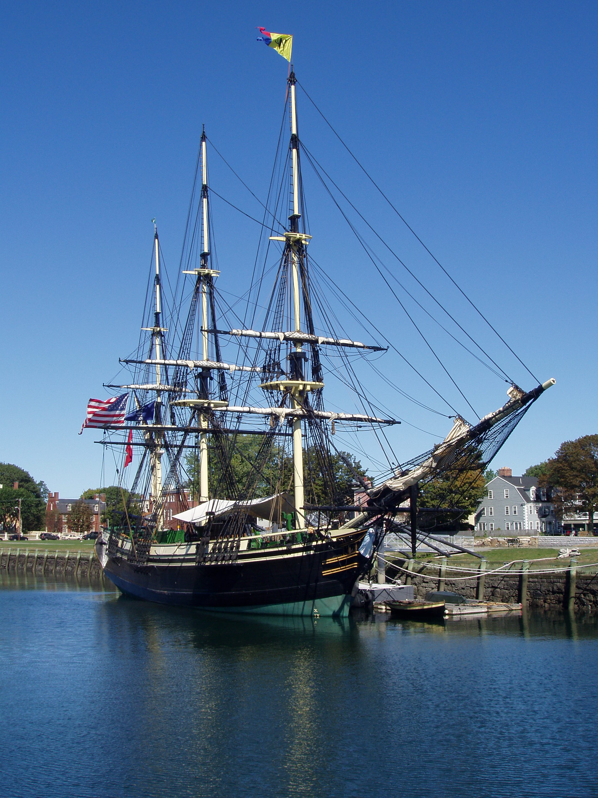
Salem Maritime National Historic Site |
 |
01966-10-15 October 15, 1966 |
Derby St.
42°31′9″N 70°53′10″W / 42.51917°N 70.88611°W / 42.51917; -70.88611 (Salem Maritime National Historic Site) |
|
| 34 |
Salem Willows Historic District |
 |
01994-03-25 March 25, 1994 |
Roughly Columbus, Bay View, Beach and Fort Aves.
42°31′57″N 70°52′6″W / 42.5325°N 70.86833°W / 42.5325; -70.86833 (Salem Willows Historic District) |
|
| 35 |
Shepard Block |
 |
01983-07-29 July 29, 1983 |
298-304 Essex St.
42°31′17″N 70°53′57″W / 42.52139°N 70.89917°W / 42.52139; -70.89917 (Shepard Block) |
|
| 36 |
St. Nicholas Orthodox Church and Rectory |
 |
01994-02-18 February 18, 1994 |
64-66 Forrester St.
42°31′32″N 70°53′7″W / 42.52556°N 70.88528°W / 42.52556; -70.88528 (St. Nicholas Orthodox Church and Rectory) |
|
| 37 |
Joseph Story House |
 |
01973-11-07 November 7, 1973 |
26 Winter St.
42°31′29″N 70°53′27″W / 42.52472°N 70.89083°W / 42.52472; -70.89083 (Story, Joseph, House) |
|
| 38 |
US Post Office-Salem Main |
 |
01986-06-04 June 4, 1986 |
2 Margin St.
42°31′10.47″N 70°53′46.95″W / 42.519575°N 70.896375°W / 42.519575; -70.896375 (US Post Office-Salem Main) |
|
| 39 |
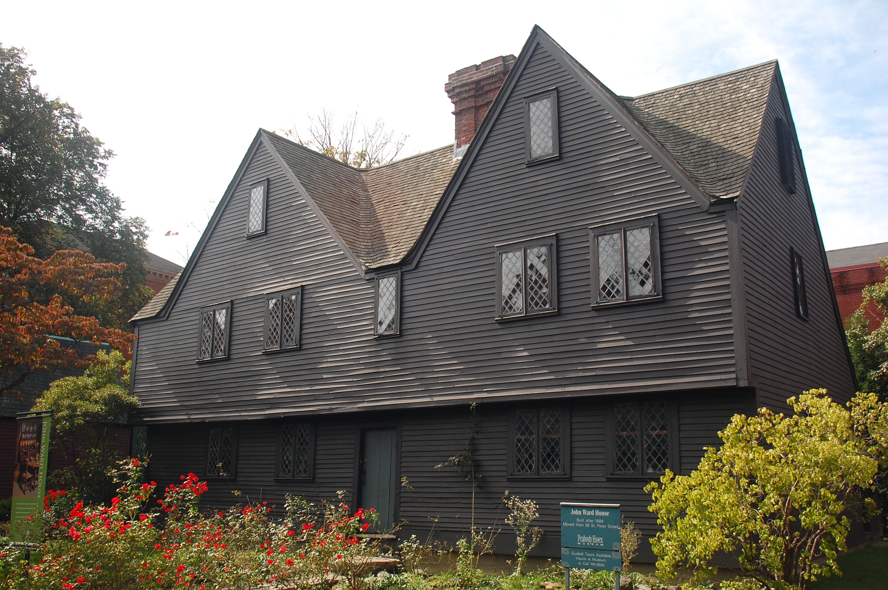
John Ward House |
 |
01968-11-24 November 24, 1968 |
132 Essex St.
42°31′22″N 70°53′36″W / 42.52278°N 70.89333°W / 42.52278; -70.89333 (Ward, John, House) |
|
| 40 |
Joshua Ward House |
 |
01978-02-08 February 8, 1978 |
148 Washington St.
42°31′13″N 70°53′48″W / 42.52028°N 70.89667°W / 42.52028; -70.89667 (Ward, Joshua, House) |
|
| 41 |
Wesley Methodist Church |
 |
01983-07-29 July 29, 1983 |
8 North St.
42°31′19″N 70°53′56″W / 42.52194°N 70.89889°W / 42.52194; -70.89889 (Wesley Methodist Church) |
|
| 42 |
West Cogswell House |
 |
01983-07-29 July 29, 1983 |
5-9 Summer St.
42°31′15″N 70°53′56″W / 42.52083°N 70.89889°W / 42.52083; -70.89889 (West Cogswell House) |
|
| 43 |
Winter Island Historic District and Archeological District |
 |
01994-04-14 April 14, 1994 |
Winter Island
42°31′42″N 70°52′9″W / 42.52833°N 70.86917°W / 42.52833; -70.86917 (Winter Island Historic District and Archeological District) |
|
| 44 |
Thomas March Woodbridge House |
|
01975-03-31 March 31, 1975 |
48 Bridge St.
42°31′58″N 70°53′21″W / 42.53278°N 70.88917°W / 42.53278; -70.88917 (Woodbridge, Thomas March, House) |
|
| 45 |
YMCA |
 |
01983-07-29 July 29, 1983 |
284-296 Essex St.
42°31′17″N 70°53′55″W / 42.52139°N 70.89861°W / 42.52139; -70.89861 (YMCA) |
|
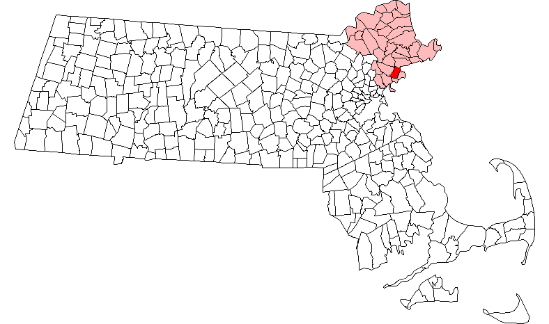
 Location of Salem in Massachusetts
 Category:National Register of Historic Places •
  Portal:National Register of Historic PlacesCategories: