- Derby Waterfront District
-
Derby Waterfront District
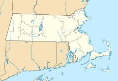

Location: Salem, Massachusetts Coordinates: 42°31′18″N 70°53′6″W / 42.52167°N 70.885°WCoordinates: 42°31′18″N 70°53′6″W / 42.52167°N 70.885°W Built: 1735 Architect: Unknown Architectural style: Federal Governing body: Local NRHP Reference#: 76000297
[1]Added to NRHP: May 17, 1976 Derby Waterfront District is a historic district on Derby Street from Herbert Street to Block House Square, and the waterfront streets between Kosciusko and Blaney Streets in Salem, Massachusetts.
References
- ^ "National Register Information System". National Register of Historic Places. National Park Service. 2008-04-15. http://nrhp.focus.nps.gov/natreg/docs/All_Data.html.
U.S. National Register of Historic Places Topics Lists by states Alabama • Alaska • Arizona • Arkansas • California • Colorado • Connecticut • Delaware • Florida • Georgia • Hawaii • Idaho • Illinois • Indiana • Iowa • Kansas • Kentucky • Louisiana • Maine • Maryland • Massachusetts • Michigan • Minnesota • Mississippi • Missouri • Montana • Nebraska • Nevada • New Hampshire • New Jersey • New Mexico • New York • North Carolina • North Dakota • Ohio • Oklahoma • Oregon • Pennsylvania • Rhode Island • South Carolina • South Dakota • Tennessee • Texas • Utah • Vermont • Virginia • Washington • West Virginia • Wisconsin • WyomingLists by territories Lists by associated states Other This article about a National Register of Historic Places listing in Essex County Massachusetts is a stub. You can help Wikipedia by expanding it.
