- National Register of Historic Places listings in Holmes County, Mississippi
-
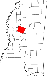 Location of Holmes County in Mississippi
This is a list of the National Register of Historic Places listings in Holmes County, Mississippi.
This is intended to be a complete list of the properties and districts on the National Register of Historic Places in Holmes County, Mississippi, United States. Latitude and longitude coordinates are provided for many National Register properties and districts; these locations may be seen together in a Google map.[1]
There are 16 properties and districts listed on the National Register in the county.
-
- This National Park Service list is complete through NPS recent listings posted November 10, 2011.[2]
Current listings
[3] Landmark name [4] Image Date listed Location City or town Summary 1 Acona Church, Cemetery, and School March 20, 2002 Mississippi Highway 17
33°16′05″N 90°01′08″W / 33.268056°N 90.018889°WLexington 2 Mollie Clark House September 15, 1980 2221 Yazoo St.
32°53′04″N 89°58′31″W / 32.884444°N 89.975278°WPickens 3 Clifton Plantation House October 3, 1985 Off Mississippi Highway 12
33°07′55″N 90°11′05″W / 33.131944°N 90.184722°WHoward 4 Joe Cowsert Place Site (22HO507) February 27, 1987 Address Restricted Goodman 5 Eureka Masonic College 
November 10, 1970 On Mississippi Highway 17
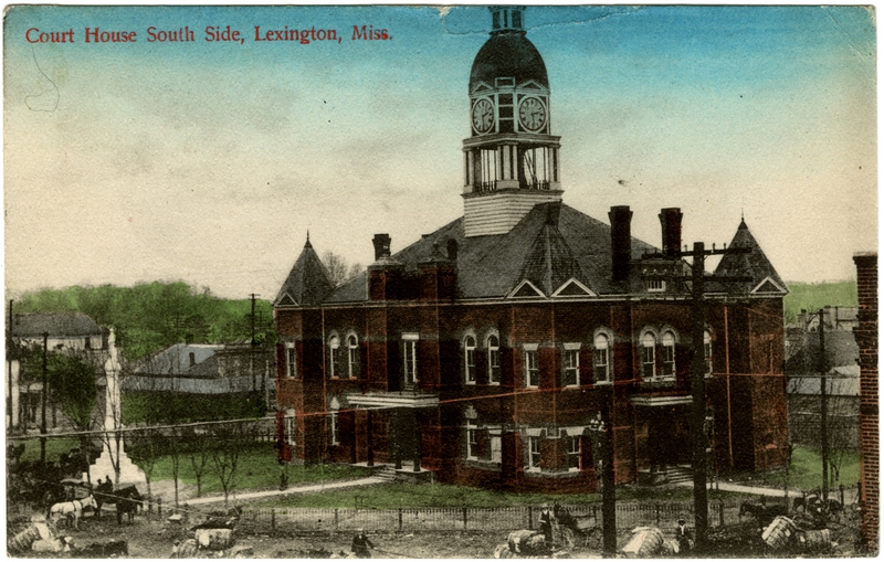
32°58′25″N 89°59′11″W / 32.973611°N 89.986389°WRichland 6 French Site (22HO565) November 6, 1986 Address Restricted Cruger Extends into Carroll County 7 Holmes County Courthouse Complex 
November 10, 1994 Court Sq.
33°06′45″N 90°03′10″W / 33.1125°N 90.052778°WLexington 8 Holmes County State Park July 25, 1997 Between Interstate 55 and Mississippi Highway 51, 1 mile south of Durant
33°01′48″N 89°55′27″W / 33.03°N 89.924167°WDurant 9 Frances Lee Mound Group (22HO654) April 6, 1988 Address Restricted Tchula 10 Lexington Historic District July 19, 2001 Roughly Courthouse Sq., along Yazoo, Vine, Tchula, Boulevard, Springs, Race Sts., and Old Tchula Rd.
33°06′53″N 90°02′59″W / 33.114722°N 90.049722°WLexington 11 Gov. Edmund F. Noel House November 18, 1999 315 North St.
33°06′57″N 90°03′00″W / 33.115833°N 90.05°WLexington 12 Old Hoover Place Site (22HO502) March 1, 1987 Address Restricted Pickens 13 Oswego Site (22HO658) April 6, 1988 Address Restricted Tchula 14 Providence Mound (22HO609) March 1, 1987 Address Restricted Lexington 15 Tye House December 18, 1979 2440 N. 1st St.
32°53′14″N 89°58′42″W / 32.887222°N 89.978333°WPickens 16 West Historic District September 14, 1993 Roughly bounded by Emory St., Anderson Ave., and Cross St., and the Illinois Central railroad tracks
33°11′55″N 89°46′48″W / 33.198611°N 89.78°WWest See also
- List of National Historic Landmarks in Mississippi
- National Register of Historic Places listings in Mississippi
References
- ^ The latitude and longitude information provided in this table was derived originally from the National Register Information System, which has been found to be fairly accurate for about 99% of listings. For about 1% of NRIS original coordinates, experience has shown that one or both coordinates are typos or otherwise extremely far off; some corrections may have been made. A more subtle problem causes many locations to be off by up to 150 yards, depending on location in the country: most NRIS coordinates were derived from tracing out latitude and longitudes off of USGS topographical quadrant maps created under the North American Datum of 1927, which differs from the current, highly accurate WGS84 GPS system used by Google maps. Chicago is about right, but NRIS longitudes in Washington are higher by about 4.5 seconds, and are lower by about 2.0 seconds in Maine. Latitudes differ by about 1.0 second in Florida. Some locations in this table may have been corrected to current GPS standards.
- ^ "National Register of Historic Places: Weekly List Actions". National Park Service, United States Department of the Interior. Retrieved on November 10, 2011.
- ^ Numbers represent an ordering by significant words. Various colorings, defined here, differentiate National Historic Landmark sites and National Register of Historic Places Districts from other NRHP buildings, structures, sites or objects.
- ^ "National Register Information System". National Register of Historic Places. National Park Service. . http://nrhp.focus.nps.gov/natreg/docs/All_Data.html.
U.S. National Register of Historic Places Topics Lists by states Alabama • Alaska • Arizona • Arkansas • California • Colorado • Connecticut • Delaware • Florida • Georgia • Hawaii • Idaho • Illinois • Indiana • Iowa • Kansas • Kentucky • Louisiana • Maine • Maryland • Massachusetts • Michigan • Minnesota • Mississippi • Missouri • Montana • Nebraska • Nevada • New Hampshire • New Jersey • New Mexico • New York • North Carolina • North Dakota • Ohio • Oklahoma • Oregon • Pennsylvania • Rhode Island • South Carolina • South Dakota • Tennessee • Texas • Utah • Vermont • Virginia • Washington • West Virginia • Wisconsin • WyomingLists by territories Lists by associated states Other Municipalities and communities of Holmes County, Mississippi Cities 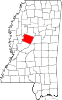
Towns Unincorporated
communitiesAcona | Coxburg | Ebenezer | Egypt | Franklin | Howard | Ituma | Marcella | Montgomery | Owens Wells | Richland | Thornton | Tolarville
Categories:- Holmes County, Mississippi
- National Register of Historic Places in Mississippi by county
- Buildings and structures in Holmes County, Mississippi
-


Wikimedia Foundation. 2010.