- National Register of Historic Places listings in Pike County, Mississippi
-
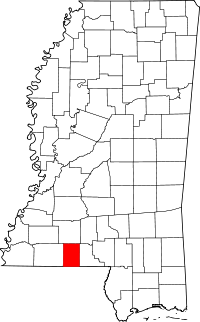 Location of Pike County in Mississippi
This is a list of the National Register of Historic Places listings in Pike County, Mississippi.
This is intended to be a complete list of the properties and districts on the National Register of Historic Places in Pike County, Mississippi, United States. Latitude and longitude coordinates are provided for many National Register properties and districts; these locations may be seen together in a Google map.[1]
There are 26 properties and districts listed on the National Register in the county.
-
- This National Park Service list is complete through NPS recent listings posted November 10, 2011.[2]
Current listings
[3] Landmark name [4] Image Date listed Location City or town Summary 1 The Annex October 11, 1984 225 Magnolia St.
31°08′41″N 90°27′31″W / 31.144722°N 90.458611°WMagnolia 2 Bank of Summit July 7, 1983 811 Robb St.
31°17′00″N 90°28′02″W / 31.283333°N 90.467222°WSummit 3 Berryhill House October 11, 1984 265 W. Railroad Ave.
31°08′44″N 90°27′28″W / 31.145556°N 90.457778°WMagnolia 4 Brentwood March 9, 1989 601 Delaware Ave.
31°14′42″N 90°26′51″W / 31.245°N 90.4475°WMcComb 5 Buie Building October 11, 1984 110 E. Railroad Ave.
31°08′37″N 90°27′27″W / 31.143611°N 90.4575°WMagnolia 6 Carraway House October 11, 1984 420 N. Clark St.
31°08′54″N 90°27′33″W / 31.148333°N 90.459167°WMagnolia 7 George Chadwick House October 11, 1984 560 N. Cherry St.
31°08′57″N 90°27′25″W / 31.149167°N 90.456944°WMagnolia 8 Depot October 11, 1984 101 E. Railroad Ave.
31°08′38″N 90°27′28″W / 31.143889°N 90.457778°WMagnolia 9 Phillip Henry Enochs House March 20, 2002 1001 Dogwood Dr.
31°10′49″N 90°26′48″W / 31.180278°N 90.446667°WFernwood 10 Everette-Gottig-Bilbo House October 11, 1984 109 E. Myrtle St.
31°08′49″N 90°27′35″W / 31.146944°N 90.459722°WMagnolia 11 Holmes House October 11, 1984 405 N. Cherry St.
31°08′52″N 90°27′30″W / 31.147778°N 90.458333°WMagnolia 12 William Frederick Holmes House March 22, 2004 302 3rd St.
31°14′30″N 90°27′18″W / 31.241667°N 90.455°WMcComb 13 Kramertown-Railroad Historic District March 13, 1980 S. Railroad Boulevard
31°14′29″N 90°26′59″W / 31.241389°N 90.449722°WMcComb 14 Lanier House October 11, 1984 400 N. Clark St.
31°08′52″N 90°27′34″W / 31.147778°N 90.459444°WMagnolia 15 Magnolia Manor September 9, 1983 3rd and Amite Sts.
31°00′17″N 90°28′31″W / 31.004722°N 90.475278°WOsyka 16 McComb Downtown Historic District April 14, 2004 Roughly bounded by Broadway, State, Front, and Canal Sts.
31°14′37″N 90°27′10″W / 31.243611°N 90.452778°WMcComb 17 Mullendore House October 11, 1984 515 N. Cherry St.
31°08′56″N 90°27′28″W / 31.148889°N 90.457778°WMagnolia 18 Myrtle Street Historic District October 11, 1984 W. Myrtle St. between N. Clark and N. Prewitt Sts.
31°08′49″N 90°27′39″W / 31.146944°N 90.460833°WMagnolia 19 Norwood-TWL Building October 11, 1984 131 W. Railroad Ave.
31°08′38″N 90°27′31″W / 31.143889°N 90.458611°WMagnolia 20 Simmons House October 11, 1984 489 Prewitt St.
31°08′58″N 90°27′39″W / 31.149444°N 90.460833°WMagnolia 21 Southtown Historic District October 11, 1984 Roughly bounded by Minnehaha Creek, the Illinois Central railroad tracks, and Bay, Laurel, and Prewitt Sts.
31°08′32″N 90°27′41″W / 31.142222°N 90.461389°WMagnolia 22 Spinks Plantation November 14, 2007 ½ mile north of the junction of Muddy Springs and Irene Rds.
31°09′06″N 90°32′18″W / 31.151667°N 90.538333°WMagnolia 23 Stogner House October 11, 1984 550 N. Cherry St.
31°08′56″N 90°27′26″W / 31.148889°N 90.457222°WMagnolia 24 Tanglewood August 23, 1991 County Road 468, 1 mile north of Mississippi Highway 48
31°08′02″N 90°22′44″W / 31.133889°N 90.378889°WMagnolia 25 US Post Office-Magnolia March 18, 1993 205 Magnolia St.
31°08′42″N 90°27′31″W / 31.145°N 90.458611°WMagnolia 26 White-Alford House April 21, 1983 845 White Boulevard
31°13′52″N 90°26′17″W / 31.231111°N 90.438056°WMcComb See also
- List of National Historic Landmarks in Mississippi
- National Register of Historic Places listings in Mississippi
References
- ^ The latitude and longitude information provided in this table was derived originally from the National Register Information System, which has been found to be fairly accurate for about 99% of listings. For about 1% of NRIS original coordinates, experience has shown that one or both coordinates are typos or otherwise extremely far off; some corrections may have been made. A more subtle problem causes many locations to be off by up to 150 yards, depending on location in the country: most NRIS coordinates were derived from tracing out latitude and longitudes off of USGS topographical quadrant maps created under the North American Datum of 1927, which differs from the current, highly accurate WGS84 GPS system used by Google maps. Chicago is about right, but NRIS longitudes in Washington are higher by about 4.5 seconds, and are lower by about 2.0 seconds in Maine. Latitudes differ by about 1.0 second in Florida. Some locations in this table may have been corrected to current GPS standards.
- ^ "National Register of Historic Places: Weekly List Actions". National Park Service, United States Department of the Interior. Retrieved on November 10, 2011.
- ^ Numbers represent an ordering by significant words. Various colorings, defined here, differentiate National Historic Landmark sites and National Register of Historic Places Districts from other NRHP buildings, structures, sites or objects.
- ^ "National Register Information System". National Register of Historic Places. National Park Service. . http://nrhp.focus.nps.gov/natreg/docs/All_Data.html.
U.S. National Register of Historic Places Topics Lists by states Alabama • Alaska • Arizona • Arkansas • California • Colorado • Connecticut • Delaware • Florida • Georgia • Hawaii • Idaho • Illinois • Indiana • Iowa • Kansas • Kentucky • Louisiana • Maine • Maryland • Massachusetts • Michigan • Minnesota • Mississippi • Missouri • Montana • Nebraska • Nevada • New Hampshire • New Jersey • New Mexico • New York • North Carolina • North Dakota • Ohio • Oklahoma • Oregon • Pennsylvania • Rhode Island • South Carolina • South Dakota • Tennessee • Texas • Utah • Vermont • Virginia • Washington • West Virginia • Wisconsin • WyomingLists by territories Lists by associated states Other Municipalities and communities of Pike County, Mississippi Cities 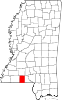
Towns Unincorporated
communitiesChatawa | Fernwood | Pricedale
Categories:- Pike County, Mississippi
- National Register of Historic Places in Mississippi by county
- Buildings and structures in Pike County, Mississippi
-

Wikimedia Foundation. 2010.