- Tchula, Mississippi
Infobox Settlement
official_name = Tchula, Mississippi
settlement_type =Town
nickname =
motto =
imagesize =
image_caption =
image_
imagesize =
image_caption =
image_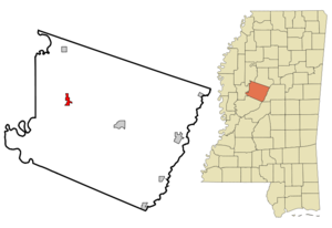
mapsize = 250px
map_caption = Location of Tchula, Mississippi
mapsize1 =
map_caption1 =subdivision_type = Country
subdivision_name =United States
subdivision_type1 = State
subdivision_name1 =Mississippi
subdivision_type2 = County
subdivision_name2 = Holmes
government_footnotes =
government_type =
leader_title =Mayor
leader_name =Yvonne Brown
leader_title1 =
leader_name1 =
established_title =
established_date =unit_pref = Imperial
area_footnotes =area_magnitude =
area_total_km2 = 3.7
area_land_km2 = 3.6
area_water_km2 = 0.1
area_total_sq_mi = 1.4
area_land_sq_mi = 1.4
area_water_sq_mi = 0.0population_as_of = 2000
population_footnotes =
population_total = 2332
population_density_km2 = 650.0
population_density_sq_mi = 1683.6timezone = Central (CST)
utc_offset = -6
timezone_DST = CDT
utc_offset_DST = -5
elevation_footnotes =
elevation_m = 34
elevation_ft = 112
latd = 33 |latm = 10 |lats = 51 |latNS = N
longd = 90 |longm = 13 |longs = 21 |longEW = Wpostal_code_type =
ZIP code
postal_code = 39169
area_code = 662
blank_name = FIPS code
blank_info = 28-72440
blank1_name = GNIS feature ID
blank1_info = 0678607
website =
footnotes =Tchula is a town in Holmes County,
Mississippi ,United States . The population was 2,332 at the 2000 census.Geography
Tchula is located at coor dms|33|10|51|N|90|13|21|W|city (33.180711, -90.222588)GR|1.
According to the
United States Census Bureau , the town has a total area of 1.4square mile s (3.7km² ), of which, 1.4 square miles (3.6 km²) of it is land and 0.04 square miles (0.1 km²) of it (2.11%) is water.Demographics
As of the
census GR|2 of 2000, there were 2,332 people, 724 households, and 524 families residing in the town. Thepopulation density was 1,683.6 people per square mile (647.8/km²). There were 772 housing units at an average density of 557.4/sq mi (214.4/km²). The racial makeup of the town was 3.43% White, 95.93% African American, 0.09% Native American, and 0.56% from two or more races. Hispanic or Latino of any race were 0.47% of the population.There were 724 households out of which 38.1% had children under the age of 18 living with them, 21.4% were married couples living together, 45.4% had a female householder with no husband present, and 27.5% were non-families. 25.1% of all households were made up of individuals and 8.8% had someone living alone who was 65 years of age or older. The average household size was 3.22 and the average family size was 3.92.
In the town the population was spread out with 37.9% under the age of 18, 13.0% from 18 to 24, 25.1% from 25 to 44, 14.7% from 45 to 64, and 9.4% who were 65 years of age or older. The median age was 24 years. For every 100 females there were 80.6 males. For every 100 females age 18 and over, there were 71.5 males.
The median income for a household in the town was $11,571, and the median income for a family was $14,773. Males had a median income of $22,250 versus $16,310 for females. The
per capita income for the town was $6,373. About 49.4% of families and 54.4% of the population were below thepoverty line , including 66.6% of those under age 18 and 55.8% of those age 65 or over.Education
The Town of Tchula is served by the
Holmes County School District .Notable natives
*
Yvonne Brown - Mayor who was the Republican challenger toBennie Thompson .
*Jimmy Dawkins - Blues guitarist and singer who moved toChicago at 18 or 19.
*Lester Davenport - blues musician.References
External links
Wikimedia Foundation. 2010.