- Moorooka, Queensland
-
Moorooka
Brisbane, QueenslandPopulation: 8523 (2001 census) Postcode: 4105 Area: 4.1 km² (1.6 sq mi) Location: 9 km (6 mi) from Brisbane LGA: City of Brisbane State District: Yeerongpilly Federal Division: Moreton Suburbs around Moorooka: Yeronga Annerley Tarragindi Yeerongpilly Moorooka Salisbury Rocklea Rocklea Salisbury Moorooka (population 8,576) is a suburb of Brisbane, the state capital of Queensland, Australia. Bordering with Toohey Forest Park, it is seven kilometres south of Brisbane's central business district. The suburb was originally founded as a stop-over for journeys from Brisbane south (Logan and Albert river valleys) and south-west (Ipswich and beyond).
Contents
History
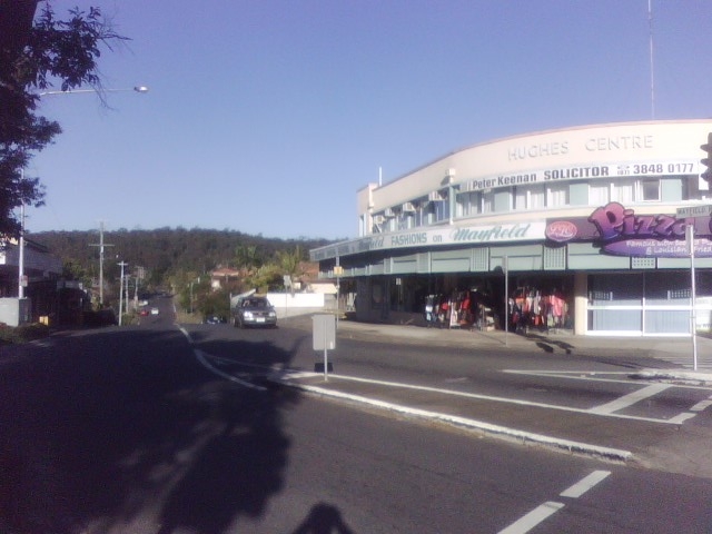
 Hughes Centre and Toohey Forest, from Beaudesert Road
The area was occupied by the Australian Aboriginal Jagera tribe before European settlement. The area was probably a hunting ground with plentiful food and water. There was also reportedly a Bora ring, which older residents of the area recall being shown. The word Moorooka is an indigenous word, either meaning 'iron bark', referring to the numerous iron bark trees in the area, or 'long nose', referring to Mt Toohey at the suburb's periphery.
Residents
Moorooka has traditionally hosted a working class population stemming from its history as a manufacturing hub during World War 2. The southern part of Moorooka bordering Salisbury was the location of government built returned servicemen housing. Recently Moorooka has seen immigrants from various places of the world, including people from the ex-Yugoslavia (Bosnia, Croatia, Serbia), Middle East (Iraq and Iran) and recently people from Africa (Southern Sudan and Eritrea), which has brought an influx of new families into the area. Many of these immigrants live in the low-cost housing and units.
Zoning
The suburb has mixed uses - large areas, particularly in the elevated eastern side of the suburb are residential. The lower, western side of the suburb is dominated by retail, particularly motor vehicle dealerships along Ipswich Road, known popularly throughout Brisbane as the "magic mile", light industry and warehouses.
Transport
The rail line to Robina on the Gold Coast forms the western border of the suburb. Commuter trains on the Beenleigh line stop at Moorooka railway station.
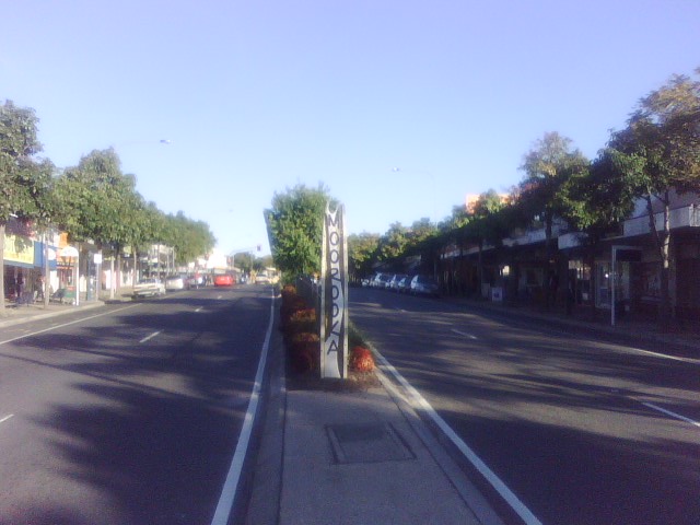
 Moorooka entrance sign at Beaudesert Road shops
Between the 1930s and 1969, trams ran along Beaudesert Road, thence along Ipswich Road to the City. The suburb continues to be served by Brisbane Transport buses, namely the 110 Inala-City server, 116 Rocklea-Moorvale service, the 117 Acacia Ridge-City Valley Service, the 124 Sunnybank-City service, and the 125 Garden City-City Valley service. There is a zone border crossing at the Beaudesert Road shops, popularly known as Moorvale, for transport zones 2 and 3.
Politics
The Moorvale Shopping district hosts office for the Brisbane City Council Councillor for Moorooka Ward Steve Griffiths, and State Government of Queensland Member for Yeerongpilly Ward the Hon Simon Finn MP. The office for the Federal Seat of Moreton is in the nearby suburb of Sunnybank.
Education
Moorooka is serviced by two kindergartens and primary schools, the non-denominational Moorooka State School at Beaudesert Road, and the Roman Catholic St Brendan's at Hawtree Street. Moorooka State School is the oldest of the two, being founded in 1929, and hosts an annual Festival in July. Approximately 700 students attend the School, which features a strong multi-cultural community. Prominent recent headmaster includes Mr Leo Hearn.
Religion
Moorooka has two principal churches, the St Brendan's Catholic Church at Hawtree Street (Roman Catholic), and the Church of Christ at Pampas Street and Beaudesert Road. Both feature Sunday services.
Shopping
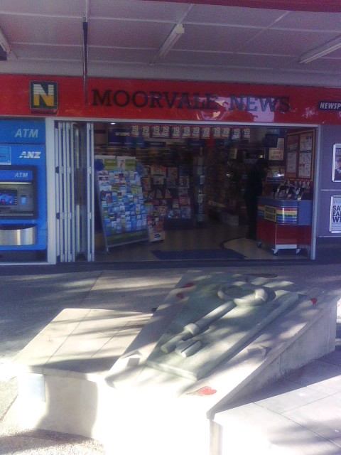
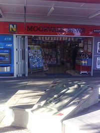 Moorvale Newsagency at Moorooka with artwork "Home is where the heart is"
The principal Moorooka shopping district on Beaudesert Road, known as Moorvale, features over 100 businesses from takeaways to restaurants and coffee shops, discount stores, newsagents, dry cleaners, locksmiths, second hand and pawn shops, and a new range of businesses that serve the African community including food and groceries, hair salons, furniture shops, and halal butcheries.
Moorvale is also known for its extensive Woolworths Supermarket, at the northern end of the shopping district, which was opened in 1972 and was the largest Woolworths in Queensland at the time.
On the South end of Moorooka near the AFL club and Moorooka State Primary School located off Beaudesert Road is Pizza Hut, Shear Image Hair & Beauty.
Architecture
Many of the houses are pre-war Queenslanders (on posts, with simple one floor, wooden construction), with small apartment blocks scattered through the suburb. As with many older suburbs of Brisbane, Moorooka is becoming gentrified, with many older homes now being either renovated and extended or replaced by more modern buildings. There are prime real estate areas on the top of hills, with views to the Great Dividing Range over Archerfield in the south, Seventeen Mile Rocks to the west, Mount Coot-tha, St. Lucia, Indooroopilly to the north-west and the city to the north.
References
External links
- University of Queensland: Queensland Places: Moorooka
- ourbrisbane.com - Moorooka
- BrisBites Moorooka Page
Coordinates: 27°32′06″S 153°01′34″E / 27.535°S 153.026°E
Categories:- Suburbs of Brisbane
Wikimedia Foundation. 2010.