- Bellbowrie, Queensland
Infobox Australian Place | type = suburb
name = Bellbowrie
city = Brisbane
state = qld
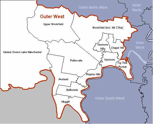
caption = Statistical Portrait, Brisbanes Outer West Region
lga =Brisbane City Council
postcode = 4070
pop = 4,995 (2006 census)
pop_footnotes = [Census 2006 AUS|id=SSC31051|name=Bellbowrie (Brisbane City) (State Suburb)|quick=on|accessdate=2008-02-28]
est =
fedgov = Ryan
stategov =Electoral district of Moggill
dist1 = 17
location1=Brisbane GPO
near-nw = Anstead
near-n = Anstead
near-ne = Pinjarra Hills
near-w = Barellan Point
near-e = Riverhills
near-sw = Moggill
near-s = Moggill
near-se = WacolBellbowrie is a suburb of
Brisbane ,Queensland ,Australia . Bellbowrie lies 17 kilometres west-southwest of Brisbane's city centre. It is a rapidly developing semi-rural area due to Brisbane's growth heading in a westwards direction.Bellbowrie is part of the 'Tyakunda Scout District', "Tyakunda" being an Aboriginal word meaning 'land of the rolling hills' [http://tyakunda.scoutsqld.com.au/about.html] . Bellbowrie is part of the Pullenvale Ward for
Brisbane City Council Elections as well as the seat of Moggill for state elections and the seat of Ryan for federal elections.The initial subdivisions in the area were commenced in the early 1970s. Development slowed in the aftermath of the
1974 Brisbane flood which saw much of the eastern, lower-lying areas of the suburb badly inundated with water. Since the construction of theWivenhoe Dam in the 1980s the threat of floods has been reduced and development has increased. Many acreage owners are subdividing their properties and as a consequence, significant areas of bushland are being cleared. Several new housing estates are being developed on land that used to be pineapple farms.Moggill Road, which bisects the suburb, is a main thoroughfare for traffic passing from Ipswich to central
Brisbane . Commuters may use the Moggill Ferry to gain access to Moggill Road as an alternative to the Centenary Highway. Neighbouring suburbs include: Moggill, Pullenvale, Pinjarra Hills and Anstead.Bellbowrie has an abundance of recreational facilities including many off-leash areas for dogs to play in. The suburb also borders the Brisbane River and some residents have boat ramps in order to access it. A Brisbane City Council run public swimming pool hosts the
Bellbowrie Swim Club . Ample sporting fields (on Sugarwood St) are the home of theMoggill Football Club and theMoggill Cricket Club . Overlooking the fields (and paying for much of the maintenance and upkeep) is the licensed Bellbowrie Sports and Recreation Club Inc - known by locals simply as the "sports & rec" or "the club".There are two schools in the area: Moggill State Primary School and Pullenvale State Primary School.
In addition to the Queensland newspaper
The Courier Mail and the national paperThe Australian , there is a local newspaper, theWestside News .The streetscape in Bellbowrie benefits from the provision of underground power and there are no power poles to be seen.
Two community/lobby groups are active in the area, the
Moggill Community Association and theRural Environmental Planning Association Inc .References
External links
* [http://www.ourbrisbane.com/living/suburbs/bellbowrie/home/ ourbrisbane.com - Bellbowrie section]
* [http://www.moggillss.qld.edu.au/ Moggill State School]
* [http://www.moggill.org/ Moggill Community Association]
* [http://www.repa.org.au/ Rural Environmental Planning Association Inc.]
* [http://www.moggillfc.org.au/ Moggill Football Club (soccer)]
* [http://www.bellbowrieswimclub.org.au/ Bellbowrie Swim Club]
* [http://www.moggill.scoutsqld.com.au/ Moggill (Bellbowrie) Scout Group]
Wikimedia Foundation. 2010.