- Maryland Route 21
-
Maryland Route 21
Tolchester Beach Road 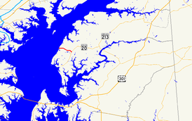
Route information Maintained by MDSHA Length: 2.42 mi[1] (3.89 km) Major junctions West end:  MD 445 in Tolchester Beach
East end:  MD 20 near Fairlee
Location Counties: Kent Highway system Maryland highway system
Interstate • US • State • Minor • Former • Turnpikes← MD 20MD 22  →
→Maryland Route 21 (MD 21) is a state highway in the U.S. state of Maryland. Known as Tolchester Beach Road, the state highway runs 2.42 miles (3.89 km) from MD 445 in Tolchester Beach east to MD 20 near Fairlee in western Kent County. MD 21 was constructed in the mid 1920s to provide a modern road connection to Tolchester Beach, then a major beach resort on the Chesapeake Bay.
Contents
Route description
MD 21's west terminus is coexistent with the northern terminus of MD 445 (Tolchester Road) in Tolchester Beach. Two county highways issue from the intersection: Bay Shore Road heads north while Tolchester Beach Road heads west to the former resort area. MD 21 heads southeast through forest and then farmland on the way to its eastern terminus at MD 20 (Rock Hall Road) south of Fairlee.[1][2]
History
Tolchester Beach was a major resort on the Chesapeake Bay featuring swimming, picnicking, and amusement park-type rides. The resort opened in 1877 and thrived with the traffic generated by steamboat excursions beginning in 1887 from various ports on the bay, including Baltimore.[3] MD 21 was constructed to provide an all-weather road from the Tolchester Beach resort to MD 20 in 1924 and 1925.[4][5] By 1927, a ferry connected Tolchester Beach with the Inner Harbor of Baltimore.[5] This ferry service continued through at least 1940.[6] After a long decline due to the rise of more modern resorts, Tolchester Beach closed in 1962.[3] MD 21's western terminus was moved from the beach east to MD 445 in 1995.[7]
Junction list
The entire route is in Kent County.
Location Mile
[1]Destinations Notes Tolchester Beach 0.00 MD 445 south (Tolchester Road) / Tolchester Beach Road west / Bay Shore Road north – Rock HallWestern terminus Fairlee 2.42 MD 20 (Rock Hall Road) – Chestertown, Galena, Rock HallEastern terminus 1.000 mi = 1.609 km; 1.000 km = 0.621 mi References
- ^ a b c "Highway Location Reference: Kent County" (PDF). Maryland State Highway Administration. 2009. http://www.marylandroads.com/Location/2009_KENT.pdf. Retrieved 2010-10-06.
- ^ Google, Inc. Google Maps – Maryland Route 21 (Map). Cartography by Google, Inc. http://maps.google.com/maps?f=d&source=s_d&saddr=MD-21+E%2FTolchester+Beach+Rd&daddr=MD-21+E%2FTolchester+Beach+Rd&geocode=FY5fVgIdduJ0-w%3BFVweVgIdom91-w&hl=en&mra=ls&sll=39.212621,-76.223187&sspn=0.007631,0.01929&ie=UTF8&t=h&z=14. Retrieved 2010-10-06.
- ^ a b Eshelman, Ralph (2005). "Tolchester Beach". Maryland Online Encyclopedia. http://www.mdoe.org/tolchesterbch.html. Retrieved 2010-10-06.
- ^ Report of the State Roads Commission of Maryland. 1924-1926. Baltimore: Maryland State Roads Commission. January 1927. pp. 31, 89. http://www.archive.org/details/annualreportsofs1924mary. Retrieved 2010-10-06.
- ^ a b Maryland Geological Survey. Map of Maryland: Showing State Road System and State Aid Roads (Map) (1927 ed.).
- ^ Maryland State Roads Commission. Map of Maryland Showing Highways and Points of Interest (Map) (1940 ed.).
- ^ Maryland State Highway Administration. Maryland: Official Highway Map (Map) (1995 ed.).
External links
Roads in Kent County, Maryland State highways 
U.S. Highways Categories:- State highways in Maryland
- Roads in Kent County, Maryland


Wikimedia Foundation. 2010.