- Maryland Route 289
-
Maryland Route 289

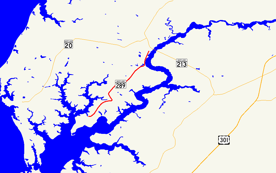
Route information Maintained by MDSHA Length: 8.83 mi[1] (14.21 km) Major junctions South end: Lands End Road/Cliffs City Road near Cliffs City North end:  MD 213 in Chestertown
Location Counties: Kent Highway system Maryland highway system
Interstate • US • State • Minor • Former • Turnpikes←  MD 288
MD 290  →
→Maryland Route 289 (MD 289) is a state highway in the U.S. state of Maryland. Known for most of its length as Quaker Neck Road, the state highway runs 8.83 miles (14.21 km) from the junction of Lands End Road and Cliffs City Road near Cliffs City north to MD 213 in Chestertown. MD 289 serves Quaker Neck, a peninsula between Langford Creek and the Chester River southwest of Chestertown in Kent County. The state highway was constructed from Chestertown beginning in the early 1920s, reaching Pomona in the mid 1920s and Cliffs City around 1930. MD 289 was rerouted within Chestertown in the 1980s and early 1990s.
Contents
Route description
MD 289 begins at a wye between Lands End Road and Cliffs City Road near Cliffs City. The state highway heads north as two-lane Quaker Neck Road, which immediately has a sharp curve to the east and a more gentle curve to the northeast. MD 289 continues through a mix of farmland and forest, passing through a sharp curve north and passing by Quaker Neck Landing Road before reaching the village of Pomona, where the highway curves to the east at Pomona Road. The state highway passes Wilkins Lane before curving to the north, crossing a creek before closely paralleling the Chester River, where the road passes some residential subdivisions. After crossing Radcliffe Creek, MD 289 enters the town limits of Chestertown, passing by Philip G. Wilmer Park and passing through a sharp S-curve. The state highway continues northeast through downtown Chestertown as Cross Street, intersecting High Street and passing Fountain Park, the Kent County Courthouse, and other buildings in the Chestertown Historic District before reaching its northern terminus at MD 213 (Maple Avenue). The roadway continues north as Philosophers Terrace.[1][2]
History
MD 289 was paved from the town limits of Chestertown south to Wilkins Lane by 1923.[3] In 1924 and 1925, the state highway was extended south to Pomona. In addition, Queen Street in Chestertown was paved to connect the highway to High Street and Maple Avenue, which would be designated MD 20 and U.S. Route 213, respectively, in 1927.[4][5] MD 289 was extended south to its present southern terminus in Cliffs City in 1929 and 1930.[6][7] The present bridge over Radcliffe Creek was built in 1949.[8] Queen Street between High Street and MD 213 was returned to municipal maintenance by 1985.[9] MD 289 was disconnected from Queen Street and moved to a newly-built S-curve to come into town on Cross Street by 1994.[10]
Junction list
The entire route is in Kent County.
Location Mile[1] Destinations Notes Cliffs City 0.00 Lands End Road west / Cliffs City Road south Southern terminus Pomona 3.91 Quaker Neck Landing Road south Former MD 661 6.53 Wilkins Lane south Former MD 664 Chestertown 8.68 High Street Old alignment of MD 20 8.83 MD 213 (Maple Avenue) – Galena, Church HillNorthern terminus 1.000 mi = 1.609 km; 1.000 km = 0.621 mi References
- ^ a b c "Highway Location Reference: Kent County" (PDF). Maryland State Highway Administration. 2009. http://www.marylandroads.com/Location/2009_KENT.pdf. Retrieved 2010-10-08.
- ^ Google, Inc. Google Maps – Maryland Route 289 (Map). Cartography by Google, Inc. http://maps.google.com/maps?f=d&source=s_d&saddr=Lands+End+Rd&daddr=N+Cross+St&geocode=FY7kVAIdiRd2-w%3BFYZOVgIdpFd3-w&hl=en&mra=ls&sll=39.208348,-76.065645&sspn=0.007632,0.01929&ie=UTF8&t=h&z=12. Retrieved 2010-10-08.
- ^ Maryland Geological Survey. Map of Maryland: Showing State Road System and State Aid Roads (Map) (1923 ed.).
- ^ Report of the State Roads Commission of Maryland. 1924-1926. Baltimore: Maryland State Roads Commission. January 1927. pp. 31, 89. http://www.archive.org/details/annualreportsofs1924mary. Retrieved 2010-10-08.
- ^ Maryland Geological Survey. Map of Maryland: Showing State Road System and State Aid Roads (Map) (1927 ed.).
- ^ Report of the State Roads Commission of Maryland. 1927-1930. Baltimore: Maryland State Roads Commission. 1930-10-01. p. 218. http://www.archive.org/details/reportofstateroa1927mary. Retrieved 2010-10-08.
- ^ Maryland Geological Survey. Map of Maryland Showing State Road System: State Aid Roads and Improved County Road Connections (Map) (1930 ed.).
- ^ Report of the State Roads Commission of Maryland. 1949-1950. Baltimore: Maryland State Roads Commission. 1950-12-20. p. 112. http://www.archive.org/details/reportofstateroa1949mary. Retrieved 2010-10-08.
- ^ Maryland State Highway Administration. Maryland: Official Highway Map (Map) (1985-86 ed.).
- ^ United States Geological Survey (1994-04-08). Chestertown, Maryland, United States (Map). Aerial Map. http://msrmaps.com/image.aspx?T=1&S=10&Z=18&X=2039&Y=21700&W=3&qs=. Retrieved 2010-10-08.
External links
Roads in Kent County, Maryland State highways 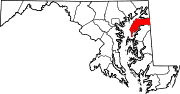
U.S. Highways Categories:- State highways in Maryland
- Roads in Kent County, Maryland


Wikimedia Foundation. 2010.