- Maryland Route 288
-
Maryland Route 288
Crosby Road 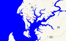
Route information Maintained by MDSHA Length: 3.33 mi[1] (5.36 km) Major junctions West end:  MD 20 in Rock Hall
East end: Long Cove Public Landing in Piney Neck Location Counties: Kent Highway system Maryland highway system
Interstate • US • State • Minor • Former • Turnpikes←  MD 287
MD 289  →
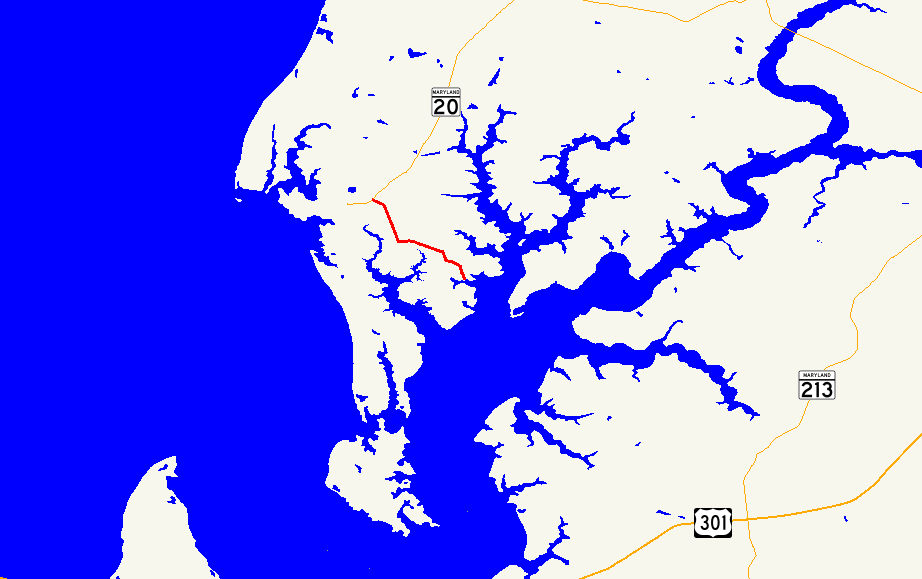
→Maryland Route 288 (MD 288) is a state highway in the U.S. state of Maryland. Known as Crosby Road, the state highway runs 3.33 miles (5.36 km) from MD 20 in Rock Hall east to Long Cove Public Landing on the Piney Neck peninsula in western Kent County. MD 288 was constructed in the mid 1920s.
Contents
Route description
MD 288 begins at an intersection with MD 20 (Rock Hall Road) just east of Rock Hall. The state highway heads south through a mix of farmland and forest. At Skinners Neck Road, MD 288 turns east and then south again at Edesville Road. The state highway turns east again in the hamlet of Crosby while Piney Neck Road continues south. MD 288 veers south while McKinleyville Road continues southeast, reaching its eastern terminus at Long Cove Public Landing on Long Cove, an inlet of Langford Creek just north of where the creek empties into the Chester River.[1][2]
History
MD 288 was constructed in 1925 and 1926.[3][4] The highway has changed very little since then.
Junction list
The entire route is in Kent County.
Location Mile[1] Destinations Notes Rock Hall 0.00 MD 20 (Rock Hall Road) – ChestertownWestern terminus Piney Neck 3.33 Entrance to Long Cove Public Landing Eastern terminus 1.000 mi = 1.609 km; 1.000 km = 0.621 mi References
- ^ a b c "Highway Location Reference: Kent County" (PDF). Maryland State Highway Administration. 2009. http://www.marylandroads.com/Location/2009_KENT.pdf. Retrieved 2010-10-07.
- ^ Google, Inc. Google Maps – Maryland Route 288 (Map). Cartography by Google, Inc. http://maps.google.com/maps?f=d&source=s_d&saddr=MD-20+E%2FRock+Hall+Rd&daddr=MD-288+E%2FCrosby+Rd&geocode=Feg9VQId6ut0-w%3BFR7DVAIdxXh1-w&hl=en&mra=ls&sll=39.109609,-76.186591&sspn=0.003821,0.009645&ie=UTF8&t=h&z=13. Retrieved 2010-10-07.
- ^ Report of the State Roads Commission of Maryland. 1924-1926. Baltimore: Maryland State Roads Commission. January 1927. pp. 31, 89. http://www.archive.org/details/annualreportsofs1924mary. Retrieved 2010-10-07.
- ^ Maryland Geological Survey. Map of Maryland: Showing State Road System and State Aid Roads (Map) (1927 ed.).
External links
Roads in Kent County, Maryland State highways 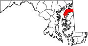
U.S. Highways Categories:- State highways in Maryland
- Roads in Kent County, Maryland


Wikimedia Foundation. 2010.