- Maryland Route 566
-
Maryland Route 566
Stillpond Harmony Road Route information Maintained by MDSHA Length: 1.19 mi[1] (1.92 km) Major junctions West end:  MD 292 in Still Pond
East end:  MD 298 near Still Pond
Location Counties: Kent Highway system Maryland highway system
Interstate • US • State • Minor • Former • Turnpikes←  MD 565
MD 567  →
→Maryland Route 566 (MD 566) is a state highway in the U.S. state of Maryland. Known as Stillpond Harmony Road, the state highway runs 1.19 miles (1.92 km) from MD 292 in Still Pond east to MD 298 near Still Pond in northern Kent County. MD 566 was constructed from Still Pond east to MD 298's intersection with MD 213 in the late 1940s. MD 298 assumed much of MD 566's course in the early 1960s.
Contents
Route description
MD 566 begins at an intersection with MD 292 (Still Pond Road) in the unincorporated village of Still Pond. MD 292 heads west from the intersection toward Betterton and south toward MD 298 near Lynch. MD 566 heads east through the Still Pond Historic District before leaving the village and passing through farmland. The state highway reaches its eastern terminus at an acute intersection with MD 298 (Lambs Meadow Road).[2]
History
Stillpond Harmony Road was constructed around 1946 to provide a direct connection between Still Pond and U.S. Route 213 (now MD 213) north of Kennedyville.[3] By 1949, the new highway was designated MD 566. The state highway originally followed Medders Road through Still Pond.[4] Medders Road was bypassed by the present straight piece of MD 566 in 1961.[5] MD 566 was cut to its present length in 1963 when MD 298 was extended east along the stretch of MD 566 east of the two routes' present intersection.[6]
Junction list
The entire route is in Still Pond in Kent County.
Mile
[1]Destinations Notes 0.00 MD 292 (Stillpond Road) – Betterton, LynchWestern terminus 1.19 MD 298 (Lambs Meadow Road) – Lynch, GalenaEastern terminus 1.000 mi = 1.609 km; 1.000 km = 0.621 mi References
- ^ a b "Highway Location Reference: Kent County" (PDF). Maryland State Highway Administration. 2009. http://www.marylandroads.com/Location/2009_KENT.pdf. Retrieved 2010-10-11.
- ^ Google, Inc. Google Maps – Maryland Route 566 (Map). Cartography by Google, Inc. http://maps.google.com/maps?f=d&source=s_d&saddr=MD-566%2FOld+Still+Pond+Rd&daddr=MD-566&hl=en&geocode=FTQXWAIdxKV3-w%3BFcwGWAId1_d3-w&mra=ls&sll=39.325567,-76.035476&sspn=0.015171,0.038581&ie=UTF8&ll=39.325434,-76.03436&spn=0.015171,0.038581&t=h&z=15. Retrieved 2010-06-11.
- ^ Report of the State Roads Commission of Maryland. 1945-1946. Baltimore: Maryland State Roads Commission. 1947-02-01. p. 90. http://www.archive.org/details/reportofstateroa1945mary. Retrieved 2010-10-11.
- ^ Maryland State Roads Commission. Maryland: Official Highway Map (Map) (1949 ed.).
- ^ Maryland State Roads Commission. Maryland: Official Highway Map (Map) (1961 ed.).
- ^ Maryland State Roads Commission. Maryland: Official Highway Map (Map) (1963 ed.).
External links
Roads in Kent County, Maryland State highways 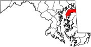
U.S. Highways Categories:- State highways in Maryland
- Roads in Kent County, Maryland


Wikimedia Foundation. 2010.