- Maryland Route 292
-
Maryland Route 292

Route information Maintained by MDSHA Length: 4.61 mi[1] (7.42 km) Major junctions South end:  MD 298 near Still Pond
 MD 566 in Still Pond
North end: Road end in Betterton Location Counties: Kent Highway system Maryland highway system
Interstate • US • State • Minor • Former • Turnpikes←  MD 291
I-295  →
→Maryland Route 292 (MD 292) is a state highway in the U.S. state of Maryland. The state highway runs 4.61 miles (7.42 km) from MD 298 near Still Pond north to Betterton, which is located where the Sassafras River flows into the Chesapeake Bay in northern Kent County. MD 292 was constructed between MD 213 and Betterton in the 1910s. The state highway's southern terminus was moved to MD 298 in the mid 1990s.
Contents
Route description
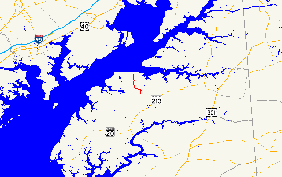
MD 292 begins at an intersection with MD 298 (Lambs Meadow Road) south of the village of Still Pond. Still Pond Road continues south as a county highway that was once part of MD 292. MD 292 heads north through farmland to Still Pond, where the highway turns west at an intersection with MD 566 (Still Pond Harmony Road) and Main Street within the Still Pond Historic District. Between intersections with Bessicks Corner Road, which is unsigned MD 864, the old alignment of MD 292, and leads to the county highway of the same name, MD 292 curves to the north. The state highway intersects Still Pond Neck Road and Royal Swan Road, both former state highways, before reaching the town of Bettertown. MD 292's name changes to Main Street, which intersects four former state highways within town: Howell Point Road, Wheeler Avenue, First Avenue, and Ericsson Avenue. Just north of Ericsson Avenue, the state highway makes a sharp turn to the east and reaches its northern terminus at a dead end adjacent to a county beach on the Sassafras River.[1][2]
History
Still Pond Road was constructed as a state-aid road in the 1910s. The highway was paved from Betterton south to Lambs Meadow Road, currently MD 298, by 1915.[3] Still Pond Road south of Lambs Meadow Road was paved by 1921; however, the paved highway followed Big Woods Road and Station Road north from what is now MD 213 to Still Pond Road.[4] By 1939, MD 292 was moved off of Big Woods Road and Station Road and onto Still Pond Road to its southern terminus.[5] The section of MD 292 between MD 213 and MD 298 was removed from the state highway system in 1995.[6]
Junction list
The entire route is in Kent County.
Location Mile[1] Intersection Notes Still Pond 0.00 Still Pond Road south Southern terminus; Still Pond Road south is former MD 292 MD 298 (Lambs Meadow Road) – Galena, Lynch, Chestertown, Rock Hall0.93 MD 566 east (Still Pond Harmony Road) / Main Street northMD 292 turns west at this intersection 1.76 Bessicks Corner Road west Old alignment of MD 292; Bessicks Corner Road is unsigned MD 864 1.86 Bessicks Corner Road south 2.69 Still Pond Neck Road Former MD 443[7] 3.07 Royal Swan Road Former MD 442[7] Betterton 4.04 Howell Point Road west / Sixth Avenue east Howell Point Road is former MD 295[7] 4.28 Wheeler Avenue west Former MD 294[7] 4.47 First Avenue east Former MD 296[7] 4.56 Ericsson Avenue south Former MD 293[7] 4.61 Road end Northern terminus 1.000 mi = 1.609 km; 1.000 km = 0.621 mi References
- ^ a b c "Highway Location Reference: Kent County" (PDF). Maryland State Highway Administration. 2009. http://www.marylandroads.com/Location/2009_KENT.pdf. Retrieved 2010-10-10.
- ^ Google, Inc. Google Maps – Maryland Route 292 (Map). Cartography by Google, Inc. http://maps.google.com/maps?f=d&source=s_d&saddr=MD-292+N%2FMain+St&daddr=Unknown+road&hl=en&geocode=FU7kVwIdLKJ3-w%3BFSbAWAIdNmF3-w&mra=ls&sll=39.282297,-76.027665&sspn=0.015247,0.038581&ie=UTF8&t=h&z=13. Retrieved 2010-10-10.
- ^ Report of the State Roads Commission of Maryland. 1912-1915. Baltimore: Maryland State Roads Commission. May 1915. p. 124. http://www.archive.org/details/annualreportsofs1912mary. Retrieved 2010-10-10.
- ^ Maryland Geological Survey. Map of Maryland: Showing State Road System and State Aid Roads (Map) (1921 ed.).
- ^ Maryland State Roads Commission. General Highway Map: State of Maryland (Map) (1939 ed.).
- ^ Maryland State Highway Administration. Maryland: Official Highway Map (Map) (1995 ed.).
- ^ a b c d e f Maryland State Roads Commission. Maryland: Official Highway Map (Map) (1946-47 ed.).
External links
Roads in Kent County, Maryland State highways 
U.S. Highways Categories:- State highways in Maryland
- Roads in Kent County, Maryland


Wikimedia Foundation. 2010.