- Rock Hall, Maryland
Infobox Settlement
official_name = Rock Hall, Maryland
settlement_type =Town
nickname =
motto =
imagesize =
image_caption =
image_
imagesize =
image_caption =
image_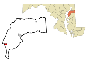
mapsize = 250x200px
map_caption = Location of Rock Hall, Maryland
mapsize1 =
map_caption1 =subdivision_type = Country
subdivision_name =United States
subdivision_type1 = State
subdivision_name1 =Maryland
subdivision_type2 = County
subdivision_name2 = Kent
government_footnotes =
government_type =
leader_title =
leader_name =
leader_title1 =
leader_name1 =
established_title =
established_date =unit_pref = Imperial
area_footnotes =area_magnitude =
area_total_km2 = 4.0
area_land_km2 = 3.4
area_water_km2 = 0.6
area_total_sq_mi = 1.6
area_land_sq_mi = 1.3
area_water_sq_mi = 0.2population_as_of = 2000
population_footnotes =
population_total = 1396
population_density_km2 = 405.5
population_density_sq_mi = 1050.3timezone = Eastern (EST)
utc_offset = -5
timezone_DST = EDT
utc_offset_DST = -4
elevation_footnotes =
elevation_m = 3
elevation_ft = 10
latd = 39 |latm = 8 |lats = 12 |latNS = N
longd = 76 |longm = 14 |longs = 31 |longEW = Wpostal_code_type =
ZIP code
postal_code = 21661
area_code = 410
blank_name = FIPS code
blank_info = 24-67400
blank1_name = GNIS feature ID
blank1_info = 0586872
website =
footnotes =Rock Hall is a town in Kent County,
Maryland ,United States . The population was 1,396 at the 2000 census.The town is a center for thefishing , crabbing, andoyster ing industries in Kent County as well as a home tomarinas that cater to the pleasure crafts that sail theChesapeake Bay . As a result there are a number of casual seafood restaurants for which the town is regionally well known.Geography
Rock Hall is located at coor dms|39|8|12|N|76|14|31|W|city (39.136579, -76.241850)GR|1.
According to the
United States Census Bureau , the town has a total area of 1.5square mile s (4.0km² ), of which, 1.3 square miles (3.4 km²) of it is land and 0.2 square miles (0.6 km²) of it (14.19%) is water.Demographics
As of the
census GR|2 of 2000, there were 1,396 people, 654 households, and 408 families residing in the town. Thepopulation density was 1,050.3 people per square mile (405.3/km²). There were 834 housing units at an average density of 627.5/sq mi (242.1/km²). The racial makeup of the town was 92.91% White, 5.52% African American, 0.07% Native American, 0.14% Asian, 0.07% Pacific Islander, 0.14% from other races, and 1.15% from two or more races. Hispanic or Latino of any race were 0.86% of the population.There were 654 households out of which 23.1% had children under the age of 18 living with them, 47.6% were married couples living together, 11.9% had a female householder with no husband present, and 37.5% were non-families. 32.4% of all households were made up of individuals and 19.7% had someone living alone who was 65 years of age or older. The average household size was 2.13 and the average family size was 2.67.
In the town the population was spread out with 19.8% under the age of 18, 5.5% from 18 to 24, 21.3% from 25 to 44, 29.5% from 45 to 64, and 23.9% who were 65 years of age or older. The median age was 47 years. For every 100 females there were 87.1 males. For every 100 females age 18 and over, there were 84.2 males.
The median income for a household in the town was $32,833, and the median income for a family was $38,672. Males had a median income of $29,375 versus $21,429 for females. The
per capita income for the town was $20,521. About 10.5% of families and 13.2% of the population were below thepoverty line , including 22.4% of those under age 18 and 10.0% of those age 65 or over.Notable Residents
David Mench- Veteran waterman and owner of F/V Miss Susan
References
External links
* [http://www.rockhallmd.com/ Official Town Site]
Wikimedia Foundation. 2010.