- Maryland Route 561
-
Maryland Route 561
Hassengers Corner Road 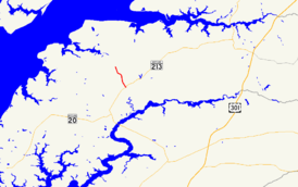
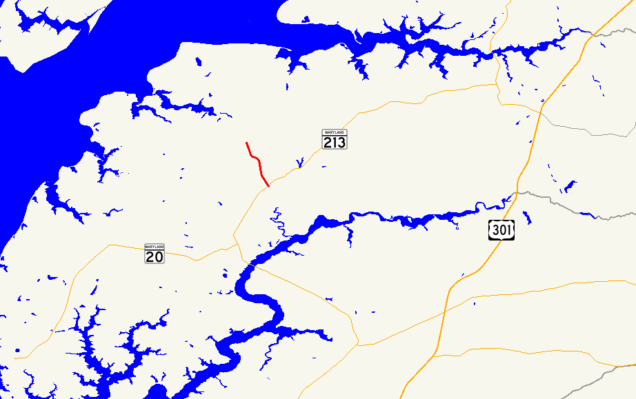
Route information Maintained by MDSHA Length: 2.48 mi[1] (3.99 km) Major junctions South end:  MD 213 at Hassengers Corner
North end:  MD 298 in Lynch
Location Counties: Kent Highway system Maryland highway system
Interstate • US • State • Minor • Former • Turnpikes←  MD 560
MD 564  →
→Maryland Route 561 (MD 561) is a state highway in the U.S. state of Maryland. Known as Hassengers Corner Road, the state highway runs 2.48 mi (3.99 km) from MD 213 at Hassengers Corner north to MD 298 in Lynch in central Kent County. MD 561 was constructed in the early 1930s.
Contents
Route description
MD 561 begins at an intersection with MD 213 (Augustine Herman Highway) at Hassengers Corner, a crossroads hamlet between Chestertown and Kennedyville. The state highway heads north through farmland, passing Worton Lynch Road before passing through the unincorporated village of Lynch.[2] MD 561 crosses the Chestertown Branch of the Northern Line of the Maryland and Delaware Railroad before reaching its northern terminus at MD 298 (Lambs Meadow Road).[1][2]
History
MD 561 was paved by 1933.[3] The state highway has changed very little since then.
Junction list
The entire route is in Kent County.
Location Mile
[1]Destinations Notes Hassengers Corner 0.00 MD 213 (Augustine Herman Highway) – Chestertown, KennedyvilleSouthern terminus Lynch 2.48 MD 298 (Lambs Meadow Road) – Worton, Still PondNorthern terminus 1.000 mi = 1.609 km; 1.000 km = 0.621 mi References
- ^ a b c "Highway Location Reference: Kent County" (PDF). Maryland State Highway Administration. 2009. http://www.marylandroads.com/Location/2009_KENT.pdf. Retrieved 2010-10-11.
- ^ a b Google, Inc. Google Maps – Maryland Route 561 (Map). Cartography by Google, Inc. http://maps.google.com/maps?f=d&source=s_d&saddr=Hassengers+Corner,+MD&daddr=MD-561+N%2FLynch+Rd&geocode=FZcmVwIdwJx3-ylV_J-IA43HiTGmSP82LTpUmg%3BFRyjVwIdsl13-w&hl=en&mra=ls&sll=39.264989,-76.047192&sspn=0.015317,0.038581&ie=UTF8&ll=39.282231,-76.05526&spn=0.060723,0.154324&t=h&z=13. Retrieved 2010-06-09.
- ^ Maryland Geological Survey. Map of Maryland Showing State Road System: State Aid Roads and Improved County Road Connections (Map) (1933 ed.).
External links
Roads in Kent County, Maryland State highways 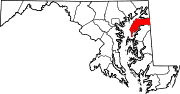
U.S. Highways Categories:- State highways in Maryland
- Roads in Kent County, Maryland


Wikimedia Foundation. 2010.