- Church Hill, Maryland
-
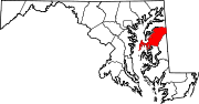
Church Hill, Maryland — Town — Location of Church Hill, Maryland
Coordinates: 39°8′40″N 75°59′6″W / 39.14444°N 75.985°WCoordinates: 39°8′40″N 75°59′6″W / 39.14444°N 75.985°W Country United States State Maryland County Queen Anne's Area – Total 0.5 sq mi (1.3 km2) – Land 0.5 sq mi (1.3 km2) – Water 0.0 sq mi (0.0 km2) Elevation 39 ft (12 m) Population (2009) – Total 720 – Density 1,031.5/sq mi (398.3/km2) Time zone Eastern (EST) (UTC-5) – Summer (DST) EDT (UTC-4) ZIP codes 21623, 21656 Area code(s) 410 FIPS code 24-17100 GNIS feature ID 0597247 Church Hill is a town in Queen Anne's County, Maryland, United States. The population was 530 at the 2000 census. Joshua Seney was born near Church Hill, and is buried on his property near the town.
Geography
Church Hill is located at 39°8′40″N 75°59′6″W / 39.14444°N 75.985°W (39.144441, -75.984869)[1].
According to the United States Census Bureau, the town has a total area of 0.5 square miles (1.3 km2), all of it land.
Demographics
As of the census[2] of 2000, there were 530 people, 210 households, and 139 families residing in the town. The population density was 1,031.5 people per square mile (401.2/km²). There were 226 housing units at an average density of 439.8 per square mile (171.1/km²). The racial makeup of the town was 76.79% White, 21.70% African American, 0.19% Native American, 0.19% Asian, 0.38% from other races, and 0.75% from two or more races. Hispanic or Latino of any race were 2.45% of the population.
There were 210 households out of which 33.3% had children under the age of 18 living with them, 46.7% were married couples living together, 15.2% had a female householder with no husband present, and 33.8% were non-families. 27.1% of all households were made up of individuals and 8.1% had someone living alone who was 65 years of age or older. The average household size was 2.48 and the average family size was 3.03.
In the town the population was spread out with 26.6% under the age of 18, 8.3% from 18 to 24, 30.8% from 25 to 44, 20.6% from 45 to 64, and 13.8% who were 65 years of age or older. The median age was 36 years. For every 100 females there were 83.4 males. For every 100 females age 18 and over, there were 81.8 males.
The median income for a household in the town was $48,250, and the median income for a family was $51,875. Males had a median income of $32,857 versus $26,964 for females. The per capita income for the town was $18,487. About 11.7% of families and 12.9% of the population were below the poverty line, including 23.4% of those under age 18 and 12.2% of those age 65 or over.
References
- ^ "US Gazetteer files: 2010, 2000, and 1990". United States Census Bureau. 2011-02-12. http://www.census.gov/geo/www/gazetteer/gazette.html. Retrieved 2011-04-23.
- ^ "American FactFinder". United States Census Bureau. http://factfinder.census.gov. Retrieved 2008-01-31.
Municipalities and communities of Queen Anne's County, Maryland Towns Barclay | Centreville | Church Hill | Millington‡ | Queen Anne‡ | Queenstown | Sudlersville | Templeville‡
CDPs Other
communitiesCrumpton | Dominion | Ingleside | Love Point | Matapeake | Price | Romancoke | Ruthsburg
Footnotes ‡This populated place also has portions in an adjacent county or counties
Categories:- Towns in Maryland
- Populated places in Queen Anne's County, Maryland


Wikimedia Foundation. 2010.